
Historic houses · Yorkshire & the Humber
Huddleston Hall
In or near Sherburn in Elmet.
Huddleston Hall — house in Huddleston with Newthorpe, Selby, England, UK.
.jpg?width=1200)
Wikimedia Commons contributors — see linked file page for photographer and licence licence
.jpg)
Plan your visit
- Typical visit
- 1 h–2 h
- Nearest railway station
- Micklefield · 2.5 km
- Family-friendly
- Limited wheelchair access
Getting there & planning your visit
To visit Huddleston Hall, the nearest railway station is Micklefield, located 2.5 km away. The postcode for sat-nav is LS25 6JX. Please note that wheelchair accessibility is limited.
About
Huddleston Hall is a historic house in the United Kingdom — typically a country seat, manor, or town house with notable architecture or history. Heritage designation: Grade II* listed building. Wikidata describes it as: "house in Huddleston with Newthorpe, Selby, England, UK". Coordinates: 53.8000°, -1.2930°.
Photo gallery
From the Wikipedia article
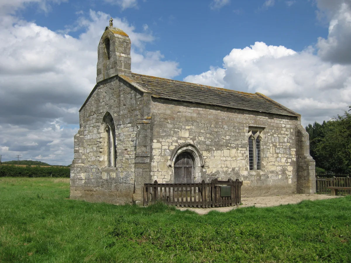
Huddleston Hall is a historic building in Huddleston with Newthorpe, a civil parish in North Yorkshire, in England. The manor house was constructed around 1700, for the Hungate family, with stables being constructed at the same time. However, the 15th-century former chapel survives from an earlier hall built by the Langton family, having later been converted into a barn. The hall was later converted into a farmhouse. It was altered in about 1912, when an additional entrance was inserted. The hall, chapel, and stables, are all separately grade II* listed. The hall was placed on the Heritage at Risk Register due to the poor condition of its roofs, although some emergency work was undertaken, and a plan put in place to fully restore them. The hall is built of limestone on a plinth, with quoins, a floor band, and a stone slate roof with shaped kneelers and stone coping. There are two storeys and attics and a cellar to the right, and an H-shaped plan consisting of a single bay flanked by single-bay gabled cross-wings. In the centre are two Tudor arched entrances with quoined and chamfered jambs. The windows are mullioned, and most also have transoms, with those on the upper floors being smaller than those on the ground floor. Inside, there is a hall with a great chamber above. Few historic features survive inside, but both the main and service staircases are early, and originally had large turned balusters. The chapel is built of magnesian limestone with a stone slate roof. The openings include a doorway with a moulded surround, a three-light window with a pointed head containing Perpendicular tracery, and a doorway with a Tudor arched lintel. The stables are also built of magnesian limestone and have a pantile roof with stone coping. There is a single storey and twelve bays. The south gable end contains a doorway with a chamfered surround and a Tudor arch, flanked by two-light mullioned windows under a continuous stepped hood mould. On the sides are stable doors and…
Excerpt from Wikipedia under CC BY-SA 4.0. See the source article linked in Sources below.
- Coordinates
- 53.8000, -1.2930
- District
- North Yorkshire
- Parish
- Huddleston with Newthorpe
- Postcode
- LS25 6JX
- Parliamentary constituency
- Selby
- Nearest railway station
- Micklefield — 2.5 km
- Official site
- sherburninelmethistory.co.uk
Sources
- wikidata: Q17542348 (CC0)
- wikipedia: Huddleston Hall (CC BY-SA 4.0)
- commons: Huddleston Hall near Sherburn in Elmet (geograph 2267389).jpg (CC BY-SA 4.0)
Other places nearby

Battle of Sherburn in Elmet
Forts · 2.1 km

Church of All Saints
Historic churches · 2.2 km

Site of King Athelstan's Palace
Palaces · 2.2 km

Site of King Athelstan's Palace
Archaeological sites · 2.2 km

Old Micklefield
Villages · 2.6 km

Lotherton Hall
Historic houses · 2.7 km

Lotherton Chapel
Chapels · 2.7 km

Fairey Swordfish
Memorials & monuments · 2.7 km

Saxton Castle
Literary houses · 2.9 km
Saxton
Castles · 2.9 km
St Mary's Chapel, Lead
Historic churches · 2.9 km

Saxton, North Yorkshire
Castles · 3.0 km
Nearby
📷 3Forts · Yorkshire & the Humber
Battle of Sherburn in Elmet
Battle of Sherburn in Elmet is a fort in the United Kingdom.
📷 4Historic churches · Yorkshire & the Humber
Church of All Saints
Church of All Saints — historic church in Sherburn in Elmet, Selby, North Yorkshire, England, UK.
📷 3Palaces · Yorkshire & the Humber
Site of King Athelstan's Palace
Site of King Athelstan's Palace — a palace in england-yorkshire, United Kingdom.
📷 5Archaeological sites · Yorkshire & the Humber
Site of King Athelstan's Palace
Site of King Athelstan's Palace — archaeological in england yorkshire.
📷 5📷 3Historic houses · Yorkshire & the Humber
Lotherton Hall
Lotherton Hall — a other in england-yorkshire, United Kingdom.
Where to eat & stay near Huddleston Hall
Places to stay
 📷 5
📷 5Caravan parks · Yorkshire & the Humber
Whitecote Caravan Park
Whitecote Caravan Park — a caravan park in england yorkshire.
 📷 5
📷 5Caravan parks · Yorkshire & the Humber
Oakland Hill Estate
Oakland Hill Estate — a caravan park in england yorkshire.
 📷 5
📷 5 📷 5
📷 5Caravan parks · Yorkshire & the Humber
York South Caravan & Camping
York South Caravan & Camping — a caravan park in england yorkshire.
 📷 5
📷 5Campsites · Yorkshire & the Humber
Moss Hagg Farm Campsite
Moss Hagg Farm Campsite — a campsite in england yorkshire.
 📷 5
📷 5Places to eat & drink
 📷 5
📷 5 📷 5
📷 5Historic pubs · Yorkshire & the Humber
The Crusader
The Crusader in England Yorkshire, United Kingdom.
 📷 5
📷 5Historic pubs · Yorkshire & the Humber
The Bird In Hand
The Bird In Hand in England Yorkshire, United Kingdom.
 📷 5
📷 5Historic pubs · Yorkshire & the Humber
The Moorgate
The Moorgate in England Yorkshire, United Kingdom.
 📷 5
📷 5Historic pubs · Yorkshire & the Humber
The Lord Gascoigne
The Lord Gascoigne in England Yorkshire, United Kingdom.
 📷 5
📷 5Historic pubs · Yorkshire & the Humber
The Commercial
The Commercial in England Yorkshire, United Kingdom.
More historic houses in this region
 📷 3
📷 3Historic houses · Yorkshire & the Humber
213, Chestergate
213, Chestergate — Grade II listed house in Stockport, Greater Manchester, England, UK.
 📷 3
📷 3Historic houses · Yorkshire & the Humber
96, Churchgate
96, Churchgate — Grade II listed house in Stockport, Greater Manchester, England, UK.
 📷 3
📷 3Historic houses · Yorkshire & the Humber
Broadbottom Hall
Broadbottom Hall — Grade II* listed house in Broadbottom, Tameside, Greater Manchester, England, UK.
.jpg?width=1200) 📷 3
📷 3Historic houses · Yorkshire & the Humber
Charles Head House
Charles Head House — house in Rainow, Cheshire East, England, UK.
Frequently asked questions
- Where is Huddleston Hall?
- Huddleston Hall is in Yorkshire, United Kingdom (postcode LS25 6JX), in the parish of Huddleston with Newthorpe.
- What is Huddleston Hall?
- Huddleston Hall — house in Huddleston with Newthorpe, Selby, England, UK.
- How do I get to Huddleston Hall?
- The nearest railway station is Micklefield, about 2.5 km away. Drivers can use postcode LS25 6JX.
- Is Huddleston Hall a listed building?
- Huddleston Hall is officially recognised as Grade II* listed building listed.
- How do I get to Huddleston Hall?
- The nearest railway station is Micklefield, about 2.5 km away. Drivers can navigate to postcode LS25 6JX.