
Forests & woodlands · East of England
Howlands Marsh
In or near East Mersea.
Howlands Marsh is a forest or woodland in the United Kingdom.

Wikimedia Commons contributors — see linked file page for photographer and licence licence

Plan your visit
- Typical visit
- 1 h–3 h
- Nearest railway station
- Great Bentley · 5.1 km
- Free entry
- Family-friendly
- Dog-friendly
Getting there & planning your visit
Howlands Marsh is located in Tendring, Essex, with the postcode CO16 8GZ. The nearest railway station is Great Bentley, which is 5.1 km away. Entry to the marsh is free.
About
Howlands Marsh is a named forest, woodland or nature reserve in the United Kingdom. Coordinates: 51.8061°, 1.0574°. This entry is part of The Great Britain Guide, a free, ad-free, open-data tourist directory.
Photo gallery
Protected designations
- Site of Special Scientific Interest: Colne Estuary SSSI
- National Nature Reserve: COLNE ESTUARY
- Ramsar wetland: Colne Estuary (Mid-Essex Coast Phase 2)
Designations sourced from Natural England open data under OGL v3.
From the Wikipedia article
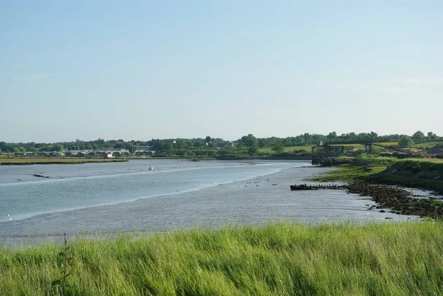
Howlands Marsh is a 29.9-hectare (74-acre) nature reserve north-east of St Osyth in Essex. It is managed by the Essex Wildlife Trust. It is part of the Colne Estuary Site of Special Scientific Interest Special Protection Area and Ramsar site, and the Blackwater Flats and Marshes Nature Conservation Review site. This site is marshy grassland, which is low lying and hummocky, and divided by water channels. There are also areas of saltmarsh, which has sea wormwood and golden samphire. Breeding birds include reed warblers, skylarks, lapwings and reed buntings. There is access by a footpath from the B1027 road.
Excerpt from Wikipedia under CC BY-SA 4.0. See the source article linked in Sources below.
- Coordinates
- 51.8061, 1.0574
- County
- Essex
- District
- Tendring
- Parish
- St Osyth
- Postcode
- CO16 8GZ
- Parliamentary constituency
- Clacton
- Nearest railway station
- Great Bentley — 5.1 km
Sources
- osm: w36871952 (ODbL)
- wikipedia: Howlands Marsh (CC BY-SA 4.0)
- commons: Flag Creek - geograph.org.uk - 1356529.jpg (CC BY-SA 4.0)
Other places nearby
Howlands Marsh
Wildlife reserves · 0.9 km

Curve Water Sports
Piers · 1.2 km

Harbour Lodge
Campsites · 1.3 km
.jpg?width=1200)
St Osyth's Priory: The Abbot's Lodging and South Wing, the Darcy Clock Tower and C18 House (formerly listed as the Convalescent Home)
Historic houses · 1.4 km

St Osyth's Priory ruined east ranges of the Darcy House including the Tower and Chapel
Memorials & monuments · 1.4 km

St Osyth War Memorial
Memorials & monuments · 1.5 km
St Osyth Village Sign
Public art & sculpture · 1.5 km

St Osyth Museum
Museums · 1.5 km

Cindery Island
Islands · 1.7 km
St Osyth
Museums · 1.7 km

The Creek
Restaurants · 1.8 km

Saint Osyth
Villages · 1.9 km
Nearby
Flagship📷 5Wildlife reserves · East of England
Howlands Marsh
Howlands Marsh — Essex Wildlife Trust Nature reserve.
📷 3Piers · East of England
Curve Water Sports
Curve Water Sports is a pier in the United Kingdom.
📷 5📷 3Historic houses · East of England
St Osyth's Priory: The Abbot's Lodging and South Wing, the Darcy Clock Tower and C18 House (formerly listed as the Convalescent Home)
St Osyth's Priory: The Abbot's Lodging and South Wing, the Darcy Clock Tower and C18 House (formerly listed as the Convalescent Home) — Grade I listed building in St Osyth, Essex, England, UK.
📷 3Memorials & monuments · East of England
St Osyth's Priory ruined east ranges of the Darcy House including the Tower and Chapel
St Osyth's Priory ruined east ranges of the Darcy House including the Tower and Chapel — Grade I listed building-listed memorial in england-east, United Kingdom.
📷 3Memorials & monuments · East of England
St Osyth War Memorial
St Osyth War Memorial — a memorial in East of England, United Kingdom.
Where to eat & stay near Howlands Marsh
Places to stay
📷 5 📷 5
📷 5Campsites · East of England
Brightlingsea Touring Park
Brightlingsea Touring Park — a campsite in england east.
📷 5Caravan parks · East of England
Brightlingsea Leisure Village
Brightlingsea Leisure Village — a caravan park in england east.
 📷 5
📷 5Campsites · East of England
The Partridge Retreat
The Partridge Retreat — a campsite in england east.
Caravan parks · East of England
Leisure Glades Park
Leisure Glades Park — a caravan park in england east.
Caravan parks · East of England
Seawick Holiday Park
Seawick Holiday Park — a caravan park in england east.
Places to eat & drink
📷 7Restaurants · East of England
The Creek
The Creek — a restaurant in england east.
 📷 7
📷 7Historic pubs · East of England
The Brewers Arms Public House
The Brewers Arms Public House in England East, United Kingdom.
 📷 7
📷 7Historic pubs · East of England
Dog And Pheasant Public House
Dog And Pheasant Public House in England East, United Kingdom.
 📷 7
📷 7Historic pubs · East of England
The Ipswich Arms Public House
The Ipswich Arms Public House in England East, United Kingdom.
 📷 7
📷 7Historic pubs · East of England
Peldon Rose Public House
Peldon Rose Public House in England East, United Kingdom.
 📷 7
📷 7Historic pubs · East of England
The Red Lion Public House
The Red Lion Public House in England East, United Kingdom.
More forests in this region
 📷 5
📷 5Forests & woodlands · East of England
Adams Road Bird Sanctuary
Adams Road Bird Sanctuary is a forest or woodland in the United Kingdom.
 📷 5
📷 5Forests & woodlands · East of England
Arthur's Meadow NR
Arthur's Meadow NR is a forest or woodland in the United Kingdom.
 📷 5
📷 5Forests & woodlands · East of England
Ashwell Quarry & Quarry Springs
Ashwell Quarry & Quarry Springs is a forest or woodland in the United Kingdom.
 📷 5
📷 5Forests & woodlands · East of England
Ashwell Springs
Ashwell Springs is a forest or woodland in the United Kingdom.
Frequently asked questions
- Where is Howlands Marsh?
- Howlands Marsh is in Essex, East of England, United Kingdom (postcode CO16 8GZ), in the parish of St Osyth.
- What is Howlands Marsh?
- Howlands Marsh is a forest or woodland in the United Kingdom.
- How do I get to Howlands Marsh?
- The nearest railway station is Great Bentley, about 5.1 km away. The nearest town is East Mersea. Drivers can use postcode CO16 8GZ.
- Who owns Howlands Marsh?
- Howlands Marsh is owned by Essex Wildlife Trust.
- Is Howlands Marsh a protected site?
- Yes — Howlands Marsh is part of the Colne Estuary SSSI Site of Special Scientific Interest and the COLNE ESTUARY National Nature Reserve.
- Is Howlands Marsh free to visit?
- Yes, Howlands Marsh is free to enter.
- How do I get to Howlands Marsh?
- The nearest railway station is Great Bentley, about 5.1 km away. Drivers can navigate to postcode CO16 8GZ.