Mountains & hills · Scottish Lowlands
Holehouse Hill
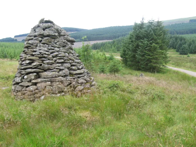
Holehouse Hill — mountain in scotland lowlands. Elevation: 398 m.

Bob Peace — CC BY-SA 2.0 via Wikimedia Commons licence
Plan your visit
- Typical visit
- 3 h–8 h
- Best time of year
- Late spring – early autumn (May–Oct)
About
Holehouse Hill is a mountain located in scotland lowlands. Elevation: 398 m. A named British peak recorded in OpenStreetMap. Peaks are typically named on Ordnance Survey 1:50k mapping.
Photo gallery
Place summary
Holehouse Hill is a mountain located in the Scottish Lowlands. It is characterised by its rugged terrain and natural beauty, making it a notable feature of the landscape. The area is suitable for outdoor activities such as hiking and offers scenic views of the surrounding countryside. Visitors can expect a tranquil environment, ideal for exploring the natural surroundings.
AI-generated from the structured facts on this page (operator, designation, listing, era). Not a substitute for visiting.
- Coordinates
- 55.2387, -3.5577
Sources
- osm: n535603937 (ODbL)
Other places nearby
Loading nearby places…
Nearby
📷 5Mountains & hills · Scottish Lowlands
Holehouse Hill
Holehouse Hill — a hill or mountain in scotland lowlands.
 📷 3
📷 3Archaeological sites · Scottish Lowlands
Forest of Ae
Forest of Ae — forest in Dumfries and Galloway, Scotland.
 📷 5
📷 5Mountains & hills · Scottish Lowlands
Bog Shaw
Bog Shaw — mountain in scotland lowlands. Elevation: 383 m.
 📷 5
📷 5Mountains & hills · Scottish Lowlands
Whitefauld Hill
Whitefauld Hill — mountain in scotland lowlands. Elevation: 352 m.
 📷 5
📷 5Mountains & hills · Scottish Lowlands
Pumro Fell
Pumro Fell — a hill or mountain in scotland lowlands.
📷 5Mountains & hills · Scottish Lowlands
Pumro Fell
Pumro Fell — mountain in scotland lowlands. Elevation: 393 m.
Where to eat & stay near Holehouse Hill
Places to stay
 📷 5
📷 5Hostels · Scottish Lowlands
Rivox Bunkhouse
Rivox Bunkhouse — a hostel in scotland lowlands.
 📷 5
📷 5Campsites · Scottish Lowlands
Oakbank Farm Campsite
Oakbank Farm Campsite — a campsite in scotland lowlands.
 📷 5
📷 5Caravan parks · Scottish Lowlands
Partridge Cottage CAMC CL
Partridge Cottage CAMC CL — a caravan park in scotland lowlands.
 📷 5
📷 5Caravan parks · Scottish Lowlands
DL Tait Rural
DL Tait Rural — a caravan park in scotland lowlands.
 📷 5
📷 5Campsites · Scottish Lowlands
Green Frog
Green Frog — a campsite in scotland lowlands.
 📷 5
📷 5Campsites · Scottish Lowlands
Moffat Camping & Caravanning Club site
Moffat Camping & Caravanning Club site — a campsite in scotland lowlands.
Places to eat & drink
 📷 5
📷 5Historic pubs · Scottish Lowlands
Auldgirth Inn
Auldgirth Inn in Scotland Lowlands, United Kingdom.
 📷 5
📷 5Historic pubs · Scottish Lowlands
Bruce Arms Public House, 3 Castle Street, Lochmaben
Bruce Arms Public House, 3 Castle Street, Lochmaben in Scotland Lowlands, United Kingdom.
 📷 5
📷 5Historic pubs · Scottish Lowlands
Rob Roy Public House, 63-65 Queensberry Street, Dumfries
Rob Roy Public House, 63-65 Queensberry Street, Dumfries in Scotland Lowlands, United Kingdom.
 📷 5
📷 5Historic pubs · Scottish Lowlands
73-77 English Street, Dumfries
73-77 English Street, Dumfries in Scotland Lowlands, United Kingdom.
 📷 5
📷 5Historic pubs · Scottish Lowlands
75 Friars Vennel, Dumfries
75 Friars Vennel, Dumfries in Scotland Lowlands, United Kingdom.
 📷 5
📷 5Historic pubs · Scottish Lowlands
The Globe Inn, 56 High Street, Dumfries
The Globe Inn, 56 High Street, Dumfries in Scotland Lowlands, United Kingdom.
More mountains in this region
 📷 3
📷 3Mountains & hills · Scottish Lowlands
Andrewhinney Hill
Andrewhinney Hill — Named summit at 677 m.
 📷 3
📷 3Mountains & hills · Scottish Lowlands
Arbory Hill
Arbory Hill — Named summit at 429 m.
 📷 3
📷 3Mountains & hills · Scottish Lowlands
Auchenton Hill ( East Mount Lowther)
Auchenton Hill ( East Mount Lowther) — Named summit at 631 m.
 📷 3
📷 3Mountains & hills · Scottish Lowlands
Bakestall
Bakestall — Named summit at 673.5 m.
Frequently asked questions
- Where is Holehouse Hill?
- Holehouse Hill is in the Scottish Lowlands, United Kingdom.
- What is Holehouse Hill?
- Holehouse Hill — mountain in scotland lowlands. Elevation: 398 m.
- How do I get to Holehouse Hill?
- Its coordinates are 55.2387°, -3.5577°.