
Campsites · South East England
Hillside Campsite
In or near Bredgar.
Hillside Campsite — a campsite in england south east.

Chris Whippet — CC BY-SA 2.0 via Wikimedia Commons licence

Plan your visit
- Typical visit
- 1 h–2 h
- Nearest railway station
- Hollingbourne · 3.2 km
About
Hillside Campsite is a campsite located in england south east. Phone: +44 1622 880272. Address: Church Road, Maidstone, ME17 1QT.
Photo gallery
Protected designations
- Area of Outstanding Natural Beauty: Kent Downs
Designations sourced from Natural England open data under OGL v3.
Place summary
Hillside Campsite is located in South-East England, postcode ME17. This campsite offers a natural setting for outdoor enthusiasts and provides basic amenities for camping. Visitors can expect a range of pitches suitable for tents, along with access to essential facilities. The site is ideal for those looking to enjoy the countryside and engage in outdoor activities.
AI-generated from the structured facts on this page (operator, designation, listing, era). Not a substitute for visiting.
- Coordinates
- 51.2936, 0.6350
- County
- Kent
- District
- Maidstone
- Parish
- Hucking
- Postcode
- ME17 1QT
- Parliamentary constituency
- Faversham and Mid Kent
- Phone
- +44 1622 880272
- Nearest railway station
- Hollingbourne — 3.2 km
- Official site
- www.hookandhatchetpub.co.uk
Sources
- osm: w610568937 (ODbL)
Other places nearby

Axe
Public art & sculpture · 0.1 km

Adventurers Sun Club
Campsites · 0.9 km

The Shepherd
Public art & sculpture · 1.4 km

North Downs Way Viewpoint
Viewpoints · 1.5 km

Coldblow Farm
Campsites · 1.7 km

Stockbury
Historic churches · 2.8 km

Hollingbourne House
Historic houses · 2.8 km

Hollingbourne
Villages · 2.9 km

Malt House
Historic houses · 3.0 km
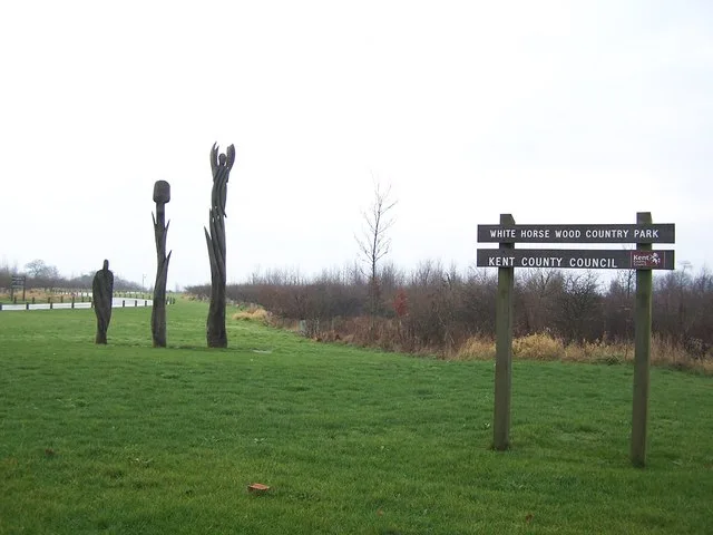
White Horse Wood
Parks · 3.0 km

Hollingbourne Manor
Historic houses · 3.0 km

Godards Castle
Castles · 3.0 km
Nearby
📷 5Public art & sculpture · South East England
Axe
Axe — a public art in South East England, United Kingdom.
📷 5Campsites · South East England
Adventurers Sun Club
Adventurers Sun Club — a campsite in england south east.
📷 5Public art & sculpture · South East England
The Shepherd
The Shepherd — a public art in South East England, United Kingdom.
📷 5Viewpoints · South East England
North Downs Way Viewpoint
North Downs Way Viewpoint is a viewpoint in the United Kingdom.
📷 5Campsites · South East England
Coldblow Farm
Coldblow Farm — a campsite in england south east.
📷 5Historic churches · South East England
Stockbury
Stockbury — a church in england-south-east, United Kingdom.
Where to eat & stay near Hillside Campsite
Places to stay
📷 5Campsites · South East England
Adventurers Sun Club
Adventurers Sun Club — a campsite in england south east.
📷 5Campsites · South East England
Coldblow Farm
Coldblow Farm — a campsite in england south east.
 📷 5
Caravan parks · South East England
Bearsted Caravan And Motorhome Club Site
Bearsted Caravan And Motorhome Club Site — a caravan park in england south east.
 📷 5
Caravan parks · South East England
Oak View Caravan Park
Oak View Caravan Park — a caravan park in england london.
 📷 5
Caravan parks · South East England
Hogbarn Caravan Park
Hogbarn Caravan Park — a caravan park in england south east.
 📷 5
Campsites · South East England
Bexon Lane Scout Campsite
Bexon Lane Scout Campsite — a campsite in england south east.
Places to eat & drink
 📷 7
Historic pubs · South East England
The Windmill Public House
The Windmill Public House in England South East, United Kingdom.
 📷 5
Historic pubs · South East England
The Cock Horse
The Cock Horse in England South East, United Kingdom.
 📷 7
Historic pubs · South East England
The Park Gate Inn
The Park Gate Inn in England South East, United Kingdom.
 📷 7
Historic pubs · South East England
Ringlestone Inn
Ringlestone Inn in England South East, United Kingdom.
 📷 5
Historic pubs · South East England
The Roebuck Public House
The Roebuck Public House in England South East, United Kingdom.
 📷 6
Historic pubs · South East England
The King's Arms
The King's Arms in England South East, United Kingdom.
More places in this region
 📷 5
Campsites · South East England
Hammonds Glamping
Hammonds Glamping — a campsite in england london.
 📷 5
Campsites · South East England
Chantry Wood Campsite
Chantry Wood Campsite — a campsite in england london.
 📷 5
Campsites · South East England
Ranmore Common Campsite
Ranmore Common Campsite — a campsite in england london.
 📷 5
Frequently asked questions
- Where is Hillside Campsite?
- Hillside Campsite is in Kent, South-East England, United Kingdom (postcode ME17 1QT), in the parish of Hucking.
- What is Hillside Campsite?
- Hillside Campsite — a campsite in england south east.
- How do I get to Hillside Campsite?
- The nearest railway station is Hollingbourne, about 3.2 km away. The nearest town is Bredgar. Drivers can use postcode ME17 1QT.
- Is Hillside Campsite a protected site?
- Yes — Hillside Campsite is part of the Kent Downs National Landscape (AONB).
- How do I get to Hillside Campsite?
- The nearest railway station is Hollingbourne, about 3.2 km away. Drivers can navigate to postcode ME17 1QT.