
Public art & sculpture · South East England
Axe
In or near Bredgar.
Axe — a public art in england-south-east, United Kingdom.

N Chadwick — CC BY-SA 2.0 via Wikimedia Commons licence

Plan your visit
- Typical visit
- 1 h–2 h
- Nearest railway station
- Hollingbourne · 3.1 km
- Free entry
- Dog-friendly
Getting there & planning your visit
To visit Axe in Maidstone, Kent, the nearest railway station is Hollingbourne, which is 3.1 km away. The postcode for navigation is ME17 1QX, and entry to the site is free.
About
Axe is a public art located in england-south-east, United Kingdom. Sourced from OpenStreetMap (ODbL licence); see local listings for visitor information, opening hours and admission details.
Photo gallery
Protected designations
- Area of Outstanding Natural Beauty: Kent Downs
Designations sourced from Natural England open data under OGL v3.
From the Wikipedia article
An axe (; sometimes spelled ax in American English; see spelling differences) is an implement that has been used for thousands of years to shape, split, and cut wood, to harvest timber, and as a weapon. The axe has many forms and specialised uses but generally consists of a head with a sharpened blade (also called a "bit") attached to a handle (also called "haft" or "helve"). Before the modern axe, the stone-age hand axe without a handle was used from 1.5 million years BP. Hafted axes (those with a handle) date from at least 46,000 years BP by Northern Indigenous Australians. The earliest examples of handled axes have heads of stone with some form of wooden handle attached (hafted) in a method to suit the available materials and use. Axes made of copper, bronze, iron and steel appeared as these technologies developed. The axe is an example of a simple machine, as it is a type of wedge, or dual inclined plane. This reduces the effort needed by the wood chopper. It cuts and splits the wood into two parts by the pressure concentration at the blade and then the movement of the head in behind the initial cut. The handle of the axe also acts as a lever allowing the user to increase the force at the cutting edge. Generally, the blades of 'cutting axes', which are used for felling, limbing, and bucking, have a shallow (acute) wedge angle, whereas 'splitting axes' have a deeper (more obtuse) angle. Most axes are double bevelled (i.e. symmetrical about the axis of the blade), but some specialist broadaxes have a single bevel blade. Most modern axes have steel heads and wooden handles, although plastic or fibreglass handles are also common. Modern axes are specialised by use, size and form. Hafted axes with short handles designed for use with one hand are often called "hand axes", but the term "hand axe" can also refer to an axe without a handle. Hatchets tend to be short-, small-hafted axes often with a hammer on the back side (the poll, or butt). Relatively easy to make and use, the axe has frequently been used in combat, and is one of humanity's oldest weapons. Axes are also linchpins to the competitive sport of wood-chopping.
Excerpt from Wikipedia under CC BY-SA 4.0. See the source article linked in Sources below.
Background
History
, Gallo-Roman Museum (Tongeren)]] socketed axe blades from the Bronze Age found in Germany. This was the prime tool of the period, and also seems to have been used as a store of value.]] , Italy]] axe]] Hand axes, of stone, and used without handles (hafts) were the first axes. They had knapped (chipped) cutting edges of flint or other stone. Early examples of hand axes date back to 1.6 mya in the later Oldowan, in Southern Ethiopia around 1.4 mya, and in 1.2 mya deposits in Olduvai Gorge. Stone axes made with ground cutting edges were first developed sometime in the late Pleistocene in Australia, where grind-edge axe fragments from sites in Arnhem Land date back at least 44,000 years;…
Sourced from Wikipedia under CC BY-SA 4.0.
- Coordinates
- 51.2930, 0.6347
- County
- Kent
- District
- Maidstone
- Parish
- Hucking
- Postcode
- ME17 1QX
- Parliamentary constituency
- Faversham and Mid Kent
- Nearest railway station
- Hollingbourne — 3.1 km
Sources
- osm: node/5782090537 (ODbL)
- wikipedia: Axe (CC BY-SA 4.0)
Other places nearby

Hillside Campsite
Campsites · 0.1 km

Adventurers Sun Club
Campsites · 0.9 km

The Shepherd
Public art & sculpture · 1.3 km

North Downs Way Viewpoint
Viewpoints · 1.4 km

Coldblow Farm
Campsites · 1.6 km

Hollingbourne House
Historic houses · 2.7 km

Stockbury
Historic churches · 2.8 km

Hollingbourne
Villages · 2.9 km

Malt House
Historic houses · 2.9 km

Hollingbourne Manor
Historic houses · 2.9 km
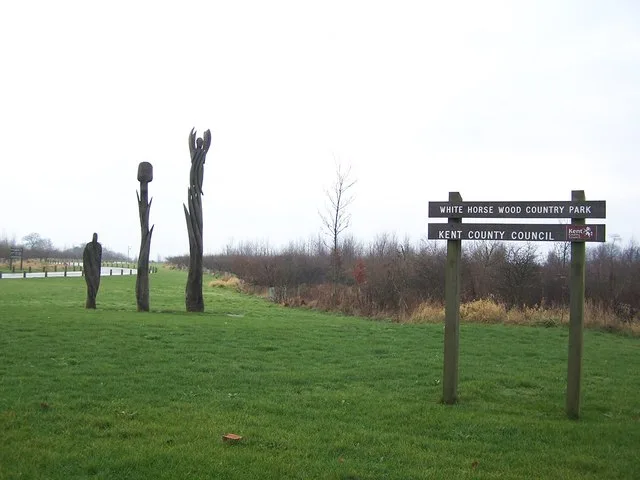
White Horse Wood
Parks · 3.0 km

Godards Castle
Castles · 3.0 km
Nearby
📷 5Campsites · South East England
Hillside Campsite
Hillside Campsite — a campsite in england south east.
📷 5Campsites · South East England
Adventurers Sun Club
Adventurers Sun Club — a campsite in england south east.
📷 5Public art & sculpture · South East England
The Shepherd
The Shepherd — a public art in england-south-east, United Kingdom.
📷 5Viewpoints · South East England
North Downs Way Viewpoint
North Downs Way Viewpoint is a viewpoint in the United Kingdom.
📷 5Campsites · South East England
Coldblow Farm
Coldblow Farm — a campsite in england south east.
📷 5Historic houses · South East England
Hollingbourne House
Hollingbourne House — house in Hollingbourne, Maidstone, Kent, England, UK.
Where to eat & stay near Axe
Places to stay
📷 5Campsites · South East England
Hillside Campsite
Hillside Campsite — a campsite in england south east.
📷 5Campsites · South East England
Adventurers Sun Club
Adventurers Sun Club — a campsite in england south east.
📷 5Campsites · South East England
Coldblow Farm
Coldblow Farm — a campsite in england south east.
 📷 5
📷 5Caravan parks · South East England
Bearsted Caravan And Motorhome Club Site
Bearsted Caravan And Motorhome Club Site — a caravan park in england south east.
 📷 5
📷 5Caravan parks · South East England
Oak View Caravan Park
Oak View Caravan Park — a caravan park in england london.
 📷 5
📷 5Caravan parks · South East England
Hogbarn Caravan Park
Hogbarn Caravan Park — a caravan park in england south east.
Places to eat & drink
 📷 7
📷 7Historic pubs · South East England
The Windmill Public House
The Windmill Public House in England South East, United Kingdom.
 📷 7
📷 7Historic pubs · South East England
The Park Gate Inn
The Park Gate Inn in England South East, United Kingdom.
 📷 5
📷 5Historic pubs · South East England
The Cock Horse
The Cock Horse in England South East, United Kingdom.
 📷 7
📷 7Historic pubs · South East England
Ringlestone Inn
Ringlestone Inn in England South East, United Kingdom.
 📷 5
📷 5Historic pubs · South East England
The Roebuck Public House
The Roebuck Public House in England South East, United Kingdom.
 📷 6
📷 6Historic pubs · South East England
The King's Arms
The King's Arms in England South East, United Kingdom.
More places in this region
 📷 5
📷 5Public art & sculpture · South East England
The Jurors
The Jurors — Public artwork (installation) by Hew Locke.
 📷 5
📷 5Public art & sculpture · South East England
The Woking Martian
The Woking Martian — a public art in england-london, United Kingdom.
 📷 5
📷 5Public art & sculpture · South East England
The Golf Ball
The Golf Ball — a public art in england-london, United Kingdom.
 📷 5
📷 5Public art & sculpture · South East England
Memorial to Alan Turing
Memorial to Alan Turing — a public art in england-london, United Kingdom.
Frequently asked questions
- Where is Axe?
- Axe is in Kent, South-East England, United Kingdom (postcode ME17 1QX), in the parish of Hucking.
- What is Axe?
- Axe — a public art in england-south-east, United Kingdom.
- How do I get to Axe?
- The nearest railway station is Hollingbourne, about 3.1 km away. Drivers can use postcode ME17 1QX.
- Is Axe a protected site?
- Yes — Axe is part of the Kent Downs National Landscape (AONB).
- Is Axe free to visit?
- Yes, Axe is free to enter.
- How do I get to Axe?
- The nearest railway station is Hollingbourne, about 3.1 km away. Drivers can navigate to postcode ME17 1QX.