
Historic houses · East of England
Hengrave Hall
In or near Fornham All Saints.
Hengrave Hall — Grade I listed building in Suffolk, United Kingdom.

Wikimedia Commons contributors — see linked file page for photographer and licence licence

Plan your visit
- Typical visit
- 1 h–2 h
- Nearest railway station
- Bury St Edmunds · 4.4 km
- Family-friendly
- Limited wheelchair access
Getting there & planning your visit
Hengrave Hall is located in Suffolk, postcode IP28 6LZ, and the nearest railway station is Bury St Edmunds, which is 4.4 km away. Entry details are not provided, and wheelchair accessibility is limited.
About
Hengrave Hall is a historic house in the United Kingdom — typically a country seat, manor, or town house with notable architecture or history. Heritage designation: Grade I listed building. Wikidata describes it as: "Grade I listed building in Suffolk, United Kingdom". Coordinates: 52.2848°, 0.6725°.
Photo gallery
Official information
Hengrave Hall is a 16th century Tudor mansion located in a 350-acre private estate in Suffolk, offering an exclusive venue for weddings and events. Visitors can enjoy the beautifully maintained gardens, a lime tree orchard, and an onsite church, all contributing to a romantic and historic atmosphere.
Protected designations
- Site of Special Scientific Interest: Breckland Farmland SSSI
Designations sourced from Natural England open data under OGL v3.
From the Wikipedia article
Hengrave Hall is a Grade I listed Tudor manor house in Hengrave near Bury St. Edmunds in Suffolk, England and was the seat of the Kitson and Gage families 1525–1887. Both families were Roman Catholic recusants.
Excerpt from Wikipedia under CC BY-SA 4.0. See the source article linked in Sources below.
Background
Architecture
Work on the house was begun in 1525 by Thomas Kitson, a London merchant and member of the Mercers Company, who completed it in 1538. The house is one of the last examples of a house built around an enclosed courtyard with a great hall. It is constructed from stone taken from Ixworth Priory (dissolved in 1536) and white bricks baked at Woolpit. The house is notable for an ornate oriel window incorporating the royal arms of Henry VIII, the Kitson arms and the arms of the wife and daughters of Sir Thomas Kitson the Younger (Kitson quartered with Paget; Kitson quartered with Cornwallis; Kitson quartered with Darcy; Kitson quartered with Cavendish). The house is embattled, and in the great hall…
Sourced from Wikipedia under CC BY-SA 4.0.
- Coordinates
- 52.2848, 0.6725
- County
- Suffolk
- District
- West Suffolk
- Parish
- Hengrave
- Postcode
- IP28 6LZ
- Parliamentary constituency
- West Suffolk
- Established
- 1525
- Nearest railway station
- Bury St Edmunds — 4.4 km
- Official site
- www.hengravehall.co.uk
Sources
- wikidata: Q5714331 (CC0)
- wikipedia: Hengrave Hall (CC BY-SA 4.0)
- commons: Hengrave Hall 1.jpg (CC BY-SA 4.0)
Other places nearby
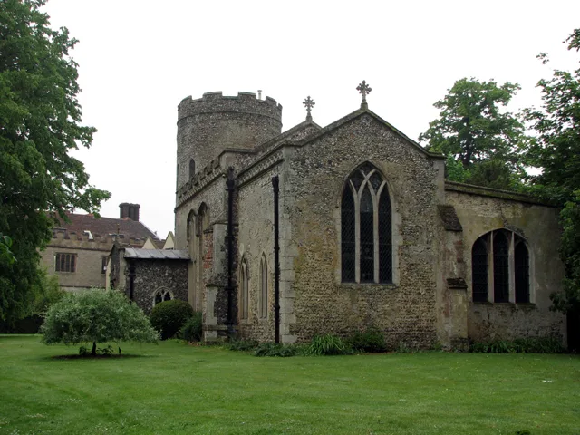
Church of St John Lateran, Hengrave
Historic churches · 0.1 km

Hengrave
Villages · 0.2 km

Hengrave Village Sign
Public art & sculpture · 0.4 km
Settlement site W of Hengrave mill
Vineyards · 0.5 km

Flempton-cum-Hengrave War Memorial
Memorials & monuments · 0.7 km

Fornham All Saints
Towns & cities · 1.6 km

Church of All Saints, Fornham All Saints
Historic churches · 1.6 km

Fornham Hall
Historic houses · 1.7 km

Fornham All Saints Village Sign
Public art & sculpture · 1.7 km

Three Kings Public House And Attached House Stable Block
Historic pubs · 1.7 km

Fornham All Saints War Memorial
Memorials & monuments · 1.7 km

Flempton
Villages · 1.8 km
Nearby
📷 4Historic churches · East of England
Church of St John Lateran, Hengrave
Church of St John Lateran, Hengrave — Grade I listed church in Hengrave, Suffolk, England, UK.
📷 5📷 3Public art & sculpture · East of England
Hengrave Village Sign
Hengrave Village Sign — a public art in East of England, United Kingdom.
📷 5Vineyards · East of England
Settlement site W of Hengrave mill
Settlement site W of Hengrave mill — a UK vineyard in england east, producing English or Welsh wine from cool-climate grape varieties.
📷 3Memorials & monuments · East of England
Flempton-cum-Hengrave War Memorial
Flempton-cum-Hengrave War Memorial — Grade II listed building-listed memorial in england-east, United Kingdom.
📷 4Towns & cities · East of England
Fornham All Saints
Fornham All Saints — village in Suffolk, England, UK.
Where to eat & stay near Hengrave Hall
Places to stay
 📷 5
📷 5 📷 7
📷 7 📷 5
📷 5Caravan parks · East of England
King's Forest Caravan Park
King's Forest Caravan Park — a caravan park in england east.
 📷 5
📷 5Hotels · East of England
Angel Hotel
Angel Hotel — a hotel in england east.
 📷 7
📷 7Hotels · East of England
Chantry Hotel
Chantry Hotel — a hotel in england east.
 📷 5
📷 5Hotels · East of England
Dragonfly Hotel
Dragonfly Hotel — a hotel in england east.
Places to eat & drink
📷 7Historic pubs · East of England
Three Kings Public House And Attached House Stable Block
Three Kings Public House And Attached House Stable Block in England East, United Kingdom.
 📷 7
📷 7Historic pubs · East of England
The White Horse Public House Cottage And Coach House
The White Horse Public House Cottage And Coach House in England East, United Kingdom.
 📷 6
📷 6Historic pubs · East of England
The Linden Tree Public House
The Linden Tree Public House in England East, United Kingdom.
 📷 6
📷 6Historic pubs · East of England
The Bushel Public House
The Bushel Public House in England East, United Kingdom.
 📷 5
📷 5Historic pubs · East of England
The Rising Sun Public House
The Rising Sun Public House in England East, United Kingdom.
 📷 7
📷 7Historic pubs · East of England
The Market Tavern Public House
The Market Tavern Public House in England East, United Kingdom.
More historic houses in this region
 📷 5
📷 5Historic houses · East of England
41 and 41a, Broad Street
41 and 41a, Broad Street — Grade II* listed house in Ely, East Cambridgeshire, England, UK.
 📷 5
📷 5Historic houses · East of England
Abbey Gate House
Abbey Gate House — house in St Albans, Hertfordshire, England, UK.
 📷 5
📷 5Historic houses · East of England
Abbey House
Abbey House — house in Cambridge, Cambridgeshire, England, UK.
.jpg?width=1200) 📷 5
📷 5Historic houses · East of England
Amores Including Outbuildings
Amores Including Outbuildings — architectural structure in Hertford, East Hertfordshire, England, UK.
Frequently asked questions
- Where is Hengrave Hall?
- Hengrave Hall is in Suffolk, East of England, United Kingdom (postcode IP28 6LZ), in the parish of Hengrave.
- What is Hengrave Hall?
- Hengrave Hall — Grade I listed building in Suffolk, United Kingdom.
- How do I get to Hengrave Hall?
- The nearest railway station is Bury St Edmunds, about 4.4 km away. The nearest town is Fornham All Saints. Drivers can use postcode IP28 6LZ.
- When was Hengrave Hall built?
- Built or established in 1525.
- Who owns Hengrave Hall?
- Hengrave Hall is owned by David Hugh Harris.
- Is Hengrave Hall a listed building?
- Hengrave Hall is officially recognised as Grade I listed building listed.
- Is Hengrave Hall a protected site?
- Yes — Hengrave Hall is part of the Breckland Farmland SSSI Site of Special Scientific Interest.
- How do I get to Hengrave Hall?
- The nearest railway station is Bury St Edmunds, about 4.4 km away. Drivers can navigate to postcode IP28 6LZ.