
Historic houses · East of England
Fornham Hall
In or near Fornham All Saints.
Fornham Hall — former stately home in Suffolk, UK.

Wikimedia Commons contributors — see linked file page for photographer and licence licence

Plan your visit
- Typical visit
- 1 h–2 h
- Nearest railway station
- Bury St Edmunds · 3.4 km
- Family-friendly
- Limited wheelchair access
About
Fornham Hall is a historic house in the United Kingdom — typically a country seat, manor, or town house with notable architecture or history. Wikidata describes it as: "former stately home in Suffolk, UK". Coordinates: 52.2825°, 0.6966°.
Photo gallery
Protected designations
- Site of Special Scientific Interest: Breckland Farmland SSSI
Designations sourced from Natural England open data under OGL v3.
From the Wikipedia article
Fornham Hall was a large 18th-century country house near Bury St Edmunds. It was demolished in 1957. The Estate included manorial land is part of the parish of Fornham St Genevieve.
Excerpt from Wikipedia under CC BY-SA 4.0. See the source article linked in Sources below.
Background
History
The Fornham estate was bought in 1731 by Samuel Kent, a rich London grain merchant who became a local MP. Sir Charles Kent, Bt (Samuel's grandson) employed James Wyatt to design a large new house on the estate in the 1770s. He also became a local MP (for Thetford) and was High Sheriff of Suffolk for 1781. The house was acquired by Bernard Howard (subsequently 12th Duke of Norfolk) in 1797 and expanded on the Duke's behalf by the architect Robert Abraham in the 1820s. It was sold in 1842 to the second Lord Manners who sold it on to Sir William Gilstrap in 1862. The estate was acquired by the War Office in 1939 and used for training purposes by the Royal Engineers during World War II before…
Sourced from Wikipedia under CC BY-SA 4.0.
- Coordinates
- 52.2825, 0.6966
- County
- Suffolk
- District
- West Suffolk
- Parish
- Fornham St. Genevieve
- Postcode
- IP28 6TT
- Parliamentary constituency
- Bury St Edmunds and Stowmarket
- Nearest railway station
- Bury St Edmunds — 3.4 km
Sources
- wikidata: Q5470381 (CC0)
- wikipedia: Fornham Hall (CC BY-SA 4.0)
- commons: Fornham Hall.jpg (CC BY-SA 4.0)
Other places nearby

Fornham All Saints
Towns & cities · 0.7 km

Church of All Saints, Fornham All Saints
Historic churches · 0.8 km

Fornham All Saints Village Sign
Public art & sculpture · 0.8 km

Fornham St Genevieve
Towns & cities · 1.0 km

Fornham All Saints War Memorial
Memorials & monuments · 1.0 km

Three Kings Public House And Attached House Stable Block
Historic pubs · 1.1 km

Hengrave Village Sign
Public art & sculpture · 1.3 km

Settlement site W of Hengrave mill
Vineyards · 1.4 km

Fornham St Martin cum Fornham St Genevieve Village Sign
Public art & sculpture · 1.4 km
Hengrave
Villages · 1.5 km
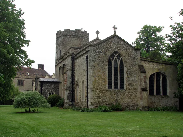
Church of St John Lateran, Hengrave
Historic churches · 1.6 km

Timworth
Villages · 1.6 km
Nearby
📷 4Towns & cities · East of England
Fornham All Saints
Fornham All Saints — village in Suffolk, England, UK.
📷 3Historic churches · East of England
Church of All Saints, Fornham All Saints
Church of All Saints, Fornham All Saints — a Grade I-listed church in england-east, United Kingdom.
📷 3Public art & sculpture · East of England
Fornham All Saints Village Sign
Fornham All Saints Village Sign — a public art in East of England, United Kingdom.
📷 5Towns & cities · East of England
Fornham St Genevieve
Fornham St Genevieve — village and civil parish in Suffolk, United Kingdom.
📷 3Memorials & monuments · East of England
Fornham All Saints War Memorial
Fornham All Saints War Memorial — Grade II listed building-listed memorial in england-east, United Kingdom.
📷 7Historic pubs · East of England
Three Kings Public House And Attached House Stable Block
Three Kings Public House And Attached House Stable Block in England East, United Kingdom.
Where to eat & stay near Fornham Hall
Places to stay
 📷 7
📷 7 📷 5
📷 5 📷 5
📷 5Hotels · East of England
Angel Hotel
Angel Hotel — a hotel in england east.
 📷 7
📷 7Hotels · East of England
Chantry Hotel
Chantry Hotel — a hotel in england east.
 📷 5
📷 5Hotels · East of England
Dragonfly Hotel
Dragonfly Hotel — a hotel in england east.
 📷 5
📷 5Caravan parks · East of England
King's Forest Caravan Park
King's Forest Caravan Park — a caravan park in england east.
Places to eat & drink
📷 7Historic pubs · East of England
Three Kings Public House And Attached House Stable Block
Three Kings Public House And Attached House Stable Block in England East, United Kingdom.
 📷 6
📷 6Historic pubs · East of England
The Linden Tree Public House
The Linden Tree Public House in England East, United Kingdom.
 📷 6
📷 6Historic pubs · East of England
The Bushel Public House
The Bushel Public House in England East, United Kingdom.
 📷 5
📷 5Historic pubs · East of England
The Rising Sun Public House
The Rising Sun Public House in England East, United Kingdom.
 📷 7
📷 7Historic pubs · East of England
The Market Tavern Public House
The Market Tavern Public House in England East, United Kingdom.
 📷 7
📷 7Restaurants · East of England
Cheers
Cheers — a restaurant in england east.
More historic houses in this region
 📷 5
📷 5Historic houses · East of England
41 and 41a, Broad Street
41 and 41a, Broad Street — Grade II* listed house in Ely, East Cambridgeshire, England, UK.
 📷 5
📷 5Historic houses · East of England
Abbey Gate House
Abbey Gate House — house in St Albans, Hertfordshire, England, UK.
 📷 5
📷 5Historic houses · East of England
Abbey House
Abbey House — house in Cambridge, Cambridgeshire, England, UK.
.jpg?width=1200) 📷 5
📷 5Historic houses · East of England
Amores Including Outbuildings
Amores Including Outbuildings — architectural structure in Hertford, East Hertfordshire, England, UK.
Frequently asked questions
- Where is Fornham Hall?
- Fornham Hall is in Suffolk, East of England, United Kingdom (postcode IP28 6TT), in the parish of Fornham St. Genevieve.
- What is Fornham Hall?
- Fornham Hall — former stately home in Suffolk, UK.
- How do I get to Fornham Hall?
- The nearest railway station is Bury St Edmunds, about 3.4 km away. The nearest town is Fornham All Saints. Drivers can use postcode IP28 6TT.
- Is Fornham Hall a protected site?
- Yes — Fornham Hall is part of the Breckland Farmland SSSI Site of Special Scientific Interest.
- How do I get to Fornham Hall?
- The nearest railway station is Bury St Edmunds, about 3.4 km away. Drivers can navigate to postcode IP28 6TT.