Reservoirs & lochs · North West England
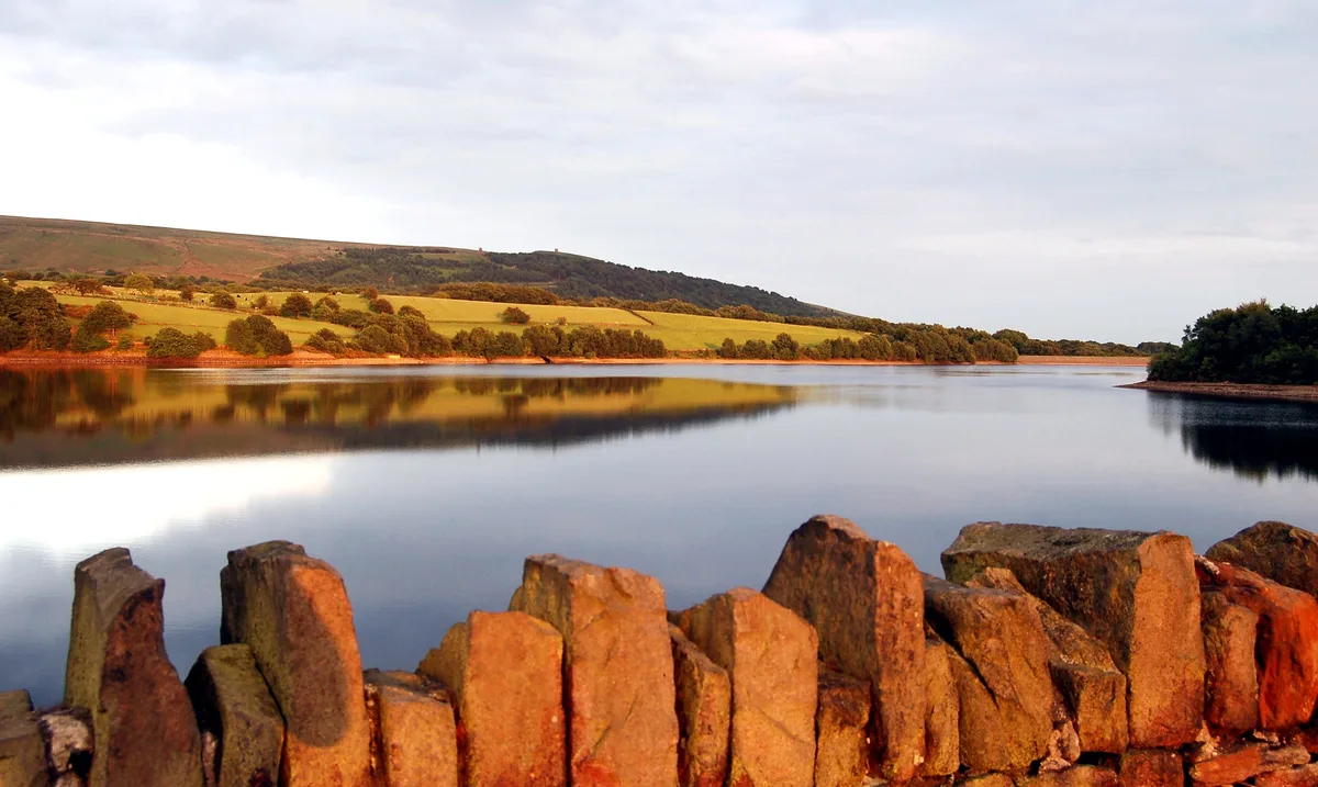
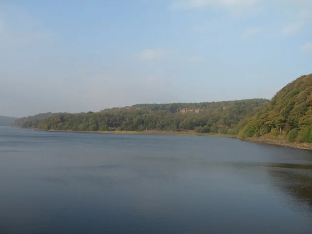
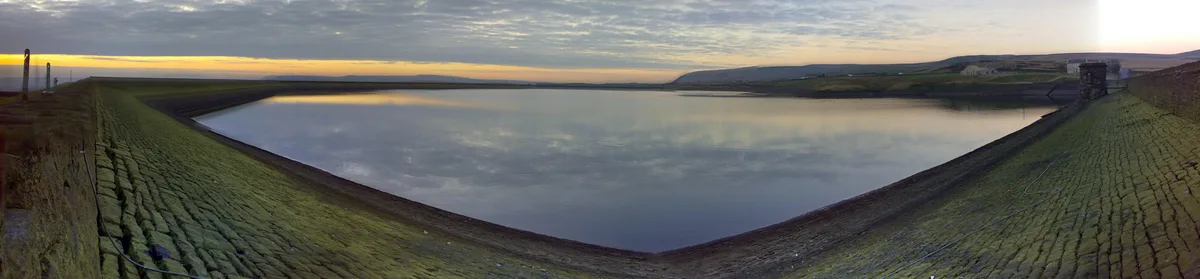
Haweswater Reservoir
In or near Bomby.
Haweswater Reservoir — reservoir in the United Kingdom.

Wikimedia Commons contributors — see linked file page for photographer and licence licence
Plan your visit
- Typical visit
- 1 h–2.5 h
- Free entry
- Dog-friendly
About
Haweswater Reservoir is a reservoir in the United Kingdom. Wikidata describes it as: "reservoir in the United Kingdom". Coordinates: 54.5189°, -2.8047°.
Photo gallery
Official information
Haweswater Reservoir is a scenic water body located in the Lake District, known for its stunning landscapes and opportunities for outdoor activities. Visitors can enjoy walking, birdwatching, and exploring the natural beauty of the surrounding area.
Protected designations
- Site of Special Scientific Interest: Naddle Forest SSSI
- Site of Special Scientific Interest: River Eden and Tributaries SSSI
Designations sourced from Natural England open data under OGL v3.
From the Wikipedia article
Haweswater is a reservoir in the valley of Mardale, Cumbria in the Lake District, England. The man-made reservoir, which was created by damming the original natural lake, was completed by 1935. It raised the water level in the valley by 29 m (95 ft). The valley was dammed by Manchester Corporation, after it had obtained permission from the UK Parliament through the passing of the Manchester Corporation Act 1919 (9 & 10 Geo. 5. c. cxix). The local act of Parliament was for the supply of drinking water to Manchester. However, the decision caused public outcry because the farming villages of Measand and Mardale Green would be lost when Mardale was flooded. Construction work on the dam began in 1929. Haweswater was completely flooded by 1935. The reservoir is now owned and managed by United Utilities. It supplies about 25% of North West England's water supply.
Excerpt from Wikipedia under CC BY-SA 4.0. See the source article linked in Sources below.
Background
History
Haweswater was originally a natural lake about 4 km long. A tongue of land at Measand divided the lake almost in two. The upper and lower reaches of the lake were known as High Water and Low Water. In 1929 work started to build the dam wall across the valley floor. At the time of construction, its design was considered to be at the forefront of civil engineering technology because it was the world's first hollow buttress dam. The wall would be created from 44 separate buttressed units joined by flexible joints. When the dam was completed by 1935, it measured 470 m long and 27.5 m high. A 1.4 m wide parapet runs atop the length of the dam. Building supplies were brought to the site from the…
Sourced from Wikipedia under CC BY-SA 4.0.
- Coordinates
- 54.5189, -2.8047
- Address
- Lake District, Cumbria
- Official site
- www.environment-agency.gov.uk
Sources
- wikidata: Q1480495 (CC0)
- wikipedia: Haweswater Reservoir (CC BY-SA 4.0)
- commons: Haweswater from Harter Fell 3.jpg (CC BY-SA 4.0)
Other places nearby

Hawes Water
Lakes · 0.4 km

Mardale
Vineyards · 1.0 km

High Forest
Mountains & hills · 1.3 km

Measand
Natural landmarks · 1.5 km

The Forces
Waterfalls · 1.6 km

Castle Crag
Vineyards · 1.7 km
Castle Crags
Castles · 1.7 km

Birks Crag Camp
Archaeological sites · 1.7 km

Wallow Crag
Mountains & hills · 1.9 km

Hare Shaw
Mountains & hills · 2.0 km

Brown Howe
Mountains & hills · 2.0 km

Fordingdale Force
Waterfalls · 2.0 km
Nearby
📷 5📷 5Vineyards · North West England
Mardale
Mardale — a UK vineyard in england north east, producing English or Welsh wine from cool-climate grape varieties.
📷 5Mountains & hills · North West England
High Forest
High Forest — mountain in england north east. Elevation: 435 m.
📷 3Natural landmarks · North West England
Measand
Measand — a other in england-north-east, United Kingdom.
📷 5📷 5Vineyards · North West England
Castle Crag
Castle Crag — a UK vineyard in england north east, producing English or Welsh wine from cool-climate grape varieties.
Where to eat & stay near Haweswater Reservoir
Places to stay
 📷 5
📷 5 📷 5
📷 5 📷 5
📷 5Caravan parks · North West England
Hartsop Fold Holiday Lodges
Hartsop Fold Holiday Lodges — a caravan park in england north east.
 📷 5
📷 5Campsites · North West England
Sykeside Camping Site
Sykeside Camping Site — a campsite in england north west.
 📷 5
📷 5Campsites · North West England
Patterdale Youth Hostel camp site
Patterdale Youth Hostel camp site — a campsite in england north east.
 📷 5
📷 5B&Bs · North West England
Greenbank Farm Bed and Breakfast
Greenbank Farm Bed and Breakfast — a bed-and-breakfast in england north east.
Places to eat & drink
 📷 5
📷 5Historic pubs · North West England
Horse And Farrier Inn And Stables
Horse And Farrier Inn And Stables in Scotland Lowlands, United Kingdom.
 📷 5
📷 5Historic pubs · North West England
Golden Rule Hotel
Golden Rule Hotel in England North West, United Kingdom.
 📷 4
📷 4Restaurants · North West England
Holbeck Ghyll
Holbeck Ghyll is a restaurant located in Windermere, Cumbria, England. "The late 19th century building was once Lord Lonsdale's hunting lodge and only became a hotel in the 1970s. It won a Michelin st
 📷 5
📷 5Restaurants · North West England
Holbeck Ghyll Restaurant
Holbeck Ghyll Restaurant — a restaurant in england north west.
📷 5Historic pubs · North West England
Holbeck Ghyll
Holbeck Ghyll in England North West, United Kingdom.
 📷 7
📷 7Historic pubs · North West England
The Travellers Rest
The Travellers Rest in England North West, United Kingdom.
More places in this region
 Flagship📷 5
Reservoirs & lochs · North West England
Yarrow Reservoir
Yarrow Reservoir — reservoir in Lancashire, England, UK.
.jpg?width=1200) 📷 3
📷 3Reservoirs & lochs · North West England
Abbey Village Reservoir
Abbey Village Reservoir — reservoir in Lancashire, England, UK.
 📷 3
📷 3Reservoirs & lochs · North West England
Anglezarke Reservoir
Anglezarke Reservoir — reservoir in Lancashire, England, UK.
 📷 3
📷 3Reservoirs & lochs · North West England
Ashworth Moor Reservoir
Ashworth Moor Reservoir — reservoir in Greater Manchester, England, UK.
Frequently asked questions
- Where is Haweswater Reservoir?
- Haweswater Reservoir is in North-East England, United Kingdom.
- What is Haweswater Reservoir?
- Haweswater Reservoir — reservoir in the United Kingdom.
- How do I get to Haweswater Reservoir?
- Its coordinates are 54.5189°, -2.8047°.
- Is Haweswater Reservoir a protected site?
- Yes — Haweswater Reservoir is part of the Naddle Forest SSSI Site of Special Scientific Interest and the River Eden and Tributaries SSSI Site of Special Scientific Interest.
- Is Haweswater Reservoir free to visit?
- Yes, Haweswater Reservoir is free to enter.