
Natural landmarks · North West England
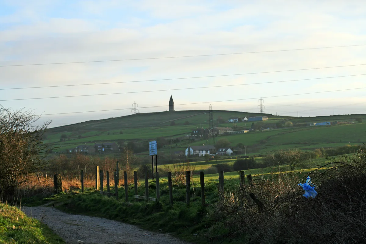
Hartshead Pike
In or near Old Glossop.
Hartshead Pike — mountain in the United Kingdom.

Wikimedia Commons contributors — see linked file page for photographer and licence licence
.jpg)
Plan your visit
- Typical visit
- 1 h–2 h
- Nearest railway station
- Mossley · 1.3 km
- Free entry
- Dog-friendly
About
Hartshead Pike is a named natural landmark in the United Kingdom. Part of South Pennines. Wikidata describes it as: "mountain in the United Kingdom". Coordinates: 53.5183°, -2.0609°.
Photo gallery
Protected designations
- Site of Special Scientific Interest: Huddersfield Narrow Canal SSSI
Designations sourced from Natural England open data under OGL v3.
From the Wikipedia article
Hartshead Pike is a hill in Tameside in Greater Manchester, England, and its name is associated with the monument on its summit. It overlooks Ashton-under-Lyne, Mossley, Saddleworth, Lees and Oldham. On a clear day you can get views of Manchester, Cheshire and Snowdonia in Wales. Hartshead Pike Tower has been a Grade II listed building since 1967.
Excerpt from Wikipedia under CC BY-SA 4.0. See the source article linked in Sources below.
Background
History
During the Roman occupation of Britain, a warning beacon for local garrisons, possibly lit during times of unrest, may have been sited on Hartshead Pike. Local trackways were routes for the Romans to access the Roman road at Limeside. The name refers to the hill and the tower. The tower is not on the highest part of the hill but its prominent position, 940 ft above sea level, has been the site of a beacon or signalling station
Sourced from Wikipedia under CC BY-SA 4.0.
- Coordinates
- 53.5183, -2.0609
- District
- Tameside
- Parish
- Tameside, unparished area
- Postcode
- OL6 9AF
- Parliamentary constituency
- Ashton-under-Lyne
- Nearest railway station
- Mossley — 1.3 km
- Official site
- www.tameside.gov.uk
Sources
- wikidata: Q339641 (CC0)
- wikipedia: Hartshead Pike (CC BY-SA 4.0)
- commons: Hartshead Pike (1).jpg (CC BY-SA 4.0)
Other places nearby
Hartshead Pike
Mountains & hills · 0.1 km

Colliers Arms Public House
Historic pubs · 0.3 km

Holly Bank
Mountains & hills · 0.7 km

War Memorial in Front of Former Town Hall
Memorials & monuments · 1.3 km

Mossley
Castles · 1.5 km

Huddersfield Narrow Canal Micklehurst Bridge And Lock Number W13
Historic bridges · 1.6 km

Hudderfield Narrow Canal Winterford Bridge And Lock Number W14
Canal locks · 1.6 km

Micklehurst
Villages · 2.0 km

Lees War Memorial
Memorials & monuments · 2.0 km

Hurst War Memorial
Memorials & monuments · 2.1 km

Church of St Thomas, Lees
Historic churches · 2.2 km

Vale Cinema
Theatres · 2.2 km
Nearby
📷 5Mountains & hills · North West England
Hartshead Pike
Hartshead Pike — Named summit at 267 m.
📷 5Historic pubs · North West England
Colliers Arms Public House
Colliers Arms Public House in England North West, United Kingdom.
📷 5Mountains & hills · North West England
Holly Bank
Holly Bank — a hill or mountain in england north west.
📷 3Memorials & monuments · North West England
War Memorial in Front of Former Town Hall
War Memorial in Front of Former Town Hall — Grade II listed building-listed memorial in england-north-west, United Kingdom.
📷 5Castles · North West England
Mossley
Mossley (/ˈmɒzli/) is a town and civil parish in Tameside, Greater Manchester, England, in the upper Tame Valley and the foothills of the Pennines, 3 miles (4.8 km) south-east of Oldham and 9 miles (1
📷 3Historic bridges · North West England
Huddersfield Narrow Canal Micklehurst Bridge And Lock Number W13
Huddersfield Narrow Canal Micklehurst Bridge And Lock Number W13 — Grade II listed building-listed bridge in england-north-west, United Kingdom.
Where to eat & stay near Hartshead Pike
Places to stay
 📷 5
📷 5Campsites · North West England
Well-i-Hole Farm Caravan and Camping
Well-i-Hole Farm Caravan and Camping — a campsite in england north west.
 📷 5
📷 5 📷 5
📷 5Campsites · North West England
Dog Hill Scout Campsite
Dog Hill Scout Campsite — a campsite in england north west.
 📷 5
📷 5Campsites · East Midlands
Crossgate Farm Campsite
Crossgate Farm Campsite — a campsite in england east midlands.
 📷 5
📷 5Caravan parks · North West England
The Moorlands
The Moorlands — a caravan park in england north west.
 📷 5
📷 5Caravan parks · East Midlands
Windy Harbour Hotel Caravan and Camping Site
Windy Harbour Hotel Caravan and Camping Site — a caravan park in england east midlands.
Places to eat & drink
📷 5Historic pubs · North West England
Colliers Arms Public House
Colliers Arms Public House in England North West, United Kingdom.
 📷 7
📷 7 📷 7
📷 7 📷 7
📷 7Historic pubs · East Midlands
The Spinners Arms Public House
The Spinners Arms Public House in England Yorkshire, United Kingdom.
 📷 7
📷 7Historic pubs · North West England
The Plough, Gorton
The Plough, Gorton in England North West, United Kingdom.
 📷 5
📷 5Historic pubs · North West England
Ye Olde Boars Head Public House
Ye Olde Boars Head Public House in England North West, United Kingdom.
More natural landmarks in this region
 📷 3
📷 3Natural landmarks · North West England
Statue of Oliver Cromwell
Statue of Oliver Cromwell — Public artwork (statue).
 📷 3
📷 3Natural landmarks · North West England
Dagfields Craft Centre
Dagfields Craft Centre — a place in North West England, United Kingdom.
 📷 3
📷 3Natural landmarks · North West England
Weaver Valley Cruises
Weaver Valley Cruises — a place in North West England, United Kingdom.
 📷 3
📷 3Natural landmarks · North West England
Golden Gates
Golden Gates — a place in North West England, United Kingdom.
Frequently asked questions
- Where is Hartshead Pike?
- Hartshead Pike is in North-West England, United Kingdom (postcode OL6 9AF), in the parish of Tameside, unparished area.
- What is Hartshead Pike?
- Hartshead Pike — mountain in the United Kingdom.
- How do I get to Hartshead Pike?
- The nearest railway station is Mossley, about 1.3 km away. The nearest town is Old Glossop. Drivers can use postcode OL6 9AF.
- Is Hartshead Pike a protected site?
- Yes — Hartshead Pike is part of the Huddersfield Narrow Canal SSSI Site of Special Scientific Interest.
- Is Hartshead Pike free to visit?
- Yes, Hartshead Pike is free to enter.
- How do I get to Hartshead Pike?
- The nearest railway station is Mossley, about 1.3 km away. Drivers can navigate to postcode OL6 9AF.