
Mountains & hills · North East England
Hartley
Also known as: Hartley, Cumbria
In or near Helbeck.
Hartley in England North East, United Kingdom.

David Medcalf — CC BY-SA 2.0 via Wikimedia Commons licence

Plan your visit
- Typical visit
- 3 h–8 h
- Best time of year
- Late spring – early autumn (May–Oct)
- Nearest railway station
- Kirkby Stephen East · 1.9 km
- Free entry
- Dog-friendly
Getting there & planning your visit
To visit Hartley, the nearest railway station is Kirkby Stephen East, located 1.9 km away. The postcode for Hartley is CA17 4JH, which can be used for sat-nav coordinates. Entry is free.
About
Hartley is a place of interest in England North East, United Kingdom — drawn from open-data sources for visitor reference. See the linked Wikipedia article for the full description.
Photo gallery
Protected designations
- Site of Special Scientific Interest: River Eden and Tributaries SSSI
- Area of Outstanding Natural Beauty: North Pennines
Designations sourced from Natural England open data under OGL v3.
From the Wikipedia article
Hartley is a village and civil parish in the Westmorland and Furness district of Cumbria, England. It is about 0.5 miles (0.8 km) east of Kirkby Stephen. The area has many old lead and copper mines that are now abandoned as well as a large quantity of iron haematite, ironstone and ore. At the highest peak in Hartley stand nine obelisks referred to as "Nine Standards". Nobody knows the true purpose of the "Nine Standards" although some believe that they were used to create a sense of a forthcoming army to scare the enemy forces. However, it is more widely believed that they were placed as geographical aid to help outline the borders between the two neighbouring counties, Westmorland and Yorkshire. Hartley is also home to Hartley Castle. It was originally built as a "tower house circa 1353 and extended circa 1600" and then re- developed in the 18th century. The castle was built at the southern point of Hartley. In the 1870s, Hartley was described as: Hartley, a township in Kirkby-Stephen parish, Westmoreland; 1 mile SE of Kirkby-Stephen. Acres, 3, 350. Real property, with Winton, £4, 159. Pop., 215. Houses, 45. Hartley Castle stood on an eminence; belonged to successively the Veteriponts, the Hartleys, the Nevilles, and the Musgraves; and was demolished in the early part of the 18th century. The township is mountainous; includes Hartley fell; and contains coal, lead, and copper
Excerpt from Wikipedia under CC BY-SA 4.0. See the source article linked in Sources below.
- Coordinates
- 54.4740, -2.3362
- District
- Westmorland and Furness
- Parish
- Hartley
- Postcode
- CA17 4JH
- Parliamentary constituency
- Westmorland and Lonsdale
- Nearest railway station
- Kirkby Stephen East — 1.9 km
Sources
- wikidata: Q2789148 (CC0)
- wikipedia: Hartley, Cumbria (CC BY-SA 4.0)
Other places nearby

Merrygill Viaduct
Historic bridges · 0.5 km

Castle Hill
Mountains & hills · 0.5 km

Hartley Castle
Castles · 0.5 km

Hartley settlement
Literary houses · 0.6 km
Hartley settlement1
Castles · 0.6 km

Frank's Bridge
Historic bridges · 0.7 km

Lesley Rowe
Galleries · 0.8 km

Kirkby Stephen War Memorial
Memorials & monuments · 0.8 km
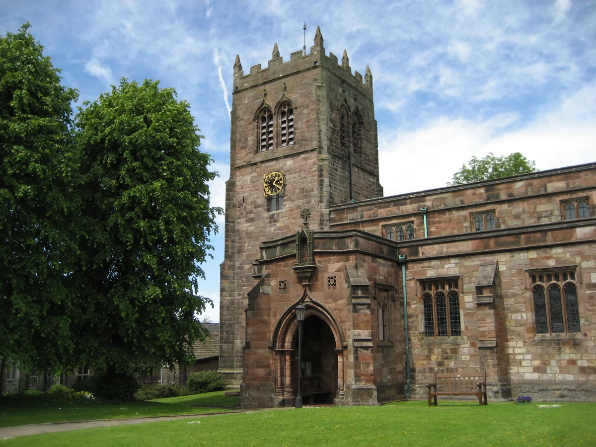
St Stephen's Church, Kirkby Stephen
Historic churches · 0.8 km

Kirkby Stephen Parish Church
Historic churches · 0.8 km

Kirkby Stephen
Historic churches · 0.8 km

Lady Anne's Way
Public art & sculpture · 0.8 km
Nearby
📷 3Historic bridges · North West England
Merrygill Viaduct
Merrygill Viaduct is a historic bridge in the United Kingdom.
📷 5Mountains & hills · North West England
Castle Hill
Castle Hill — mountain in england north west. Elevation: 221 m.
📷 4📷 5Literary houses · North West England
Hartley settlement
Hartley settlement — a literary house museum in england north west.
📷 5Castles · North West England
Hartley settlement1
Hartley settlement1 — a castle in england north west.
📷 4Historic bridges · North West England
Frank's Bridge
Frank's Bridge — Grade II listed building-listed bridge in england-north-west, United Kingdom.
Where to eat & stay near Hartley
Places to stay
 📷 7
📷 7Hotels · North West England
The Pennine Hotel
The Pennine Hotel — a hotel in england north west.
 📷 7
📷 7Hotels · North West England
Black Bull Hotel
Black Bull Hotel — a hotel in england north west.
 📷 7
📷 7B&Bs · North West England
Fletcher House
Fletcher House — a bed-and-breakfast in england north west.
 📷 5
📷 5Hostels · North West England
Kirkby Stephen Hostel
Kirkby Stephen Hostel — a hostel in england north west.
 📷 5
📷 5Campsites · North West England
Pennine View Park
Pennine View Park — a campsite in england north west.
 📷 5
📷 5Hotels · North East England
Augill Castle
Augill Castle — a hotel in england north east.
Places to eat & drink
📷 7Cafés · North West England
The White Hare Cafe
The White Hare Cafe — a café in england north west.
 📷 5
📷 5 📷 5
📷 5Cafés · North West England
The Cross Keys Temperance Inn
The Cross Keys Temperance Inn — a café in england north west.
 📷 5
📷 5Historic pubs · North East England
1, Scattergate
1, Scattergate in England North East, United Kingdom.
 📷 5
📷 5Historic pubs · Yorkshire & the Humber
Kings Head Inn
Kings Head Inn in England North West, United Kingdom.
 📷 5
📷 5Cafés · North West England
Gun Dog Coffee Shop
Gun Dog Coffee Shop — a café in england north west.
More mountains in this region
 📷 5
📷 5Mountains & hills · North East England
Danby High Moor
Danby High Moor — a hill or mountain in england yorkshire.
 📷 5
📷 5Mountains & hills · North East England
Arndale Hill
Arndale Hill — mountain in england yorkshire. Elevation: 515.7 m.
 📷 5
📷 5Mountains & hills · North East England
Peat Hill
Peat Hill — mountain in england yorkshire. Elevation: 396 m.
 📷 5
📷 5Mountains & hills · North East England
Cocker Hill
Cocker Hill — mountain in england yorkshire. Elevation: 470 m.
Frequently asked questions
- Where is Hartley?
- Hartley is in North-East England, United Kingdom (postcode CA17 4JH), in the parish of Hartley.
- What is Hartley?
- Hartley in England North East, United Kingdom.
- How do I get to Hartley?
- The nearest railway station is Kirkby Stephen East, about 1.9 km away. Drivers can use postcode CA17 4JH.
- Is Hartley a protected site?
- Yes — Hartley is part of the River Eden and Tributaries SSSI Site of Special Scientific Interest and the North Pennines National Landscape (AONB).
- Is Hartley free to visit?
- Yes, Hartley is free to enter.
- How do I get to Hartley?
- The nearest railway station is Kirkby Stephen East, about 1.9 km away. Drivers can navigate to postcode CA17 4JH.