
Forests & woodlands · North East England
Hartlepool Submerged Forest
In or near The Hartlepools.
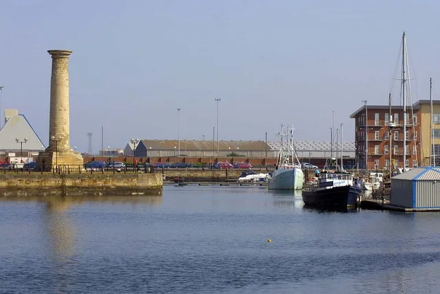
Hartlepool Submerged Forest in England North East, United Kingdom.

JThomas — CC BY-SA 2.0 via Wikimedia Commons licence

Plan your visit
- Typical visit
- 1 h–3 h
- Nearest railway station
- Hartlepool · 1.5 km
- Free entry
- Family-friendly
- Dog-friendly
Getting there & planning your visit
Hartlepool Submerged Forest is located in Hartlepool, North East England, with the nearest railway station being Hartlepool, approximately 1.5 km away. Entry to the forest is free. The postcode for sat-nav is TS25 1NR.
About
Hartlepool Submerged Forest is a place of interest in England North East, United Kingdom — drawn from open-data sources for visitor reference. See the linked Wikipedia article for the full description.
Photo gallery
Protected designations
- Site of Special Scientific Interest: Teesmouth and Cleveland Coast SSSI
Designations sourced from Natural England open data under OGL v3.
From the Wikipedia article
Hartlepool Submerged Forest (grid reference NZ520315) is a 19.7 hectare geological Site of Special Scientific Interest in County Durham, England notified in 1988. The site is located to the south of Hartlepool Docks. SSSIs are designated by Natural England, formally English Nature, which uses the 1974–1996 county system. This means there is no grouping of SSSIs by Hartlepool unitary authority, or County Durham which is the relevant ceremonial county . As such Hartlepool Submerged Forest is one of 18 SSSIs in the Cleveland area of search. A forest stretching for several miles along the Hartlepool coast is thought to have originated around 7,000 years ago. It became submerged as sea levels rose over the next five millennia, but remains preserved to this day as a peaty soil, intermittently revealed on the foreshore by the ebb and flow of the tide. Animal bones, including those of deer and wild boar have been discovered at the site, as well as flint tools and other implements pointing to human activity in the area thousands of years ago. These have been analysed by scientists hoping to understand the environment that existed in the area before the forest was submerged. The site is also considered to be of significant importance in understanding sea level and environmental changes since the last ice age, and is identified as such in the Geological Conservation Review.
Excerpt from Wikipedia under CC BY-SA 4.0. See the source article linked in Sources below.
- Coordinates
- 54.6761, -1.1928
- District
- Hartlepool
- Parish
- Hartlepool, unparished area
- Postcode
- TS25 1NR
- Parliamentary constituency
- Hartlepool
- Established
- 1988
- Nearest railway station
- Hartlepool — 1.5 km
- Official site
- www.natureonthemap.org.uk
Sources
- wikidata: Q2490225 (CC0)
- wikipedia: Hartlepool Submerged Forest (CC BY-SA 4.0)
Other places nearby
West Hartlepool Lifeboat Station
Beaches · 0.4 km

Waves
Public art & sculpture · 0.8 km

West Hartlepool
Villages · 0.9 km

Hartlepool Bay
Natural landmarks · 1.0 km
Seaton Carew lighthouse
Lighthouses · 1.1 km

Lion Sculpture And Pier 15 Metres To East Of Lion Brewery
Public art & sculpture · 1.3 km
RAF Jet Provost
Memorials & monuments · 1.4 km

Beacon Tower At East End Of North Pier Of West Harbour
Memorials & monuments · 1.4 km
Park Tower (Former North Eastern Co-Operative Society Department Store)
Memorials & monuments · 1.4 km

The Studio
Theatres · 1.4 km

Hartlepool College of Further Education
Other places · 1.5 km

Seaton Carew War Memorial
Memorials & monuments · 1.5 km
Nearby
📷 4Beaches · North East England
West Hartlepool Lifeboat Station
West Hartlepool Lifeboat Station in England North East, United Kingdom.
📷 3Public art & sculpture · North East England
Waves
Waves — a public art in scotland-lowlands, United Kingdom.
📷 5📷 5Natural landmarks · North East England
Hartlepool Bay
Hartlepool Bay — a natural feature in scotland lowlands.
📷 3Lighthouses · North East England
Seaton Carew lighthouse
Seaton Carew lighthouse is a lighthouse in the United Kingdom.
📷 3Public art & sculpture · North East England
Lion Sculpture And Pier 15 Metres To East Of Lion Brewery
Lion Sculpture And Pier 15 Metres To East Of Lion Brewery in England North East, United Kingdom.
Where to eat & stay near Hartlepool Submerged Forest
Places to stay
 📷 6
📷 6 📷 7
📷 7Hotels · North East England
Seaton Hotel
Seaton Hotel — a hotel in scotland lowlands.
 📷 3
📷 3Caravan parks · North East England
Ashfield Caravan Park
Ashfield Caravan Park — a caravan park in scotland lowlands.
 📷 5
📷 5Campsites · North East England
Crimdon House Farm
Crimdon House Farm — a campsite in scotland lowlands.
 📷 5
📷 5Caravan parks · North East England
North Hart Farm
North Hart Farm — a caravan park in scotland lowlands.
 📷 5
📷 5Caravan parks · North East England
Crimdon Dene Holiday Park
Crimdon Dene Holiday Park — a caravan park in scotland lowlands. Brand: Parkdean Resorts.
Places to eat & drink
 📷 5
📷 5Cafés · North East England
Mary Rowntrees Tea Rooms
Mary Rowntrees Tea Rooms — a café in scotland lowlands.
 📷 5
📷 5 📷 6
📷 6Historic pubs · North East England
The Zetland
The Zetland in England North East, United Kingdom.
 📷 4
📷 4 📷 5
📷 5Historic pubs · North East England
The Stainton Public House
The Stainton Public House in England North East, United Kingdom.
 📷 5
📷 5Historic pubs · North East England
Dun Cow Public House And 2 Mounting Blocks At Front At Rear
Dun Cow Public House And 2 Mounting Blocks At Front At Rear in England North East, United Kingdom.
More forests in this region
 📷 3
📷 3Forests & woodlands · North East England
Berwick Hills Nature Reserve
Berwick Hills Nature Reserve is a forest or woodland in the United Kingdom.
 📷 4
📷 4Forests & woodlands · North East England
Maze Park
Maze Park is a forest or woodland in the United Kingdom.
 📷 3
📷 3Forests & woodlands · North East England
Portrack Marsh, Nature Reserve
Portrack Marsh, Nature Reserve is a forest or woodland in the United Kingdom.
 📷 3
📷 3Forests & woodlands · North East England
Saltholme Wildlife Reserve and Discovery Park
Saltholme Wildlife Reserve and Discovery Park is a forest or woodland in the United Kingdom.
Frequently asked questions
- Where is Hartlepool Submerged Forest?
- Hartlepool Submerged Forest is in North-East England, United Kingdom (postcode TS25 1NR), in the parish of Hartlepool, unparished area.
- What is Hartlepool Submerged Forest?
- Hartlepool Submerged Forest in England North East, United Kingdom.
- How do I get to Hartlepool Submerged Forest?
- The nearest railway station is Hartlepool, about 1.5 km away. Drivers can use postcode TS25 1NR.
- When was Hartlepool Submerged Forest built?
- Built or established in 1988.
- Is Hartlepool Submerged Forest a protected site?
- Yes — Hartlepool Submerged Forest is part of the Teesmouth and Cleveland Coast SSSI Site of Special Scientific Interest.
- Is Hartlepool Submerged Forest free to visit?
- Yes, Hartlepool Submerged Forest is free to enter.
- How do I get to Hartlepool Submerged Forest?
- The nearest railway station is Hartlepool, about 1.5 km away. Drivers can navigate to postcode TS25 1NR.