
Museums · Yorkshire & the Humber
Greetland
In or near Ripponden.
Greetland is a village situated within the metropolitan borough of Calderdale, West Yorkshire, England. It falls within the Calderdale Ward of Greetland and Stainland. According to the 2011 Census, th

Humphrey Bolton — CC BY-SA 2.0 via Wikimedia Commons licence

Plan your visit
- Typical visit
- 1.5 h–3 h
- Best time of year
- Year-round
- Nearest railway station
- Sowerby Bridge · 3.3 km
- Family-friendly
- Limited wheelchair access
Getting there & planning your visit
To visit Greetland, the nearest railway station is Sowerby Bridge, which is 3.3 km away. The postcode is HX4 8JR. Accessibility is limited for wheelchair users.
About
Greetland is a village situated within the metropolitan borough of Calderdale, West Yorkshire, England. It falls within the Calderdale Ward of Greetland and Stainland. According to the 2011 Census, this ward had a population of 11,389. Geographically, Greetland is approximately 1 mile (1.6 km) west of Elland and 2.5 miles (4.0 km) south of Halifax. Historical records from 1870–1872, documented in John Marius Wilson's Imperial Gazetteer of England and Wales, describe Greetland as a village and chapelry in the Halifax parish, West Riding of Yorkshire. The village is noted to have been situated 1 mile west of the Elland railway station and 3 miles south-southwest of Halifax. It had amenities such as a post office under Halifax's jurisdiction during that period. The chapelry formed a part of the Elland-cum-Greetland township. The population at the time was 2,584, with local industries including stone quarries and several large mills producing woollens, worsted, and cotton.
Photo gallery
Protected designations
- Site of Special Scientific Interest: South Pennine Moors SSSI
Designations sourced from Natural England open data under OGL v3.
From the Wikipedia article
Greetland is a village situated within the metropolitan borough of Calderdale, West Yorkshire, England. It falls within the Calderdale Ward of Greetland and Stainland. According to the 2011 Census, this ward had a population of 11,389. Geographically, Greetland is approximately 1 mile (1.6 km) west of Elland and 2.5 miles (4.0 km) south of Halifax. Historical records from 1870–1872, documented in John Marius Wilson's Imperial Gazetteer of England and Wales, describe Greetland as a village and chapelry in the Halifax parish, West Riding of Yorkshire. The village is noted to have been situated 1 mile west of the Elland railway station and 3 miles south-southwest of Halifax. It had amenities such as a post office under Halifax's jurisdiction during that period. The chapelry formed a part of the Elland-cum-Greetland township. The population at the time was 2,584, with local industries including stone quarries and several large mills producing woollens, worsted, and cotton.
Excerpt from Wikipedia under CC BY-SA 4.0. See the source article linked in Sources below.
Background
History
The origins of Greetland may trace back to a Roman settlement, potentially identified as Cambodunum. This hypothesis is supported by the discovery of a Roman altar stone, dated to 208 AD, found in 1597 at Bank Top in Greetland. From 1844 to 1962, Greetland was served by the Greetland railway station. Greetland was formerly a chapelry in the parish of Halifax, in 1894 Greetland became an urban district, on 31 December 1894 Greetland became a civil parish, being formed from the part of the parish of Elland with Greetland in Greetland Urban District, on 1 April 1937 the district was abolished and merged with Elland Urban District. On 1 April 1937 the parish was abolished and merged with…
Sourced from Wikipedia under CC BY-SA 4.0.
- Coordinates
- 53.6869, -1.8714
- District
- Calderdale
- Parish
- Calderdale, unparished area
- Postcode
- HX4 8JR
- Parliamentary constituency
- Calder Valley
- Nearest railway station
- Sowerby Bridge — 3.3 km
Sources
- wikipedia: Greetland (CC BY-SA 4.0)
Other places nearby

Sunny Bank
Historic houses · 0.2 km

West Vale Viaduct
Historic bridges · 0.8 km
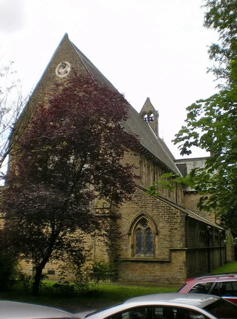
St Stephen's Church, Copley
Historic churches · 1.2 km

Clay House
Historic houses · 1.2 km

Copley Bridge Over River Calder At Junction Of Copley Land And North Dean Road
Historic bridges · 1.2 km

St. Helen's Well
Memorials & monuments · 1.5 km

The Brooksbank School
Natural landmarks · 1.6 km

Shaw Castle
Castles · 1.6 km

Calder And Hebble Navigation Woodside Mills Lock And Bridge Approach
Historic bridges · 1.6 km

Copley Viaduct
Historic bridges · 1.6 km

Wakefield Road Bridge At Se09542248
Historic bridges · 1.6 km

Elland War Memorial
Memorials & monuments · 1.6 km
Nearby
📷 3Historic houses · Yorkshire & the Humber
Sunny Bank
Sunny Bank — Grade II listed house in Greetland, Calderdale, West Yorkshire, England, UK.
📷 3Historic bridges · Yorkshire & the Humber
West Vale Viaduct
West Vale Viaduct is a historic bridge in the United Kingdom.
📷 3Historic churches · Yorkshire & the Humber
St Stephen's Church, Copley
St Stephen's Church, Copley — church in Copley, Calderdale, West Yorkshire, England, UK.
📷 3Historic houses · Yorkshire & the Humber
Clay House
Clay House — Grade II* listed house in Greetland, Calderdale, West Yorkshire, England, UK.
📷 3Historic bridges · Yorkshire & the Humber
Copley Bridge Over River Calder At Junction Of Copley Land And North Dean Road
Copley Bridge Over River Calder At Junction Of Copley Land And North Dean Road — Grade II listed building-listed bridge in england-yorkshire, United Kingdom.
📷 3Memorials & monuments · Yorkshire & the Humber
St. Helen's Well
St. Helen's Well is a memorial in the United Kingdom.
Where to eat & stay near Greetland
Places to stay
 📷 5
📷 5Caravan parks · Yorkshire & the Humber
Elland Hall Farm Caravan Park
Elland Hall Farm Caravan Park — a caravan park in england yorkshire.
 📷 7
📷 7 📷 5
📷 5Caravan parks · Yorkshire & the Humber
Upper Abotts Royd Farm and Caravan Park
Upper Abotts Royd Farm and Caravan Park — a caravan park in england yorkshire.
 📷 5
📷 5Caravan parks · Yorkshire & the Humber
Ashdene Naturist Club
Ashdene Naturist Club — a caravan park in england yorkshire.
 📷 5
📷 5Campsites · Yorkshire & the Humber
Rough Hey Wood Campsite
Rough Hey Wood Campsite — a campsite in england yorkshire.
 📷 5
📷 5Hotels · Yorkshire & the Humber
The White Swan Hotel
The White Swan Hotel — a hotel in england yorkshire.
Places to eat & drink
 📷 5
📷 5 📷 5
📷 5Historic pubs · Yorkshire & the Humber
Spring Gardens Public House
Spring Gardens Public House in England Yorkshire, United Kingdom.
 📷 7
📷 7Historic pubs · Yorkshire & the Humber
The Bull on the Bridge
The Bull on the Bridge in England Yorkshire, United Kingdom.
.jpg?width=1200) 📷 3
📷 3Historic pubs · Yorkshire & the Humber
The Old Cock
The Old Cock — Historic pub — listed building or notable heritage status.
 📷 5
📷 5Historic pubs · Yorkshire & the Humber
The Black Bull Public House
The Black Bull Public House in England Yorkshire, United Kingdom.
 📷 5
📷 5More museums in this region
 📷 3
📷 3Museums · Yorkshire & the Humber
Avro Heritage Museum
Avro Heritage Museum — aviation museum in England.
 📷 5
📷 5Museums · Yorkshire & the Humber
Hat Works
Hat Works — museum and former cotton mill Greater Manchester, England.
 📷 3
📷 3Museums · Yorkshire & the Humber
Anson Engine Museum
Anson Engine Museum — a museum in england-west-midlands, United Kingdom.
 📷 3
📷 3Museums · Yorkshire & the Humber
Portland Basin Museum
Portland Basin Museum — a museum in england-west-midlands, United Kingdom.
Frequently asked questions
- Where is Greetland?
- Greetland is in Yorkshire, United Kingdom (postcode HX4 8JR), in the parish of Calderdale, unparished area.
- What is Greetland?
- Greetland is a village situated within the metropolitan borough of Calderdale, West Yorkshire, England. It falls within the Calderdale Ward of Greetland and Stainland. According to the 2011 Census, th
- How do I get to Greetland?
- The nearest railway station is Sowerby Bridge, about 3.3 km away. The nearest town is Ripponden. Drivers can use postcode HX4 8JR.
- Is Greetland a protected site?
- Yes — Greetland is part of the South Pennine Moors SSSI Site of Special Scientific Interest.
- How do I get to Greetland?
- The nearest railway station is Sowerby Bridge, about 3.3 km away. Drivers can navigate to postcode HX4 8JR.