
Natural landmarks · South West England
Greenways School
In or near Codford.
Greenways School — a school heritage in england-south-east, United Kingdom.

Neil Owen — CC BY-SA 2.0 via Wikimedia Commons licence

Plan your visit
- Typical visit
- 1 h–2 h
- Nearest railway station
- Warminster · 9.8 km
- Free entry
- Dog-friendly
About
Greenways School is a school heritage located in england-south-east, United Kingdom. Catalogued from Wikidata's UK heritage register; see the Wikipedia article for further historical and visitor details.
Photo gallery
See it from the streetimagery from 2021
Imagery © Mapillary contributors, CC BY-SA 4.0
Protected designations
- Site of Special Scientific Interest: River Avon System SSSI
- Area of Outstanding Natural Beauty: Cranborne Chase & West Wiltshire Downs
Designations sourced from Natural England open data under OGL v3.
Place summary
Greenways School is located in South-East England. It serves as an educational institution, providing various learning opportunities for students in the region.
AI-generated from the structured facts on this page (operator, designation, listing, era). Not a substitute for visiting.
Background
History
The school was a prep school for boys, preparing them for the Common Entrance Examination. Boys were divided into two houses, called Greens and Blues. and his brother-in-law Anthony Maurice Bell. A modern linguist born in the Transvaal, Hancock had been educated at Corpus Christi College, Oxford, with Bell, and was a fellow of the Royal Meteorological Society. In 1929, the school advertised itself in The Times in the following terms: In 1929, Bell left the school on his conversion to Roman Catholicism. He then became Dom Maurice Bell, a Benedictine monk of Downside Abbey and its school Worth Priory, and was headmaster of Worth Preparatory School from 1940 to 1959. In the 1930s the school…
Sourced from Wikipedia under CC BY-SA 4.0.
- Coordinates
- 51.1601, -2.0572
- District
- Wiltshire
- Parish
- Codford
- Postcode
- BA12 0NJ
- Parliamentary constituency
- South West Wiltshire
- Established
- 1969
- Nearest railway station
- Warminster — 9.8 km
Sources
- wikidata: Q15222132 (CC0)
- wikipedia: Greenways School (CC BY-SA 4.0)
Other places nearby

Ashton Gifford House
Historic houses · 0.0 km

Codford Saint Peter
Villages · 0.3 km

Woolstore Theatre
Theatres · 0.7 km

Woolstore Theatre
Open-air theatres · 0.7 km

Sherrington Castle mound
Literary houses · 0.9 km

Church of St Cosmas and St Damian
Historic churches · 0.9 km

Codford
Towns & cities · 1.0 km

Sherrington
Castles · 1.0 km
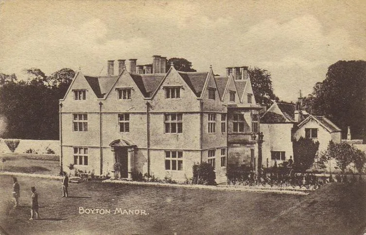
Boyton Manor
Stately homes · 1.2 km

Church of St Mary
Historic churches · 1.2 km

Codford Saint Mary
Villages · 1.4 km

Bridge Over River Wylye
Historic bridges · 1.4 km
Nearby
📷 5Historic houses · South West England
Ashton Gifford House
Ashton Gifford House — Codford, Wiltshire, England, UK.
📷 5Villages · South West England
Codford Saint Peter
Codford Saint Peter — a village in england south east.
📷 5Theatres · South West England
Woolstore Theatre
Woolstore Theatre is a theatre in the United Kingdom.
📷 5Open-air theatres · South West England
Woolstore Theatre
Woolstore Theatre — a open-air theatre in england south east.
📷 5Literary houses · South West England
Sherrington Castle mound
Sherrington Castle mound — a literary house museum in england south east.
📷 5Historic churches · South West England
Church of St Cosmas and St Damian
Church of St Cosmas and St Damian — Grade I listed building-listed church in england-south-east, United Kingdom.
Where to eat & stay near Greenways School
Places to stay
 📷 5
📷 5 📷 5
📷 5Hotels · South West England
The Bishopstrow Hotel & Spa
The Bishopstrow Hotel & Spa — a hotel in england south east.
 📷 5
📷 5 📷 5
📷 5Campsites · South West England
Marshwood Farm Camping
Marshwood Farm Camping — a campsite in england south east.
 📷 7
📷 7 📷 5
📷 5Campsites · South West England
Botany Camping & Glamping
Botany Camping & Glamping — a campsite in england south east.
Places to eat & drink
 📷 5
📷 5Historic pubs · South West England
The Old Bell Public House
The Old Bell Public House in England South West, United Kingdom.
 📷 7
📷 7Historic pubs · South West England
The Bath Arms
The Bath Arms in England South West, United Kingdom.
 📷 7
📷 7Historic pubs · South West England
The Bell And Crown Public House
The Bell And Crown Public House in England South West, United Kingdom.
 📷 6
📷 6Restaurants · South West England
New China Cottage
New China Cottage — a restaurant in england south east.
 📷 7
📷 7Historic pubs · South West England
The Benett Arms
The Benett Arms in England South West, United Kingdom.
 📷 7
📷 7Historic pubs · South West England
The Bath Arms
The Bath Arms in England South West, United Kingdom.
More natural landmarks in this region
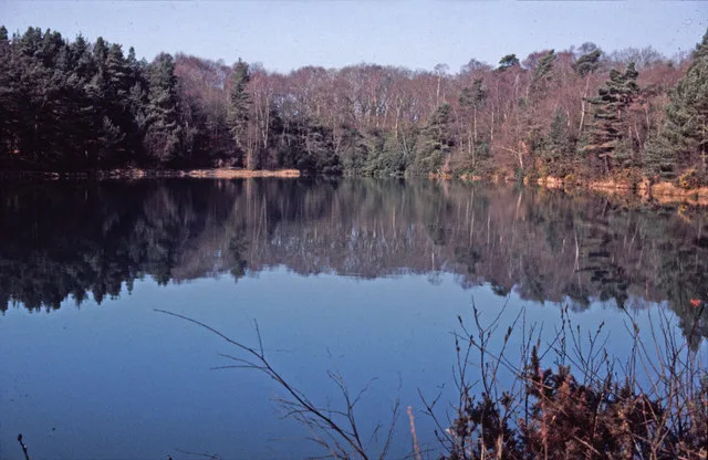 📷 5
📷 5Natural landmarks · South West England
Blue Pool
Blue Pool — lake in Dorset, England, UK.
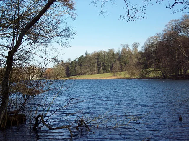 📷 5
📷 5Natural landmarks · South West England
Fonthill Lake
Fonthill Lake — lake in Wiltshire, England, UK.
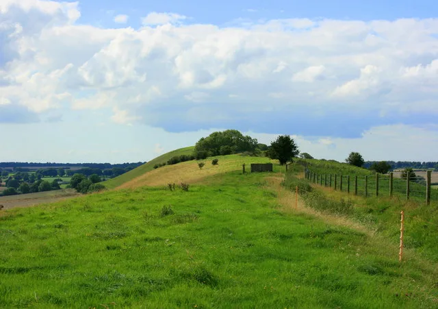 📷 5
📷 5 📷 5
📷 5Natural landmarks · South West England
Orchardleigh Lake
Orchardleigh Lake — lake in the United Kingdom.
Frequently asked questions
- Where is Greenways School?
- Greenways School is in South-West England, United Kingdom (postcode BA12 0NJ), in the parish of Codford.
- What is Greenways School?
- Greenways School — a school heritage in england-south-east, United Kingdom.
- How do I get to Greenways School?
- The nearest railway station is Warminster, about 9.8 km away. The nearest town is Codford. Drivers can use postcode BA12 0NJ.
- When was Greenways School built?
- Built or established in 1969.
- Is Greenways School a protected site?
- Yes — Greenways School is part of the River Avon System SSSI Site of Special Scientific Interest and the Cranborne Chase & West Wiltshire Downs National Landscape (AONB).
- Is Greenways School free to visit?
- Yes, Greenways School is free to enter.
- How do I get to Greenways School?
- Drivers can navigate to postcode BA12 0NJ. It sits within the South West Wiltshire parliamentary constituency.