
Natural landmarks · North West England
Great Mell Fell
In or near Penruddock.
Great Mell Fell — mountain in United Kingdom.

Wikimedia Commons contributors — see linked file page for photographer and licence licence

Plan your visit
- Typical visit
- 1 h–2 h
- Nearest railway station
- Threlkeld Quarry Station · 7.2 km
- Free entry
- Dog-friendly
Getting there & planning your visit
To visit Great Mell Fell, the nearest railway station is Threlkeld Quarry Station, located 7.2 km away. The postcode for navigation is CA11 0SB, and entry is free.
About
Great Mell Fell is a named natural landmark in the United Kingdom. Wikidata describes it as: "mountain in United Kingdom". Coordinates: 54.6200°, -2.9330°.
Photo gallery
Protected designations
- Site of Special Scientific Interest: River Eden and Tributaries SSSI
Designations sourced from Natural England open data under OGL v3.
From the Wikipedia article
Great Mell Fell (Bare hill, with the later additions of both "Fell" and "Great") is an isolated hill or fell in the English Lake District, north of Ullswater and adjacent to the Eastern Fells. It rises from a level plain to a height of 537 m. Its top is a viewpoint for many of the surrounding higher fells. The fell is now owned and managed by the National Trust and offers a place of quiet refuge. The fell was once well wooded, and retains a good covering of trees on the lower slopes, as well as scattered larches and pines higher up. Its rock is unusual for the Lake District, a reddish conglomerate of Devonian age, which has been eroded to form a rounded hill with smooth outlines and no rocky crags.
Excerpt from Wikipedia under CC BY-SA 4.0. See the source article linked in Sources below.
Background
History
There is a disused rifle range to the north-west of the fell. The target control building may still be seen. This was in use from the late 1890s, then by the War Department (now the Ministry of Defence) during the war years and into the 1950s. As a result, access to the whole fell was prohibited at the time by red danger signs. Alfred Wainwright includes a drawing of one of the signs in his 1955 guide book, but he himself apparently ignored the warnings and explored the fell anyway. Careful examination of the exposed soil in the butts will still reveal dead 303 rounds from the era
Sourced from Wikipedia under CC BY-SA 4.0.
- Coordinates
- 54.6200, -2.9330
- District
- Westmorland and Furness
- Parish
- Matterdale
- Postcode
- CA11 0SB
- Parliamentary constituency
- Westmorland and Lonsdale
- Nearest railway station
- Threlkeld Quarry Station — 7.2 km
Sources
- wikidata: Q5599559 (CC0)
- wikipedia: Great Mell Fell (CC BY-SA 4.0)
- commons: Greatmellfell.jpg (CC BY-SA 4.0)
Other places nearby
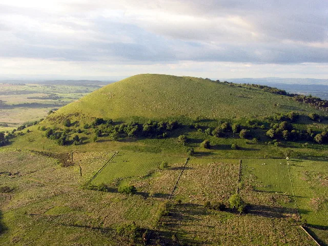
Great Mell Fell
Mountains & hills · 0.2 km

Brownhow Hill
Mountains & hills · 1.5 km

Troutbeck Head (Caravan & Motorhome Club)
Caravan parks · 1.6 km

Tarn Moss Nature Reserve
Forests & woodlands · 2.1 km

Roman Fort
Archaeological sites · 2.4 km

Gill Head Farm
Campsites · 2.4 km
Gill Head Farm Caravan and Camping
Caravan parks · 2.5 km

Lofshaw Hill
Mountains & hills · 2.7 km
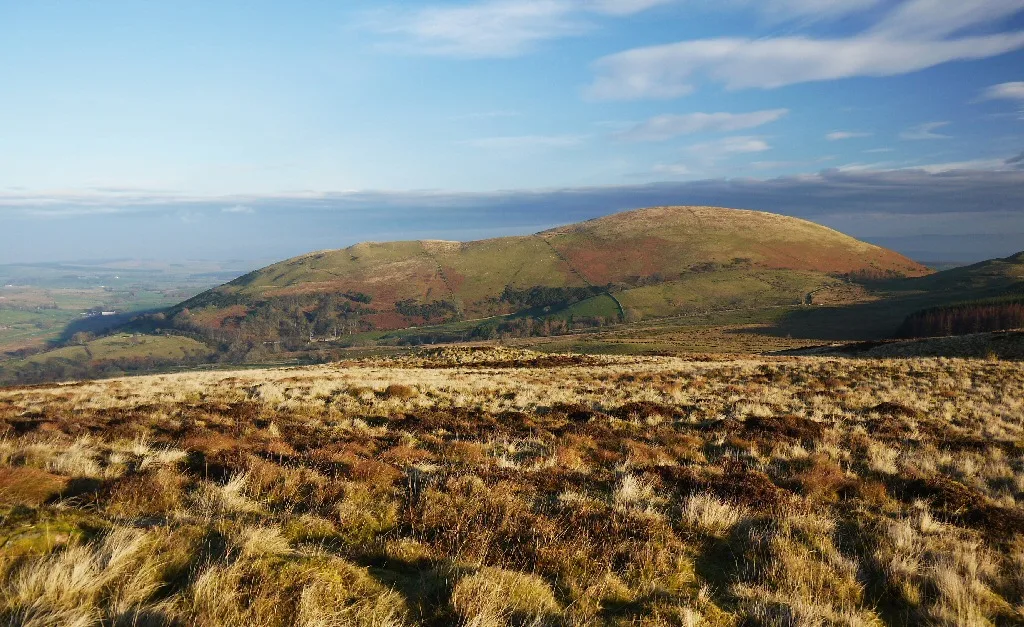
Little Mell Fell
Natural landmarks · 2.8 km
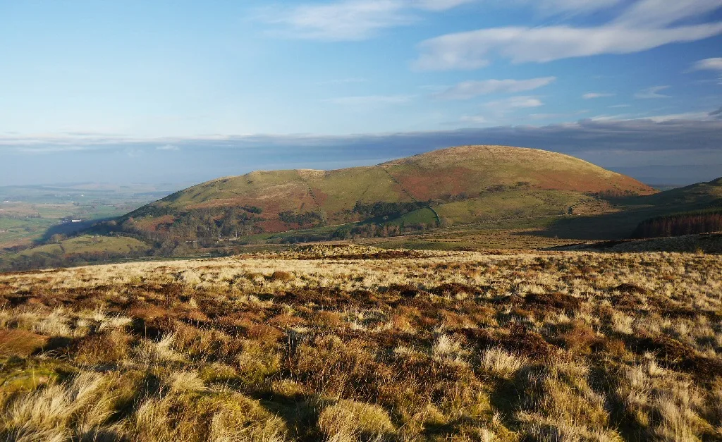
Little Mell Fell
Mountains & hills · 2.8 km

Beckses Caravan and Camping
Caravan parks · 2.9 km

Priest's Crag
Mountains & hills · 3.3 km
Nearby
📷 3Mountains & hills · North West England
Great Mell Fell
Great Mell Fell — Named summit at 536.6 m.
📷 5Mountains & hills · North West England
Brownhow Hill
Brownhow Hill — mountain in scotland lowlands. Elevation: 305 m.
📷 5Caravan parks · North West England
Troutbeck Head (Caravan & Motorhome Club)
Troutbeck Head (Caravan & Motorhome Club) — a caravan park in scotland lowlands.
📷 3Forests & woodlands · North West England
Tarn Moss Nature Reserve
Tarn Moss Nature Reserve is a forest or woodland in the United Kingdom.
📷 5Archaeological sites · North West England
Roman Fort
Roman Fort — archaeological in scotland lowlands.
📷 5Campsites · North West England
Gill Head Farm
Gill Head Farm — a campsite in scotland lowlands.
Where to eat & stay near Great Mell Fell
Places to stay
📷 5Caravan parks · North West England
Troutbeck Head (Caravan & Motorhome Club)
Troutbeck Head (Caravan & Motorhome Club) — a caravan park in scotland lowlands.
📷 5Campsites · North West England
Gill Head Farm
Gill Head Farm — a campsite in scotland lowlands.
📷 5Caravan parks · North West England
Gill Head Farm Caravan and Camping
Gill Head Farm Caravan and Camping — a caravan park in scotland lowlands.
📷 5Caravan parks · North West England
Beckses Caravan and Camping
Beckses Caravan and Camping — a caravan park in scotland lowlands.
 📷 5
📷 5Caravan parks · North West England
Whitbarrow Hall
Whitbarrow Hall — a caravan park in scotland lowlands.
 📷 5
📷 5Caravan parks · North West England
The Quiet Site
The Quiet Site — a caravan park in scotland lowlands.
Places to eat & drink
 📷 5
📷 5Historic pubs · North West England
Horse And Farrier Inn And Stables
Horse And Farrier Inn And Stables in Scotland Lowlands, United Kingdom.
 📷 6
📷 6Historic pubs · North West England
Gloucester Arms
Gloucester Arms in Scotland Lowlands, United Kingdom.
 📷 7
📷 7Historic pubs · North West England
Two Lions public house and integral stables
Two Lions public house and integral stables in Scotland Lowlands, United Kingdom.
 📷 7
📷 7Cafés · North West England
Narrowbar Cafe
Narrowbar Cafe — a café in scotland lowlands.
 📷 5
📷 5 📷 4
📷 4Historic pubs · North West England
Oddfellows Arms
Oddfellows Arms — Historic pub — listed building or notable heritage status.
More natural landmarks in this region
 📷 3
📷 3Natural landmarks · North West England
Statue of Oliver Cromwell
Statue of Oliver Cromwell — Public artwork (statue).
 📷 3
📷 3Natural landmarks · North West England
Dagfields Craft Centre
Dagfields Craft Centre — a other in england-west-midlands, United Kingdom.
 📷 3
📷 3Natural landmarks · North West England
Weaver Valley Cruises
Weaver Valley Cruises — a other in england-west-midlands, United Kingdom.
 📷 3
📷 3Natural landmarks · North West England
Golden Gates
Golden Gates — a other in england-west-midlands, United Kingdom.
Frequently asked questions
- Where is Great Mell Fell?
- Great Mell Fell is in the Scottish Lowlands, United Kingdom (postcode CA11 0SB), in the parish of Matterdale.
- What is Great Mell Fell?
- Great Mell Fell — mountain in United Kingdom.
- How do I get to Great Mell Fell?
- The nearest railway station is Threlkeld Quarry Station, about 7.2 km away. Drivers can use postcode CA11 0SB.
- Is Great Mell Fell a protected site?
- Yes — Great Mell Fell is part of the River Eden and Tributaries SSSI Site of Special Scientific Interest.
- Is Great Mell Fell free to visit?
- Yes, Great Mell Fell is free to enter.
- How do I get to Great Mell Fell?
- The nearest railway station is Threlkeld Quarry Station, about 7.2 km away. Drivers can navigate to postcode CA11 0SB.