Mountains & hills · North West England
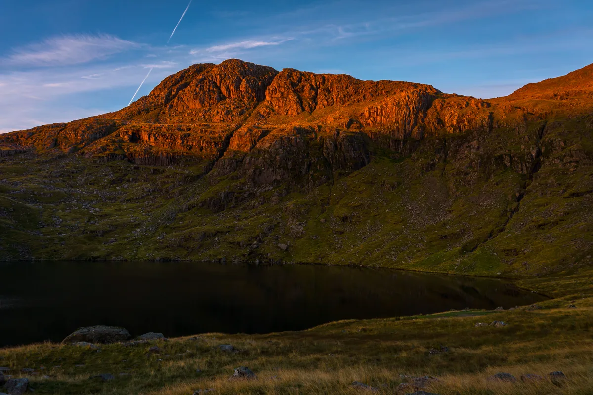
Great End
In or near Boot.
Great End — Named summit at 909.5 m.

Wikimedia Commons contributors — see linked file page for photographer and licence licence
Plan your visit
- Typical visit
- 3 h–8 h
- Best time of year
- Late spring – early autumn (May–Oct)
- Nearest railway station
- Dalegarth · 9.3 km
- Free entry
- Dog-friendly
Getting there & planning your visit
To visit Great End, the nearest railway station is Dalegarth, which is 9.3 km away. Entry to the site is free. There are no specific accessibility details provided.
About
Great End is a named summit in the United Kingdom. Wikidata describes it as: "Named summit at 909.5 m.". Coordinates: 54.4650°, -3.1945°.
Photo gallery
Protected designations
- Site of Special Scientific Interest: Scafell Pikes SSSI
Designations sourced from Natural England open data under OGL v3.
From the Wikipedia article
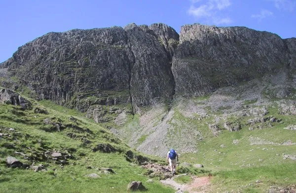
Great End is the most northerly mountain in the Scafell chain, in the English Lake District. From the south it is simply a lump continuing this chain. From the north, however, it appears as an immense mountain, with an imposing north face rising above Sprinkling Tarn (lake). This is a popular location for wild camping, and the north face attracts many climbers. Alfred Wainwright wrote of Great End in his Pictorial Guide to the Lakeland Fells: "This is the true Lakeland of the fellwalker, the sort of terrain that calls him back time after time, the sort of memory that haunts his long winter exile. It is not the pretty places – the flowery lanes of Grasmere or Derwentwater's wooded bays – that keep him restless in his bed; it is the magnificent ones. Places like Great End..."
Excerpt from Wikipedia under CC BY-SA 4.0. See the source article linked in Sources below.
- Coordinates
- 54.4650, -3.1945
- Address
- Cumbria, England
- Nearest railway station
- Dalegarth — 9.3 km
Sources
- osm: n5053235473 (ODbL)
- wikipedia: Great End (CC BY-SA 4.0)
- commons: Great end.jpg (CC BY-SA 4.0)
Other places nearby
Great End
Natural landmarks · 0.1 km

Great End West Cairn
Mountains & hills · 0.2 km

Long Pike
Mountains & hills · 0.4 km
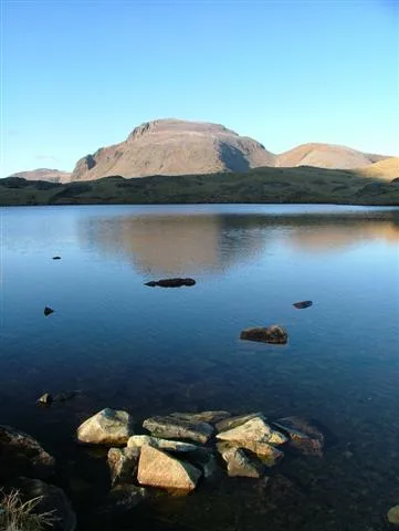
Sprinkling Tarn
Natural landmarks · 0.7 km
Allen Crags
Natural landmarks · 0.9 km

Allen Crags
Mountains & hills · 1.0 km

Great Slack
Mountains & hills · 1.0 km
Ill Crag
Mountains & hills · 1.1 km

Broad Crag
Natural landmarks · 1.2 km
Esk Pike
Mountains & hills · 1.3 km
Seathwaite Fell (summit)
Mountains & hills · 1.3 km

Esk Pike
Natural landmarks · 1.4 km
Nearby
📷 3Natural landmarks · North West England
Great End
Great End — mountain in the Scafell chain, in the English Lake District.
📷 5Mountains & hills · North West England
Great End West Cairn
Great End West Cairn — mountain in england north west. Elevation: 908.5 m.
📷 5Mountains & hills · North West England
Long Pike
Long Pike — mountain in england north west. Elevation: 825 m.
📷 3Natural landmarks · North West England
Sprinkling Tarn
Sprinkling Tarn — lake in the United Kingdom.
📷 3📷 3Where to eat & stay near Great End
Places to stay
 📷 5
📷 5Campsites · North West England
Seathwaite Farm Campsite
Seathwaite Farm Campsite — a campsite in england north west.
 📷 5
📷 5Campsites · North West England
Wasdale Head Campsite
Wasdale Head Campsite — a campsite in england north west.
 📷 5
📷 5Campsites · North West England
Wasdale Campsite
Wasdale Campsite — a campsite in england north west.
 📷 5
📷 5Hostels · North West England
YHA Black Sail
YHA Black Sail — a hostel in england north east.
 📷 5
📷 5Hostels · North West England
Honister Pass YHA
Honister Pass YHA — a hostel in england north east.
 📷 5
📷 5Campsites · North West England
Seatoller Farm
Seatoller Farm — a campsite in england north east.
Places to eat & drink
 📷 7
📷 7Cafés · North West England
Grange Bridge Cottage
Grange Bridge Cottage — a café in england north east.
 📷 7
📷 7Historic pubs · North West England
The Travellers Rest
The Travellers Rest in England North West, United Kingdom.
 📷 5
📷 5Restaurants · North West England
The Terrace Coffee House and Restaurant
The Terrace Coffee House and Restaurant — a restaurant in england north west. Cuisine: sandwich;lunch.
 📷 7
📷 7Historic pubs · North West England
Church House Public House
Church House Public House in England North West, United Kingdom.
 📷 5
📷 5Historic pubs · North West England
Golden Rule Hotel
Golden Rule Hotel in England North West, United Kingdom.
 📷 5
📷 5More mountains in this region
 📷 5
📷 5Mountains & hills · North West England
Appleton Park
Appleton Park — a hill or mountain in england west midlands.
 📷 5
📷 5Mountains & hills · North West England
High Warren
High Warren — mountain in england west midlands. Elevation: 105 m.
 📷 5
📷 5Mountains & hills · North West England
Alderley Edge
Alderley Edge — mountain in england west midlands. Elevation: 194 m.
📷 3Frequently asked questions
- Where is Great End?
- Great End is in North-West England, United Kingdom.
- What is Great End?
- Great End — Named summit at 909.5 m.
- How do I get to Great End?
- The nearest railway station is Dalegarth, about 9.3 km away. Its coordinates are 54.4650°, -3.1945°.
- Is Great End a protected site?
- Yes — Great End is part of the Scafell Pikes SSSI Site of Special Scientific Interest.
- Is Great End free to visit?
- Yes, Great End is free to enter.