
Museums · North West England
Grange-over-Sands
In or near Cartmel.
Grange-over-Sands is a town and civil parish on the north side of Morecambe Bay in Cumbria, England, a few miles south of the Lake District National Park. In the 2011 census the parish had a populatio

James Allan — CC BY-SA 2.0 via Wikimedia Commons licence

Plan your visit
- Typical visit
- 1.5 h–3 h
- Best time of year
- Year-round
- Nearest railway station
- Grange-over-Sands · 1.0 km
- Family-friendly
- Limited wheelchair access
Getting there & planning your visit
To visit Grange-over-Sands museum, the nearest railway station is Grange-over-Sands, located 1 km away. The postcode for sat-nav is LA11 7HS. Please note that wheelchair accessibility is limited.
About
Grange-over-Sands is a town and civil parish on the north side of Morecambe Bay in Cumbria, England, a few miles south of the Lake District National Park. In the 2011 census the parish had a population of 4,114, increasing at the 2021 census to 4,279. Within the boundaries of the historic county of Lancashire, the town became administered as an urban district in 1894. Though the town remains part of the Duchy of Lancaster, since 2023 it has been administered as part of the Westmorland and Furness Council area. Travelling by road, Grange-over-Sands is 13.1 miles (21.1 km) to the south of Kendal, 14.9 miles (24.0 km) to the east of Ulverston, 25 miles (40 km) to the east of Barrow-in-Furness and 28.1 miles (45.2 km) to the north of Lancaster.
Photo gallery
Protected designations
- Site of Special Scientific Interest: Morecambe Bay SSSI
- Ramsar wetland: Morecambe Bay
Designations sourced from Natural England open data under OGL v3.
From the Wikipedia article
Grange-over-Sands is a town and civil parish on the north side of Morecambe Bay in Cumbria, England, a few miles south of the Lake District National Park. In the 2011 census the parish had a population of 4,114, increasing at the 2021 census to 4,279. Within the boundaries of the historic county of Lancashire, the town became administered as an urban district in 1894. Though the town remains part of the Duchy of Lancaster, since 2023 it has been administered as part of the Westmorland and Furness Council area. Travelling by road, Grange-over-Sands is 13.1 miles (21.1 km) to the south of Kendal, 14.9 miles (24.0 km) to the east of Ulverston, 25 miles (40 km) to the east of Barrow-in-Furness and 28.1 miles (45.2 km) to the north of Lancaster.
Excerpt from Wikipedia under CC BY-SA 4.0. See the source article linked in Sources below.
Background
History
The town developed in the Victorian era from a small fishing village and the arrival of the railway in 1857 made it a popular seaside resort on the north side of Morecambe Bay, across the sands from Morecambe. The "over-Sands" suffix was added in the late 19th or early 20th century by the local vicar, who was fed up with his post going to Grange in Borrowdale near Keswick. In 1932 Grange Lido was built on the seafront, and remained in use until 1993, in 2011 it was listed Grade II. There is a campaign to restore and re-open it (as 2019). The River Kent used to flow past the town's mile-long promenade but its course migrated south, away from Grange. The sands or mudflats with dangerous…
Visiting
The town is a centre for tourists exploring the southern Lakeland fells, and is home to a number of hotels, bed & breakfasts and holiday properties. Within the town itself, there is an ornamental duck pond and a traffic-free promenade. Adjacent to Grange are Lindale, to the north-east, Cartmel to the north-west, with its priory to which the village was once the 'grange' or farm, and Allithwaite to the west. Also nearby is a country house, Holker Hall, which was built on land that once belonged to the priory. The stables at Holker Hall housed the Lakeland Motor Museum until its move to Backbarrow in 2010. In December 2019, National Geographic published an article called How to spend a…
Sourced from Wikipedia under CC BY-SA 4.0.
- Coordinates
- 54.1900, -2.9150
- District
- Westmorland and Furness
- Parish
- Grange-over-Sands
- Postcode
- LA11 7HS
- Parliamentary constituency
- Westmorland and Lonsdale
- Nearest railway station
- Grange-over-Sands — 1 km
- Official site
- www.thelakesplanner.co.uk
Sources
- wikipedia: Grange-over-Sands (CC BY-SA 4.0)
Other places nearby
Cox's Corner
Memorials & monuments · 0.1 km

The Royal British Legion
Memorials & monuments · 0.2 km

Tea Rooms
Memorials & monuments · 0.3 km

Hardcragg Hall
Memorials & monuments · 0.4 km

The Piers
Memorials & monuments · 0.5 km

Grange Fell Church, Grange-Over-Sands
Historic churches · 0.5 km
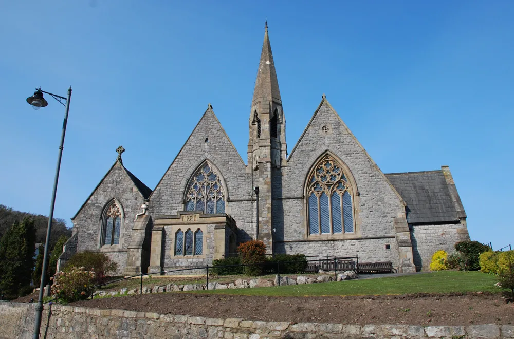
St Paul Parish Church, Grange-over-Sands
Historic churches · 0.5 km

Commodore Hotel
Memorials & monuments · 0.6 km

The Coffee Pot
Restaurants · 0.6 km

Bay Villa
Memorials & monuments · 0.6 km
Bay Villa
B&Bs · 0.6 km
The Station House
Memorials & monuments · 0.7 km
Nearby
📷 3Memorials & monuments · North West England
Cox's Corner
Cox's Corner — a memorial in england-north-west, United Kingdom.
📷 3Memorials & monuments · North West England
The Royal British Legion
The Royal British Legion — a memorial in england-north-west, United Kingdom.
📷 3Memorials & monuments · North West England
Tea Rooms
Tea Rooms — a memorial in england-north-west, United Kingdom.
📷 3Memorials & monuments · North West England
Hardcragg Hall
Hardcragg Hall — a memorial in england-north-west, United Kingdom.
📷 3Memorials & monuments · North West England
The Piers
The Piers — a memorial in england-north-west, United Kingdom.
📷 3Historic churches · North West England
Grange Fell Church, Grange-Over-Sands
Grange Fell Church, Grange-Over-Sands — church in United Kingdom.
Where to eat & stay near Grange-over-Sands
Places to stay
📷 6B&Bs · North West England
Bay Villa
Bay Villa — a bed-and-breakfast in england north west.
 📷 5
📷 5Hotels · North West England
Grange Hotel
Grange Hotel — a hotel in england north west.
Caravan parks · North West England
Highfell Gate Caravan Park
Highfell Gate Caravan Park — a caravan park in england north west.
 📷 5
📷 5Hotels · North West England
Netherwood Hotel
Netherwood Hotel — a hotel in england north west.
 📷 5
📷 5 📷 5
📷 5Caravan parks · North West England
New Barns Caravan Park
New Barns Caravan Park — a caravan park in england north west.
Places to eat & drink
📷 7 📷 5
📷 5Restaurants · North West England
L'Enclume
L'Enclume — a restaurant in england north west.
 📷 4
📷 4Restaurants · North West England
L'Enclume
L'Enclume (pronounced [lɑ̃.klym], French for "the anvil") is a Modern British restaurant opened in 2002 in Cartmel, Cumbria, England, run by the chef Simon Rogan and his partner, Penny Tapsell. L'Encl
 📷 5
📷 5Historic pubs · North West England
Hoppers Public House
Hoppers Public House in England North West, United Kingdom.
 📷 3
📷 3Historic pubs · North West England
The Eagles Head
The Eagles Head — Historic pub — listed building or notable heritage status.
 📷 5
📷 5Historic pubs · North West England
The Old Hall Inn
The Old Hall Inn in England North West, United Kingdom.
More museums in this region
 📷 3
📷 3Museums · North West England
Cube Gallery
Cube Gallery — former architecture museum in Manchester, England.
 📷 3
📷 3Museums · North West England
Cuckooland Museum
Cuckooland Museum — horological museum in England, UK.
 📷 4
📷 4Museums · North West England
Elizabeth Gaskell's House
Elizabeth Gaskell's House — museum in Manchester.
 📷 3
📷 3Museums · North West England
Englesea Brook Chapel and Museum of Primitive Methodism
Englesea Brook Chapel and Museum of Primitive Methodism — Primitive Methodist chapel and museum, United Kingdom.
Frequently asked questions
- Where is Grange-over-Sands?
- Grange-over-Sands is in North-West England, United Kingdom (postcode LA11 7HS), in the parish of Grange-over-Sands.
- What is Grange-over-Sands?
- Grange-over-Sands is a town and civil parish on the north side of Morecambe Bay in Cumbria, England, a few miles south of the Lake District National Park. In the 2011 census the parish had a populatio
- How do I get to Grange-over-Sands?
- The nearest railway station is Grange-over-Sands, about 1.0 km away. The nearest town is Cartmel. Drivers can use postcode LA11 7HS.
- Is Grange-over-Sands a protected site?
- Yes — Grange-over-Sands is part of the Morecambe Bay SSSI Site of Special Scientific Interest and the Morecambe Bay Ramsar wetland.
- How do I get to Grange-over-Sands?
- The nearest railway station is Grange-over-Sands, about 1.0 km away. Drivers can navigate to postcode LA11 7HS.