
Natural landmarks · North East England
Gilley Law
In or near Offerton.
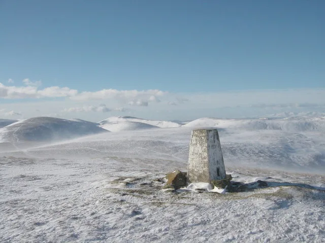
Gilley Law in England North East, United Kingdom.

Alex McGregor — CC BY-SA 2.0 via Wikimedia Commons licence

Plan your visit
- Typical visit
- 1 h–2 h
- Nearest railway station
- University · 3.5 km
- Dog-friendly
About
Gilley Law is a place of interest in England North East, United Kingdom — drawn from open-data sources for visitor reference. See the linked Wikipedia article for the full description.
Photo gallery
From the Wikipedia article
Gilley Law or otherwise known as Lakeside Village is a neighbourhood in Sunderland, England.
Excerpt from Wikipedia under CC BY-SA 4.0. See the source article linked in Sources below.
- Coordinates
- 54.8760, -1.4198
- District
- Sunderland
- Parish
- Sunderland, unparished area
- Postcode
- SR3 3AR
- Parliamentary constituency
- Houghton and Sunderland South
- Nearest railway station
- University — 3.5 km
Sources
- wikidata: Q5562164 (CC0)
- wikipedia: Gilley Law (CC BY-SA 4.0)
Other places nearby

Farringdon
Manor houses · 0.4 km

Mill Hill
Mountains & hills · 0.6 km

Farringdon Community Academy
Historic churches · 0.6 km

Newport Hill
Mountains & hills · 0.6 km
Silksworth
Villages · 0.6 km

New Silksworth
Villages · 0.7 km

Doxford House
Historic houses · 0.9 km

New Silksworth
Mines & mining heritage · 1.1 km

Thorney Close
Manor houses · 1.1 km

Silksworth and Tunstall War Memorial
Memorials & monuments · 1.2 km

Plains Farm
Farms (open to visitors) · 1.4 km

Springwell
Farms (open to visitors) · 1.5 km
Nearby
📷 4📷 5Mountains & hills · North East England
Mill Hill
Mill Hill — mountain in scotland lowlands. Elevation: 107 m.
📷 3Historic churches · North East England
Farringdon Community Academy
Farringdon Community Academy in England North East, United Kingdom.
📷 5Mountains & hills · North East England
Newport Hill
Newport Hill — mountain in scotland lowlands. Elevation: 91 m.
📷 5📷 5Where to eat & stay near Gilley Law
Places to stay
 📷 5
Caravan parks · North East England
Showmen's Guild Site - Sunnyside Farm
Showmen's Guild Site - Sunnyside Farm — a caravan park in scotland lowlands.
 📷 5
Hotels · North East England
Hilton Garden Inn Sunderland
Hilton Garden Inn Sunderland — a hotel in scotland lowlands. 3-star. Brand: Hilton Garden Inn.
 📷 5
 📷 3
Campsites · North East England
Colliery Farm Campsite
Colliery Farm Campsite — a campsite in scotland lowlands.
 📷 5
Hotels · North East England
Bowes Incline Hotel
Bowes Incline Hotel — a hotel in scotland lowlands.
 📷 5
Caravan parks · North East England
Finchale Abbey Touring Park
Finchale Abbey Touring Park — a caravan park in scotland lowlands.
Places to eat & drink
 📷 5
 📷 5
Historic pubs · North East England
Mountain Daisy Public House
Mountain Daisy Public House in England North East, United Kingdom.
 📷 6
Historic pubs · North East England
Fitzgerald's Public House
Fitzgerald's Public House in England North East, United Kingdom.
 📷 5
Historic pubs · North East England
Greens Public House
Greens Public House in England North East, United Kingdom.
 📷 5
Historic pubs · North East England
Livingstone's Public House
Livingstone's Public House in England North East, United Kingdom.
 📷 5
Historic pubs · North East England
The Dun Cow Public House
The Dun Cow Public House in England North East, United Kingdom.
More natural landmarks in this region
 📷 4
Natural landmarks · North East England
Cleveland Way
109-mile horseshoe trail around the North York Moors and its sea cliffs.
 📷 3
Natural landmarks · North East England
The Hand Stone
The Hand Stone — a place in North East England, United Kingdom.
 📷 3
Natural landmarks · North East England
The Face Stone
The Face Stone — a place in North East England, United Kingdom.
 📷 3
Frequently asked questions
- Where is Gilley Law?
- Gilley Law is in North-East England, United Kingdom (postcode SR3 3AR), in the parish of Sunderland, unparished area.
- What is Gilley Law?
- Gilley Law in England North East, United Kingdom.
- How do I get to Gilley Law?
- The nearest railway station is University, about 3.5 km away. The nearest town is Offerton. Drivers can use postcode SR3 3AR.
- How do I get to Gilley Law?
- The nearest railway station is University, about 3.5 km away. Drivers can navigate to postcode SR3 3AR.