
Memorials & monuments · East of England
Gibraltar Farm
In or near Everton.
Gibraltar Farm — a memorial in england-london, United Kingdom.

David Sands — CC BY-SA 2.0 via Wikimedia Commons licence

Plan your visit
- Typical visit
- 15 min–45 min
- Nearest railway station
- Sandy · 4.0 km
- Free entry
- Dog-friendly
Getting there & planning your visit
To visit Gibraltar Farm, the nearest railway station is Sandy, located 4 km away. The postcode for sat-nav is SG19 2JW. Entry is free.
About
Gibraltar Farm is a memorial located in england-london, United Kingdom. Sourced from OpenStreetMap (ODbL licence); see local listings for visitor information, opening hours and admission details.
Photo gallery
Official information
Gibraltar Farm Barn is a Grade II listed building located in Tempsford, Central Bedfordshire. Originally a barn, it was later adapted to store flight equipment for Special Operations Executive agents during World War II and now serves as a memorial to those who flew from the adjacent airfield.
From the Wikipedia article
Gibraltar Dam is located on the Santa Ynez River, in southeastern Santa Barbara County, California, in the United States. Forming Gibraltar Reservoir, the dam is owned by the city of Santa Barbara. Originally constructed in 1920 and expanded in 1948, the dam and reservoir are located in a remote part of the Los Padres National Forest. The main purpose of Gibraltar Dam is domestic water supply. It provides about 4,600 acre-feet (5,700,000 m3) of water to Santa Barbara each year, supplying almost 30% of the city's needs. Water diverted from the dam also powers a small hydroelectric plant. Due to having lost a massive portion of its capacity to sediment build-up, the lake can often fill and spill after a single storm, while drying up completely in some years. As of February 2019, sedimentation has reduced the reservoir's capacity to 4,314 acre-feet (5,321,000 m3), only 19% of its designed capacity. The dam is built in a part of the Santa Ynez River called the "Gibraltar Narrows" that gave its name to the Gibraltar (or Sunbird) mercury mine, which operated next to what is now Gibraltar Reservoir between the 1870s and 1990s.
Excerpt from Wikipedia under CC BY-SA 4.0. See the source article linked in Sources below.
Background
History
In the early 1900s the City of Santa Barbara had exhausted its local water supplies, and looked to the drainage basin of the nearby Santa Ynez River, which is much larger than any of the city's local streams. In 1904 construction began on the Mission Tunnel which was bored under Mission Canyon in the Santa Ynez Mountains, to tap surface and ground water in the Santa Ynez basin. for which a $40,000 contract was awarded to Arthur S. Bent Construction Co. In 1917 a concrete "thrust block" was poured on the south side of the canyon to take the weight of the future dam, as the rock on this side was not high enough to support the structure. Because there was no road to the site, workers and…
Description
Gibraltar Dam is a constant radius concrete arch dam 194.5 ft high and 600 ft long. Downstream of Gibraltar, the Santa Ynez flows into the much larger Lake Cachuma, owned by the U.S. Bureau of Reclamation. The spillway is designed so that overflow water cascades down the natural sandstone face adjacent to the dam, creating a 150 ft high waterfall. The original design capacity of Gibraltar Reservoir was 15374 acre feet. Water is drawn from the reservoir via an intake structure near the south end of the dam into the 3.7 mi Mission Tunnel, which transports water beneath the Santa Ynez Mountains to a small regulation basin, Lauro Reservoir. The water is either treated at the Cater Water…
Visiting
Although the dam and reservoir are open to the public, only official vehicles are allowed on the narrow winding dirt roads leading to the dam. The shortest way to reach the dam on foot is a 6 mi round trip hike along the Santa Ynez River from Red Rock Campground. It can also be reached from several trails originating at Camino Cielo Road. The Gibraltar Trail follows the southern edge of the reservoir from the dam, and several other trails branch around the reservoir into the backcountry of Los Padres National Forest. Boating, fishing and swimming are not allowed at the reservoir since it is a public water supply.
Sourced from Wikipedia under CC BY-SA 4.0.
- Coordinates
- 52.1583, -0.2580
- District
- Central Bedfordshire
- Parish
- Everton
- Postcode
- SG19 2JW
- Parliamentary constituency
- North Bedfordshire
- Nearest railway station
- Sandy — 4 km
- Official site
- www.britishlistedbuildings.co.uk
Sources
- osm: node/1426900700 (ODbL)
- wikipedia: Gibraltar Dam (CC BY-SA 4.0)
Other places nearby
Gibraltar Farm world war 2 memorial
Memorials & monuments · 0.0 km
.jpg?width=1200)
Everton
Towns & cities · 1.6 km
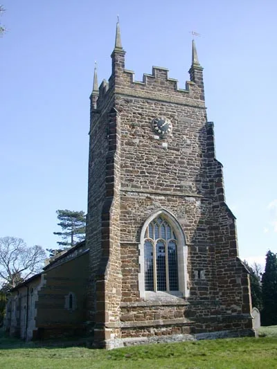
Church of St Mary, Everton, Bedfordshire
Historic churches · 1.6 km

Mossbury Manor
Manor houses · 2.3 km

Knotts of Tempsford
Zoos & aquariums · 2.6 km

Tempsford
Museums · 2.9 km

SOE WWII
Memorials & monuments · 3.1 km

Gannocks Castle
Castles · 3.2 km

Gannock Castle
Castles · 3.2 km

Gamlingay Meadows
Wildlife reserves · 3.3 km
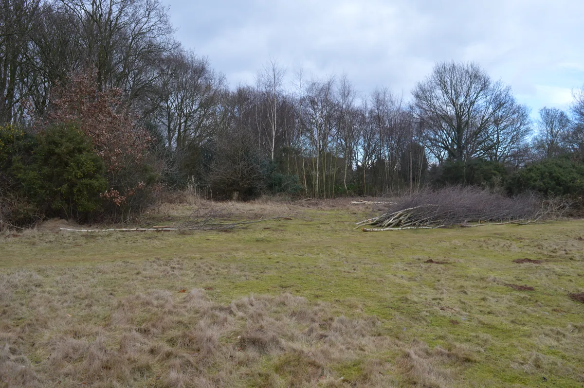
Gamlingay Cinques Common
Wildlife reserves · 3.4 km

Caravan Club Site (members)
Caravan parks · 3.4 km
Nearby
📷 5Memorials & monuments · East of England
Gibraltar Farm world war 2 memorial
Gibraltar Farm world war 2 memorial — a other in england-london, United Kingdom.
📷 5Towns & cities · East of England
Everton
Everton — village and civil parish in Bedfordshire, England, UK.
📷 5Historic churches · East of England
Church of St Mary, Everton, Bedfordshire
Church of St Mary, Everton, Bedfordshire — church in Everton, Bedfordshire, England, UK.
📷 5Manor houses · East of England
Mossbury Manor
Mossbury Manor — Grade II listed building-listed manor in england-london, United Kingdom.
📷 5Zoos & aquariums · East of England
Knotts of Tempsford
Knotts of Tempsford — a zoo aquarium in england-london, United Kingdom.
📷 5Museums · East of England
Tempsford
Tempsford — a museum in england-london, United Kingdom.
Where to eat & stay near Gibraltar Farm
Places to stay
📷 5Caravan parks · East of England
Caravan Club Site (members)
Caravan Club Site (members) — a caravan park in england london.
 📷 5
📷 5 📷 5
📷 5Campsites · East of England
Jordans Close Scout Activity Centre
Jordans Close Scout Activity Centre — a campsite in england london.
 📷 5
📷 5 📷 5
📷 5Caravan parks · East of England
St Neots Mobile Home Park
St Neots Mobile Home Park — a caravan park in england london.
 📷 5
📷 5Campsites · East of England
St Neots Camping and Caravanning Club
St Neots Camping and Caravanning Club — a campsite in england london.
Places to eat & drink
 📷 5
📷 5Historic pubs · East of England
Kings Arms Public House
Kings Arms Public House in England East, United Kingdom.
 📷 5
📷 5Historic pubs · East of England
The Anchor Public House
The Anchor Public House in England East, United Kingdom.
 📷 5
📷 5Historic pubs · East of England
Duncombe Arms Public House
Duncombe Arms Public House in England East, United Kingdom.
 📷 5
📷 5 📷 5
📷 5Historic pubs · East of England
The Plough Public House With Attached Stables And Hayloft
The Plough Public House With Attached Stables And Hayloft in England East, United Kingdom.
 📷 5
📷 5More memorials in this region
 📷 5
📷 5Memorials & monuments · East of England
386th B.G.(M), 9th Air Force USAAF Memorial
386th B.G.(M), 9th Air Force USAAF Memorial is a memorial in the United Kingdom.
 📷 5
📷 5Memorials & monuments · East of England
Ailesbury Mausoleum
Ailesbury Mausoleum is a memorial in the United Kingdom.
 📷 5
📷 5Memorials & monuments · East of England
Archie F. Daniels Memorial
Archie F. Daniels Memorial is a memorial in the United Kingdom.
 📷 5
📷 5Memorials & monuments · East of England
Barnwell War Memorial
Barnwell War Memorial is a memorial in the United Kingdom.
Frequently asked questions
- Where is Gibraltar Farm?
- Gibraltar Farm is in London, United Kingdom (postcode SG19 2JW), in the parish of Everton.
- What is Gibraltar Farm?
- Gibraltar Farm — a memorial in england-london, United Kingdom.
- How do I get to Gibraltar Farm?
- The nearest railway station is Sandy, about 4.0 km away. Drivers can use postcode SG19 2JW.
- Who owns Gibraltar Farm?
- Gibraltar Farm is owned by City of Santa Barbara.
- Is Gibraltar Farm free to visit?
- Yes, Gibraltar Farm is free to enter.
- How do I get to Gibraltar Farm?
- The nearest railway station is Sandy, about 4.0 km away. Drivers can navigate to postcode SG19 2JW.