Holy wells · East Midlands
Gatehouse 400 Metres North West Of Harlaxton Manor And Attached Boundary Walls
Gatehouse 400 Metres North West Of Harlaxton Manor And Attached Boundary Walls — wall in Harlaxton, South Kesteven, England, UK.

Wikimedia Commons contributors — see linked file page for photographer and licence licence
Plan your visit
- Typical visit
- 15 min–30 min
- Nearest railway station
- Grantham · 3.4 km
- Free entry
- Dog-friendly
About
Gatehouse 400 Metres North West Of Harlaxton Manor And Attached Boundary Walls is a place of interest in Lincolnshire, the East Midlands. Officially recognised as Grade II* listed building. It sits within the Grantham and Bourne parliamentary constituency. The nearest railway station is Grantham, about 3.4 km away. Postcode area NG32.
Photo gallery
Place summary
The Gatehouse 400 metres north-west of Harlaxton Manor, located in Harlaxton, Lincolnshire, is a Grade II* listed building. This structure is part of the boundary walls surrounding the manor and reflects the historical significance of the area. It is situated within the East Midlands region.
AI-generated from the structured facts on this page (operator, designation, listing, era). Not a substitute for visiting.
- Coordinates
- 52.8830, -0.6762
- County
- Lincolnshire
- District
- South Kesteven
- Parish
- Harlaxton
- Postcode
- NG32 1AG
- Parliamentary constituency
- Grantham and Bourne
- Nearest railway station
- Grantham — 3.4 km
Sources
- wikidata: Q17550135 (CC0)
- commons: Harlaxton Manor Gatehouse - geograph.org.uk - 2005528.jpg (CC BY-SA 4.0)
Other places nearby
Loading nearby places…
Nearby
 📷 5
📷 5Historic houses · East Midlands
Harlaxton Manor
Harlaxton Manor — a Grade I-listed historic house in england-east-midlands, United Kingdom.
 📷 3
📷 3Historic bridges · East Midlands
Bridge 800 Metres North West Of Harlaxton Manor
Bridge 800 Metres North West Of Harlaxton Manor — Grade II* listed building-listed bridge in england-east-midlands, United Kingdom.
 📷 3
📷 3Towns & cities · East Midlands
Harlaxton
Harlaxton — village in Lincolnshire, UK.
 📷 3
📷 3Historic houses · East Midlands
Harlaxton village cross
Harlaxton village cross — a Grade II*-listed historic house in england-east-midlands, United Kingdom.
 📷 4
📷 4Historic churches · East Midlands
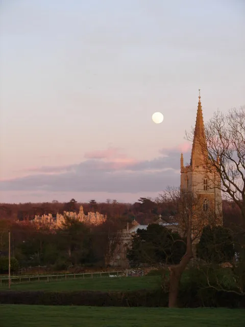
St Mary and St Peter’s Church, Harlaxton
St Mary and St Peter’s Church, Harlaxton — church in Harlaxton, Lincolnshire, England, UK.
 📷 3
📷 3Public art & sculpture · East Midlands
Harlaxton Village Sign
Harlaxton Village Sign — a public art in england-east-midlands, United Kingdom.
More places in this region
 📷 3
📷 3Holy wells · East Midlands
Boundary Wall Extending Along Eastern Boundary Of Footpath Between Number 65 And The Churchyard Of St Bartholomew's Church
Boundary Wall Extending Along Eastern Boundary Of Footpath Between Number 65 And The Churchyard Of St Bartholomew's Church — wall in Chesterfield, Derbyshire, England, UK.
 📷 3
📷 3Holy wells · East Midlands
Close Wall between Number 16a Minster Yard and the Deanery
Close Wall between Number 16a Minster Yard and the Deanery — Grade I listed wall in Lincoln, United Kingdom.
 📷 3
📷 3Holy wells · East Midlands
Close Wall To South And West Of The Deanery
Close Wall To South And West Of The Deanery — Grade I listed wall in Lincoln, Lincolnshire, England, UK.
.jpg?width=1200) 📷 3
📷 3Holy wells · East Midlands
Colonia Wall And Lower West Gate
Colonia Wall And Lower West Gate — Grade I listed wall in Lincoln, Lincolnshire, England, UK.
Frequently asked questions
- Where is Gatehouse 400 Metres North West Of Harlaxton Manor And Attached Boundary Walls?
- Gatehouse 400 Metres North West Of Harlaxton Manor And Attached Boundary Walls is in Lincolnshire, the East Midlands, United Kingdom (postcode NG32 1AG), in the parish of Harlaxton.
- Is Gatehouse 400 Metres North West Of Harlaxton Manor And Attached Boundary Walls a listed building?
- Gatehouse 400 Metres North West Of Harlaxton Manor And Attached Boundary Walls is officially recognised as Grade II* listed building listed.
- Is Gatehouse 400 Metres North West Of Harlaxton Manor And Attached Boundary Walls free to visit?
- Yes, Gatehouse 400 Metres North West Of Harlaxton Manor And Attached Boundary Walls is free to enter.
- How do I get to Gatehouse 400 Metres North West Of Harlaxton Manor And Attached Boundary Walls?
- The nearest railway station is Grantham, about 3.4 km away. Drivers can navigate to postcode NG32 1AG.