Holy wells · East Midlands
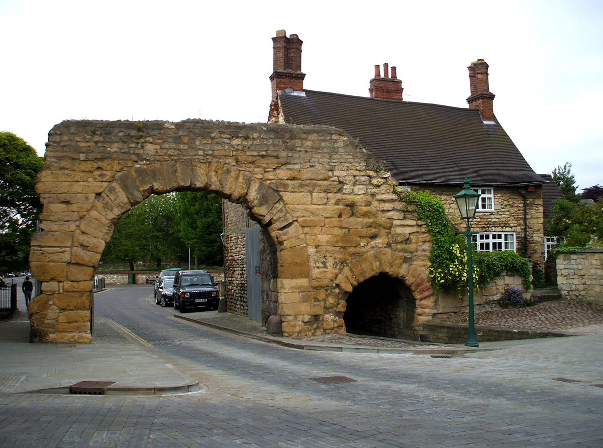
Close Wall To South And West Of The Deanery
Close Wall To South And West Of The Deanery — Grade I listed wall in Lincoln, Lincolnshire, England, UK.

Wikimedia Commons contributors — see linked file page for photographer and licence licence
Plan your visit
- Typical visit
- 15 min–30 min
- Nearest railway station
- Lincoln · 0.9 km
- Free entry
- Family-friendly
- Dog-friendly
About
Close Wall To South And West Of The Deanery is a place of interest in Lincolnshire, the East Midlands. Officially recognised as Grade I listed building. It sits within the Lincoln parliamentary constituency. The nearest railway station is Lincoln, about 0.9 km away. Postcode area LN2.
Photo gallery
Place summary
Close Wall To South And West Of The Deanery is a Grade I listed holy well located in Lincoln, within the East Midlands region of England. This structure is notable for its historical significance and architectural integrity.
AI-generated from the structured facts on this page (operator, designation, listing, era). Not a substitute for visiting.
- Coordinates
- 53.2338, -0.5379
- County
- Lincolnshire
- District
- Lincoln
- Parish
- Lincoln, unparished area
- Postcode
- LN2 1PX
- Parliamentary constituency
- Lincoln
- Nearest railway station
- Lincoln — 0.9 km
Sources
- wikidata: Q17526704 (CC0)
- commons: Bail Wall - geograph.org.uk - 718379.jpg (CC BY-SA 4.0)
Other places nearby
Loading nearby places…
Nearby
 📷 5
📷 5Hill forts · East Midlands
Lindum Colonia
Lindum Colonia — Roman settlement in Lincoln, United Kingdom.
 📷 3
📷 3Historic houses · East Midlands
The Deanery And Paley Flats And Adjoining Outbuildings And Stables
The Deanery And Paley Flats And Adjoining Outbuildings And Stables — a Grade I-listed historic house in england-east-midlands, United Kingdom.
 📷 5
📷 5Gardens · East Midlands
Norman House
Norman House — a garden in england-east-midlands, United Kingdom.
 📷 3
📷 3Natural landmarks · East Midlands
Exchequergate
Exchequergate — a other in england-east-midlands, United Kingdom.
Hotels · East Midlands
The Old Palace Lodge
The Old Palace Lodge — a hotel in england east midlands.
 📷 3
📷 3Historic churches · East Midlands
St. Mary Magdalene, Bailgate, Lincoln
St. Mary Magdalene, Bailgate, Lincoln — Grade II listed church in Lincoln, England.
More places in this region
 📷 3
📷 3Holy wells · East Midlands
Boundary Wall Extending Along Eastern Boundary Of Footpath Between Number 65 And The Churchyard Of St Bartholomew's Church
Boundary Wall Extending Along Eastern Boundary Of Footpath Between Number 65 And The Churchyard Of St Bartholomew's Church — wall in Chesterfield, Derbyshire, England, UK.
 📷 3
📷 3Holy wells · East Midlands
Close Wall between Number 16a Minster Yard and the Deanery
Close Wall between Number 16a Minster Yard and the Deanery — Grade I listed wall in Lincoln, United Kingdom.
.jpg?width=1200) 📷 3
📷 3Holy wells · East Midlands
Colonia Wall And Lower West Gate
Colonia Wall And Lower West Gate — Grade I listed wall in Lincoln, Lincolnshire, England, UK.
 📷 3
📷 3Holy wells · East Midlands
Garden Wall At Number 28 Gatepiers And Corner Pier
Garden Wall At Number 28 Gatepiers And Corner Pier — wall in Chesterfield, Derbyshire, England, UK.
Frequently asked questions
- Where is Close Wall To South And West Of The Deanery?
- Close Wall To South And West Of The Deanery is in Lincolnshire, the East Midlands, United Kingdom (postcode LN2 1PX), in the parish of Lincoln, unparished area.
- Is Close Wall To South And West Of The Deanery a listed building?
- Close Wall To South And West Of The Deanery is officially recognised as Grade I listed building listed.
- Is Close Wall To South And West Of The Deanery free to visit?
- Yes, Close Wall To South And West Of The Deanery is free to enter.
- How do I get to Close Wall To South And West Of The Deanery?
- The nearest railway station is Lincoln, about 0.9 km away. Drivers can navigate to postcode LN2 1PX.