
Wildlife reserves · London
Furzefield Wood and Lower Halfpenny
In or near Welham Green.
Furzefield Wood and Lower Halfpenny — nature reserve in Hertfordshire, England.

Wikimedia Commons licence
Plan your visit
- Typical visit
- 2 h–4 h
- Best time of year
- Autumn & winter (migration & wildfowl)
- Nearest railway station
- Potters Bar · 1.2 km
- Free entry
- Dog-friendly
Getting there & planning your visit
Furzefield Wood and Lower Halfpenny is located in Hertfordshire, with the nearest railway station being Potters Bar, which is 1.2 km away. Entry to the wildlife reserve is free. The postcode for sat-nav is EN6 3DQ.
About
Furzefield Wood and Lower Halfpenny is a wildlife reserve in the United Kingdom. Heritage designation: local nature reserve. Wikidata describes it as: "nature reserve in Hertfordshire, England". Coordinates: 51.7057°, -0.2040°.
Photo gallery
From the Wikipedia article
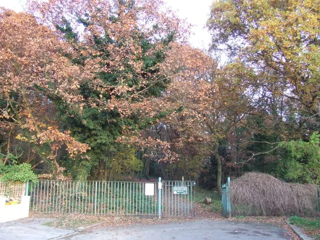
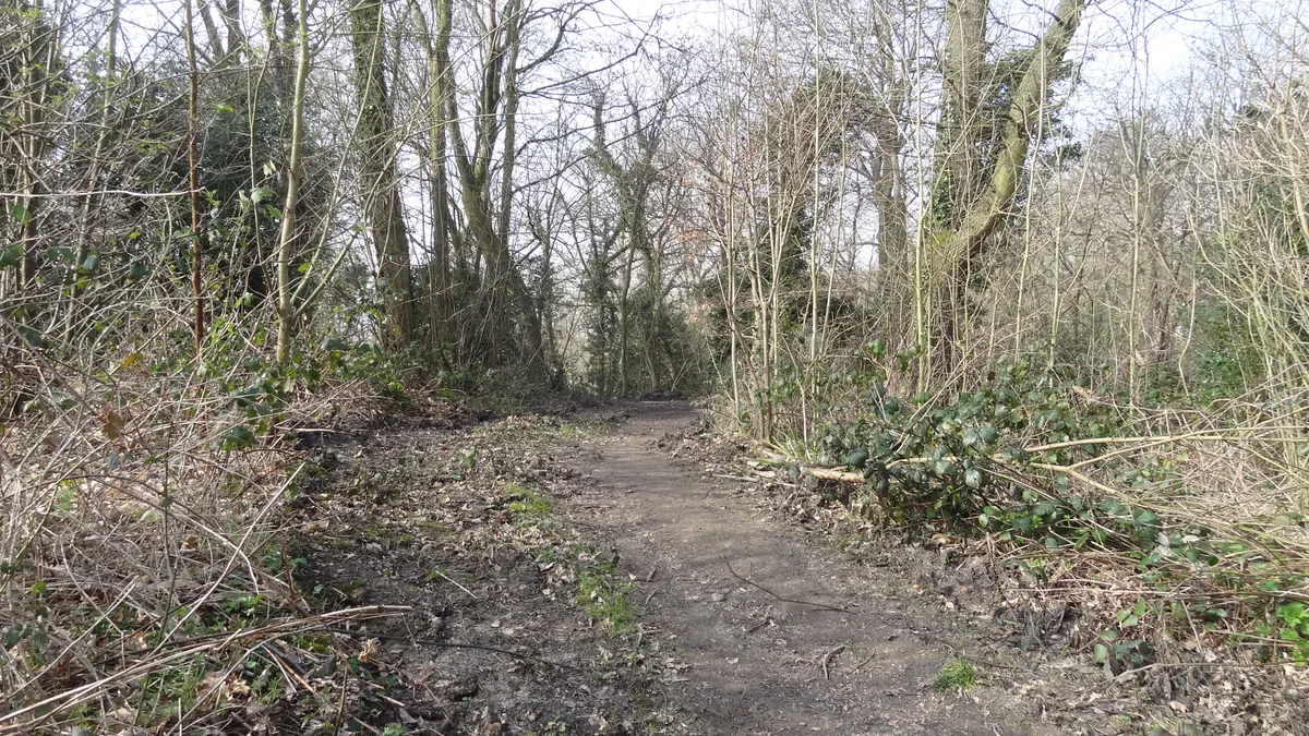
Furzefield Wood and Lower Halfpenny is a 7.4 hectare Local Nature Reserve in Potters Bar in Hertfordshire. It is owned and managed by Hertsmere Borough Council. The site is part of a parcel of land purchased in 1935 by Potters Bar Urban District Council. The southern area became the King George V Playing Fields, which are used for recreation, while the wood and meadow are managed for wildlife. Furze is an ancient name for gorse, and the wood has been managed for coppicing for over 300 years. It now provides a habitat for birds, and fallen branches are important for invertebrates. Lower Halfpenny Bottom is a meadow which was once the route of an old drovers' track. There is access from Cranbourne Avenue.
Excerpt from Wikipedia under CC BY-SA 4.0. See the source article linked in Sources below.
- Coordinates
- 51.7057, -0.2040
- County
- Hertfordshire
- District
- Hertsmere
- Parish
- Hertsmere, unparished area
- Postcode
- EN6 3DQ
- Parliamentary constituency
- Hertsmere
- Nearest railway station
- Potters Bar — 1.2 km
Sources
- wikidata: Q19873408 (CC0)
- wikipedia: Furzefield Wood and Lower Halfpenny Bottom (CC BY-SA 4.0)
Other places nearby

The Duty Stone On District Boundary To North West Of Golf Course
Forts · 0.5 km

John Gunther
Memorials & monuments · 0.7 km

Potters Bar Car Boot Sale (Second Site)
Farmers’ markets · 1.0 km

Sefton Memorial
Memorials & monuments · 1.0 km
Duncan's Horses
Public art & sculpture · 1.1 km

North Mymms
Villages · 1.1 km

Potters Bar Farmers Market & Craft Fair
Farmers’ markets · 1.1 km

South Mimms Castle
Castles · 1.2 km

South Mimms Castle
Literary houses · 1.2 km
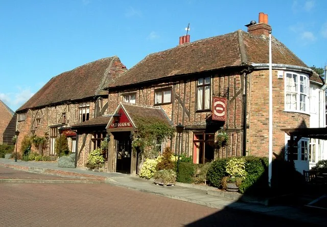
Wyllyotts Manor
Stately homes · 1.2 km

Wyllyotts Manor
Historic pubs · 1.2 km
South Mymms Castle
Castles · 1.3 km
Nearby
📷 5Forts · London
The Duty Stone On District Boundary To North West Of Golf Course
The Duty Stone On District Boundary To North West Of Golf Course — a martello broad in england-london, United Kingdom.
📷 5Memorials & monuments · London
John Gunther
John Gunther — a memorial in england-london, United Kingdom.
📷 5Farmers’ markets · East of England
Potters Bar Car Boot Sale (Second Site)
Potters Bar Car Boot Sale (Second Site) — a UK farmers' market in england london.
📷 5Memorials & monuments · East of England
Sefton Memorial
Sefton Memorial — a memorial in england-london, United Kingdom.
📷 5Public art & sculpture · East of England
Duncan's Horses
Duncan's Horses — a public art in england-london, United Kingdom.
📷 5Where to eat & stay near Furzefield Wood and Lower Halfpenny
Places to stay
 📷 5
📷 5Caravan parks · London
The Mimms Caravan Park
The Mimms Caravan Park — a caravan park in england london.
 📷 5
📷 5 📷 5
📷 5Hotels · East of England
Mercure Hatfield Oak Hotel
Mercure Hatfield Oak Hotel — a hotel in england london.
 📷 3
📷 3Campsites · East of England
Cherry Green Trees
Cherry Green Trees — a campsite in england london.
 📷 5
📷 5 📷 5
📷 5Places to eat & drink
📷 5 📷 5
📷 5Historic pubs · East of England
The Old Maypole Public House
The Old Maypole Public House in England East, United Kingdom.
 📷 5
📷 5Historic pubs · East of England
The Black Horse Public House
The Black Horse Public House in England East, United Kingdom.
 📷 5
📷 5Restaurants · London
The Oakmere
The Oakmere — a restaurant in england london. Cuisine: american. Brand: Harvester.
 📷 5
📷 5Restaurants · London
Potty Pancakes & Burger Bar
Potty Pancakes & Burger Bar — a restaurant in england london. Cuisine: pancakes;burger.
 📷 5
📷 5More places in this region
 Flagship📷 10
Wildlife reserves · London
Bedfords Park
Bedfords Park — Havering London Borough green landscape, also an Essex Wildlife Trust Nature reserve.
 Flagship📷 10
 Flagship📷 10
Wildlife reserves · London
Bramley Bank
Bramley Bank — Nature reserve in Upper Shirley.
 Flagship📷 10
Wildlife reserves · London
Chafford Gorges Nature Park
Chafford Gorges Nature Park — Essex Wildlife Trust Nature reserve.
Frequently asked questions
- Where is Furzefield Wood and Lower Halfpenny?
- Furzefield Wood and Lower Halfpenny is in Hertfordshire, London, United Kingdom (postcode EN6 3DQ), in the parish of Hertsmere, unparished area.
- What is Furzefield Wood and Lower Halfpenny?
- Furzefield Wood and Lower Halfpenny — nature reserve in Hertfordshire, England.
- How do I get to Furzefield Wood and Lower Halfpenny?
- The nearest railway station is Potters Bar, about 1.2 km away. The nearest town is Welham Green. Drivers can use postcode EN6 3DQ.
- Is Furzefield Wood and Lower Halfpenny a listed building?
- Furzefield Wood and Lower Halfpenny is officially recognised as local nature reserve listed.
- Is Furzefield Wood and Lower Halfpenny free to visit?
- Yes, Furzefield Wood and Lower Halfpenny is free to enter.
- How do I get to Furzefield Wood and Lower Halfpenny?
- The nearest railway station is Potters Bar, about 1.2 km away. Drivers can navigate to postcode EN6 3DQ.
- Are dogs allowed at Furzefield Wood and Lower Halfpenny?
- Most wildlife reserves allow dogs on lead only, with restrictions during ground-nesting bird season (March-July). Check signage at the reserve.