
Historic houses · North West England
Fooden Hall
In or near Sawley.
Fooden Hall — house in Bolton-by-Bowland, Ribble Valley, England, UK.

Wikimedia Commons contributors — see linked file page for photographer and licence licence

Plan your visit
- Typical visit
- 1 h–2 h
- Nearest railway station
- Clitheroe · 9.1 km
- Family-friendly
- Limited wheelchair access
About
Fooden Hall is a historic house in Lancashire, North-West England. Officially recognised as Grade II* listed building. The site is within the Forest Of Bowland National Landscape (AONB). It sits within the Ribble Valley parliamentary constituency. The nearest railway station is Clitheroe, about 9.1 km away. Postcode area BB7.
Photo gallery
Protected designations
- Area of Outstanding Natural Beauty: Forest Of Bowland
Designations sourced from Natural England open data under OGL v3.
Place summary
Fooden Hall is a historic house located in Bolton-by-Bowland, Lancashire, in North-West England. It is a Grade II* listed building, recognised for its architectural significance. The hall is situated within the Area of Outstanding Natural Beauty (AONB) of the Forest of Bowland.
AI-generated from the structured facts on this page (operator, designation, listing, era). Not a substitute for visiting.
- Coordinates
- 53.9364, -2.3061
- County
- Lancashire
- District
- Ribble Valley
- Parish
- Bolton-by-Bowland
- Postcode
- BB7 4LT
- Parliamentary constituency
- Ribble Valley
- Nearest railway station
- Clitheroe — 9.1 km
Sources
- wikidata: Q17532278 (CC0)
- commons: Farmhouse at Fooden-geograph.org.uk-2274763.jpg (CC BY-SA 4.0)
Other places nearby
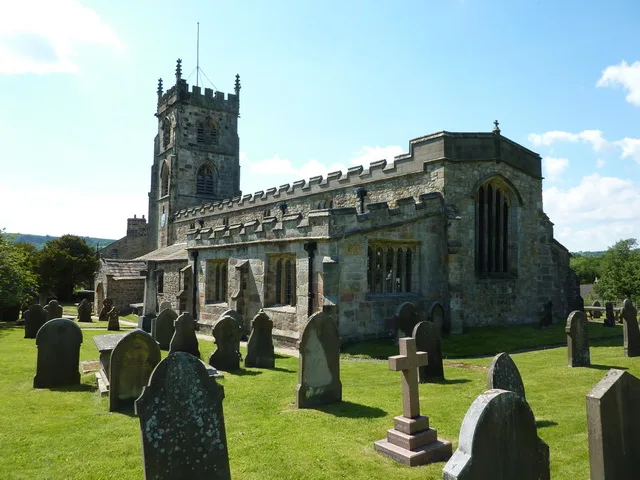
St Peter and St Paul's Church, Bolton-by-Bowland
Historic churches · 1.4 km

Skirden Bridge
Historic bridges · 1.7 km

Calder Farm Campsite
Campsites · 2.2 km

Gisburn Bridge
Historic bridges · 2.3 km

Ellenthorpe Castle Banks
Castles · 2.5 km

Gisburne Park
Manor houses · 2.6 km

Forest Becks Bridge
Historic bridges · 2.7 km

Gisburn
Villages · 2.8 km

Poultry House Bridge
Historic bridges · 2.8 km

Church of St Mary, Gisburn
Historic churches · 3.0 km

Little Painley Bowl Barrow
Burial mounds & barrows · 3.1 km

Little Painley Bowl Barrow
Archaeological sites · 3.1 km
Nearby
📷 3Historic churches · North West England
St Peter and St Paul's Church, Bolton-by-Bowland
St Peter and St Paul's Church, Bolton-by-Bowland — Grade I listed church in Bolton-by-Bowland, Ribble Valley, Lancashire, England, UK.
📷 3Historic bridges · North West England
Skirden Bridge
Skirden Bridge is a historic bridge in the United Kingdom.
📷 5Campsites · North West England
Calder Farm Campsite
Calder Farm Campsite — a campsite in england north west.
📷 3Historic bridges · North West England
Gisburn Bridge
Gisburn Bridge — Grade II listed building-listed bridge in england-north-west, United Kingdom.
📷 5Castles · North West England
Ellenthorpe Castle Banks
Ellenthorpe Castle Banks — a castle in england north west.
📷 3Manor houses · North West England
Gisburne Park
Gisburne Park — a manor in england-north-west, United Kingdom.
Where to eat & stay near Fooden Hall
Places to stay
📷 5Campsites · North West England
Calder Farm Campsite
Calder Farm Campsite — a campsite in england north west.
 📷 5
📷 5Caravan parks · North West England
Holgates Ribble Valley
Holgates Ribble Valley — a caravan park in england north west.
 📷 5
📷 5Caravan parks · North West England
Manor House Farm Caravan Site
Manor House Farm Caravan Site — a caravan park in england north west.
 📷 5
📷 5Campsites · North West England
Bridge Holme Caravan Site
Bridge Holme Caravan Site — a campsite in england north west.
 📷 5
📷 5Campsites · North West England
Gallaber Park
Gallaber Park — a campsite in england north west.
 📷 5
📷 5Caravan parks · North West England
Cross Lane Caravan and Camping Park
Cross Lane Caravan and Camping Park — a caravan park in england north west.
Places to eat & drink
 📷 5
📷 5Restaurants · North West England
The Spread Eagle
The Spread Eagle — a restaurant in england north west.
 📷 5
📷 5Historic pubs · North West England
Crow Trees Inn
Crow Trees Inn in England North West, United Kingdom.
 📷 7
📷 7 📷 5
📷 5Historic pubs · North West England
Cross Gaits Inn
Cross Gaits Inn in England North West, United Kingdom.
 📷 5
📷 5Historic pubs · North West England
Swan with Two Necks
Swan with Two Necks in England North West, United Kingdom.
 📷 5
📷 5Restaurants · North West England
Fence Gate Inn
Fence Gate Inn — a restaurant in england north west.
More historic houses in this region
 📷 3
📷 3Historic houses · North West England
116 Hospital Street, Nantwich
116 Hospital Street, Nantwich — substantial townhouse in Nantwich, Cheshire, England, UK.
 📷 3
📷 3Historic houses · North West England
140–142 Hospital Street, Nantwich
140–142 Hospital Street, Nantwich — grade II listed building in Nantwich, Cheshire East, Cheshire, England, UK.
 📷 3
📷 3Historic houses · North West England
46 High Street, Nantwich
46 High Street, Nantwich — house in Nantwich, Cheshire, England, UK.
 📷 3
📷 3Historic houses · North West England
64, St Ann's Road
64, St Ann's Road — Grade II* listed house in Middlewich, Cheshire East, England, UK.
Frequently asked questions
- Where is Fooden Hall?
- Fooden Hall is in Lancashire, North-West England, United Kingdom (postcode BB7 4LT), in the parish of Bolton-by-Bowland.
- What is Fooden Hall?
- Fooden Hall — house in Bolton-by-Bowland, Ribble Valley, England, UK.
- How do I get to Fooden Hall?
- The nearest railway station is Clitheroe, about 9.1 km away. Drivers can use postcode BB7 4LT.
- Is Fooden Hall a listed building?
- Fooden Hall is officially recognised as Grade II* listed building listed.
- Is Fooden Hall a protected site?
- Yes — Fooden Hall is part of the Forest Of Bowland National Landscape (AONB).
- How do I get to Fooden Hall?
- Drivers can navigate to postcode BB7 4LT. It sits within the Ribble Valley parliamentary constituency.