
Castles · East Midlands
Folkingham
In or near Billingborough.
Folkingham ( FOK-ing-əm) is a village and civil parish in the South Kesteven district of Lincolnshire, England. It lies on the A15 road 11 miles (18 km) north of Bourne and 10 miles (16 km) south of

Bob Harvey — CC BY-SA 2.0 via Wikimedia Commons licence

Plan your visit
- Typical visit
- 1.5 h–3 h
- Family-friendly
- Limited wheelchair access
About
Folkingham ( FOK-ing-əm) is a village and civil parish in the South Kesteven district of Lincolnshire, England. It lies on the A15 road 11 miles (18 km) north of Bourne and 10 miles (16 km) south of Sleaford. The 2001 Census gave a population of 729, rising to 796 at the 2011 census, and estimated at 795 in 2016.
Photo gallery
From the Wikipedia article
Folkingham ( FOK-ing-əm) is a village and civil parish in the South Kesteven district of Lincolnshire, England. It lies on the A15 road 11 miles (18 km) north of Bourne and 10 miles (16 km) south of Sleaford. The 2001 Census gave a population of 729, rising to 796 at the 2011 census, and estimated at 795 in 2016.
Excerpt from Wikipedia under CC BY-SA 4.0. See the source article linked in Sources below.
Background
History
It is likely that Folkingham originated as an Anglo-Saxon settlement in the sixth century, developing into a regionally important royal soke centre, or multiple estate by the eighth century. In 679 the region was conquered by Mercia, bringing it into the sphere of Mercian royal interest. A royal nunnery at Stow Green, off Mareham Lane founded by Æthelthryth, was entrusted to St Werberg by King Æthelred of Mercia. It is likely that King Æthelred developed nearby Folkingham into a soke centre, or multiple estate, in this period with a minster church dedicated to the popular St Andrew. The Soke of Folkingham, which grew into an estate of over 23 dependent villages, was roughly analogous with…
Description
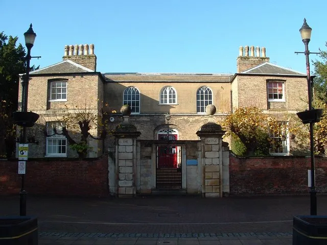
In the early 19th century Folkingham was part of Quarter Sessions, the higher court that dispensed justice for the area, which explains why a House of Correction, or minor prison, was built. It was constructed on the site of Folkingham Castle. The surviving Grade II* listed buildings consist of the original 19th-century governor's house and gateway, dating from 1808 and 1825. It was closed in 1878 but was taken over in about 1980 by the Landmark Trust, which converted the Gateway into a holiday home.
Sourced from Wikipedia under CC BY-SA 4.0.
- Coordinates
- 52.8873, -0.4060
- County
- Lincolnshire
- District
- South Kesteven
- Parish
- Folkingham
- Postcode
- NG34 0SF
- Parliamentary constituency
- Grantham and Bourne
- Official site
- www.neighbourhood.statistics.gov.uk
Sources
- wikipedia: Folkingham (CC BY-SA 4.0)
Other places nearby

Folkingham Manor House
Historic houses · 0.2 km

The Whipping Post Public House
Historic pubs · 0.2 km
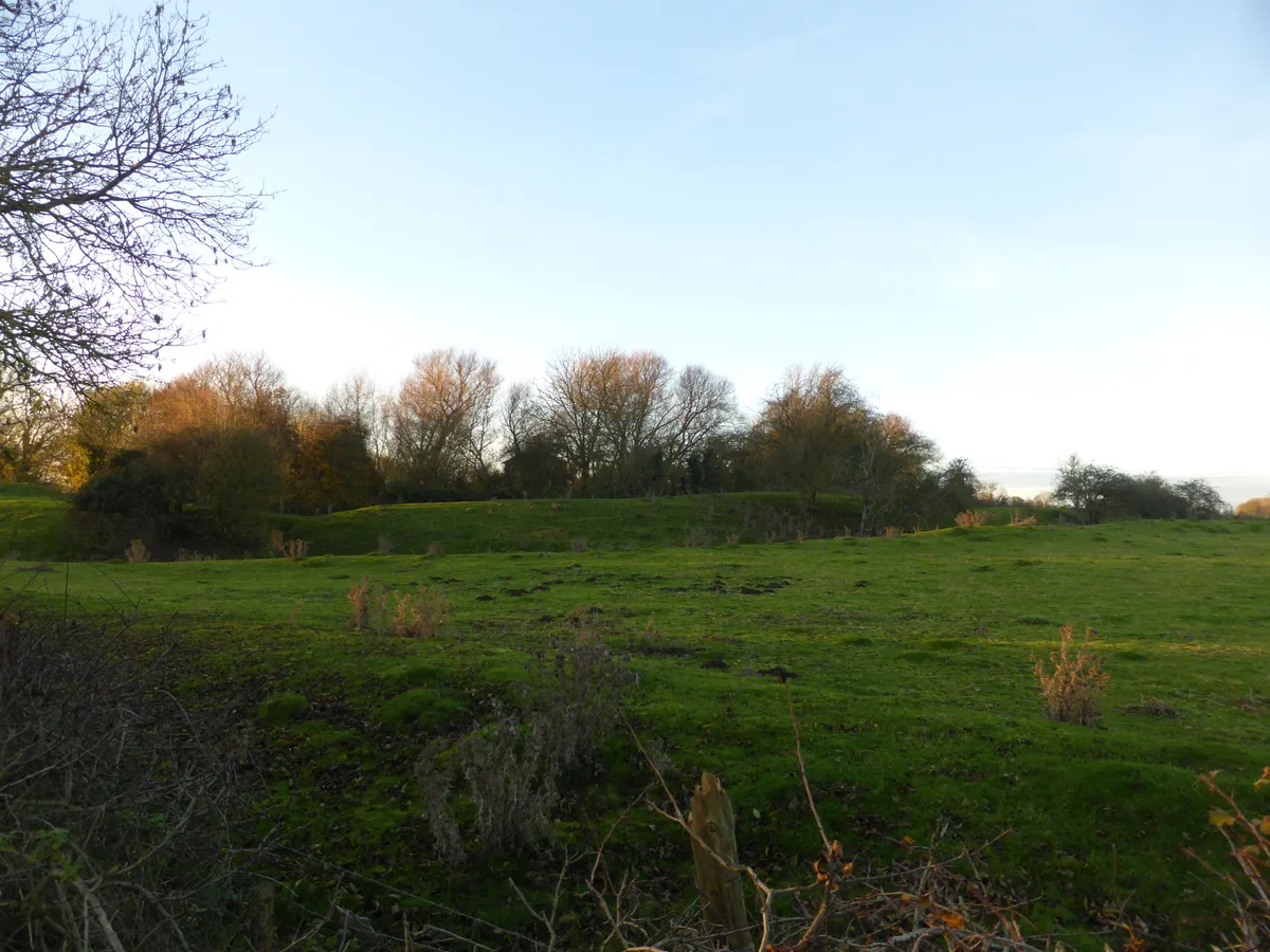
Folkingham Castle
Castles · 0.2 km

Greyhound Antique Shop
Historic pubs · 0.3 km
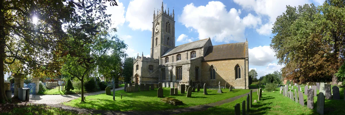
St. Andrew's Church, Folkingham
Historic churches · 0.4 km

Walcot
Villages · 2.2 km

Cross In The Churchyard Of The Church Of St Nicholas
Historic churches · 2.2 km

Aslaackby Castle
Castles · 3.1 km

Aslaackby Castle
Archaeological sites · 3.1 km
Aslackby Castle
Castles · 3.1 km
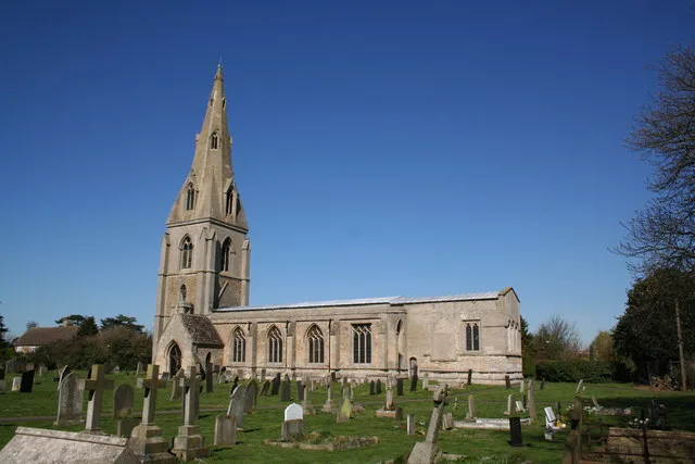
St Peter's Church, Threekingham
Historic churches · 3.2 km

St James' Church, Aslackby
Historic churches · 3.2 km
Nearby
📷 3Historic houses · East Midlands
Folkingham Manor House
Folkingham Manor House — house in Folkingham, South Kesteven, England, UK.
📷 7Historic pubs · East Midlands
The Whipping Post Public House
The Whipping Post Public House in England East, United Kingdom.
📷 3Castles · East Midlands
Folkingham Castle
Folkingham Castle — castle in Lincolnshire, England, UK.
📷 7Historic pubs · East Midlands
Greyhound Antique Shop
Greyhound Antique Shop in England East, United Kingdom.
📷 5Historic churches · East Midlands
St. Andrew's Church, Folkingham
St. Andrew's Church, Folkingham — church in Folkingham, Lincolnshire, England, UK.
📷 5Where to eat & stay near Folkingham
Places to stay
 📷 5
📷 5Caravan parks · East Midlands
Wishing Well Caravan Site
Wishing Well Caravan Site — a caravan park in england east midlands.
 📷 7
📷 7Hotels · East Midlands
The Angel Hotel
The Angel Hotel — a hotel in england east midlands.
 📷 5
📷 5Campsites · East Midlands
Woodland Waters
Woodland Waters — a campsite in england east midlands.
 📷 5
📷 5 📷 5
📷 5Caravan parks · East Midlands
Windmill Farm Caravan Park
Windmill Farm Caravan Park — a caravan park in england east midlands.
 📷 4
📷 4Caravan parks · East Midlands
Home Farm Camping and Caravaning
Home Farm Camping and Caravaning — a caravan park in england east midlands.
Places to eat & drink
📷 7Historic pubs · East Midlands
The Whipping Post Public House
The Whipping Post Public House in England East, United Kingdom.
📷 7Historic pubs · East Midlands
Greyhound Antique Shop
Greyhound Antique Shop in England East, United Kingdom.
 📷 5
📷 5Historic pubs · East Midlands
Three Kings Public House
Three Kings Public House in England East, United Kingdom.
 📷 5
📷 5 📷 5
📷 5 📷 5
📷 5Historic pubs · East Midlands
Houblon Arms Public House
Houblon Arms Public House in England East, United Kingdom.
More castles in this region
 📷 4
📷 4Castles · East Midlands
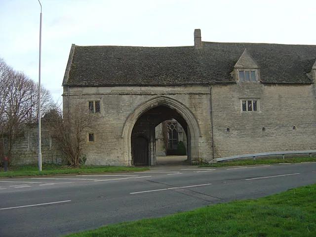
Maxey Castle
Maxey Castle — castle, now ruinous, in Maxey, Cambridgeshire, England, UK.
 📷 5
📷 5Castles · East Midlands
Northborough Manor House
Northborough Manor House — Grade I listed house in Northborough, Peterborough, Cambridgeshire, England, UK.
 📷 5
📷 5Castles · East Midlands
Wisbech Castle
Wisbech Castle — former castle in Wisbech, Cambridgeshire, England.
 📷 5
📷 5Castles · East Midlands
Site of Stamford Castle
Site of Stamford Castle — a castle in england-london, United Kingdom.
Frequently asked questions
- Where is Folkingham?
- Folkingham is in Lincolnshire, the East Midlands, United Kingdom (postcode NG34 0SF), in the parish of Folkingham.
- What is Folkingham?
- Folkingham ( FOK-ing-əm) is a village and civil parish in the South Kesteven district of Lincolnshire, England. It lies on the A15 road 11 miles (18 km) north of Bourne and 10 miles (16 km) south of
- How do I get to Folkingham?
- Drivers can use postcode NG34 0SF.
- Does Folkingham charge admission?
- Folkingham typically charges admission. Check the official site for current ticket prices and opening hours.
- How do I get to Folkingham?
- Drivers can navigate to postcode NG34 0SF. It sits within the Grantham and Bourne parliamentary constituency.