
Museums · South East England
Fleet, Hampshire
In or near Hartfordbridge.
Fleet is a town and civil parish in the Hart District of Hampshire, England, centred 38 miles (61 km) south-west of London and 13 miles (21 km) east of Basingstoke, near the towns of Farnborough, Alde

Basher Eyre — CC BY-SA 2.0 via Wikimedia Commons licence
_-_geograph.org.uk_-_2931467.jpg)
Plan your visit
- Typical visit
- 1.5 h–3 h
- Best time of year
- Year-round
- Nearest railway station
- Fleet · 1.3 km
- Family-friendly
- Limited wheelchair access
Getting there & planning your visit
To visit the museum in Fleet, Hampshire, the nearest railway station is Fleet, located 1.3 km away. The postcode for sat-nav is GU51 4JG. Accessibility is limited for wheelchair users.
About
Fleet is a town and civil parish in the Hart District of Hampshire, England, centred 38 miles (61 km) south-west of London and 13 miles (21 km) east of Basingstoke, near the towns of Farnborough, Aldershot and Farnham. The town is sometimes referred to as Fleet and Crookham, as the urban development is continuous and inseparable between Fleet, Church Crookham and Crookham Village, while the civil parish of Fleet Town Council manages Fleet town centre and its surrounding areas. It is the largest town of the Hart District and features several major technology business areas, fast rail links to London, and a nearby connection to the M3 motorway. The nearby motorway service station, Fleet services, is named after the town. Fleet railway station is the only railway station in the town, providing direct commuter services to major cities such as London, Winchester, Southampton and Portsmouth. The Basingstoke Canal runs through the town; once a major transport route for goods, it has become a leisure route and an important habitat for waterfowl. As of 2021 town of Fleet had a total population of 44,822 and includes the contiguous parishes of Church Crookham, Crookham Village, Dogmersfield, Elvetham Heath, as well as Ewshot. The town has a prominent golf club, an athletics club and two major football clubs. Major annual events in the town include Fleet Half Marathon, Fleet Carnival, Music on The Views, Lions Firework Fiesta, Remembrance Sunday and Fleet Christmas Festival. Local land
Photo gallery
Official information
The page provides statistical data from the Census 2021 for parishes in England and Wales, focusing on various demographic and economic characteristics. It includes estimates on population, households, and classifications by sex, disability, economic activity, and more.
Protected designations
- Site of Special Scientific Interest: Basingstoke Canal SSSI
Designations sourced from Natural England open data under OGL v3.
From the Wikipedia article
Fleet is a town and civil parish in the Hart District of Hampshire, England, centred 38 miles (61 km) south-west of London and 13 miles (21 km) east of Basingstoke, near the towns of Farnborough, Aldershot and Farnham. The town is sometimes referred to as Fleet and Crookham, as the urban development is continuous and inseparable between Fleet, Church Crookham and Crookham Village, while the civil parish of Fleet Town Council manages Fleet town centre and its surrounding areas. It is the largest town of the Hart District and features several major technology business areas, fast rail links to London, and a nearby connection to the M3 motorway. The nearby motorway service station, Fleet services, is named after the town. Fleet railway station is the only railway station in the town, providing direct commuter services to major cities such as London, Winchester, Southampton and Portsmouth. The Basingstoke Canal runs through the town; once a major transport route for goods, it has become a leisure route and an important habitat for waterfowl. As of 2021 town of Fleet had a total population of 44,822 and includes the contiguous parishes of Church Crookham, Crookham Village, Dogmersfield, Elvetham Heath, as well as Ewshot. The town has a prominent golf club, an athletics club and two major football clubs. Major annual events in the town include Fleet Half Marathon, Fleet Carnival, Music on The Views, Lions Firework Fiesta, Remembrance Sunday and Fleet Christmas Festival. Local landmarks include Fleet Pond, the largest freshwater lake in Hampshire, and a High Street featuring many Victorian and Edwardian buildings. Major civic services are located in Fleet town centre, including Fleet Library and The Harlington, a community arts and civic centre. A weekly Saturday market is held in Gurkha Square, in front of the library. The eastern end of Fleet is occupied by the Aldershot and Minley training areas, which are covered by forest and heathland and managed by the Ministry of
Excerpt from Wikipedia under CC BY-SA 4.0. See the source article linked in Sources below.
Background
History
The Fleet area has yielded few archaeological finds. Some have speculated that the Fleet Pond was built by the Romans, and later Saxons named it Fuglemere, meaning "wildfowl lake". Isaac Taylor's Map of Hampshire (1759) shows three small habitations in the area, namely Crookham Common, that was later to become Fleet. According to Taylor's Map of 1759, the area now occupied by the town of Fleet was once uninhabited land known as Crookham Common, situated between the village of Crookham and Fleet Pond. Two streams ran into the pond and several road ran cross the surrounding wilderness. A range of hills separated the common from Aldershot Common in the east. At this time, Fleet Pond was…
Description
The Harlington, also known as (The) Harlington Centre or Fleet Civic Centre, situated between Fleet Road and Harlington Way, is the two-storey civic centre in the town centre. Next to Fleet Library, the centre serves as a venue for arts and entertainment, as well as community functions. It consists of an auditorium, a dance studio, a function room and a bar. In 1956, Fleet Carnival for fundraising was revived for a new civic centre. It was built in 1972 as a civic complex, offering meeting rooms, offices, and a main hall, with a library separate library building. Following a fire that destroyed the roof in May 1991, the centre was renovated in 1993 and integrated with the library building.…
Sourced from Wikipedia under CC BY-SA 4.0.
- Coordinates
- 51.2834, -0.8456
- County
- Hampshire
- District
- Hart
- Parish
- Fleet
- Postcode
- GU51 4JG
- Parliamentary constituency
- North East Hampshire
- Nearest railway station
- Fleet — 1.3 km
- Official site
- www.nomisweb.co.uk
Sources
- wikipedia: Fleet, Hampshire (CC BY-SA 4.0)
Other places nearby
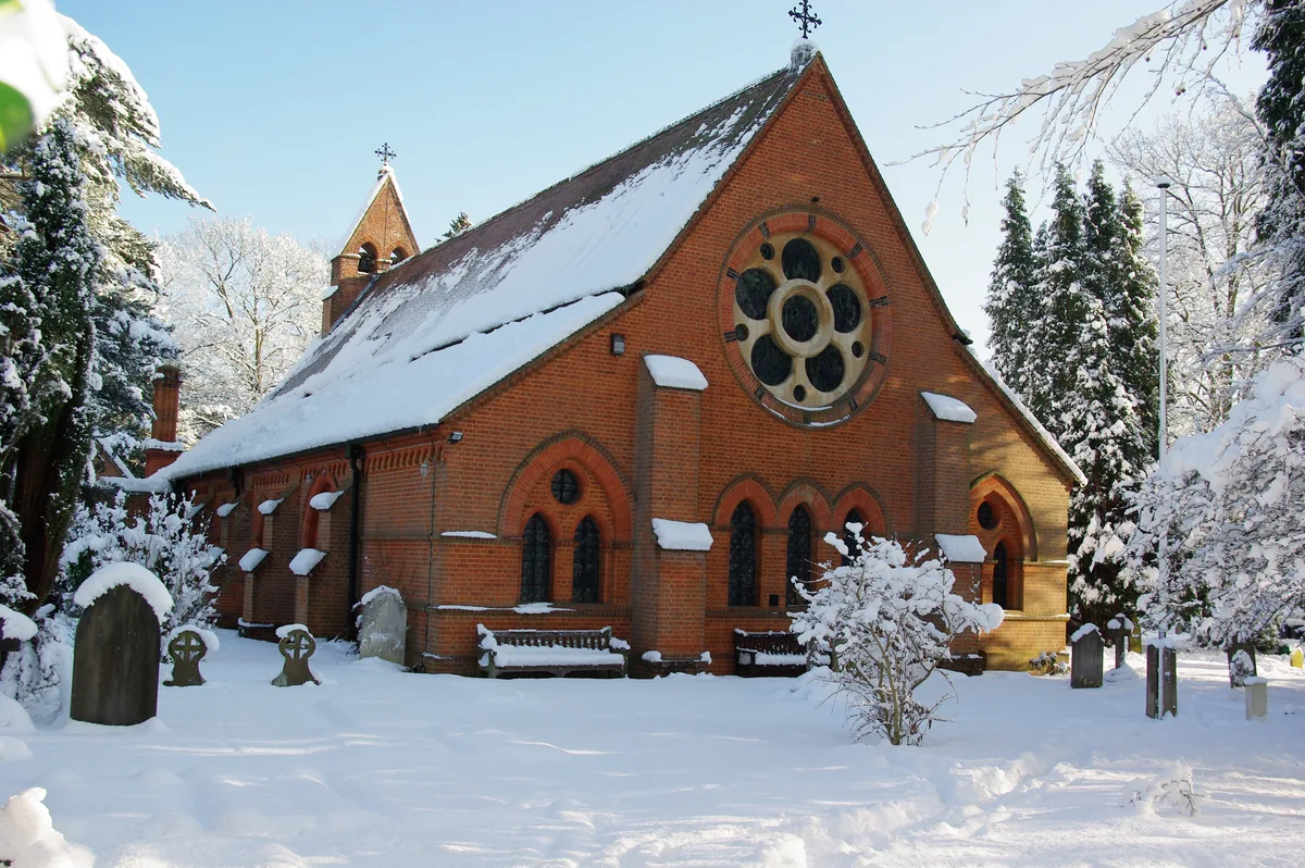
All Saints Church, Fleet
Historic churches · 0.2 km

Sunday School
Natural landmarks · 0.3 km

The Harlington
Open-air theatres · 0.4 km

Gurkha Exhibition
Memorials & monuments · 0.4 km
Tree of Heaven
Memorials & monuments · 0.4 km

Odeon Fleet
Theatres · 0.4 km
Hart District
Museums · 0.4 km
Cornus florida (Flowering Dogwood)
Memorials & monuments · 0.5 km
Cornus florida tree
Memorials & monuments · 0.5 km

Fleet Saturday Market
Farmers’ markets · 0.5 km

War Memorial
Memorials & monuments · 0.5 km

Gurkha Square
Mines & mining heritage · 0.5 km
Nearby
📷 5Historic churches · South East England
All Saints Church, Fleet
All Saints Church, Fleet — church in Hart, United Kingdom.
📷 5Natural landmarks · South East England
Sunday School
Sunday School — a school heritage in england-south-east, United Kingdom.
📷 5Open-air theatres · South East England
The Harlington
The Harlington — a open-air theatre in england south east.
📷 5Memorials & monuments · South East England
Gurkha Exhibition
Gurkha Exhibition — a memorial in england-south-east, United Kingdom.
📷 5Memorials & monuments · South East England
Tree of Heaven
Tree of Heaven — a memorial in england-south-east, United Kingdom.
📷 5Theatres · South East England
Odeon Fleet
Odeon Fleet in England South East, United Kingdom.
Where to eat & stay near Fleet, Hampshire
Places to stay
 📷 5
📷 5 📷 5
📷 5 📷 5
📷 5Campsites · South East England
Runways End Outdoor Centre
Runways End Outdoor Centre — a campsite in england south east.
 📷 5
📷 5Hotels · South East England
Warbrook House Hotel
Warbrook House Hotel — a hotel in england south east.
 📷 5
📷 5Caravan parks · South East England
Mytchett Farm (Mobile Home Park)
Mytchett Farm (Mobile Home Park) — a caravan park in england south east.
 📷 5
📷 5Caravan parks · South East England
Grove Farm Park Mobile Home Park
Grove Farm Park Mobile Home Park — a caravan park in england south east.
Places to eat & drink
 📷 5
📷 5Historic pubs · South East England
The Tumble Down Dick Pub
The Tumble Down Dick Pub in England South East, United Kingdom.
 📷 5
📷 5Historic pubs · South East England
The Waterwitch
The Waterwitch in England South East, United Kingdom.
 📷 5
📷 5 📷 7
📷 7Historic pubs · South East England
Leather Bottle Public House
Leather Bottle Public House in England South East, United Kingdom.
 📷 7
📷 7Historic pubs · South East England
8 And 9 (The Queens Head), The Borough
8 And 9 (The Queens Head), The Borough in England South East, United Kingdom.
 📷 7
📷 7Historic pubs · South East England
William Cobbett Public House
William Cobbett Public House in England South East, United Kingdom.
More museums in this region
 📷 5
📷 5Museums · South East England
Coldrum Long Barrow
Coldrum Long Barrow — neolithic chambered long barrow near Trottiscliffe, Kent, England, UK.
 📷 5
📷 5Museums · South East England
Guildford House
Guildford House — house in Guildford, Surrey, England, UK.
 📷 5
📷 5Museums · South East England
Huguenot Museum
Huguenot Museum — museum in Rochester, England, UK.
 📷 5
📷 5Museums · South East England
Medway megaliths
Medway megaliths — group of long barrows in Kent, England.
Frequently asked questions
- Where is Fleet, Hampshire?
- Fleet, Hampshire is in Hampshire, South-East England, United Kingdom (postcode GU51 4JG), in the parish of Fleet.
- What is Fleet, Hampshire?
- Fleet is a town and civil parish in the Hart District of Hampshire, England, centred 38 miles (61 km) south-west of London and 13 miles (21 km) east of Basingstoke, near the towns of Farnborough, Alde
- How do I get to Fleet, Hampshire?
- The nearest railway station is Fleet, about 1.3 km away. Drivers can use postcode GU51 4JG.
- Is Fleet, Hampshire a protected site?
- Yes — Fleet, Hampshire is part of the Basingstoke Canal SSSI Site of Special Scientific Interest.
- How do I get to Fleet, Hampshire?
- The nearest railway station is Fleet, about 1.3 km away. Drivers can navigate to postcode GU51 4JG.