
Historic houses · South West England
Five Mile House
In or near Duntisbourne Abbots.
Five Mile House — a Grade II*-listed historic house in england-west-midlands, United Kingdom.

Colin Pyle — CC BY-SA 2.0 via Wikimedia Commons licence

Plan your visit
- Typical visit
- 1 h–2 h
- Family-friendly
- Limited wheelchair access
About
Five Mile House is a Grade II*-listed building in england-west-midlands, United Kingdom. Grade II* status is conferred by Historic England (or Cadw, Historic Environment Scotland or NIEA equivalents) on buildings of exceptional national interest. See the linked Wikipedia article for full historical and architectural details.
Photo gallery
Protected designations
- Area of Outstanding Natural Beauty: Cotswolds
Designations sourced from Natural England open data under OGL v3.
From the Wikipedia article
The Five Mile House is a historic former pub located on Old Gloucester Road in Duntisbourne Abbots, Gloucestershire, England. Built in the 17th century, it is a grade II listed building. The pub was noted for its inclusion in the Campaign for Real Ale's National Inventory of Historic Pub Interiors, highlighting its historical and architectural importance. Situated on the ancient Roman road of Ermin Street, the pub was referred to in documents from 1891 and 1903 as "The Old Inn," suggesting a long history of serving travelers and locals alike. The Five Mile House was owned and operated by the Ruck family from the 1930s until Ivy Ruck's passing in 1995. The pub's charm lay in its rustic features, including bare wood floors, open fires, wooden seating, and a small bar that led into the tap room. The pub was bought and refurbished by the Carrier family, and reopened in 1997. Despite its historical allure, the Five Mile House closed in 2015. The closure was attributed to a significant decline in passing trade following the re-routing of the A419, which diverted traffic away from the area. The building was converted into a private residence.
Excerpt from Wikipedia under CC BY-SA 4.0. See the source article linked in Sources below.
- Coordinates
- 51.7802, -2.0331
- County
- Gloucestershire
- District
- Cotswold
- Parish
- Duntisbourne Abbots
- Postcode
- GL7 7JR
- Parliamentary constituency
- North Cotswolds
- Official site
- thecotswoldsapp.com
Sources
- wikidata: Q18160157 (CC0)
- wikipedia: Five Mile House, Duntisbourne Abbots (CC BY-SA 4.0)
Other places nearby

Five Mile House
Historic pubs · 0.0 km

Unidentified Monument In The Churchyard Approximately 7 Metres South Of Tower To Church Of St Peter
Memorials & monuments · 1.4 km

Duntisbourne Abbots
Towns & cities · 1.4 km

The Ditches, North Cerney
Vineyards · 1.8 km

Cotswolds
Museums · 2.2 km

Hoar Stone
Archaeological sites · 2.7 km

Winstone Hill
Mountains & hills · 2.8 km

Jack Barrow
Burial mounds & barrows · 2.8 km

Jackbarrow Camping
Campsites · 2.9 km
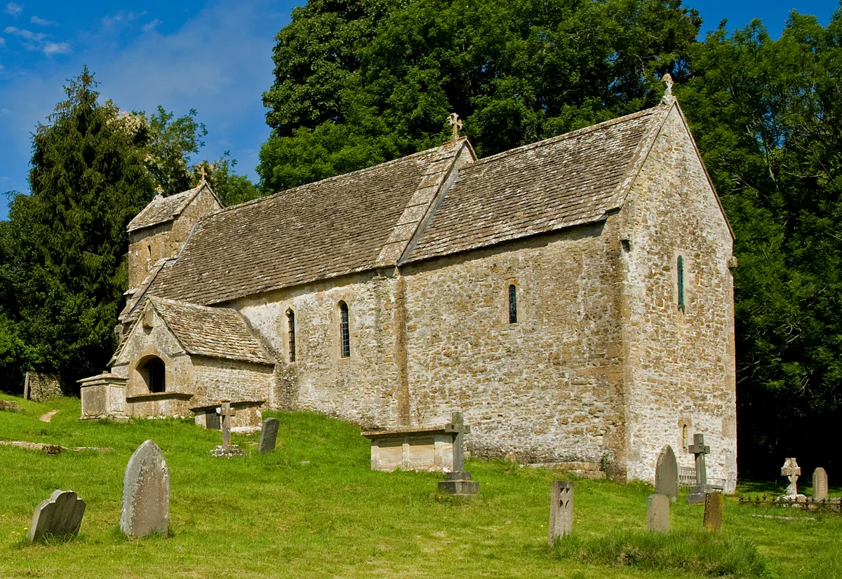
St Michael's Church, Duntisbourne Rouse
Historic churches · 3.1 km

Jefferis Monument In The Churchyard Approximately 3.5M South Of Church Of St Michael
Memorials & monuments · 3.1 km
Unidentified Monument In The Churchyard 1M West Of Jefferis Memorial To South Of Church Of St Michael
Memorials & monuments · 3.1 km
Nearby
📷 5Historic pubs · South West England
Five Mile House
Five Mile House in England South East, United Kingdom.
📷 3Memorials & monuments · South West England
Unidentified Monument In The Churchyard Approximately 7 Metres South Of Tower To Church Of St Peter
Unidentified Monument In The Churchyard Approximately 7 Metres South Of Tower To Church Of St Peter — Grade II listed building-listed memorial in england-west-midlands, United Kingdom.
📷 4Towns & cities · South West England
Duntisbourne Abbots
Duntisbourne Abbots — village in Gloucestershire, England, UK.
📷 5Vineyards · South West England
The Ditches, North Cerney
The Ditches, North Cerney — a UK vineyard in england west midlands, producing English or Welsh wine from cool-climate grape varieties.
📷 5Museums · South West England
Cotswolds
The Cotswolds ( KOTS-wohldz, KOTS-wəldz) is a region of South West and South Central England, along a range of wolds or rolling hills that rise from the meadows of the upper River Thames to an escarpm
📷 3Archaeological sites · South West England
Hoar Stone
Hoar Stone — a archaeological in england-west-midlands, United Kingdom.
Where to eat & stay near Five Mile House
Places to stay
Campsites · South West England
Jackbarrow Camping
Jackbarrow Camping — a campsite in england west midlands.
 📷 5
📷 5Campsites · South West England
Mayfield Park Touring & Camping
Mayfield Park Touring & Camping — a campsite in england west midlands.
 📷 7
📷 7Hotels · South West England
Cowley Manor
Cowley Manor — a hotel in england west midlands.
 📷 5
📷 5Hotels · South West England
Stratton House Hotel
Stratton House Hotel — a hotel in england west midlands.
 📷 5
📷 5Campsites · South West England
Buckshead Farm campsite
Buckshead Farm campsite — a campsite in england west midlands.
 📷 5
📷 5Hotels · South West England
The Corinium Hotel And Restaurant
The Corinium Hotel And Restaurant — a hotel in england west midlands.
Places to eat & drink
📷 5Historic pubs · South West England
Five Mile House
Five Mile House in England South East, United Kingdom.
 📷 7
📷 7Historic pubs · South West England
Colesbourne Inn
Colesbourne Inn in England South East, United Kingdom.
 📷 5
📷 5 📷 7
📷 7Historic pubs · South West England
Foston's Ash Inn
Foston's Ash Inn in England South East, United Kingdom.
 📷 5
📷 5 📷 7
📷 7Historic pubs · South West England
The Nelson Inn
The Nelson Inn in England South East, United Kingdom.
More historic houses in this region
 📷 5
📷 5Historic houses · South West England
1 South Parade
1 South Parade — Grade I listed house in Bath, Somerset, England, UK.
_(geograph_6440799).jpg?width=1200) 📷 5
📷 5Historic houses · South West England
1-4 Lansdowne Grove, Morris Lane
1-4 Lansdowne Grove, Morris Lane — houses in Devizes, Wiltshire, England, UK.
 📷 5
📷 5Historic houses · South West England
2 North Parade
2 North Parade — building in Bath, UK; part of Abbey Hotel.
 📷 5
📷 5Historic houses · South West England
2, South Place, Lacock Road
2, South Place, Lacock Road — house in Corsham, Wiltshire, England, UK.
Frequently asked questions
- Where is Five Mile House?
- Five Mile House is in Gloucestershire, the West Midlands, United Kingdom (postcode GL7 7JR), in the parish of Duntisbourne Abbots.
- What is Five Mile House?
- Five Mile House — a Grade II*-listed historic house in england-west-midlands, United Kingdom.
- How do I get to Five Mile House?
- Drivers can use postcode GL7 7JR.
- Is Five Mile House a listed building?
- Five Mile House is officially recognised as Grade II* listed.
- Is Five Mile House a protected site?
- Yes — Five Mile House is part of the Cotswolds National Landscape (AONB).
- How do I get to Five Mile House?
- Drivers can navigate to postcode GL7 7JR. It sits within the North Cotswolds parliamentary constituency.