
Museums · South West England
Cotswolds
In or near Duntisbourne Abbots.
The Cotswolds ( KOTS-wohldz, KOTS-wəldz) is a region of South West and South Central England, along a range of wolds or rolling hills that rise from the meadows of the upper River Thames to an escarpm

Graham Horn — CC BY-SA 2.0 via Wikimedia Commons licence

Plan your visit
- Typical visit
- 1.5 h–3 h
- Best time of year
- Year-round
- Free entry
- Family-friendly
- Limited wheelchair access
About
The Cotswolds ( KOTS-wohldz, KOTS-wəldz) is a region of South West and South Central England, along a range of wolds or rolling hills that rise from the meadows of the upper River Thames to an escarpment above the Severn Valley and the Vale of Evesham. The area is defined by the bedrock of Jurassic limestone that creates a type of grassland habitat that is quarried for the golden-coloured Cotswold stone. It lies across the boundaries of several English counties: mainly Gloucestershire and Oxfordshire, and parts of Wiltshire, Somerset, Worcestershire, and Warwickshire. The highest point is Cleeve Hill at 1,083 ft (330 m), just east of Cheltenham. The predominantly rural landscape contains stone-built villages, towns, stately homes and gardens featuring the local stone. A large area within the Cotswolds has been designated as a National Landscape (legally still known as Area of Outstanding Natural Beauty, or AONB) since 1966. The designation covers 787 square miles (2,038 km2), with boundaries roughly 25 miles (40 km) across and 90 miles (140 km) long, stretching south-west from just south of Stratford-upon-Avon to just south of Bath, making it the largest National Landscape area and England's third-largest protected landscape. The Cotswold local government district is within Gloucestershire. Its main town is Cirencester. In 2021, the population of the 450-square-mile (1,200 km2) district was 91,000. The much larger area referred to as the Cotswolds encompasses nearly 800 squar
Photo gallery
Official information
The Cotswolds National Landscape is a vast area known for its stunning scenery, charming towns, and outdoor activities. Visitors can explore nearly 800 square miles of picturesque landscapes through various guided and self-guided routes, including walking, cycling, and horse riding. It is recognized as an Area of Outstanding Natural Beauty, highlighting its ecological and historical significance.
Protected designations
- Area of Outstanding Natural Beauty: Cotswolds
Designations sourced from Natural England open data under OGL v3.
From the Wikipedia article
The Cotswolds ( KOTS-wohldz, KOTS-wəldz) is a region of South West and South Central England, along a range of wolds or rolling hills that rise from the meadows of the upper River Thames to an escarpment above the Severn Valley and the Vale of Evesham. The area is defined by the bedrock of Jurassic limestone that creates a type of grassland habitat that is quarried for the golden-coloured Cotswold stone. It lies across the boundaries of several English counties: mainly Gloucestershire and Oxfordshire, and parts of Wiltshire, Somerset, Worcestershire, and Warwickshire. The highest point is Cleeve Hill at 1,083 ft (330 m), just east of Cheltenham. The predominantly rural landscape contains stone-built villages, towns, stately homes and gardens featuring the local stone. A large area within the Cotswolds has been designated as a National Landscape (legally still known as Area of Outstanding Natural Beauty, or AONB) since 1966. The designation covers 787 square miles (2,038 km2), with boundaries roughly 25 miles (40 km) across and 90 miles (140 km) long, stretching south-west from just south of Stratford-upon-Avon to just south of Bath, making it the largest National Landscape area and England's third-largest protected landscape. The Cotswold local government district is within Gloucestershire. Its main town is Cirencester. In 2021, the population of the 450-square-mile (1,200 km2) district was 91,000. The much larger area referred to as the Cotswolds encompasses nearly 800 square miles (2,100 km2). The population of the National Landscape area was 139,000 in 2016.
Excerpt from Wikipedia under CC BY-SA 4.0. See the source article linked in Sources below.
Background
History
The largest excavation of Jurassic period echinoderm fossils, including of rare and previously unknown species, occurred at a quarry in the Cotswolds in 2021. There is evidence of Neolithic settlement from burial chambers on Cotswold Edge, and there are remains of Bronze and Iron Age forts. Later the Romans built villas, such as at Chedworth, and settlements such as Gloucester, and paved the Celtic path later known as Fosse Way. During the Middle Ages, thanks to the breed of sheep known as the Cotswold Lion, the Cotswolds became prosperous from the wool trade with the continent, with much of the money made from wool directed towards the building of churches. The most successful era for the…
Visiting
Tourism is a significant part of the economy. The Cotswold District area gained over £373 million from visitor spending on accommodation, £157 million on local attractions and entertainments, and about £100m on travel in 2016. In the larger Cotswolds Tourism area, including Stroud, Cheltenham, Gloucester and Tewkesbury, tourism generated about £1 billion in 2016, providing 200,000 jobs. Some 38 million day visits were made to the Cotswold Tourism area that year. Many travel guides direct tourists to Chipping Campden, Stow-on-the-Wold, Bourton-on-the-Water, Broadway, Bibury, and Stanton. Some of these locations can be very crowded at times. Roughly 300,000 people visit Bourton per year, for…
Sourced from Wikipedia under CC BY-SA 4.0.
- Coordinates
- 51.8000, -2.0333
- County
- Gloucestershire
- District
- Cotswold
- Parish
- Elkstone
- Postcode
- GL53 9PT
- Parliamentary constituency
- North Cotswolds
- Established
- 1966
- Official site
- cotswolds-nl.org.uk
Sources
- wikipedia: Cotswolds (CC BY-SA 4.0)
Other places nearby

Young Monument In The Churchyard Approximatley 6M South Of Tower To Church Of St John
Memorials & monuments · 1.5 km
Unidentified Monument In The Churchyard Approximatley 1.5m South Of Church Of St John
Memorials & monuments · 1.5 km

Elkstone
Villages · 1.6 km

Pen Hill
Mountains & hills · 2.1 km

Five Mile House
Historic pubs · 2.2 km

Five Mile House
Historic houses · 2.2 km

The Ditches, North Cerney
Vineyards · 2.6 km

Syde
Villages · 2.9 km
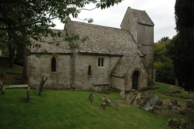
Church of St Mary the Virgin
Historic churches · 2.9 km

Syde Manor
Manor houses · 2.9 km

Colesbourne Inn
Historic pubs · 2.9 km

Colesbourne
Villages · 2.9 km
Nearby
📷 3Memorials & monuments · South West England
Young Monument In The Churchyard Approximatley 6M South Of Tower To Church Of St John
Young Monument In The Churchyard Approximatley 6M South Of Tower To Church Of St John — Grade II listed building-listed memorial in england-west-midlands, United Kingdom.
📷 3Memorials & monuments · South West England
Unidentified Monument In The Churchyard Approximatley 1.5m South Of Church Of St John
Unidentified Monument In The Churchyard Approximatley 1.5m South Of Church Of St John — Grade II* listed building-listed memorial in england-west-midlands, United Kingdom.
📷 5📷 5Mountains & hills · South West England
Pen Hill
Pen Hill — mountain in england west midlands. Elevation: 260 m.
📷 5Historic pubs · South West England
Five Mile House
Five Mile House in England South East, United Kingdom.
📷 4Historic houses · South West England
Five Mile House
Five Mile House — a Grade II-listed historic house in england-west-midlands, United Kingdom.
Where to eat & stay near Cotswolds
Places to stay
 📷 7
📷 7Hotels · South West England
Cowley Manor
Cowley Manor — a hotel in england west midlands.
 📷 5
📷 5Campsites · South West England
Jackbarrow Camping
Jackbarrow Camping — a campsite in england west midlands.
 📷 5
📷 5Campsites · South West England
Buckshead Farm campsite
Buckshead Farm campsite — a campsite in england west midlands.
 📷 5
📷 5Campsites · South West England
The Tree Nursery
The Tree Nursery — a campsite in england west midlands.
 📷 5
📷 5Campsites · South West England
Mayfield Park Touring & Camping
Mayfield Park Touring & Camping — a campsite in england west midlands.
 📷 5
📷 5Campsites · South West England
Cherry Tree Glamping
Cherry Tree Glamping — a campsite in england west midlands.
Places to eat & drink
📷 5Historic pubs · South West England
Five Mile House
Five Mile House in England South East, United Kingdom.
📷 7Historic pubs · South West England
Colesbourne Inn
Colesbourne Inn in England South East, United Kingdom.
 📷 7
📷 7Historic pubs · South West England
Foston's Ash Inn
Foston's Ash Inn in England South East, United Kingdom.
 📷 5
📷 5 📷 5
📷 5.jpg?width=1200) 📷 3
📷 3Historic pubs · South West England
The 7 Tuns
The 7 Tuns — Historic pub — listed building or notable heritage status.
More museums in this region
 📷 5
📷 5Museums · South West England
Alexander Keiller Museum
Alexander Keiller Museum — museum in South West England, United Kingdom.
 📷 5
📷 5Museums · South West England
American Museum and Gardens
American Museum and Gardens — culture and arts museum near Bath, England, United Kingdom.
 📷 5
📷 5Museums · South West England
Atwell-Wilson Motor Museum
Atwell-Wilson Motor Museum — museum in Calne, England, UK.
 📷 5
📷 5Museums · South West England
Bath Abbey Heritage Vaults
Bath Abbey Heritage Vaults — museum in Bath Abbey, Bath, England, UK.
Frequently asked questions
- Where is Cotswolds?
- Cotswolds is in Gloucestershire, South-West England, United Kingdom (postcode GL53 9PT), in the parish of Elkstone.
- What is Cotswolds?
- The Cotswolds ( KOTS-wohldz, KOTS-wəldz) is a region of South West and South Central England, along a range of wolds or rolling hills that rise from the meadows of the upper River Thames to an escarpm
- How do I get to Cotswolds?
- The nearest town is Duntisbourne Abbots. Drivers can use postcode GL53 9PT.
- When was Cotswolds built?
- Built or established in 1966.
- Is Cotswolds a protected site?
- Yes — Cotswolds is part of the Cotswolds National Landscape (AONB).
- Is Cotswolds free to visit?
- Yes, Cotswolds is free to enter.
- How do I get to Cotswolds?
- Drivers can navigate to postcode GL53 9PT. It sits within the North Cotswolds parliamentary constituency.