
Forts · North West England
Fell of Barhullion
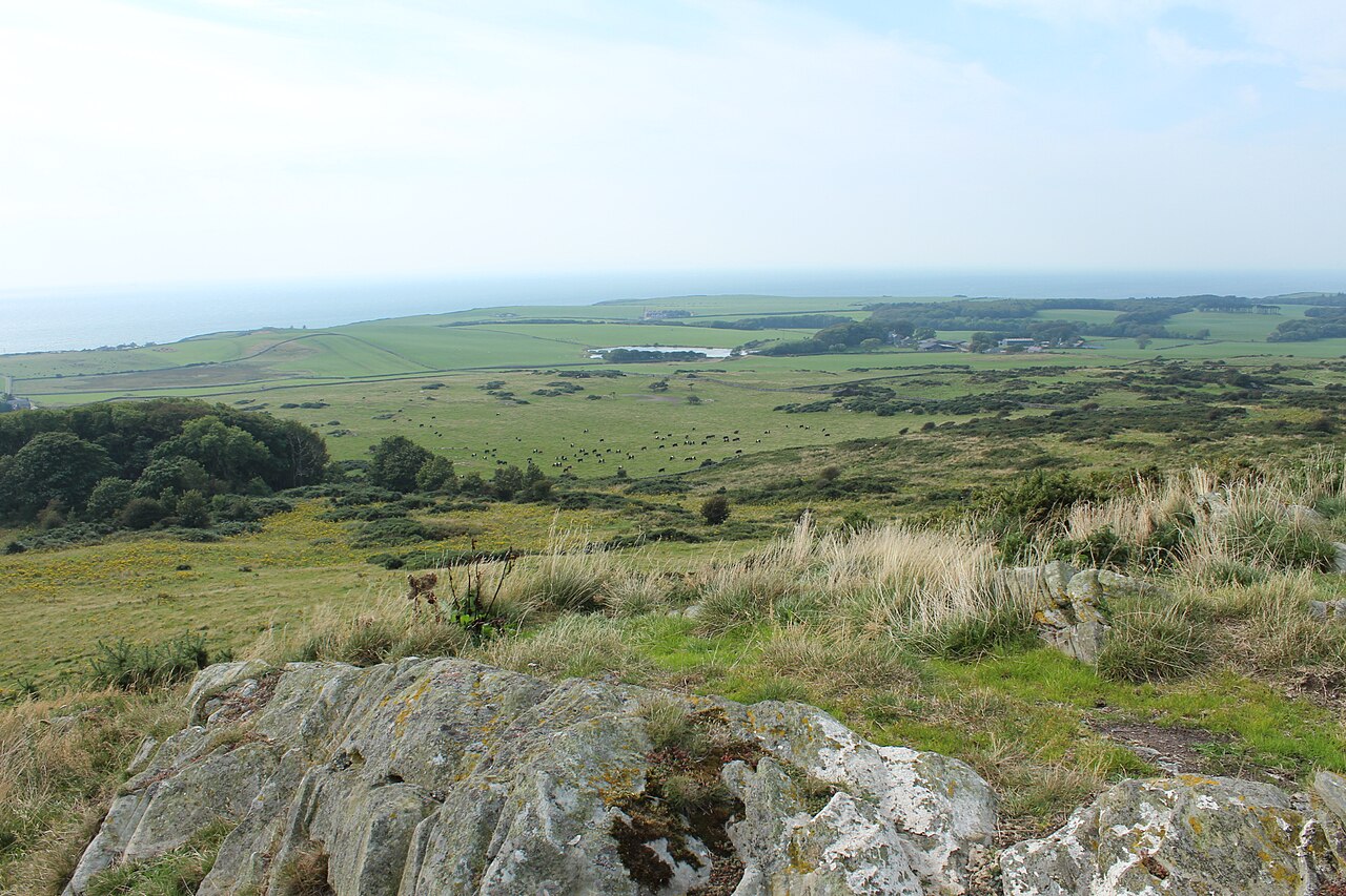
Fell of Barhullion is a fort in the United Kingdom.

Billy McCrorie — CC BY-SA 2.0 via Wikimedia Commons licence

Plan your visit
- Typical visit
- 45 min–1.5 h
About
Fell of Barhullion is a historic fort or fortified site in the United Kingdom. Coordinates: 54.7455°, -4.5267°. This entry is part of The Great Britain Guide, a free, ad-free, open-data tourist directory.
Photo gallery
Place summary
Fell of Barhullion is a fort located in the Scottish Lowlands, postcode DG8. The site features remnants of ancient fortifications, reflective of its historical military significance.
AI-generated from the structured facts on this page (operator, designation, listing, era). Not a substitute for visiting.
- Coordinates
- 54.7455, -4.5267
- District
- Dumfries and Galloway
- Postcode
- DG8 9LN
- Parliamentary constituency
- Dumfries and Galloway
Sources
- osm: n12802513088 (ODbL)
Other places nearby
Fell of Barhullion
Vineyards · 0.0 km
Fell of Barhullion
Mountains & hills · 0.0 km

Old Place of Monreith
Literary houses · 1.3 km

Drumfad Bridge
Historic bridges · 1.6 km

White Loch of Myrton
Lakes · 1.6 km

Monreith
Villages · 1.7 km

Myrton Castle
Castles · 2.0 km

Maxwell's otter
Public art & sculpture · 2.0 km

Monreith Bay
Natural landmarks · 2.0 km

Monreith House
Historic houses · 2.1 km

Crannog
Archaeological sites · 2.1 km

Front Bay
Natural landmarks · 2.3 km
Nearby
📷 5Vineyards · North West England
Fell of Barhullion
Fell of Barhullion — a UK vineyard in scotland lowlands, producing English or Welsh wine from cool-climate grape varieties.
📷 5Mountains & hills · North West England
Fell of Barhullion
Fell of Barhullion — mountain in scotland lowlands. Elevation: 136 m.
📷 5Literary houses · North West England
Old Place of Monreith
Old Place of Monreith — a literary house museum in scotland lowlands.
📷 5Historic bridges · North West England
Drumfad Bridge
Drumfad Bridge — category C listed building-listed bridge in scotland-lowlands, United Kingdom.
📷 5📷 5Where to eat & stay near Fell of Barhullion
Places to stay
 📷 5
📷 5Campsites · North West England
Kings Green Caravan Park
Kings Green Caravan Park — a campsite in scotland lowlands.
 📷 5
📷 5Caravan parks · North West England
Burrowhead Holiday Village
Burrowhead Holiday Village — a caravan park in scotland lowlands.
 📷 5
📷 5Campsites · North West England
Garlieston Lodge Caravan Site
Garlieston Lodge Caravan Site — a campsite in scotland lowlands.
 📷 5
📷 5Campsites · North West England
Garlieston Caravan Club Site
Garlieston Caravan Club Site — a campsite in scotland lowlands.
 📷 5
📷 5Campsites · North West England
DRUMROAMIN FARM CAMPING & CARAVAN SITE
DRUMROAMIN FARM CAMPING & CARAVAN SITE — a campsite in scotland lowlands.
 📷 5
📷 5Campsites · North West England
Castle Cary Holiday Park
Castle Cary Holiday Park — a campsite in scotland lowlands.
Places to eat & drink
 📷 7
📷 7Historic pubs · North West England
The Harbour Inn, 18, 19 South Crescent, Garlieston
The Harbour Inn, 18, 19 South Crescent, Garlieston in Scotland Lowlands, United Kingdom.
 📷 7
📷 7Historic pubs · North West England
17 North Main Street, Wigtown
17 North Main Street, Wigtown in Scotland Lowlands, United Kingdom.
 📷 7
📷 7Historic pubs · North West England
The Craighlaw Arms, 23 Main Street, Kirkcowan
The Craighlaw Arms, 23 Main Street, Kirkcowan in Scotland Lowlands, United Kingdom.
More forts in this region
 📷 3
📷 3 📷 5
📷 5Forts · North West England
Obelisk in Whiteoaks Wood
Obelisk in Whiteoaks Wood — a martello broad in england-west-midlands, United Kingdom.
 📷 5
📷 5Forts · North West England
Obelisk At Rode Hall
Obelisk At Rode Hall — a martello broad in england-west-midlands, United Kingdom.
 📷 5
📷 5Forts · North West England
The Stanley Obelisk
The Stanley Obelisk — a martello broad in england-west-midlands, United Kingdom.
Frequently asked questions
- Where is Fell of Barhullion?
- Fell of Barhullion is in North-West England, United Kingdom (postcode DG8 9LN).
- What is Fell of Barhullion?
- Fell of Barhullion is a fort in the United Kingdom.
- How do I get to Fell of Barhullion?
- Drivers can use postcode DG8 9LN.
- How do I get to Fell of Barhullion?
- Drivers can navigate to postcode DG8 9LN. It sits within the Dumfries and Galloway parliamentary constituency.