
Mountains & hills · South Wales
Fan Hir
In or near Cwmllynfell.
Fan Hir — Named summit at 761 m.

Wikimedia Commons contributors — see linked file page for photographer and licence licence

Plan your visit
- Typical visit
- 3 h–8 h
- Best time of year
- Late spring – early autumn (May–Oct)
- Free entry
- Dog-friendly
About
Fan Hir is a named summit in the United Kingdom. Wikidata describes it as: "Named summit at 761 m.". Coordinates: 51.8750°, -3.7002°.
Photo gallery
From the Wikipedia article
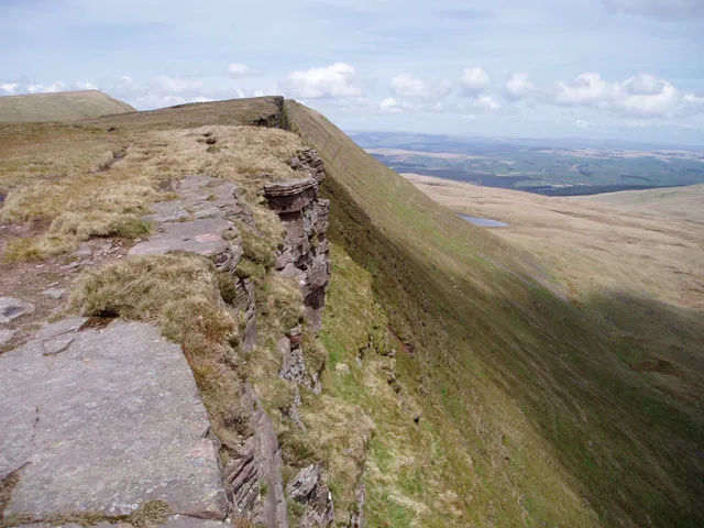
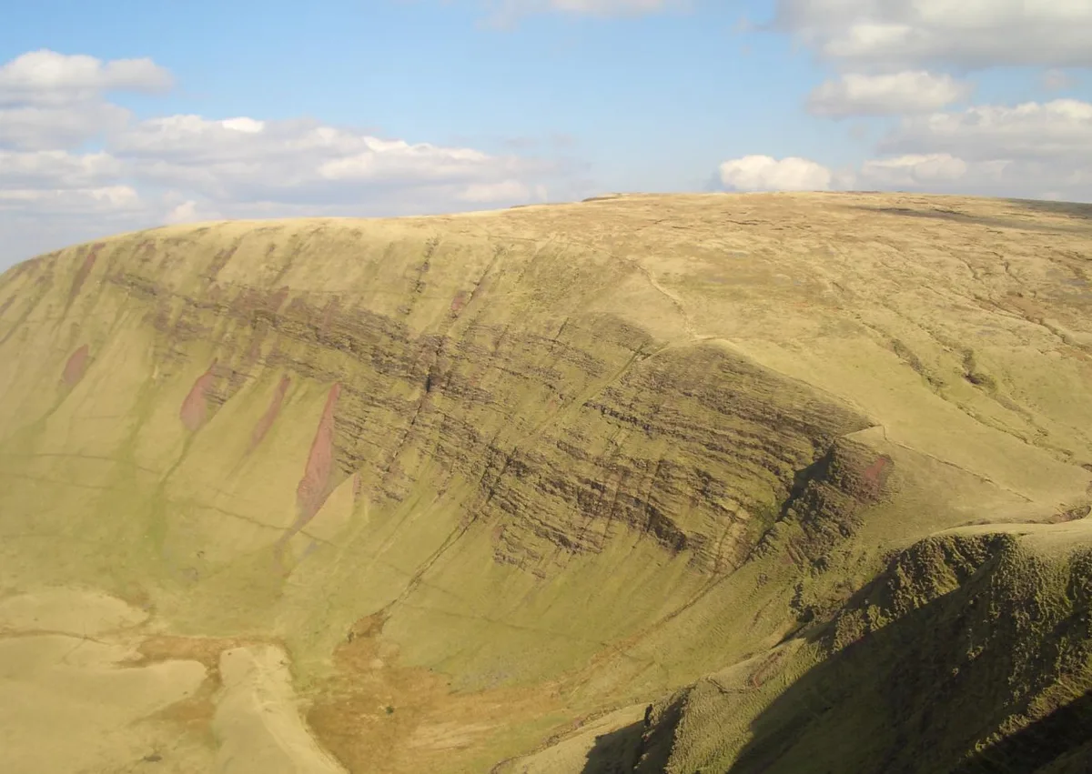
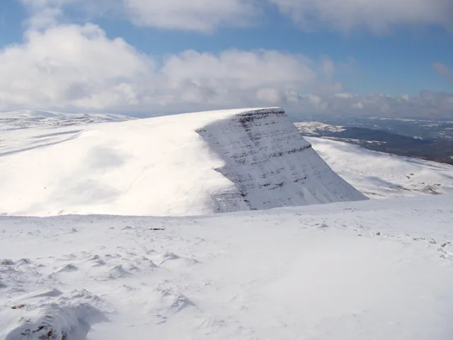
Fan Hir is a peak at the eastern end of the Black Mountain (Y Mynydd Du) in the Brecon Beacons National Park (Parc Cenedlaethol Bannau Brycheiniog) in southern Wales. It is a subsidiary summit of Fan Brycheiniog. It falls within the county of Powys and is also a part of the traditional area of Fforest Fawr. Its Welsh name means "long peak", a fitting description, particularly if seen from the east when its steep eastern face is seen to advantage. It is about 2.5 miles or 4 km long and faces east. Its summit is 2490 feet (about 760m) above sea level. Fan Hir is separated from its higher neighbour to the north-west, Fan Brycheiniog (2633 feet or 802 metres) by a col known as Bwlch Giedd, where a path rises from Llyn y Fan Fawr via a stone staircase. The hill is drained to east and north by streams which make their way into the River Tawe.
Excerpt from Wikipedia under CC BY-SA 4.0. See the source article linked in Sources below.
Background
Visiting
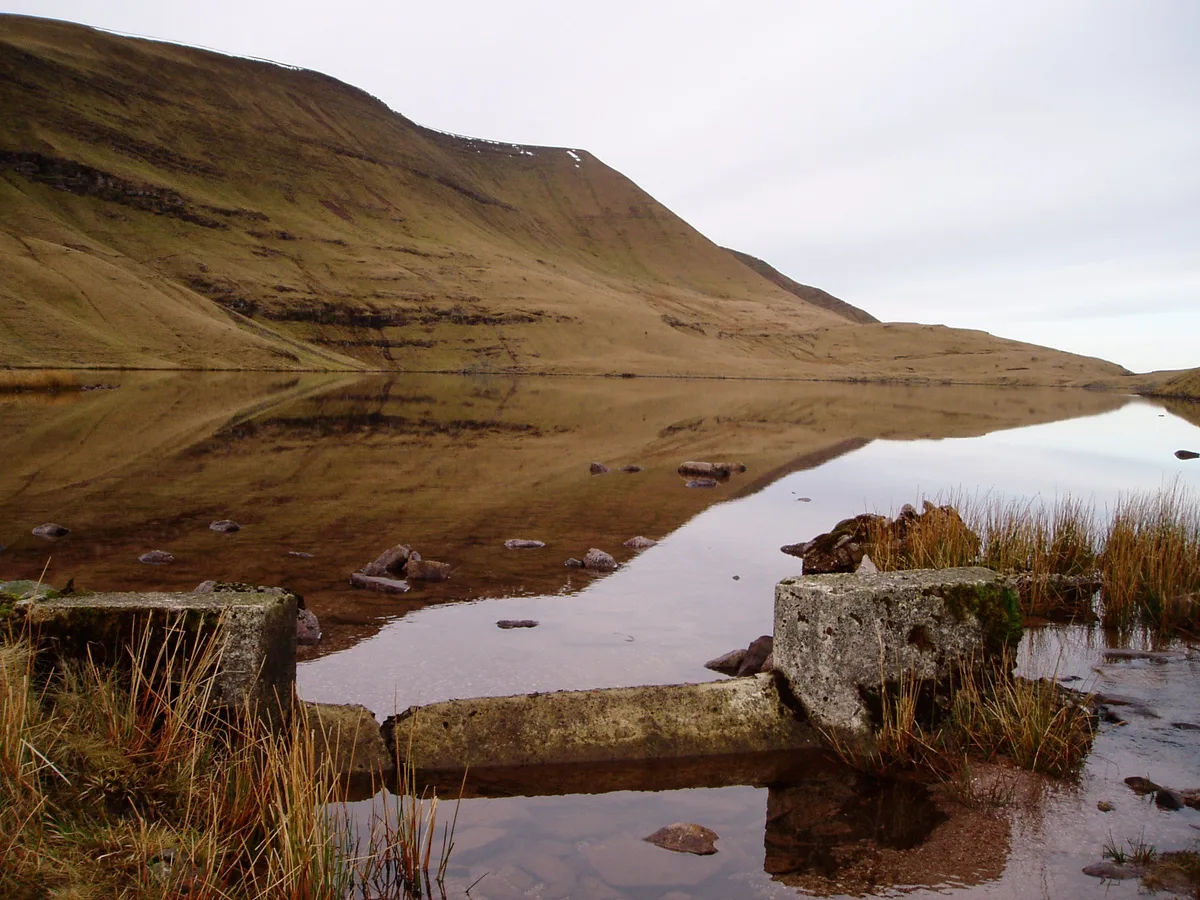
The entire hill is open country and thus available for walkers to roam at will, although there is much peat bog off route, which can be difficult to cross. The path along the ridge is popular and forms a part of a circuit. The views from the edge of the escarpment are spectacular with Pen y Fan and Corn Du visible on the skyline to the east, and Fan Gyhirych closer in Fforest Fawr. The Beacons Way long distance footpath runs beneath Fan Hir on the east affording close-up views of this impressive hill. The path leads to the glacial lake of Llyn y Fan Fawr and then climbs up the escarpment via a stone staircase of even gradient to the bwlch below Fan Brycheiniog. The stone path is well…
Sourced from Wikipedia under CC BY-SA 4.0.
- Coordinates
- 51.8750, -3.7002
- Address
- Powys, Wales
Sources
- osm: n1542069956 (ODbL)
- wikipedia: Fan Hir (CC BY-SA 4.0)
- commons: Fan Hir.jpg (CC BY-SA 4.0)
Other places nearby
Fan Hir
Natural landmarks · 0.2 km
Llyn y Fan Fawr
Natural landmarks · 0.7 km
Fan Brycheiniog
Mountains & hills · 1.0 km

Twr y Fan Foel
Mountains & hills · 1.3 km

Fan Brycheiniog - Twr y Fan Foel
Mountains & hills · 1.3 km

Gwal y Cadno
Historic houses · 1.4 km

Gaer Fan Foel
Literary houses · 1.5 km

Fan Foel
Mountains & hills · 1.6 km

Fan Foel
Mountains & hills · 1.7 km
Picws Du
Natural landmarks · 2.1 km
Picws Du
Mountains & hills · 2.1 km

Bannau Sir Gaer - Picws Du
Mountains & hills · 2.1 km
Nearby
📷 3📷 3📷 3📷 3Mountains & hills · South Wales
Twr y Fan Foel
Twr y Fan Foel — a mountain in wales-south, United Kingdom, 803 m.
📷 5Mountains & hills · South Wales
Fan Brycheiniog - Twr y Fan Foel
Fan Brycheiniog - Twr y Fan Foel — a hill or mountain in wales south.
📷 3Historic houses · South Wales
Gwal y Cadno
Gwal y Cadno — a historic house in wales-south, United Kingdom.
Where to eat & stay near Fan Hir
Places to stay
 📷 5
📷 5 📷 5
📷 5Campsites · South Wales
Brecon Beacons Camping & Caravan Park
Brecon Beacons Camping & Caravan Park — a campsite in wales south.
 📷 5
📷 5Campsites · South Wales
The Wildman Woods Campsite
The Wildman Woods Campsite — a campsite in wales south.
 📷 5
📷 5 📷 5
📷 5Campsites · South Wales
Cae Glas Camping
Cae Glas Camping — a campsite in wales south.
 📷 5
📷 5Places to eat & drink
 📷 5
📷 5 📷 7
📷 7Restaurants · South Wales
Chang Thai Cuisine
Chang Thai Cuisine — a restaurant in wales south.
 📷 7
📷 7More mountains in this region
 Flagship📷 3
Mountains & hills · South Wales
Milford Haven Waterway
Milford Haven Waterway — ria, or flooded valley, in Pembrokeshire, south-west Wales, UK.
 📷 5
📷 5Mountains & hills · South Wales
Ogof Ffynnon Ddu
Ogof Ffynnon Ddu — cave in the Upper Swansea Valley in South Wales.
 📷 3
📷 3 📷 3
📷 3Frequently asked questions
- Where is Fan Hir?
- Fan Hir is in South Wales, United Kingdom.
- What is Fan Hir?
- Fan Hir — Named summit at 761 m.
- How do I get to Fan Hir?
- The nearest town is Cwmllynfell. Its coordinates are 51.8750°, -3.7002°.
- Is Fan Hir free to visit?
- Yes, Fan Hir is free to enter.