
Memorials & monuments · South Wales
Fairy Toot
In or near Nempnett Thrubwell.
The Fairy Toot is an extensive oval barrow in the civil parish of Nempnett Thrubwell, Somerset, England (grid reference ST520618). It is an example of the Severn-Cotswold tomb type which consist of pr

Neil Owen — CC BY-SA 2.0 via Wikimedia Commons licence

Plan your visit
- Typical visit
- 15 min–45 min
- Nearest railway station
- Nailsea and Backwell · 8.5 km
- Free entry
- Dog-friendly
Getting there & planning your visit
To visit Fairy Toot, the nearest railway station is Nailsea and Backwell, which is 8.5 km away. The postcode for sat-nav is BS40 7UY, and entry is free.
About
The Fairy Toot is an extensive oval barrow in the civil parish of Nempnett Thrubwell, Somerset, England (grid reference ST520618). It is an example of the Severn-Cotswold tomb type which consist of precisely-built, long trapezoid earth mounds covering a burial chamber. Because of this they are a type of chambered long barrow. Fairy Toot was formerly a chambered cairn which is a Scheduled Ancient Monument. Located south-southwest of Howgrove Farm, it is a mound 60 m long, 25 m wide and now 2.5 m high, retained by a stone wall. Its summit is covered with ash trees and shrubs. Formerly it was considerably higher. On being opened and essentially destroyed between 1787 and 1835 by the Reverend Thomas Bere of Butcombe and the Reverend John Skinner of Camerton, it was found to contain two rows of cells, running from south to north, formed by immense stones set edgeways, and covered by others of larger dimensions. A human skull from the barrow is now in the Bristol Museum and Art Gallery. At the time it was conjectured to be a work of the Druids, but its origins are far older and probably date from the Neolithic period. Wade and Wade in their 1929 book "Somerset" described it as "a remarkably fine tumulus of masonry, said to have been one of the finest in Britain, in the chambers of which skeletons have been discovered. A few vestiges of it now only remain, the rest has been used as a lime-kiln." The site was visited in the past as it was known as a place for curing warts.
Photo gallery
Protected designations
- Site of Special Scientific Interest: Severn Estuary SSSI
Designations sourced from Natural England open data under OGL v3.
From the Wikipedia article
The Fairy Toot is an extensive oval barrow in the civil parish of Nempnett Thrubwell, Somerset, England (grid reference ST520618). It is an example of the Severn-Cotswold tomb type which consist of precisely-built, long trapezoid earth mounds covering a burial chamber. Because of this they are a type of chambered long barrow. Fairy Toot was formerly a chambered cairn which is a Scheduled Ancient Monument. Located south-southwest of Howgrove Farm, it is a mound 60 m long, 25 m wide and now 2.5 m high, retained by a stone wall. Its summit is covered with ash trees and shrubs. Formerly it was considerably higher. On being opened and essentially destroyed between 1787 and 1835 by the Reverend Thomas Bere of Butcombe and the Reverend John Skinner of Camerton, it was found to contain two rows of cells, running from south to north, formed by immense stones set edgeways, and covered by others of larger dimensions. A human skull from the barrow is now in the Bristol Museum and Art Gallery. At the time it was conjectured to be a work of the Druids, but its origins are far older and probably date from the Neolithic period. Wade and Wade in their 1929 book "Somerset" described it as "a remarkably fine tumulus of masonry, said to have been one of the finest in Britain, in the chambers of which skeletons have been discovered. A few vestiges of it now only remain, the rest has been used as a lime-kiln." The site was visited in the past as it was known as a place for curing warts.
Excerpt from Wikipedia under CC BY-SA 4.0. See the source article linked in Sources below.
- Coordinates
- 51.3531, -2.6899
- District
- North Somerset
- Parish
- Butcombe
- Postcode
- BS40 7UY
- Parliamentary constituency
- North Somerset
- Nearest railway station
- Nailsea and Backwell — 8.5 km
Sources
- wikipedia: Fairy Toot (CC BY-SA 4.0)
Other places nearby

Walnut Tree Farm Camping
Campsites · 1.7 km

Nempnett Thrubwell
Towns & cities · 1.8 km
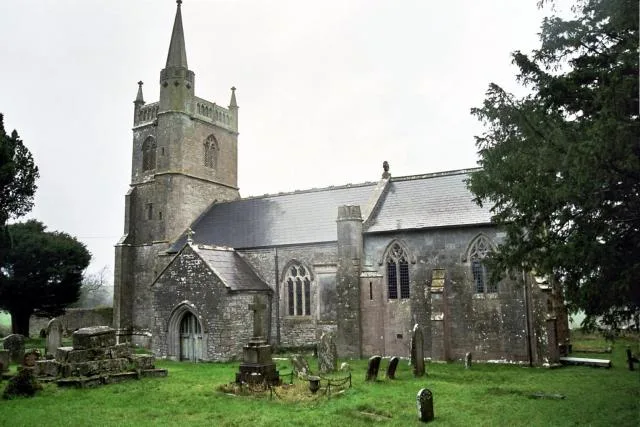
Church of St Mary, Nempnett Thrubwell
Historic churches · 1.8 km

Belvedere Manor
Manor houses · 1.9 km

Butcombe Court Mulberry House The Old Manor
Manor houses · 2.1 km

Blagdon Lake
Reservoirs & lochs · 2.1 km

Byewash Bridge
Historic bridges · 2.2 km

Blagdon Pumping Station & Visitor Centre
Museums · 2.5 km

Redhill
Villages · 2.5 km

tumulus
Archaeological sites · 3.0 km

Windmill House
Windmills · 3.2 km

The Waterstone Burial Chamber
Archaeological sites · 3.3 km
Nearby
📷 5Campsites · South Wales
Walnut Tree Farm Camping
Walnut Tree Farm Camping — a campsite in wales south.
📷 5Towns & cities · South Wales
Nempnett Thrubwell
Nempnett Thrubwell — village and civil parish in Somerset, UK.
📷 5Historic churches · South Wales
Church of St Mary, Nempnett Thrubwell
Church of St Mary, Nempnett Thrubwell — church in Bath and North East Somerset, England, UK.
📷 3Manor houses · South Wales
Belvedere Manor
Belvedere Manor — Grade II listed building-listed manor in wales-south, United Kingdom.
📷 3Manor houses · South Wales
Butcombe Court Mulberry House The Old Manor
Butcombe Court Mulberry House The Old Manor — Grade II listed building-listed manor in wales-south, United Kingdom.
📷 5Where to eat & stay near Fairy Toot
Places to stay
📷 5Campsites · South Wales
Walnut Tree Farm Camping
Walnut Tree Farm Camping — a campsite in wales south.
 📷 5
📷 5Campsites · South Wales
Brook Lodge Farm Camping & Caravan Park
Brook Lodge Farm Camping & Caravan Park — a campsite in wales south.
 📷 5
📷 5Hotels · South Wales
Hampton by Hilton Bristol Airport
Hampton by Hilton Bristol Airport — a hotel in wales south. 3-star. Brand: Hampton.
 📷 5
📷 5Campsites · South Wales
Cleeve Caravan & Camping
Cleeve Caravan & Camping — a campsite in wales south.
 📷 5
📷 5Campsites · South West England
Bristol View Glamping
Bristol View Glamping — a campsite in wales south.
 📷 5
📷 5Caravan parks · South West England
Chew Valley Caravan Park
Chew Valley Caravan Park — a caravan park in england south west.
Places to eat & drink
 📷 5
📷 5 📷 7
📷 7 📷 7
📷 7
 📷 7
📷 7Historic pubs · South West England
Nova Scotia
Nova Scotia in Wales South, United Kingdom.
 📷 7
📷 7Historic pubs · South West England
Pump House, Bristol
Pump House, Bristol in Wales South, United Kingdom.
More memorials in this region
 📷 3
📷 3Memorials & monuments · South Wales
614 (County of Glamorgan) Squadron
614 (County of Glamorgan) Squadron is a memorial in the United Kingdom.
 📷 3
📷 3Memorials & monuments · South Wales
Aberdare Cenotaph
Aberdare Cenotaph — War memorial, dating to 1922.
.jpg?width=1200) 📷 3
📷 3Memorials & monuments · South Wales
Abergavenny Market
Abergavenny Market is a place of interest in the United Kingdom.
 📷 3
📷 3Memorials & monuments · South Wales
Abertillery War Memorial
Abertillery War Memorial is a memorial in the United Kingdom.
Frequently asked questions
- Where is Fairy Toot?
- Fairy Toot is in South Wales, United Kingdom (postcode BS40 7UY), in the parish of Butcombe.
- What is Fairy Toot?
- The Fairy Toot is an extensive oval barrow in the civil parish of Nempnett Thrubwell, Somerset, England (grid reference ST520618). It is an example of the Severn-Cotswold tomb type which consist of pr
- How do I get to Fairy Toot?
- The nearest railway station is Nailsea and Backwell, about 8.5 km away. Drivers can use postcode BS40 7UY.
- Is Fairy Toot a protected site?
- Yes — Fairy Toot is part of the Severn Estuary SSSI Site of Special Scientific Interest.
- Is Fairy Toot free to visit?
- Yes, Fairy Toot is free to enter.
- How do I get to Fairy Toot?
- Drivers can navigate to postcode BS40 7UY. It sits within the North Somerset parliamentary constituency.