
Historic bridges · West Midlands
Estate Bridge Approximately 120 Metres To South East Of Attingham Park
In or near Wroxeter.
Estate Bridge Approximately 120 Metres To South East Of Attingham Park — Grade II* listed building-listed bridge in wales-mid, United Kingdom.

David Lally — CC BY-SA 2.0 via Wikimedia Commons licence

Plan your visit
- Typical visit
- 15 min–30 min
- Nearest railway station
- Shrewsbury · 6.4 km
- Free entry
- Dog-friendly
Getting there & planning your visit
To visit Estate Bridge, the nearest railway station is Shrewsbury, located 6.4 km away. The postcode for the site is SY4 4TP, and entry is free. Accessibility details are not provided.
About
Estate Bridge Approximately 120 Metres To South East Of Attingham Park is a Grade II* listed building-listed bridge in wales-mid, United Kingdom, registered on the National Heritage List for England (NHLE entry 1055096). Listed status protects buildings and structures of special architectural or historic interest. See the linked Wikipedia article for further details.
Photo gallery
Heritage listing
Details SJ 50 NW ATCHAM C.P. ATTINGHAM PARK 6/32 Estate bridge approximately - 120 metres to south-east of Attingham Park GV II* Estate bridge. 1780, by William Hayward. Grey sandstone ashlar. Single round arch with raised architrave and projecting keystone, flanking square piers, and retaining walls curving out to square end-piers with chamfered caps; string course to solid coped parapet. The bridge has also been attributed to Robert Mylne (Shropshire Magazine). The bridge spans the River Tern at the lower end of a lake formed from it in the Park. B.o.E., p.67; Attingham Park, The National Trust 1981, p.33; John L. Hobbs, The Hayward Family of Whitchurch, The Shropshire Magazine, Vol.ll (1960), p.21. Listing NGR: SJ5515209897 Legacy The contents of this record have been generated from a legacy data system. Legacy System number: 259258 Legacy System: LBS
From the Historic England List Entry under OGL v3.
Protected designations
- Site of Special Scientific Interest: Attingham Park SSSI
- Area of Outstanding Natural Beauty: Shropshire Hills
Designations sourced from Natural England open data under OGL v3.
Place summary
Estate Bridge is located approximately 120 metres to the south-east of Attingham Park in Atcham, Mid Wales. This Grade II* listed building is notable for its architectural significance and historical value.
AI-generated from the structured facts on this page (operator, designation, listing, era). Not a substitute for visiting.
- Coordinates
- 52.6849, -2.6649
- District
- Shropshire
- Parish
- Atcham
- Postcode
- SY4 4TP
- Parliamentary constituency
- South Shropshire
- Nearest railway station
- Shrewsbury — 6.4 km
Sources
- wikidata: Q17539977 (CC0)
Other places nearby

Attingham Park
Parks · 0.5 km

Tern Bridge
Historic bridges · 0.6 km

The Berwick Memorial
Memorials & monuments · 0.7 km
River Tern
Museums · 0.8 km

Home Farm Attingham Open Farm
Farms (open to visitors) · 0.9 km

Atcham
Museums · 1.2 km

Atcham Bridge
Historic bridges · 1.2 km
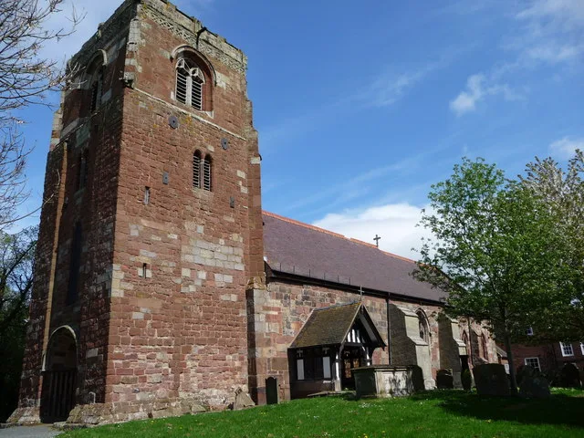
St Eata's Church, Atcham
Historic churches · 1.3 km

Roman temple at insula I, Wroxeter
Follies · 1.7 km

Shropshire Union Canal, Shrewsbury Branch Canal Bridge Approximately 20 Metres To West Of Numbers 1 And 2, Canal Cottages
Historic bridges · 1.7 km

Wroxeter Roman Site Museum
Museums · 1.8 km

Wroxeter Roman City/Viroconium
Archaeological sites · 1.8 km
Nearby
📷 3📷 3Historic bridges · West Midlands
Tern Bridge
Tern Bridge — scheduled monument-listed bridge in wales-mid, United Kingdom.
📷 3Memorials & monuments · West Midlands
The Berwick Memorial
The Berwick Memorial is a memorial in the United Kingdom.
📷 5📷 3Farms (open to visitors) · West Midlands
Home Farm Attingham Open Farm
Home Farm Attingham Open Farm — a other in wales-mid, United Kingdom.
📷 5Museums · West Midlands
Atcham
Atcham is a village, ecclesiastical parish and civil parish in Shropshire, England. It lies on the B4380 (once the A5), 5 miles south-east of Shrewsbury. The River Severn flows round the village. To t
Where to eat & stay near Estate Bridge Approximately 120 Metres To South East Of Attingham Park
Places to stay
 📷 5
📷 5 📷 5
📷 5Hotels · West Midlands
Abbots Mead Hotel
Abbots Mead Hotel — a hotel in wales north.
 📷 6
📷 6Hotels · West Midlands
Lion & Pheasant
Lion & Pheasant — a hotel in wales north.
 📷 5
📷 5 📷 7
📷 7 📷 7
📷 7Places to eat & drink
 📷 7
📷 7 📷 5
📷 5Historic pubs · West Midlands
The Dun And Cow Public House
The Dun And Cow Public House in Wales North, United Kingdom.
 📷 7
📷 7Historic pubs · West Midlands
Canal Tavern Public House And Attached Outbuilding Range
Canal Tavern Public House And Attached Outbuilding Range in Wales North, United Kingdom.
 📷 7
📷 7 📷 7
📷 7Historic pubs · West Midlands
Yorkshire House Public House
Yorkshire House Public House in Wales North, United Kingdom.
 📷 7
📷 7Historic pubs · West Midlands
The Castle Vaults Public House
The Castle Vaults Public House in Wales North, United Kingdom.
More bridges in this region
 📷 3
📷 3Historic bridges · West Midlands
Wolseley Bridge
Wolseley Bridge is a historic bridge in the United Kingdom.
 📷 3
📷 3Historic bridges · West Midlands
Bridge, Gatepiers, Walls And Ha Ha South Of Blithfield Hall
Bridge, Gatepiers, Walls And Ha Ha South Of Blithfield Hall — Grade II listed building-listed bridge in england-east-midlands, United Kingdom.
 📷 3
📷 3Historic bridges · West Midlands
Bridge Over River Swarbourn At West End Of Town Hill
Bridge Over River Swarbourn At West End Of Town Hill — Grade II listed building-listed bridge in england-east-midlands, United Kingdom.
 📷 3
📷 3Historic bridges · West Midlands
Viaduct over Trent and Mersey Canal at SK 0485 1780
Viaduct over Trent and Mersey Canal at SK 0485 1780 — Grade II listed building-listed bridge in england-east-midlands, United Kingdom.
Frequently asked questions
- Where is Estate Bridge Approximately 120 Metres To South East Of Attingham Park?
- Estate Bridge Approximately 120 Metres To South East Of Attingham Park is in Mid Wales, United Kingdom (postcode SY4 4TP), in the parish of Atcham.
- What is Estate Bridge Approximately 120 Metres To South East Of Attingham Park?
- Estate Bridge Approximately 120 Metres To South East Of Attingham Park — Grade II* listed building-listed bridge in wales-mid, United Kingdom.
- How do I get to Estate Bridge Approximately 120 Metres To South East Of Attingham Park?
- The nearest railway station is Shrewsbury, about 6.4 km away. Drivers can use postcode SY4 4TP.
- Is Estate Bridge Approximately 120 Metres To South East Of Attingham Park a listed building?
- Estate Bridge Approximately 120 Metres To South East Of Attingham Park is officially recognised as Grade II* listed building listed.
- Is Estate Bridge Approximately 120 Metres To South East Of Attingham Park a protected site?
- Yes — Estate Bridge Approximately 120 Metres To South East Of Attingham Park is part of the Attingham Park SSSI Site of Special Scientific Interest and the Shropshire Hills National Landscape (AONB).
- Is Estate Bridge Approximately 120 Metres To South East Of Attingham Park free to visit?
- Yes, Estate Bridge Approximately 120 Metres To South East Of Attingham Park is free to enter.
- How do I get to Estate Bridge Approximately 120 Metres To South East Of Attingham Park?
- The nearest railway station is Shrewsbury, about 6.4 km away. Drivers can navigate to postcode SY4 4TP.