
Museums · Scottish Lowlands
Ellisland Farm
In or near Locharbriggs.
Ellisland Farm — museum in Dumfries and Galloway, Scotland, UK.

Wikimedia Commons contributors — see linked file page for photographer and licence licence

Plan your visit
- Typical visit
- 1.5 h–3 h
- Best time of year
- Year-round
- Nearest railway station
- Dumfries · 8.7 km
- Free entry
- Family-friendly
- Wheelchair accessible
Getting there & planning your visit
To visit Ellisland Farm, the nearest railway station is Dumfries, located 8.7 km away. Admission is paid, and the site is wheelchair accessible. The postcode for sat-nav is DG2 0RP.
About
Ellisland Farm is a museum in the United Kingdom. Heritage designation: category A listed building. Wikidata describes it as: "museum in Dumfries and Galloway, Scotland, UK". Coordinates: 55.1374°, -3.6802°.
Photo gallery
Heritage listing
Ellisland Farm lies about 6.5 mi/10.4 km northwest of Dumfries near the village of Auldgirth, located in the Parish of Dunscore, Dumfries and Galloway, Scotland. The complex is a museum in the farm Robert Burns built, lived in and farmed from 1788 until 1791. One of the earliest references to the site is in 1465. Cardinal Antonius confirming a Charter by the Monastery of Melrose of the adjoining property of Ellisland to John Kirkpatrick.
From Historic Environment Scotland under OGL v3.
Summary from the official site
Ellisland Farm, built by Robert Burns in 1788, is a historic site where the poet created many of his famous works, including Auld Lang Syne. Visitors can explore the preserved home and its beautiful surroundings, which inspired Burns's poetry and songs.
Read more on the official property page.
From the Wikipedia article
Ellisland Farm lies about 6.5 mi/10.4 km northwest of Dumfries near the village of Auldgirth, located in the Parish of Dunscore, Dumfries and Galloway, Scotland. The complex is a museum in the farm Robert Burns built, lived in and farmed from 1788 until 1791. One of the earliest references to the site is in 1465. Cardinal Antonius confirming a Charter by the Monastery of Melrose of the adjoining property of Ellisland to John Kirkpatrick.
Excerpt from Wikipedia under CC BY-SA 4.0. See the source article linked in Sources below.
Background
History
William Roy's map, circa 1747–55, does not show any form of settlement at Ellisland. However William Crawford's 1804 map of Dumfries-shire marks an 'Elliesland' in the expected location, the farm having been built a few years before, however another building is marked closer to Friars' Carse. The name is said to be derived from "Isle's Land", the name of a neighbouring estate. The river may have been less of a barrier to transport than today and a ford is known to have existed nearby. The nearby Old Dunscore Churchyard is the location of 18th century memorials to the Ireland family of Elliesland (sic). Patrick Miller of Dalswinton wrote of the area in September 1810, saying; "When I…
Description
, 1787]] Patrick Miller of Dalswinton had offered Burns a choice of three farms, two on the rich holms of the River Nith's east side; and one, Ellisland, on the west bank, composed of a fertile strip along the river itself and stony fields between the river and the Dumfries road. Burns visited Ellisland on 27 February 1788 with James Tennant of Glenconner, a friend of himself and his father; taking James's advice he agreed to sign up to the seventy-six-year lease from his friend Patrick Miller of Dalswinton, taking up the lease of the farm at Whitsun (25 May) 1788. The lease was divided up into four periods of nineteen years, the rent for the first three years to be £50 per annum, and £70…
Visiting
A group from the University of Glasgow would recreate Ellisland Farm in Minecraft in collaboration with the Robert Burns Ellisland Trust and the South of Scotland Destination Alliance with funding from the Tourism Leadership and Recovery Fund.
Sourced from Wikipedia under CC BY-SA 4.0.
- Coordinates
- 55.1374, -3.6802
- District
- Dumfries and Galloway
- Postcode
- DG2 0RP
- Parliamentary constituency
- Dumfriesshire, Clydesdale and Tweeddale
- Phone
- 01387 740426
- Established
- 1788
- Nearest railway station
- Dumfries — 8.7 km
- Opening
- Tuesday, Thursday, Saturday and Sunday; closed Monday, Wednesday and Friday
- Official site
- www.ellislandfarm.co.uk
Sources
- wikidata: Q5366039 (CC0)
- wikipedia: Ellisland Farm (CC BY-SA 4.0)
- commons: Ellisland Farm Auldgirth.JPG (CC BY-SA 4.0)
Featured in this guide
Other places nearby

Dunscore Old Kirk
Historic churches · 0.7 km

Lagg’s Tomb
Vineyards · 0.7 km

Quark Walk
Public art & sculpture · 1.0 km
Garden of Taking Leave Of Your Senses
Public art & sculpture · 1.0 km
Nonsense Pavilion
Public art & sculpture · 1.1 km
Fractal Bridge
Public art & sculpture · 1.1 km
Comet Bridge
Public art & sculpture · 1.1 km
Snake Mound
Public art & sculpture · 1.1 km
Willow Twist
Public art & sculpture · 1.1 km
Time Garden
Public art & sculpture · 1.2 km
Rail Garden
Public art & sculpture · 1.2 km
Birchbone Garden
Public art & sculpture · 1.2 km
Nearby
📷 3Historic churches · Scottish Lowlands
Dunscore Old Kirk
Dunscore Old Kirk — church building in Dumfries and Galloway, Scotland, UK, now demolished.
📷 5Vineyards · Scottish Lowlands
Lagg’s Tomb
Lagg’s Tomb — a UK vineyard in scotland lowlands, producing English or Welsh wine from cool-climate grape varieties.
📷 3Public art & sculpture · Scottish Lowlands
Quark Walk
Quark Walk — a public art in scotland-lowlands, United Kingdom.
📷 3Public art & sculpture · Scottish Lowlands
Garden of Taking Leave Of Your Senses
Garden of Taking Leave Of Your Senses — a public art in scotland-lowlands, United Kingdom.
📷 3Public art & sculpture · Scottish Lowlands
Nonsense Pavilion
Nonsense Pavilion — a public art in scotland-lowlands, United Kingdom.
📷 3Public art & sculpture · Scottish Lowlands
Fractal Bridge
Fractal Bridge — a public art in scotland-lowlands, United Kingdom.
Where to eat & stay near Ellisland Farm
Places to stay
 📷 5
📷 5Hotels · Scottish Lowlands
Friars Carse Country House Hotel
Friars Carse Country House Hotel — a hotel in scotland lowlands.
 📷 5
📷 5Caravan parks · Scottish Lowlands
Partridge Cottage CAMC CL
Partridge Cottage CAMC CL — a caravan park in scotland lowlands.
 📷 5
📷 5Campsites · Scottish Lowlands
Oakbank Farm Campsite
Oakbank Farm Campsite — a campsite in scotland lowlands.
 📷 3
📷 3Campsites · Scottish Lowlands
Barnsoul Caravan Park
Barnsoul Caravan Park — a campsite in scotland lowlands.
 📷 5
📷 5Caravan parks · Scottish Lowlands
Dumfries Caravan Park
Dumfries Caravan Park — a caravan park in scotland lowlands.
 📷 5
📷 5Hostels · Scottish Lowlands
Marthrown of Mabie
Marthrown of Mabie — a hostel in scotland lowlands.
Places to eat & drink
 📷 7
📷 7 📷 5
📷 5Historic pubs · Scottish Lowlands
75 Friars Vennel, Dumfries
75 Friars Vennel, Dumfries in Scotland Lowlands, United Kingdom.
 📷 7
📷 7Historic pubs · Scottish Lowlands
Rob Roy Public House, 63-65 Queensberry Street, Dumfries
Rob Roy Public House, 63-65 Queensberry Street, Dumfries in Scotland Lowlands, United Kingdom.
 📷 5
📷 5Historic pubs · Scottish Lowlands
73-77 English Street, Dumfries
73-77 English Street, Dumfries in Scotland Lowlands, United Kingdom.
 📷 5
📷 5Historic pubs · Scottish Lowlands
The Globe Inn, 56 High Street, Dumfries
The Globe Inn, 56 High Street, Dumfries in Scotland Lowlands, United Kingdom.
 📷 5
📷 5Historic pubs · Scottish Lowlands
Queen O' The South Public House, 8-10 Nith Place, Dumfries
Queen O' The South Public House, 8-10 Nith Place, Dumfries in Scotland Lowlands, United Kingdom.
More museums in this region
 📷 4
📷 4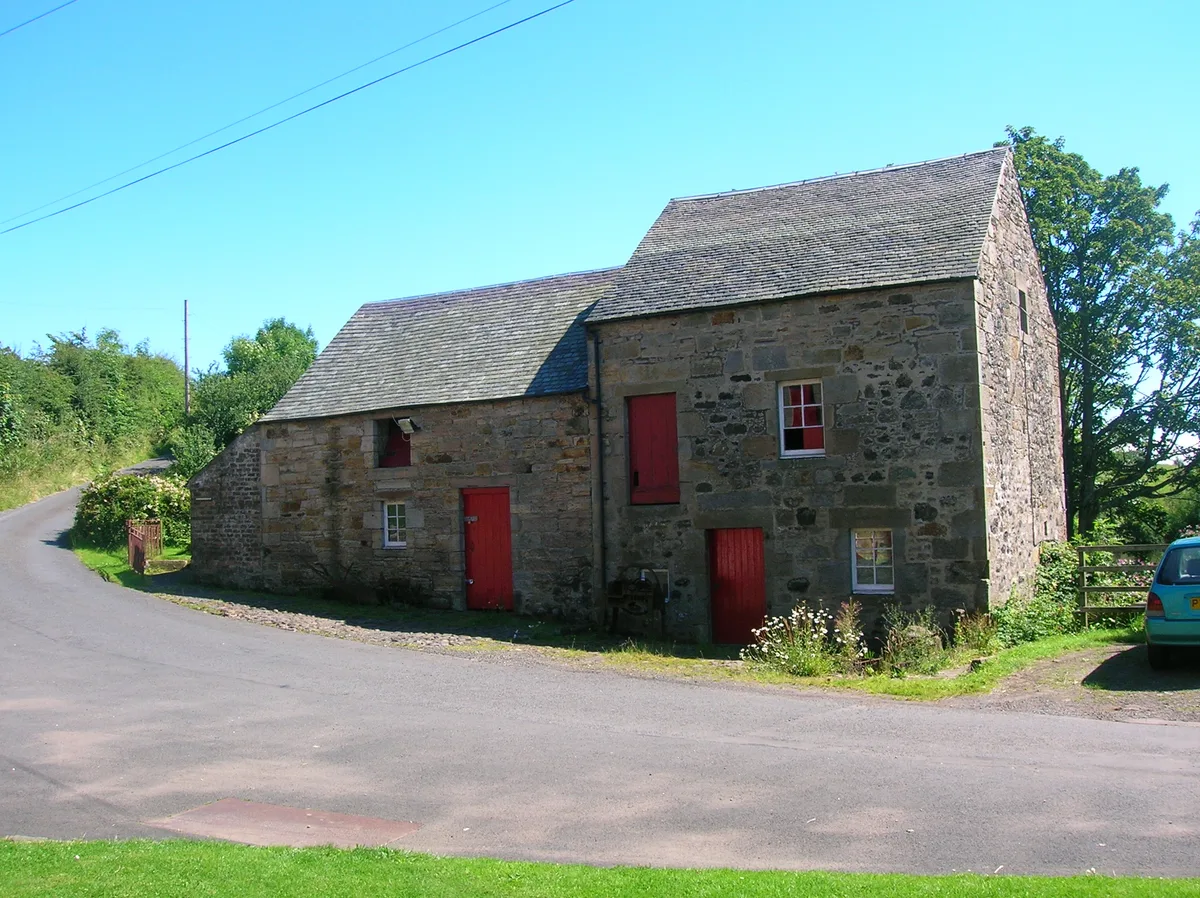 📷 5
📷 5Museums · Scottish Lowlands
Dalgarven Mill Museum of Country Life and Costume
Dalgarven Mill Museum of Country Life and Costume — museum in Kilwinning, North Ayrshire, Scotland, United Kingdom.
 📷 3
📷 3Museums · Scottish Lowlands
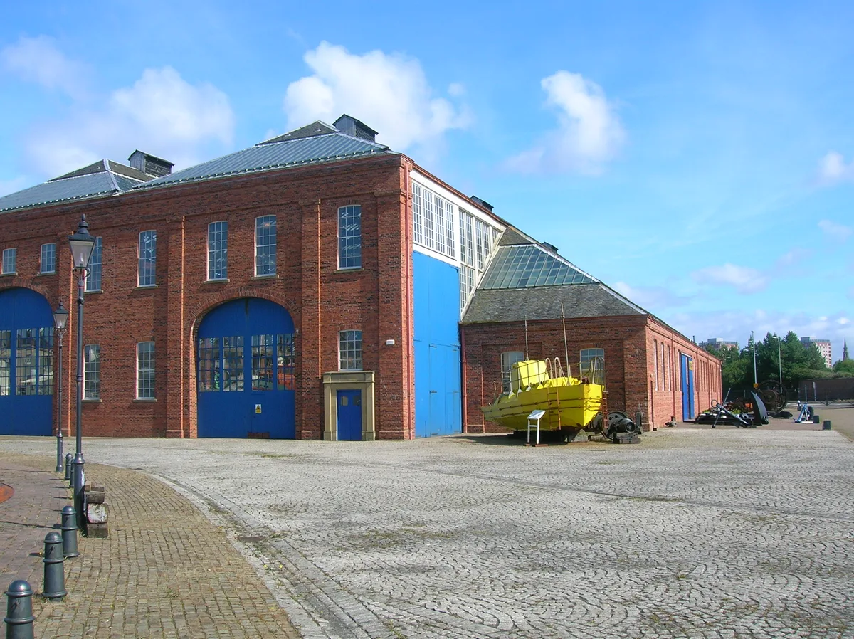
Linthouse Building
Linthouse Building — former shipyard production building, moved from Glasgow to Irvine in 1991, now part of the Scottish Maritime Museum.
 📷 3
📷 3Museums · Scottish Lowlands
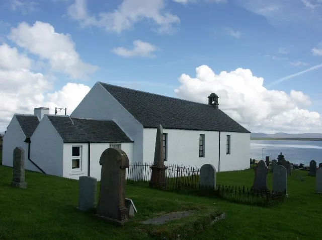
Museum of Islay Life
Museum of Islay Life — museum in Scotland, United Kingdom.
Frequently asked questions
- Where is Ellisland Farm?
- Ellisland Farm is in the Scottish Lowlands, United Kingdom (postcode DG2 0RP).
- What is Ellisland Farm?
- Ellisland Farm — museum in Dumfries and Galloway, Scotland, UK.
- How do I get to Ellisland Farm?
- The nearest railway station is Dumfries, about 8.7 km away. The nearest town is Locharbriggs. Drivers can use postcode DG2 0RP.
- When was Ellisland Farm built?
- Built or established in 1788.
- Is Ellisland Farm a listed building?
- Ellisland Farm is officially recognised as category A listed building listed.
- Is Ellisland Farm free to visit?
- Yes, Ellisland Farm is free to enter.
- How do I get to Ellisland Farm?
- Drivers can navigate to postcode DG2 0RP. It sits within the Dumfriesshire, Clydesdale and Tweeddale parliamentary constituency.