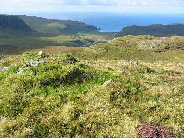
Natural landmarks · Scottish Islands
Dunrossness
Dunrossness in Orkney + Shetland, United Kingdom.

Ken Craig — CC BY-SA 2.0 via Wikimedia Commons licence
Plan your visit
- Typical visit
- 1 h–2 h
- Free entry
- Dog-friendly
About
Dunrossness is a place of interest in Orkney + Shetland, United Kingdom — drawn from open-data sources for visitor reference. See the linked Wikipedia article for the full description.
Photo gallery
From the Wikipedia article
Dunrossness (Old Norse: Dynrastarnes meaning "headland of the loud tide-race", referring to the noise of Sumburgh Roost) is the southernmost parish of Shetland, Scotland. Historically the name Dunrossness has usually referred to the area on the Shetland mainland south of Quarff. However, in 2016 there were three separate Shetland Community Councils for a) Gulberwick, Quarff and Cunningsburgh; b) Sandwick; and c) Dunrossness. The 2011 census defined Dunrossness as including everybody within the British ZE2 postal code, which goes as far north as Gulberwick. It has the best and largest area of fertile farmland of any parish in Shetland. Dunrossness includes the island of Mousa, Levenwick, St Ninian's Isle, Bigton, Scousburgh, the Lochs of Spiggie and Brow, Boddam, Quendale, Virkie, Exnaboe, Grutness, Toab, Ness of Burgi, Clumlie Broch, Scatness, Sumburgh Airport, Sumburgh Head, West Voe, the islands of Lady's Holm, Little Holm, Horse Holm island and Fair Isle.
Excerpt from Wikipedia under CC BY-SA 4.0. See the source article linked in Sources below.
- Coordinates
- 59.9221, -1.2960
- District
- Shetland Islands
- Postcode
- ZE2 9JW
- Parliamentary constituency
- Orkney and Shetland
Sources
- wikidata: Q5315660 (CC0)
- wikipedia: Dunrossness (CC BY-SA 4.0)
Other places nearby

Dunrossness Parish Church
Historic churches · 0.4 km

Boddam
Museums · 0.4 km

Crofthouse Museum
Museums · 0.9 km
Southvoe Broch
Archaeological sites · 0.9 km

Southvoe Broch
Archaeological sites · 0.9 km

Gallow Hill
Mountains & hills · 1.0 km

Loch Of Brow Broch
Archaeological sites · 1.1 km

Loch Of Brow Broch
Archaeological sites · 1.1 km

North Green of Huesbreck
Mountains & hills · 1.2 km

Dalsetter Broch
Archaeological sites · 1.3 km

Dalsetter Broch
Archaeological sites · 1.3 km

Broch View, Settlement
Archaeological sites · 1.3 km
Nearby
📷 5Historic churches · Scottish Islands
Dunrossness Parish Church
Dunrossness Parish Church — category B listed building-listed church in scotland-islands, United Kingdom.
📷 5📷 3Museums · Scottish Islands
Crofthouse Museum
Crofthouse Museum — a museum in scotland-islands, United Kingdom.
📷 3Archaeological sites · Scottish Islands
Southvoe Broch
Southvoe Broch — a archaeological in scotland-islands, United Kingdom.
📷 5Archaeological sites · Scottish Islands
Southvoe Broch
Southvoe Broch — archaeological in scotland islands.
📷 5Mountains & hills · Scottish Islands
Gallow Hill
Gallow Hill — mountain in scotland islands. Elevation: 62 m.
Where to eat & stay near Dunrossness
Places to stay
Hostels · Scottish Islands
Betty Mouat's Camping Böd
Betty Mouat's Camping Böd — a hostel in scotland islands.
 📷 5
📷 5Campsites · Scottish Islands
Levenwick Campsite
Levenwick Campsite — a campsite in scotland islands.
 📷 5
📷 5Caravan parks · Scottish Islands
Cunningsburgh Touring Park
Cunningsburgh Touring Park — a caravan park in scotland islands.
More natural landmarks in this region
 📷 3
📷 3Natural landmarks · Scottish Islands
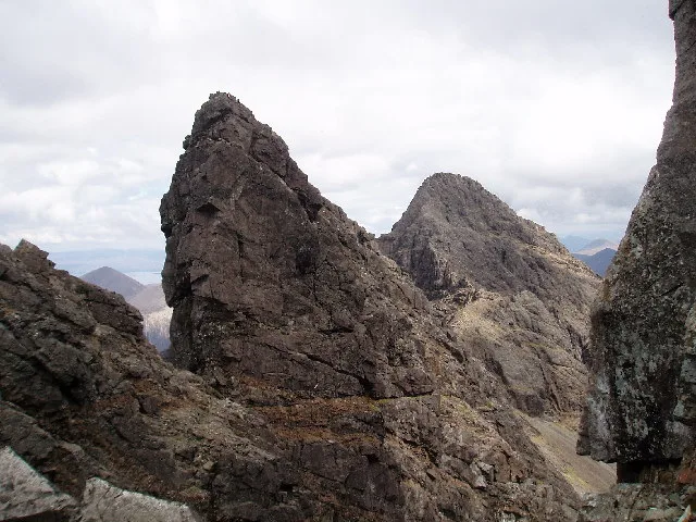
Am Basteir
Am Basteir — 934m high mountain in Highland, Scotland, UK.
 📷 3
📷 3Natural landmarks · Scottish Islands
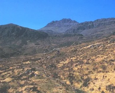
Arnaval
Arnaval — mountain on the Isle of Skye, in Highland, Scotland, UK.
 📷 5
📷 5Natural landmarks · Scottish Islands
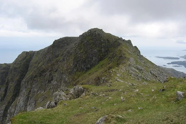
Askival
Askival — 812m high mountain in Highland, Scotland, UK.
 📷 5
📷 5Natural landmarks · Scottish Islands
Beinn Mhòr
Beinn Mhòr — 620m high mountain on South Uist, Outer Hebrides, Scotland, UK.
Frequently asked questions
- Where is Dunrossness?
- Dunrossness is in the Scottish Islands, United Kingdom (postcode ZE2 9JW).
- What is Dunrossness?
- Dunrossness in Orkney + Shetland, United Kingdom.
- How do I get to Dunrossness?
- Drivers can use postcode ZE2 9JW.
- Is Dunrossness free to visit?
- Yes, Dunrossness is free to enter.
- How do I get to Dunrossness?
- Drivers can navigate to postcode ZE2 9JW. It sits within the Orkney and Shetland parliamentary constituency.