
Manor houses · South East England
Dropmore House
In or near Hedsor.
Dropmore House — a manor in South East England, United Kingdom.

Colin Pyle — CC BY-SA 2.0 via Wikimedia Commons licence

Plan your visit
- Typical visit
- 1 h–2 h
- Nearest railway station
- Bourne End · 3.4 km
- Limited wheelchair access
About
Dropmore House is a manor located in South East England, United Kingdom. Sourced from OpenStreetMap (ODbL licence); see local listings for visitor information, opening hours and admission details.
Photo gallery
Protected designations
- Area of Outstanding Natural Beauty: Chilterns
Designations sourced from Natural England open data under OGL v3.
Place summary
Dropmore House is a manor located in South-East England. It is notable for its historical significance and architectural features, though further details on its era or designation are not provided.
AI-generated from the structured facts on this page (operator, designation, listing, era). Not a substitute for visiting.
- Coordinates
- 51.5656, -0.6649
- District
- Buckinghamshire
- Parish
- Taplow
- Postcode
- SL1 8PA
- Parliamentary constituency
- Beaconsfield
- Nearest railway station
- Bourne End — 3.4 km
Sources
- osm: way/342041604 (ODbL)
Other places nearby
Aviary At Dropmore
Historic houses · 0.1 km
Water Tower At Dropmore Estate
Memorials & monuments · 0.2 km
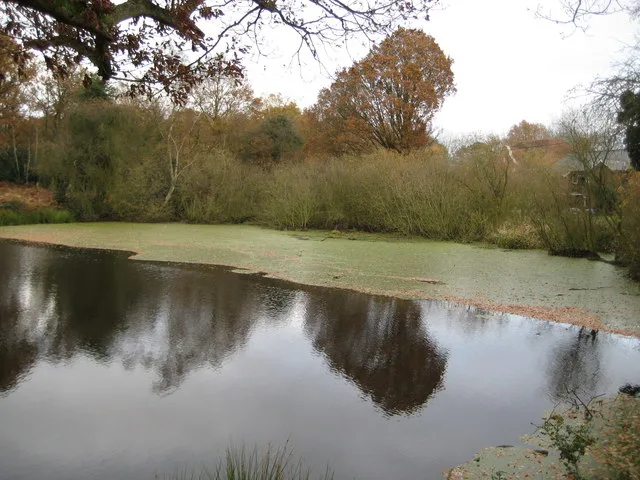
Littleworth Common
Wildlife reserves · 0.9 km

Littleworth Common
Forests & woodlands · 1.0 km

Hedsor
Towns & cities · 1.2 km

Sheepcote Manor
Manor houses · 1.2 km

The Feathers Public House
Historic pubs · 1.5 km
Odds Farm Park
Theme parks · 1.6 km

Shell Fountain, Cliveden
Public art & sculpture · 1.6 km

Cliveden
Historic houses · 1.8 km
Cliveden House
Manor houses · 1.8 km
Cliveden House
Hotels · 1.8 km
Nearby
📷 3Historic houses · South East England
Aviary At Dropmore
Aviary At Dropmore — a Grade I-listed historic house in england-south-east, United Kingdom.
📷 4Memorials & monuments · South East England
Water Tower At Dropmore Estate
Water Tower At Dropmore Estate — a water tower in england-south-east, United Kingdom.
📷 5Wildlife reserves · South East England
Littleworth Common
Littleworth Common — protected area in Buckinghamshire, England.
📷 5Forests & woodlands · South East England
Littleworth Common
Littleworth Common is a forest or woodland in the United Kingdom.
📷 5Towns & cities · South East England
Hedsor
Hedsor — village and civil parish in Buckinghamshire, England.
📷 5Manor houses · South East England
Sheepcote Manor
Sheepcote Manor — Grade II listed building-listed manor in england-south-east, United Kingdom.
Where to eat & stay near Dropmore House
Places to stay
📷 5Hotels · South East England
Cliveden House
Cliveden House — a hotel in england south east.
 📷 7
 📷 5
Hotels · South East England
Burnham Beeches Hotel
Burnham Beeches Hotel — a hotel in england south east.
 📷 5
Hotels · South East England
Bel and the Dragon
Bel and the Dragon — a hotel in england south east.
 📷 5
Hotels · South East England
Taplow House Hotel
Taplow House Hotel — a hotel in england south east.
 📷 5
Campsites · East of England
Walter Davies Scout Campsite
Walter Davies Scout Campsite — a campsite in england london.
Places to eat & drink
📷 7Historic pubs · South East England
The Feathers Public House
The Feathers Public House in England South East, United Kingdom.
 📷 5
Restaurants · South East England
The Ferry
The Ferry — a restaurant in england south east.
 📷 5
 📷 7
Historic pubs · South East England
The Green Man Public House
The Green Man Public House in England South East, United Kingdom.
 📷 5
Restaurants · South East England
The Greyhound
The Greyhound — a restaurant in england west midlands.
 📷 7
Historic pubs · South East England
Royal Saracens Head
Royal Saracens Head in England East, United Kingdom.
More places in this region
 📷 5
Manor houses · South East England
Albury Manor
Albury Manor — a manor in South East England, United Kingdom.
 📷 5
Manor houses · South East England
Weardale Manor
Weardale Manor — a manor in South East England, United Kingdom.
 📷 5
Manor houses · South East England
Rowbarns Manor
Rowbarns Manor — a manor in South East England, United Kingdom.
 📷 5
Manor houses · South East England
Sutton Place
Sutton Place — a manor in South East England, United Kingdom.
Frequently asked questions
- Where is Dropmore House?
- Dropmore House is in South-East England, United Kingdom (postcode SL1 8PA), in the parish of Taplow.
- What is Dropmore House?
- Dropmore House — a manor in South East England, United Kingdom.
- How do I get to Dropmore House?
- The nearest railway station is Bourne End, about 3.4 km away. The nearest town is Hedsor. Drivers can use postcode SL1 8PA.
- Is Dropmore House a protected site?
- Yes — Dropmore House is part of the Chilterns National Landscape (AONB).
- How do I get to Dropmore House?
- The nearest railway station is Bourne End, about 3.4 km away. Drivers can navigate to postcode SL1 8PA.