
Museums · East Midlands
Dorrington, Lincolnshire
In or near Bloxholm.
Dorrington is a village and civil parish in the North Kesteven district of Lincolnshire, England. It is situated 1.2 miles (2 km) both south from Digby and north from Ruskington. It is to the east of

JThomas — CC BY-SA 2.0 via Wikimedia Commons licence

Plan your visit
- Typical visit
- 1.5 h–3 h
- Best time of year
- Year-round
- Nearest railway station
- Ruskington · 2.4 km
- Family-friendly
- Limited wheelchair access
Getting there & planning your visit
To visit Dorrington in Lincolnshire, the nearest railway station is Ruskington, which is 2.4 km away. The postcode for sat-nav is LN4 3PX. Accessibility is limited for wheelchair users.
About
Dorrington is a village and civil parish in the North Kesteven district of Lincolnshire, England. It is situated 1.2 miles (2 km) both south from Digby and north from Ruskington. It is to the east of the north–south B1188, which lies just within the parish boundaries. The nearest town is Sleaford, approximately 4 miles (6 km) to the south. In the 2001 census, the parish had a population of 340, increasing slightly to 344 at the 2011 census. Dorrington Grade I listed Anglican church is dedicated to St James and St John. It is mainly in Decorated style. On the sides of the east window are ogee canopied niches. The church tower previously held a spire. On the exterior of the east window is a sculpture of the Last Judgment. The church is situated on the B1188 approximately 0.5 miles (0.8 km) north-west from the village centre, overlooking the village. Frank Whittle lodged at a house in the village while developing the jet engine at RAF Cranwell; the remains of this house lie near the church. In the village are the remains of a Grade II listed Medieval ashlar cross. The Peterborough to Lincoln Line passes to the east of the village. The village public house was the Musicians Arms on Main Street which closed down and was converted into a Londis convenience store opening its doors on 21 April 2025.
Photo gallery
From the Wikipedia article
Dorrington is a village and civil parish in the North Kesteven district of Lincolnshire, England. It is situated 1.2 miles (2 km) both south from Digby and north from Ruskington. It is to the east of the north–south B1188, which lies just within the parish boundaries. The nearest town is Sleaford, approximately 4 miles (6 km) to the south. In the 2001 census, the parish had a population of 340, increasing slightly to 344 at the 2011 census. Dorrington Grade I listed Anglican church is dedicated to St James and St John. It is mainly in Decorated style. On the sides of the east window are ogee canopied niches. The church tower previously held a spire. On the exterior of the east window is a sculpture of the Last Judgment. The church is situated on the B1188 approximately 0.5 miles (0.8 km) north-west from the village centre, overlooking the village. Frank Whittle lodged at a house in the village while developing the jet engine at RAF Cranwell; the remains of this house lie near the church. In the village are the remains of a Grade II listed Medieval ashlar cross. The Peterborough to Lincoln Line passes to the east of the village. The village public house was the Musicians Arms on Main Street which closed down and was converted into a Londis convenience store opening its doors on 21 April 2025.
Excerpt from Wikipedia under CC BY-SA 4.0. See the source article linked in Sources below.
- Coordinates
- 53.0620, -0.3890
- County
- Lincolnshire
- District
- North Kesteven
- Parish
- Dorrington
- Postcode
- LN4 3PX
- Parliamentary constituency
- Sleaford and North Hykeham
- Nearest railway station
- Ruskington — 2.4 km
Sources
- wikipedia: Dorrington, Lincolnshire (CC BY-SA 4.0)
Other places nearby

Dorrington
Villages · 0.1 km

Bloxholm
Towns & cities · 1.7 km
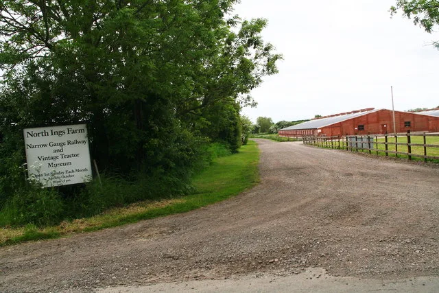
North Ings Farm Museum
Museums · 1.7 km

Digby, Lincolnshire
Museums · 1.8 km

Digby village cross
Historic houses · 1.9 km

Digby War Memorial
Memorials & monuments · 1.9 km

Ruskington
Towns & cities · 2.0 km

Deanery of Lafford
Historic churches · 2.0 km

Digby
Villages · 2.0 km

Ashby de la Launde and Bloxholm
Historic churches · 2.3 km

Brauncewell
Archaeological sites · 3.3 km
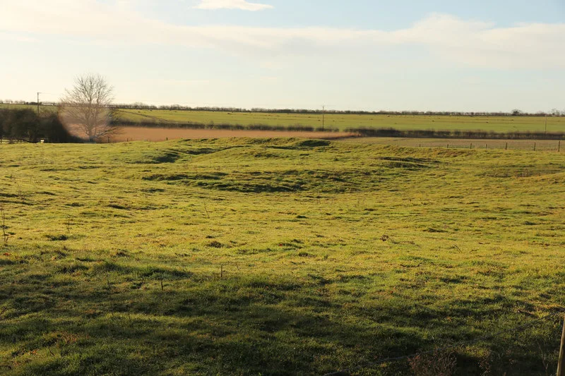
Brauncewell medieval village
Archaeological sites · 3.4 km
Nearby
📷 5📷 3📷 4Museums · East Midlands
North Ings Farm Museum
North Ings Farm Museum — Farm museum in Dorrington, England.
📷 5Museums · East Midlands
Digby, Lincolnshire
Digby, Lincolnshire — a museum in england-east-midlands, United Kingdom.
📷 3Historic houses · East Midlands
Digby village cross
Digby village cross — a Grade II*-listed historic house in england-east-midlands, United Kingdom.
📷 3Memorials & monuments · East Midlands
Digby War Memorial
Digby War Memorial — Grade II listed building-listed memorial in england-east-midlands, United Kingdom.
Where to eat & stay near Dorrington, Lincolnshire
Places to stay
 📷 5
📷 5 📷 5
📷 5Campsites · East Midlands
Riverview Caravan Park
Riverview Caravan Park — a campsite in england east midlands.
 📷 5
📷 5Caravan parks · East Midlands
Tattershall Lakes
Tattershall Lakes — a caravan park in england east midlands. Brand: Away Resorts.
 📷 5
📷 5Campsites · East Midlands
Willow Holt C. & C.
Willow Holt C. & C. — a campsite in england east midlands.
 📷 5
📷 5Campsites · East Midlands
Woodland Waters
Woodland Waters — a campsite in england east midlands.
 📷 5
📷 5Places to eat & drink
 📷 7
📷 7Historic pubs · East Midlands
The Marquis Of Granby Public House And Attached Outbuildings
The Marquis Of Granby Public House And Attached Outbuildings in England East, United Kingdom.
 📷 7
📷 7 📷 7
📷 7 📷 5
📷 5Historic pubs · East Midlands
Star And Garter Public House
Star And Garter Public House in England East, United Kingdom.
 📷 5
📷 5Historic pubs · East Midlands
The Lion And Royal Public House
The Lion And Royal Public House in England East, United Kingdom.
 📷 5
📷 5Historic pubs · East Midlands
The Marquis Of Granby
The Marquis Of Granby in England East, United Kingdom.
More museums in this region
 📷 5
📷 5Museums · East Midlands
Stamford Town Hall
Stamford Town Hall — building in Stamford, Lincolnshire, England, UK.
 📷 5
📷 5Museums · East Midlands
Thorney Museum
Thorney Museum — a museum in england-london, United Kingdom.
 📷 5
📷 5Museums · East Midlands
Octavia Hill Birthplace Museum
Octavia Hill Birthplace Museum — a museum in england-london, United Kingdom.
 📷 5
📷 5Museums · East Midlands
Museum of Technology
Museum of Technology — a museum in england-london, United Kingdom.
Frequently asked questions
- Where is Dorrington, Lincolnshire?
- Dorrington, Lincolnshire is in Lincolnshire, the East Midlands, United Kingdom (postcode LN4 3PX), in the parish of Dorrington.
- What is Dorrington, Lincolnshire?
- Dorrington is a village and civil parish in the North Kesteven district of Lincolnshire, England. It is situated 1.2 miles (2 km) both south from Digby and north from Ruskington. It is to the east of
- How do I get to Dorrington, Lincolnshire?
- The nearest railway station is Ruskington, about 2.4 km away. Drivers can use postcode LN4 3PX.
- How do I get to Dorrington, Lincolnshire?
- The nearest railway station is Ruskington, about 2.4 km away. Drivers can navigate to postcode LN4 3PX.