
Museums · South East England
Dorking
In or near Betchworth.
Dorking () is a market town in Surrey in South East England about 21 mi (34 km) south-west of London. It is in Mole Valley District and the council headquarters are to the east of the centre. The High

David960 — CC BY-SA 2.0 via Wikimedia Commons licence

Plan your visit
- Typical visit
- 1.5 h–3 h
- Best time of year
- Year-round
- Nearest railway station
- Dorking West · 0.8 km
- Free entry
- Family-friendly
- Limited wheelchair access
Getting there & planning your visit
To visit Dorking museum, the nearest railway station is Dorking West, located 0.8 km away. Entry to the museum is free, but wheelchair accessibility is limited. The postcode for sat-nav is RH4 1BG.
About
Dorking () is a market town in Surrey in South East England about 21 mi (34 km) south-west of London. It is in Mole Valley District and the council headquarters are to the east of the centre. The High Street runs roughly east–west, parallel to the Pipp Brook and along the northern face of an outcrop of Lower Greensand. The town is surrounded on three sides by the Surrey Hills National Landscape and is close to Box Hill and Leith Hill. The earliest archaeological evidence of human activity is from the Mesolithic and Neolithic periods, and there are several Bronze Age bowl barrows in the local area. The town may have been the site of a staging post on Stane Street during Roman times, however the name 'Dorking' suggests an Anglo-Saxon origin for the modern settlement. A market is thought to have been held at least weekly since early medieval times and was highly regarded for the poultry traded there. The Dorking breed of domestic chicken is named after the town. The local economy thrived during Tudor times, but declined in the 17th century due to poor infrastructure and competition from neighbouring towns. During the early modern period many inhabitants were nonconformists, including the author, Daniel Defoe, who lived in Dorking as a child. Six of the Mayflower Pilgrims, including William Mullins and his daughter Priscilla, lived in the town before setting sail for the New World. Dorking started to expand during the 18th and 19th centuries as transport links improved and farmla
Photo gallery
See it from the streetimagery from 2023
Imagery © Mapillary contributors, CC BY-SA 4.0
Summary from the official site
Dorking Museum and Heritage Centre is a local history museum that showcases the story of Dorking and its surrounding areas. Visitors can explore exhibits featuring local fossils, historical figures, and artifacts, as well as participate in guided walks and cave visits that highlight the town's rich heritage.
Read more on the official property page.
Protected designations
- Area of Outstanding Natural Beauty: Surrey Hills
Designations sourced from Natural England open data under OGL v3.
From the Wikipedia article
Dorking () is a market town in Surrey in South East England about 21 mi (34 km) south-west of London. It is in Mole Valley District and the council headquarters are to the east of the centre. The High Street runs roughly east–west, parallel to the Pipp Brook and along the northern face of an outcrop of Lower Greensand. The town is surrounded on three sides by the Surrey Hills National Landscape and is close to Box Hill and Leith Hill. The earliest archaeological evidence of human activity is from the Mesolithic and Neolithic periods, and there are several Bronze Age bowl barrows in the local area. The town may have been the site of a staging post on Stane Street during Roman times, however the name 'Dorking' suggests an Anglo-Saxon origin for the modern settlement. A market is thought to have been held at least weekly since early medieval times and was highly regarded for the poultry traded there. The Dorking breed of domestic chicken is named after the town. The local economy thrived during Tudor times, but declined in the 17th century due to poor infrastructure and competition from neighbouring towns. During the early modern period many inhabitants were nonconformists, including the author, Daniel Defoe, who lived in Dorking as a child. Six of the Mayflower Pilgrims, including William Mullins and his daughter Priscilla, lived in the town before setting sail for the New World. Dorking started to expand during the 18th and 19th centuries as transport links improved and farmland to the south of the centre was released for housebuilding. The new turnpike, and later the railways, facilitated the sale of lime produced in the town, but also attracted wealthier residents, who had had no previous connection to the area. Residential expansion continued in the first half of the 20th century, as the Deepdene and Denbies estates began to be broken up. Further development is now constrained by the Metropolitan Green Belt, which encircles the town.
Excerpt from Wikipedia under CC BY-SA 4.0. See the source article linked in Sources below.
Background
Description
The Nower is an area of open grassland, which rises above Dorking to the west of the town centre. Together with the adjacent Milton Heath, it forms a nature reserve owned by Mole Valley District Council The Nower was given to the town in 1931 by Charles Barclay, the owner of the Bury Hill estate, although it had been accessible to visitors since Victorian times. Views over Dorking may be enjoyed from "The Temple", which dates from the early 19th century.
Sourced from Wikipedia under CC BY-SA 4.0.
- Coordinates
- 51.2325, -0.3306
- County
- Surrey
- District
- Mole Valley
- Parish
- Mole Valley, unparished area
- Postcode
- RH4 1BG
- Parliamentary constituency
- Dorking and Horley
- Nearest railway station
- Dorking West — 0.8 km
- Official site
- dorkingmuseum.org.uk
Sources
- wikipedia: Dorking (CC BY-SA 4.0)
Other places nearby
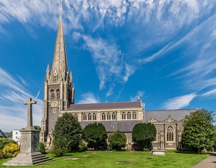
St Martin's Church, Dorking
Historic churches · 0.1 km

Surrey Yeoman House
Historic houses · 0.1 km

Dorking Mosque
Historic churches · 0.2 km

John Arthur gallery
Galleries · 0.2 km

Cakerider
Cafés · 0.2 km

Dorking Museum
Museums · 0.2 km

Green Room Theatre
Open-air theatres · 0.3 km

William Mullins Pilgrim Father
Memorials & monuments · 0.3 km

Dorking Caves
Caves · 0.3 km

Dorking War Memorial
Memorials & monuments · 0.3 km

Dorking Cockerel
Public art & sculpture · 0.4 km

Green Room Theatre
Theatres · 0.4 km
Nearby
📷 5Historic churches · South East England
St Martin's Church, Dorking
St Martin's Church, Dorking — church in Mole Valley, Surrey, England, UK.
📷 5Historic houses · South East England
Surrey Yeoman House
Surrey Yeoman House — house in Mole Valley, Surrey, England, UK.
📷 5Historic churches · South East England
Dorking Mosque
Dorking Mosque — a church in england-london, United Kingdom.
📷 5Galleries · South East England
John Arthur gallery
John Arthur gallery — a gallery in england-london, United Kingdom.
📷 7📷 5Museums · South East England
Dorking Museum
Dorking Museum — a museum in england-london, United Kingdom.
Where to eat & stay near Dorking
Places to stay
 📷 5
📷 5Caravan parks · South East England
Conifer Park Caravan Site
Conifer Park Caravan Site — a caravan park in england london.
 📷 5
📷 5Campsites · South East England
Ranmore Common Campsite
Ranmore Common Campsite — a campsite in england london.
 📷 5
📷 5Campsites · South East England
Dorking Scouts Camp Site
Dorking Scouts Camp Site — a campsite in england london.
 📷 5
📷 5 📷 5
📷 5Hotels · South East England
Hartsfield Manor
Hartsfield Manor — a hotel in england london.
 📷 5
📷 5Places to eat & drink
📷 7 📷 7
📷 7Historic pubs · South East England
The Seven Stars Public House
The Seven Stars Public House in England South East, United Kingdom.
 📷 5
📷 5Historic pubs · South East England
The Windsor Castle Public House
The Windsor Castle Public House in England South East, United Kingdom.
 📷 5
📷 5 📷 5
📷 5Historic pubs · South East England
The Skimmington Castle Public House
The Skimmington Castle Public House in England South East, United Kingdom.
 📷 7
📷 7Historic pubs · South East England
Duke Of Wellington Public House
Duke Of Wellington Public House in England South East, United Kingdom.
More museums in this region
 📷 5
📷 5Museums · South East England
Coldrum Long Barrow
Coldrum Long Barrow — neolithic chambered long barrow near Trottiscliffe, Kent, England, UK.
 📷 5
📷 5Museums · South East England
Guildford House
Guildford House — house in Guildford, Surrey, England, UK.
 📷 5
📷 5Museums · South East England
Huguenot Museum
Huguenot Museum — museum in Rochester, England, UK.
 📷 5
📷 5Museums · South East England
Medway megaliths
Medway megaliths — group of long barrows in Kent, England.
Frequently asked questions
- Where is Dorking?
- Dorking is in Surrey, London, United Kingdom (postcode RH4 1BG), in the parish of Mole Valley, unparished area.
- What is Dorking?
- Dorking () is a market town in Surrey in South East England about 21 mi (34 km) south-west of London. It is in Mole Valley District and the council headquarters are to the east of the centre. The High
- How do I get to Dorking?
- The nearest railway station is Dorking West, about 0.8 km away. Drivers can use postcode RH4 1BG.
- Is Dorking a protected site?
- Yes — Dorking is part of the Surrey Hills National Landscape (AONB).
- Is Dorking free to visit?
- Yes, Dorking is free to enter.
- How do I get to Dorking?
- The nearest railway station is Dorking West, about 0.8 km away. Drivers can navigate to postcode RH4 1BG.