
Natural landmarks · Northern Ireland
Donagh
In or near Newtownbutler.
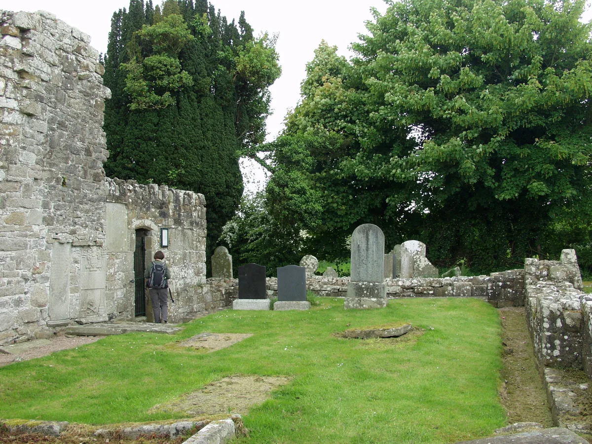
Donagh in Northern Ireland, United Kingdom.

Kenneth Allen — CC BY-SA 2.0 via Wikimedia Commons licence

Plan your visit
- Typical visit
- 1 h–2 h
- Free entry
- Dog-friendly
About
Donagh is a place of interest in Northern Ireland, United Kingdom — drawn from open-data sources for visitor reference. See the linked Wikipedia article for the full description.
Photo gallery
See it from the streetimagery from 2025
Imagery © Mapillary contributors, CC BY-SA 4.0
From the Wikipedia article
Donagh (pronounced DOH-nə, from Irish Domhnach, meaning 'church') is a small village and townland in County Fermanagh, Northern Ireland. It lies between Lisnaskea and Newtownbutler in the south-east of the county. The nearest town is Lisnaskea, 3 miles (5 km) to the north-west. In the 2021 census it had a population of 164. It is situated within Fermanagh and Omagh district. There is another townland called Donagh in County Fermanagh, as well as one in County Monaghan in the Republic of Ireland. Donagh was originally known in Irish as Ua Dúnáin Dhomhnaigh Maighe da Claoíne do Mharbhad (meaning 'O'Doonan's Church of the Plain of the Two Slopes'), later known in Irish as Domhnach Maighe Dhá Chlaoine (meaning 'Church of the Plain of the Two Slopes'). It was originally anglicised as 'Donoghmoychinny' or 'Donaghmoyline'. It was later anglicised simply as Donagh.
Excerpt from Wikipedia under CC BY-SA 4.0. See the source article linked in Sources below.
Background
Description
The village is home to two protected landmarks: Donagh House, which is officially listed, and an ancient religious site that includes the remains of a church and an adjoining graveyard. St Patrick's is the local GAA club, and won the Fermanagh Senior Football Championship in 2008.
Sourced from Wikipedia under CC BY-SA 4.0.
- Coordinates
- 54.2150, -7.3940
- District
- Fermanagh and Omagh
- Postcode
- BT92 5AF
- Parliamentary constituency
- Fermanagh and South Tyrone
Sources
Other places nearby

Donagh
Villages · 0.7 km

A34 road
Natural landmarks · 1.3 km

Sidaire
Natural landmarks · 1.9 km

Cloghagaddy Stone
Archaeological sites · 3.5 km

Relagh
Natural landmarks · 3.8 km

Salry
Natural landmarks · 3.9 km

Lisnamallard
Historic houses · 3.9 km

Rathmoran Castle
Castles · 4.2 km
Golan
Historic houses · 4.2 km

Newtownbutler
Towns & cities · 4.3 km

Newtownbutler railway station
Natural landmarks · 4.3 km
Aghalurcher Monastery
Abbeys & priories · 4.3 km
Nearby
📷 5📷 4📷 4📷 5Archaeological sites · Northern Ireland
Cloghagaddy Stone
Cloghagaddy Stone — a archaeological in northern-ireland, United Kingdom.
📷 4📷 3Where to eat & stay near Donagh
Places to stay
 📷 5
📷 5 📷 3
📷 3Caravan parks · Northern Ireland
Lisnaskea Caravan Park
Lisnaskea Caravan Park — a caravan park in northern ireland.
 📷 5
📷 5Caravan parks · Northern Ireland
Round Lake Caravan Park
Round Lake Caravan Park — a caravan park in northern ireland.
 📷 5
📷 5Caravan parks · Northern Ireland
Round Lake Caravan Park
Round Lake Caravan Park — a caravan park in northern ireland.
 📷 4
📷 4Caravan parks · Northern Ireland
Riverside Farm, Marina & Caravan Park
Riverside Farm, Marina & Caravan Park — a caravan park in northern ireland.
More natural landmarks in this region
 Flagship📷 4
Natural landmarks · Northern Ireland
Lough Erne
Lough Erne — lake in County Fermanagh, Northern Ireland, UK.
 Flagship📷 4
Natural landmarks · Northern Ireland
Lough Neagh
Lough Neagh — large lake in Northern Ireland.
 📷 3
📷 3Natural landmarks · Northern Ireland
Ballysaggart Lough
Ballysaggart Lough — lake in the United Kingdom.
 📷 5
📷 5Natural landmarks · Northern Ireland
Belmore Mountain
Belmore Mountain — mountain in the United Kingdom.
Frequently asked questions
- Where is Donagh?
- Donagh is in Northern Ireland, United Kingdom (postcode BT92 5AF).
- What is Donagh?
- Donagh in Northern Ireland, United Kingdom.
- How do I get to Donagh?
- Drivers can use postcode BT92 5AF.
- Is Donagh free to visit?
- Yes, Donagh is free to enter.
- How do I get to Donagh?
- Drivers can navigate to postcode BT92 5AF. It sits within the Fermanagh and South Tyrone parliamentary constituency.