
Historic bridges · East Midlands
Dinting Vale Viaduct
In or near Old Glossop.
Dinting Vale Viaduct is a historic bridge in the United Kingdom.

Wikimedia Commons contributors — see linked file page for photographer and licence licence

Plan your visit
- Typical visit
- 15 min–30 min
- Nearest railway station
- Dinting · 0.3 km
- Free entry
- Dog-friendly
Getting there & planning your visit
To visit Dinting Vale Viaduct, you can take a train to Dinting station, which is 0.3 km away. The postcode for navigation is SK13 6PB. Entry to the viaduct is free.
About
Dinting Vale Viaduct is a named historic bridge in the United Kingdom. Coordinates: 53.4474°, -1.9728°. This entry is part of The Great Britain Guide, a free, ad-free, open-data tourist directory.
Photo gallery
See it from the streetimagery from 2019
Imagery © Mapillary contributors, CC BY-SA 4.0
Protected designations
- Site of Special Scientific Interest: Dark Peak SSSI
Designations sourced from Natural England open data under OGL v3.
From the Wikipedia article
Dinting Viaduct (also known as Dinting Arches) is a 19th-century railway viaduct in Glossopdale in Derbyshire, England, that carries the Glossop Line over a valley at the village of Dinting. It crosses the Glossop Brook and the A57 road between Manchester and Sheffield. First opened in 1844 as part of the original Woodhead Line by the Sheffield, Ashton-under-Lyne and Manchester Railway (later the MSLR and GCR), the viaduct has been modified a number of times, most notably by the addition of seven brick strengthening piers in 1918–20. The viaduct comprises three sections: starting from the south end, there is a series of seven stone arches, each 50 feet (15 m) wide. The central section consists of five openings (later divided by strengthening piers). A further four stone arches take the railway to the northerly junction with the branch to Hadfield and into Dinting station. It is of similar design to the shorter Broadbottom Viaduct about 1.5 miles (2.4 km) west down the same line, which crosses the River Etherow at Broadbottom.
Excerpt from Wikipedia under CC BY-SA 4.0. See the source article linked in Sources below.
Background
History
The modern-day Glossop branch line originally opened as the Woodhead Line in December 1845, which linked Sheffield to Manchester. It was closed in 1981 leaving only the Manchester to Glossop/Hadfield section still in operation. The viaduct over the River Etherow at Broadbottom had been completed in December 1842, extending train services to Broadbottom, with the contract for the Dinting viaduct being let in June that year. In August 1844 the bridge was opened allowing trains to reach Hadfield and Glossop from Manchester. The original construction of the two bridges used laminated timber arches. The first electric train travelled over in 1954. The scheme cost £6.4 million.
Architecture
Dinting is much the larger of two similar viaducts on the line (the other being the Broadbottom Viaduct), both of which are significant for their height. It has four main spans, each of four ribs, flanked by eleven brick-built, semi-circular approach arches, each with a fifty-foot (fifteen-metre) span—four at one end and seven at the other. Seven intermediate supporting piers were added in 1919, constructed of blue brick and irregularly spaced to avoid the road and river beneath, thus resulting in the loss of the viaduct's symmetry. This alteration was criticised by the architectural writer Nikolaus Pevsner.
Sourced from Wikipedia under CC BY-SA 4.0.
- Coordinates
- 53.4474, -1.9728
- County
- Derbyshire
- District
- High Peak
- Parish
- High Peak, unparished area
- Postcode
- SK13 6PB
- Parliamentary constituency
- High Peak
- Nearest railway station
- Dinting — 0.3 km
- Opening
- {{start date|1844|08|08|df=y}}
Sources
- osm: w1024039909 (ODbL)
- wikipedia: Dinting Viaduct (CC BY-SA 4.0)
- commons: Dinting6265.JPG (CC BY-SA 4.0)
Other places nearby

Melandra Castle
Castles · 1.1 km

Melandra Castle
Archaeological sites · 1.1 km

Ardotalia
Other places · 1.2 km

St Philip Howard Catholic Voluntary Academy
Historic churches · 1.2 km
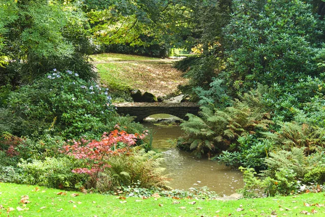
Howard Park
Country parks · 1.2 km

Mouselow Castle
Vineyards · 1.3 km

Glossop Castle
Castles · 1.3 km
Mouselow Castle
Literary houses · 1.3 km

The Oakwood and Oakwood Restaurant
Historic pubs · 1.4 km

Hadfield, Derbyshire
Museums · 1.4 km

The Spinners Arms Public House
Historic pubs · 1.5 km
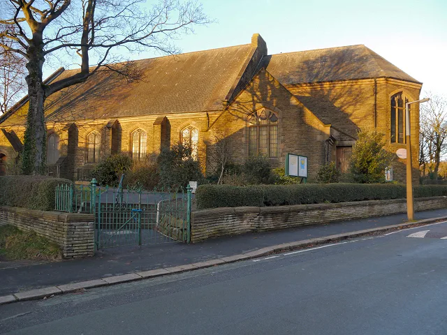
St. Luke's Church, Glossop
Historic churches · 1.5 km
Nearby
📷 3📷 5Archaeological sites · East Midlands
Melandra Castle
Melandra Castle — archaeological in england east midlands.
📷 5📷 5Historic churches · East Midlands
St Philip Howard Catholic Voluntary Academy
St Philip Howard Catholic Voluntary Academy — a school heritage in england-east-midlands, United Kingdom.
📷 3Country parks · East Midlands
Howard Park
Howard Park — public park in Glossop, Derbyshire, England, UK.
📷 5Vineyards · East Midlands
Mouselow Castle
Mouselow Castle — a UK vineyard in england east midlands, producing English or Welsh wine from cool-climate grape varieties.
Where to eat & stay near Dinting Vale Viaduct
Places to stay
 📷 5
📷 5Caravan parks · East Midlands
Windy Harbour Hotel Caravan and Camping Site
Windy Harbour Hotel Caravan and Camping Site — a caravan park in england east midlands.
 📷 5
📷 5Campsites · East Midlands
Crossgate Farm Campsite
Crossgate Farm Campsite — a campsite in england east midlands.
 📷 5
📷 5Campsites · Yorkshire & the Humber
Boarfold Scout Camp
Boarfold Scout Camp — a campsite in england west midlands.
 📷 5
📷 5 📷 5
📷 5Caravan parks · Yorkshire & the Humber
Far Benfield Farm Caravan Storage
Far Benfield Farm Caravan Storage — a caravan park in england west midlands.
 📷 5
📷 5Campsites · East Midlands
Crowden Campsite
Crowden Campsite — a campsite in england east midlands.
Places to eat & drink
📷 5Historic pubs · East Midlands
The Oakwood and Oakwood Restaurant
The Oakwood and Oakwood Restaurant in England Yorkshire, United Kingdom.
📷 7Historic pubs · East Midlands
The Spinners Arms Public House
The Spinners Arms Public House in England Yorkshire, United Kingdom.
 📷 5
📷 5Historic pubs · East Midlands
Former Dollars Public House
Former Dollars Public House in England Yorkshire, United Kingdom.
 📷 5
📷 5Historic pubs · East Midlands
The Crown Inn, Glossop
The Crown Inn, Glossop in England Yorkshire, United Kingdom.
 📷 5
📷 5Historic pubs · East Midlands
Norfolk Arms Public House
Norfolk Arms Public House in England Yorkshire, United Kingdom.
 📷 5
📷 5Historic pubs · East Midlands
Bulls Head Public House
Bulls Head Public House in England Yorkshire, United Kingdom.
More bridges in this region
 📷 5
📷 5Historic bridges · East Midlands
Mill Race Bridge To Market Deeping Mill
Mill Race Bridge To Market Deeping Mill — Grade II listed building-listed bridge in england-london, United Kingdom.
 📷 5
📷 5Historic bridges · East Midlands
Bridge Over West Glen River
Bridge Over West Glen River — Grade II listed building-listed bridge in england-london, United Kingdom.
 📷 5
📷 5Historic bridges · East Midlands
Bridge And Sluices
Bridge And Sluices — Grade II listed building-listed bridge in england-london, United Kingdom.
 📷 5
📷 5Historic bridges · East Midlands
Bridge Over River Gwash
Bridge Over River Gwash — Grade II listed building-listed bridge in england-london, United Kingdom.
Frequently asked questions
- Where is Dinting Vale Viaduct?
- Dinting Vale Viaduct is in Derbyshire, the East Midlands, United Kingdom (postcode SK13 6PB), in the parish of High Peak, unparished area.
- What is Dinting Vale Viaduct?
- Dinting Vale Viaduct is a historic bridge in the United Kingdom.
- How do I get to Dinting Vale Viaduct?
- The nearest railway station is Dinting, about 0.3 km away. The nearest town is Old Glossop. Drivers can use postcode SK13 6PB.
- Who owns Dinting Vale Viaduct?
- Dinting Vale Viaduct is owned by | maint = Network Rail.
- Is Dinting Vale Viaduct a protected site?
- Yes — Dinting Vale Viaduct is part of the Dark Peak SSSI Site of Special Scientific Interest.
- Is Dinting Vale Viaduct free to visit?
- Yes, Dinting Vale Viaduct is free to enter.
- How do I get to Dinting Vale Viaduct?
- The nearest railway station is Dinting, about 0.3 km away. Drivers can navigate to postcode SK13 6PB.