
Archaeological sites · North West England
Dike, circles and cairns on Bleaberry Haws
In or near Bowmanstead.
Dike, circles and cairns on Bleaberry Haws — Scheduled Monument in the parish of Torver, Cumbria, England, UK.

Wikimedia Commons contributors — see linked file page for photographer and licence licence

Plan your visit
- Typical visit
- 45 min–1.5 h
- Free entry
- Dog-friendly
About
Dike, circles and cairns on Bleaberry Haws is an archaeological site in the United Kingdom. Heritage designation: scheduled monument. Wikidata describes it as: "Scheduled Monument in the parish of Torver, Cumbria, England, UK". Coordinates: 54.3402°, -3.1280°.
Photo gallery
Place summary
Dike, circles and cairns on Bleaberry Haws is an archaeological site located in Torver, North-West England, postcode LA21. It is designated as a scheduled monument, highlighting its historical significance. The site features ancient earthworks and stone structures, indicative of past human activity in the region.
AI-generated from the structured facts on this page (operator, designation, listing, era). Not a substitute for visiting.
- Coordinates
- 54.3402, -3.1280
- District
- Westmorland and Furness
- Parish
- Torver
- Postcode
- LA21 8BS
- Parliamentary constituency
- Westmorland and Lonsdale
Sources
- wikidata: Q17642833 (CC0)
- commons: Ancient Cairn, Bleaberry Haws - geograph.org.uk - 1405993.jpg (CC BY-SA 4.0)
Other places nearby

Bleaberry Haws Stone Circle
Stone circles · 0.4 km

Banks
Mountains & hills · 0.4 km
Banks
Mountains & hills · 0.5 km

Shepherd's View Caravan Site
Caravan parks · 1.7 km

Torver
Villages · 1.7 km
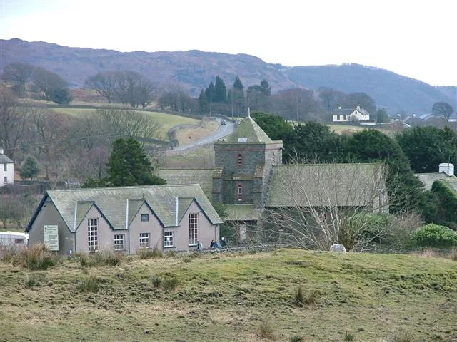
St Luke's Church, Torver
Historic churches · 1.7 km

Torver War Memorial
Memorials & monuments · 1.7 km

Church House Public House
Historic pubs · 1.7 km
The Church House Inn
B&Bs · 1.7 km

Lag Bank
Mountains & hills · 1.8 km

White Maiden
Mountains & hills · 1.8 km
White Maiden
Mountains & hills · 1.8 km
Nearby
📷 3Stone circles · North West England
Bleaberry Haws Stone Circle
Bleaberry Haws Stone Circle — a stone circle in england-north-west, United Kingdom.
📷 5Mountains & hills · North West England
Banks
Banks — mountain in england north west. Elevation: 311 m.
📷 5📷 5Caravan parks · North West England
Shepherd's View Caravan Site
Shepherd's View Caravan Site — a caravan park in england north west.
📷 5📷 3Historic churches · North West England
St Luke's Church, Torver
St Luke's Church, Torver — grade II listed church in Cumbria, England, UK.
Where to eat & stay near Dike, circles and cairns on Bleaberry Haws
Places to stay
📷 5Caravan parks · North West England
Shepherd's View Caravan Site
Shepherd's View Caravan Site — a caravan park in england north west.
📷 7B&Bs · North West England
The Church House Inn
The Church House Inn — a bed-and-breakfast in england north west.
 📷 5
📷 5Campsites · North West England
Hoathwaite Campsite
Hoathwaite Campsite — a campsite in england north west.
 📷 5
📷 5Caravan parks · North West England
Coniston Park Coppice Caravan Club Site
Coniston Park Coppice Caravan Club Site — a caravan park in england north west.
 📷 5
📷 5Campsites · North West England
Coniston Hall Campsite
Coniston Hall Campsite — a campsite in england north west.
 📷 5
📷 5Campsites · North West England
Turner Hall Farm Campsite
Turner Hall Farm Campsite — a campsite in england north west.
Places to eat & drink
📷 7Historic pubs · North West England
Church House Public House
Church House Public House in England North West, United Kingdom.
 📷 5
📷 5Restaurants · North West England
The Terrace Coffee House and Restaurant
The Terrace Coffee House and Restaurant — a restaurant in england north west. Cuisine: sandwich;lunch.
 📷 5
📷 5Historic pubs · North West England
Blacksmiths Arms
Blacksmiths Arms in England North West, United Kingdom.
 📷 5
📷 5Historic pubs · North West England
Sun Cottage Sun Inn Public House
Sun Cottage Sun Inn Public House in England North West, United Kingdom.
 📷 7
📷 7Cafés · North West England
Joey's Cafe
Joey's Cafe — a café in england north west.
 📷 7
📷 7Historic pubs · North West England
Hole in t'Wall public house, With Attached Buildings To South
Hole in t'Wall public house, With Attached Buildings To South in England North West, United Kingdom.
More archaeological sites in this region
 📷 3
📷 3Archaeological sites · North West England
Early medieval sculptural fragments in St Mary's churchyard
Early medieval sculptural fragments in St Mary's churchyard — archaeological site in Sandbach, Cheshire East, England, UK.
 📷 3
📷 3Archaeological sites · North West England
Gaddum's Wood
Gaddum's Wood is a archaeological site in the United Kingdom.
 📷 3
📷 3Archaeological sites · North West England
Marton moated monastic grange, three fishponds, connecting channels and base of stone cross
Marton moated monastic grange, three fishponds, connecting channels and base of stone cross — archaeological site in Whitegate and Marton, Cheshire West and Chester, England, UK.
 📷 3
📷 3Archaeological sites · North West England
St Oswalds Well
St Oswalds Well — a archaeological in england-west-midlands, United Kingdom.
Frequently asked questions
- Where is Dike, circles and cairns on Bleaberry Haws?
- Dike, circles and cairns on Bleaberry Haws is in North-West England, United Kingdom (postcode LA21 8BS), in the parish of Torver.
- What is Dike, circles and cairns on Bleaberry Haws?
- Dike, circles and cairns on Bleaberry Haws — Scheduled Monument in the parish of Torver, Cumbria, England, UK.
- How do I get to Dike, circles and cairns on Bleaberry Haws?
- Drivers can use postcode LA21 8BS.
- Is Dike, circles and cairns on Bleaberry Haws a listed building?
- Dike, circles and cairns on Bleaberry Haws is officially recognised as scheduled monument listed.
- Is Dike, circles and cairns on Bleaberry Haws free to visit?
- Yes, Dike, circles and cairns on Bleaberry Haws is free to enter.
- How do I get to Dike, circles and cairns on Bleaberry Haws?
- Drivers can navigate to postcode LA21 8BS. It sits within the Westmorland and Lonsdale parliamentary constituency.