Natural landmarks · South West England
Devil's Chimney (Gloucestershire)
In or near Cowley.
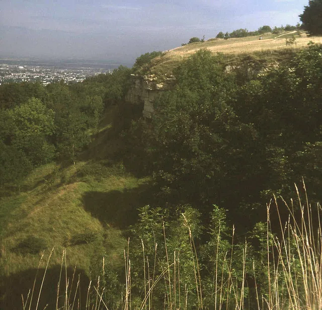
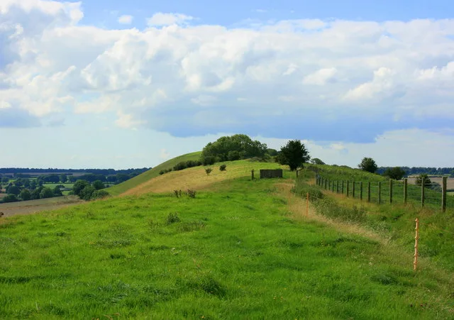
The Devil's Chimney is a rock formation on Leckhampton Hill, south of Cheltenham, Gloucestershire, England. It is a largely man-made pillar outcrop, formed when an incline to a quarry was cut behind i

Roger Davies — CC BY-SA 2.0 via Wikimedia Commons licence
Plan your visit
- Typical visit
- 1 h–2 h
- Nearest railway station
- Cheltenham Spa · 3.9 km
- Family-friendly
- Dog-friendly
Getting there & planning your visit
To visit Devil's Chimney in Gloucestershire, the nearest railway station is Cheltenham Spa, located 3.9 km away. The postcode for sat-nav is GL53 9QH. Entry is free, and accessibility details are not provided.
About
The Devil's Chimney is a rock formation on Leckhampton Hill, south of Cheltenham, Gloucestershire, England. It is a largely man-made pillar outcrop, formed when an incline to a quarry was cut behind it, isolating the pillar from the main hillside. It is named for its peculiar shape, that of a crooked and twisted chimney rising from the ground. The Devil's Chimney is a local landmark, but its origins are uncertain. In 1926 it survived an earthquake, but not without a few cracks. In 1985 it was repaired and protected from further erosion.
Photo gallery
Protected designations
- Site of Special Scientific Interest: Leckhampton Hill and Charlton Kings Common SSSI
- Area of Outstanding Natural Beauty: Cotswolds
Designations sourced from Natural England open data under OGL v3.
From the Wikipedia article
The Devil's Chimney is a rock formation on Leckhampton Hill, south of Cheltenham, Gloucestershire, England. It is a largely man-made pillar outcrop, formed when an incline to a quarry was cut behind it, isolating the pillar from the main hillside. It is named for its peculiar shape, that of a crooked and twisted chimney rising from the ground. The Devil's Chimney is a local landmark, but its origins are uncertain. In 1926 it survived an earthquake, but not without a few cracks. In 1985 it was repaired and protected from further erosion.
Excerpt from Wikipedia under CC BY-SA 4.0. See the source article linked in Sources below.
- Coordinates
- 51.8642, -2.0791
- County
- Gloucestershire
- District
- Tewkesbury
- Parish
- Shurdington
- Postcode
- GL53 9QH
- Parliamentary constituency
- North Cotswolds
- Nearest railway station
- Cheltenham Spa — 3.9 km
Sources
- wikipedia: Devil's Chimney (Gloucestershire) (CC BY-SA 4.0)
Other places nearby

Leckhampton camp and tumulus
Vineyards · 0.1 km
Leckhampton Hill
Mountains & hills · 0.2 km

Foreman's Cottage
Historic houses · 0.3 km

The Continental By Boulevard Memorial
Memorials & monuments · 0.6 km

Leckhampton Hill
Forests & woodlands · 0.9 km

Row Of 9 Medieval Monuments In The Churchyard Of The Church Of St Peter Immediately West Of The Porch
Memorials & monuments · 1.1 km

Hartley Hill
Mountains & hills · 1.1 km
St Peter's Church, Leckhampton
Historic churches · 1.1 km

Southfild Manor
Manor houses · 1.4 km

Malvern Inn
Memorials & monuments · 1.5 km

Crippets Barrow
Burial mounds & barrows · 1.6 km

Crippets Barrow
Archaeological sites · 1.6 km
Nearby
📷 5Vineyards · South West England
Leckhampton camp and tumulus
Leckhampton camp and tumulus — a UK vineyard in england west midlands, producing English or Welsh wine from cool-climate grape varieties.
📷 4Mountains & hills · South West England
Leckhampton Hill
Leckhampton Hill — Named summit at 293 m.
📷 3Historic houses · South West England
Foreman's Cottage
Foreman's Cottage — a historic house in england-west-midlands, United Kingdom.
📷 3Memorials & monuments · South West England
The Continental By Boulevard Memorial
The Continental By Boulevard Memorial — a memorial in england-west-midlands, United Kingdom.
📷 4Forests & woodlands · South West England
Leckhampton Hill
Leckhampton Hill is a forest or woodland in the United Kingdom.
📷 3Memorials & monuments · South West England
Row Of 9 Medieval Monuments In The Churchyard Of The Church Of St Peter Immediately West Of The Porch
Row Of 9 Medieval Monuments In The Churchyard Of The Church Of St Peter Immediately West Of The Porch — Grade II listed building-listed memorial in england-west-midlands, United Kingdom.
Where to eat & stay near Devil's Chimney (Gloucestershire)
Places to stay
 📷 7
📷 7Hotels · South West England
DoubleTree by Hilton Cheltenham-Cotswolds
DoubleTree by Hilton Cheltenham-Cotswolds — a hotel in england west midlands. 4-star. Brand: DoubleTree.
 📷 5
📷 5Campsites · South West England
The Tree Nursery
The Tree Nursery — a campsite in england west midlands.
 📷 7
📷 7Hotels · South West England
Charlton Kings Hotel
Charlton Kings Hotel — a hotel in england west midlands.
 📷 5
📷 5Hotels · South West England
Malmaison Cheltenham
Malmaison Cheltenham — a hotel in england west midlands. 4-star. Brand: Malmaison.
 📷 7
📷 7Hotels · South West England
George Hotel
George Hotel — a hotel in england west midlands.
 📷 7
📷 7Hotels · South West England
Cowley Manor
Cowley Manor — a hotel in england west midlands.
Places to eat & drink
 📷 5
📷 5Historic pubs · South West England
Queens Hotel
Queens Hotel in England South East, United Kingdom.
 📷 3
📷 3Historic pubs · South West England
The Bath Tavern
The Bath Tavern — Historic pub — listed building or notable heritage status.
 📷 5
📷 5Historic pubs · South West England
Town Hall, Town Hall Public House and attached wall
Town Hall, Town Hall Public House and attached wall in England South East, United Kingdom.
 📷 5
📷 5Historic pubs · South West England
Sandford Park Alehouse
Sandford Park Alehouse in England South East, United Kingdom.
 📷 3
📷 3Historic pubs · South West England
The Old Restoration
The Old Restoration — Historic pub — listed building or notable heritage status.
 📷 7
📷 7Historic pubs · South West England
Colesbourne Inn
Colesbourne Inn in England South East, United Kingdom.
More natural landmarks in this region
 📷 5
📷 5Natural landmarks · South West England
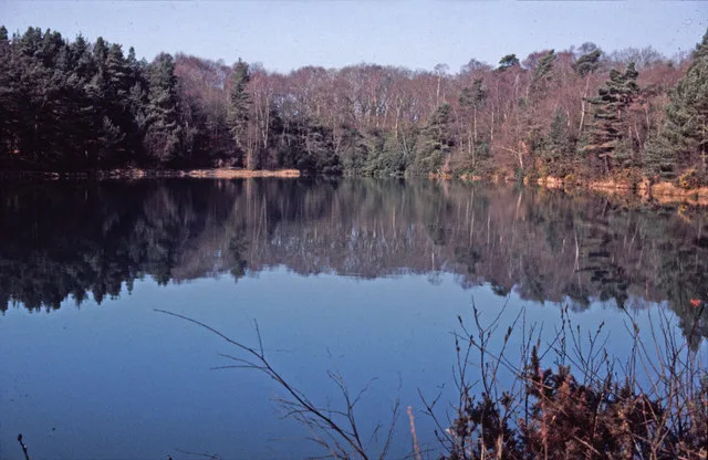
Blue Pool
Blue Pool — lake in Dorset, England, UK.
 📷 5
📷 5Natural landmarks · South West England
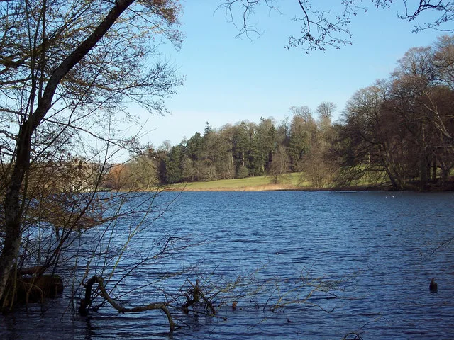
Fonthill Lake
Fonthill Lake — lake in Wiltshire, England, UK.
 📷 5
📷 5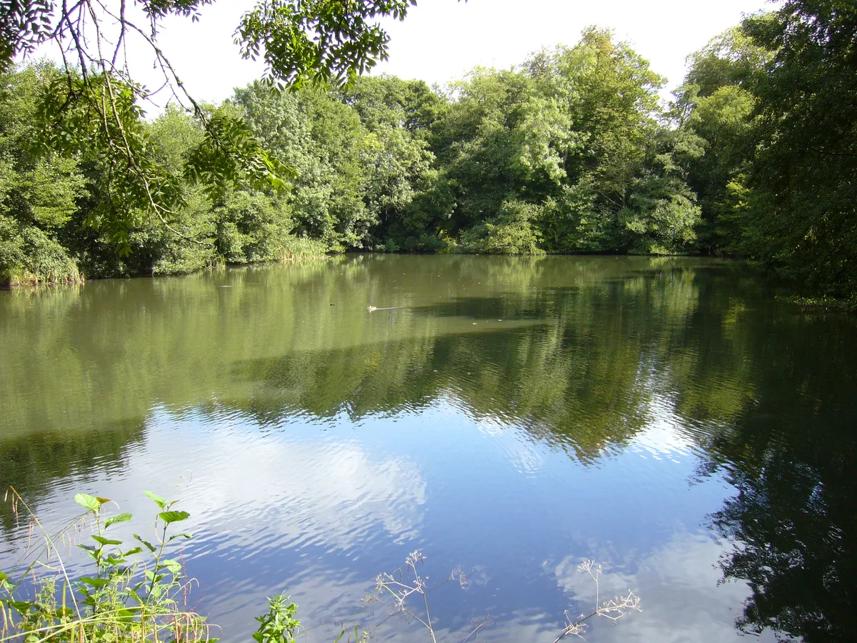 📷 5
📷 5Natural landmarks · South West England
Orchardleigh Lake
Orchardleigh Lake — lake in the United Kingdom.
Frequently asked questions
- Where is Devil's Chimney (Gloucestershire)?
- Devil's Chimney (Gloucestershire) is in Gloucestershire, South-East England, United Kingdom (postcode GL53 9QH), in the parish of Shurdington.
- What is Devil's Chimney (Gloucestershire)?
- The Devil's Chimney is a rock formation on Leckhampton Hill, south of Cheltenham, Gloucestershire, England. It is a largely man-made pillar outcrop, formed when an incline to a quarry was cut behind i
- How do I get to Devil's Chimney (Gloucestershire)?
- The nearest railway station is Cheltenham Spa, about 3.9 km away. Drivers can use postcode GL53 9QH.
- Is Devil's Chimney (Gloucestershire) a protected site?
- Yes — Devil's Chimney (Gloucestershire) is part of the Leckhampton Hill and Charlton Kings Common SSSI Site of Special Scientific Interest and the Cotswolds National Landscape (AONB).
- How do I get to Devil's Chimney (Gloucestershire)?
- The nearest railway station is Cheltenham Spa, about 3.9 km away. Drivers can navigate to postcode GL53 9QH.