
Archaeological sites · South West England
Deserted post-medieval farmstead and part of the surrounding field system at High House Waste
In or near Cornwood.
Deserted post-medieval farmstead and part of the surrounding field system at High House Waste — archaeological site in Cornwood, South Hams, England, UK.

Wikimedia Commons contributors — see linked file page for photographer and licence licence

Plan your visit
- Typical visit
- 45 min–1.5 h
- Nearest railway station
- Ivybridge · 6.9 km
- Free entry
- Dog-friendly
About
Deserted post-medieval farmstead and part of the surrounding field system at High House Waste is a place of interest in Devon, South-West England. Officially recognised as scheduled monument. The site is a designated Site of Special Scientific Interest. It sits within the South West Devon parliamentary constituency. The nearest railway station is Ivybridge, about 6.9 km away. Postcode area PL21.
Photo gallery
Protected designations
- Site of Special Scientific Interest: South Dartmoor SSSI
- Site of Special Scientific Interest: Dendles Wood SSSI
Designations sourced from Natural England open data under OGL v3.
Place summary
The Deserted post-medieval farmstead and part of the surrounding field system at High House Waste is located in Cornwood, Devon, in South-West England. This site is designated as a scheduled monument and is part of the South Dartmoor SSSI and Dendles Wood SSSI.
AI-generated from the structured facts on this page (operator, designation, listing, era). Not a substitute for visiting.
- Coordinates
- 50.4452, -3.9578
- County
- Devon
- District
- South Hams
- Parish
- Cornwood
- Postcode
- PL21 9RE
- Parliamentary constituency
- South West Devon
- Nearest railway station
- Ivybridge — 6.9 km
Sources
- wikidata: Q17648085 (CC0)
- commons: Ruined farmstead - geograph.org.uk - 1807544.jpg (CC BY-SA 4.0)
Other places nearby

Medieval settlement on Ford Waste
Vineyards · 0.9 km

Yealm Steps
Waterfalls · 1.4 km
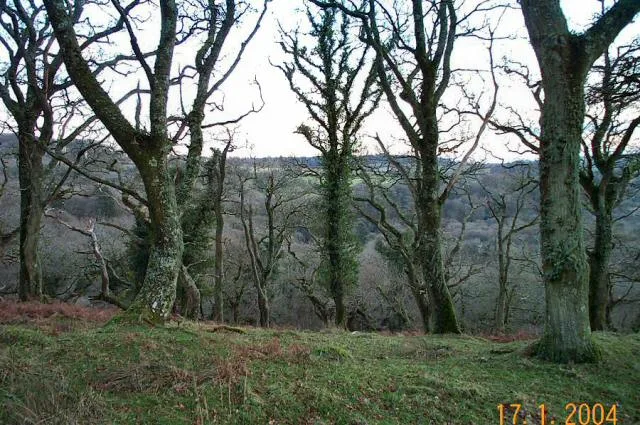
Dendles Wood
Archaeological sites · 1.8 km

Wisdome Bridge
Historic bridges · 2.1 km

Stalldown Cairn Circle
Burial mounds & barrows · 2.1 km

Penn Moor
Mountains & hills · 2.3 km

Piall Bridge
Historic bridges · 2.5 km

Stalldown Barrow
Mountains & hills · 2.5 km
Hillson's House;Stalldown Barrow
Burial mounds & barrows · 2.6 km
Hillson's House;Stalldown Barrow
Mountains & hills · 2.6 km

Hillson's House cairn, Stalldown
Archaeological sites · 2.6 km

Cornwood
Towns & cities · 2.7 km
Nearby
📷 5Vineyards · South West England
Medieval settlement on Ford Waste
Medieval settlement on Ford Waste — a UK vineyard in england south west, producing English or Welsh wine from cool-climate grape varieties.
📷 5Archaeological sites · South West England
Dendles Wood
Dendles Wood — protected woodland in Devon, England.
📷 3Historic bridges · South West England
Wisdome Bridge
Wisdome Bridge — Grade II listed building-listed bridge in england-south-west, United Kingdom.
📷 3Burial mounds & barrows · South West England
Stalldown Cairn Circle
Stalldown Cairn Circle — a burial mound in england-south-west, United Kingdom.
📷 5Mountains & hills · South West England
Penn Moor
Penn Moor — a hill or mountain in england south west.
Where to eat & stay near Deserted post-medieval farmstead and part of the surrounding field system at High House Waste
Places to stay
 📷 5📷 5
Hostels · South West England
Harford Bunkhouse
Harford Bunkhouse — a hostel in england south west.
 📷 5
📷 5Campsites · South West England
Smithaleigh Caravan And Camping Park
Smithaleigh Caravan And Camping Park — a campsite in england south west.
 📷 7
📷 7B&Bs · South West England
The Pack Horse Inn
The Pack Horse Inn — a bed-and-breakfast in england south west.
 📷 5
📷 5Campsites · South West England
Brackenhill Glamping
Brackenhill Glamping — a campsite in england south west.
 📷 5
📷 5Campsites · South West England
Dunwell Farm Campsite
Dunwell Farm Campsite — a campsite in england south west.
Places to eat & drink
 📷 5
📷 5Cafés · South West England
Station House
Station House — a café in england south west.
 📷 7
📷 7Historic pubs · South West England
St Elizabeth's House
St Elizabeth's House in England South West, United Kingdom.
 📷 5
📷 5Restaurants · South West England
Toby Carvery
Toby Carvery — a restaurant in england south west. Cuisine: british. Brand: Toby Carvery.
 📷 7
📷 7Historic pubs · South West England
White Hart Hotel And The Assembly Rooms
White Hart Hotel And The Assembly Rooms in England South West, United Kingdom.
 📷 5
📷 5Historic pubs · South West England
Church House Inn
Church House Inn in England South West, United Kingdom.
 📷 5
📷 5Restaurants · South West England
Furzeleigh Mill
Furzeleigh Mill — a restaurant in england south west.
More archaeological sites in this region
 📷 5
📷 5Archaeological sites · South West England
Battlesbury Camp Monuments: hillfort, settlement, cemetery, barrows, enclosure, and field systems
Battlesbury Camp Monuments: hillfort, settlement, cemetery, barrows, enclosure, and field systems — archaeological site in Warminster, Wiltshire, England, UK.
 📷 2
📷 2Archaeological sites · South West England
Blandford Forest
Blandford Forest — forest in Blandford Forum, England.
 📷 5
📷 5Archaeological sites · South West England
Boulsbury Wood
Boulsbury Wood — protected area in Dorset and Hampshire, England.
.jpg?width=1200) 📷 5
📷 5Archaeological sites · South West England
Cranborne Chase
Cranborne Chase — Plateau in southern England.
Frequently asked questions
- Where is Deserted post-medieval farmstead and part of the surrounding field system at High House Waste?
- Deserted post-medieval farmstead and part of the surrounding field system at High House Waste is in Devon, South-West England, United Kingdom (postcode PL21 9RE), in the parish of Cornwood.
- What is Deserted post-medieval farmstead and part of the surrounding field system at High House Waste?
- Deserted post-medieval farmstead and part of the surrounding field system at High House Waste — archaeological site in Cornwood, South Hams, England, UK.
- How do I get to Deserted post-medieval farmstead and part of the surrounding field system at High House Waste?
- The nearest railway station is Ivybridge, about 6.9 km away. Drivers can use postcode PL21 9RE.
- Is Deserted post-medieval farmstead and part of the surrounding field system at High House Waste a listed building?
- Deserted post-medieval farmstead and part of the surrounding field system at High House Waste is officially recognised as scheduled monument listed.
- Is Deserted post-medieval farmstead and part of the surrounding field system at High House Waste a protected site?
- Yes — Deserted post-medieval farmstead and part of the surrounding field system at High House Waste is part of the South Dartmoor SSSI Site of Special Scientific Interest and the Dendles Wood SSSI Site of Special Scientific Interest.
- Is Deserted post-medieval farmstead and part of the surrounding field system at High House Waste free to visit?
- Yes, Deserted post-medieval farmstead and part of the surrounding field system at High House Waste is free to enter.
- How do I get to Deserted post-medieval farmstead and part of the surrounding field system at High House Waste?
- The nearest railway station is Ivybridge, about 6.9 km away. Drivers can navigate to postcode PL21 9RE.