Islands · South Wales
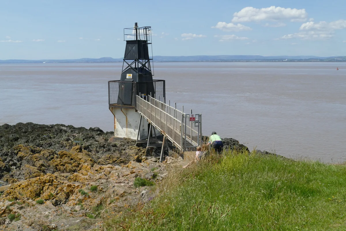
Denny Island
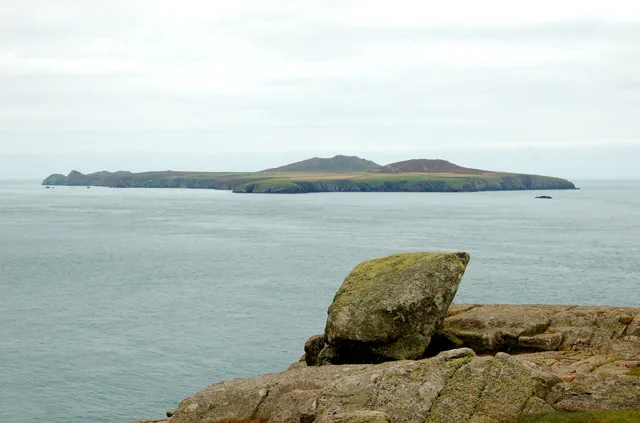
Denny Island — island in the Severn Estuary in Monmouthshire, Wales, United Kingdom.

Wikimedia Commons contributors — see linked file page for photographer and licence licence
Plan your visit
- Typical visit
- 4 h–12 h
- Nearest railway station
- St Andrews Road · 6.0 km
- Free entry
- Dog-friendly
About
Denny Island is a island in the United Kingdom. It covers approximately 2,400 km². Wikidata describes it as: "island in the Severn Estuary in Monmouthshire, Wales, United Kingdom". Coordinates: 51.5258°, -2.7809°.
Photo gallery
Protected designations
- Site of Special Scientific Interest: Severn Estuary SSSI
- Ramsar wetland: Severn Estuary
Designations sourced from Natural England open data under OGL v3.
From the Wikipedia article
Denny Island (Welsh: Ynys Denny; grid reference ST459810) is a small uninhabited rocky island of 0.24 hectares (0.6 acres), with scrub vegetation, in the Severn Estuary. Its rocky southern foreshore marks the boundary between England and Wales. Above high water mark, the island is reckoned administratively to Monmouthshire, South Wales. The island also marks the north-western limit of the City of Bristol's water boundary in the Severn estuary. It is located approximately three miles north of Portishead, midway between Redwick in Wales and Avonmouth in England. It is surrounded by sandbanks known as the Welsh Grounds. Its foreshore area changes dramatically according to the state of the tide, because tides in the estuary and Bristol Channel are amongst the highest in the world, reaching 13.7 m (45 ft) at the spring equinox. It is known as a nesting-place for gulls, cormorants and other seabirds, which are regularly seen and ringed there.
Excerpt from Wikipedia under CC BY-SA 4.0. See the source article linked in Sources below.
Background
History
Denny Island appears in the historical record for the first time as Dunye, in the charter recording the creation of the county of Bristol in 1373. This suggests that the name means, in Old English, 'island shaped like a down (i.e. a hill with a rounded profile)'. It gives its name to the Denny Island Fault Zone, a part of the Avon-Solent Fracture zone. On 21 September 1995, Neil Carter from Portishead spent 3 nights on Denny Island to raise money for the RNLI. 23 years later, on 21 September 2018, he slept overnight on the island to raise money for the maintenance of the Black Nore Lighthouse by the Black Nore Lighthouse Trust. In 2004, the island was subject to an unsuccessful appeal under…
Sourced from Wikipedia under CC BY-SA 4.0.
- Coordinates
- 51.5258, -2.7809
- Address
- Severn Estuary
- Nearest railway station
- St Andrews Road — 6 km
Sources
- wikidata: Q5259197 (CC0)
- wikipedia: Denny Island (CC BY-SA 4.0)
- commons: Denny Island.jpg (CC BY-SA 4.0)
Other places nearby
Loading nearby places…
Nearby
 📷 4
📷 4Viewpoints · South Wales
Portishead Point
Portishead Point is a viewpoint in the United Kingdom.
📷 3Memorials & monuments · South Wales
Seafarers' Memorial Stone
Seafarers' Memorial Stone — a memorial in wales-south, United Kingdom.
📷 3Historic houses · South Wales
Remains of Pill Box
Remains of Pill Box — a historic house in wales-south, United Kingdom.
 📷 4
📷 4Lighthouses · South Wales
Portishead Point lighthouse
Portishead Point lighthouse — lighthouse in Somerset, England.
 📷 4
📷 4Viewpoints · South Wales
Portishead Pier
Portishead Pier is a viewpoint in the United Kingdom.
 📷 3
📷 3Public art & sculpture · South Wales
Ship to Shore
Ship to Shore — a public art in wales-south, United Kingdom.
More places in this region
 Flagship📷 5
Islands · South Wales
Caldey Island
Caldey Island — small island in Pembrokeshire, Wales, UK.
 📷 5
📷 5Islands · South Wales
Flat Holm
Flat Holm — island off the coast of Wales.
 Flagship📷 3
Islands · South Wales
Midland Isle
Midland Isle — island in Pembrokeshire, Wales.
 📷 5
📷 5Islands · South Wales
Ramsey Island
Ramsey Island — island in Pembrokeshire, Wales, UK.
Frequently asked questions
- Where is Denny Island?
- Denny Island is in South Wales, United Kingdom.
- Is Denny Island a protected site?
- Yes — Denny Island is part of the Severn Estuary SSSI Site of Special Scientific Interest and the Severn Estuary Ramsar wetland.
- Is Denny Island free to visit?
- Yes, Denny Island is free to enter.
- How do I get to Denny Island?
- The nearest railway station is St Andrews Road, about 6.0 km away.