
Historic churches · East Midlands
Cross situated 12 metres to south of porch of Church of All Saints
In or near Youlgrave.
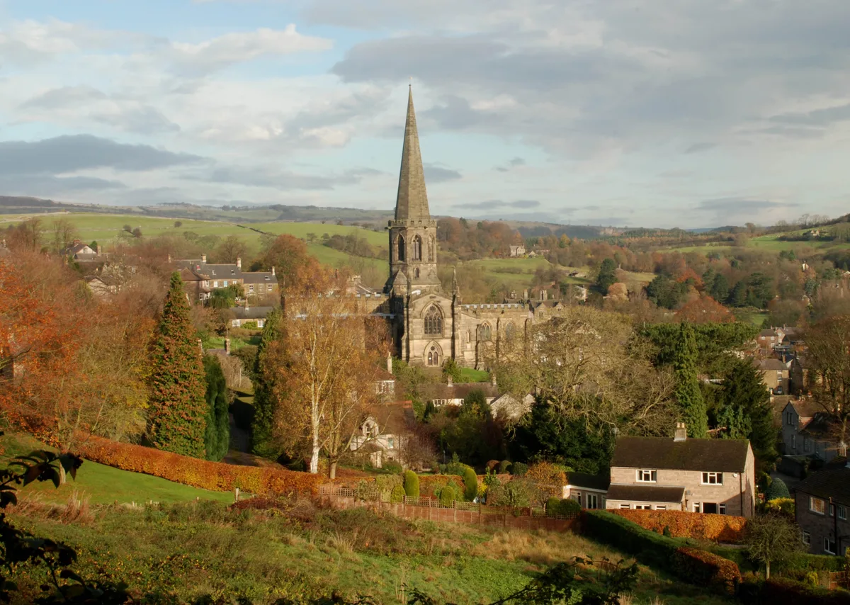
Cross situated 12 metres to south of porch of Church of All Saints — a Grade I-listed church in england-east-midlands, United Kingdom.

Peter Barr — CC BY-SA 2.0 via Wikimedia Commons licence

Plan your visit
- Typical visit
- 30 min–1 h
- Nearest railway station
- Rowsley South · 6.3 km
- Paid entry
- Wheelchair accessible
About
Cross situated 12 metres to south of porch of Church of All Saints is a Grade I-listed building in england-east-midlands, United Kingdom. Grade I status is conferred by Historic England (or Cadw, Historic Environment Scotland or NIEA equivalents) on buildings of exceptional national interest. See the linked Wikipedia article for full historical and architectural details.
Photo gallery
See it from the streetimagery from 2021
Imagery © Mapillary contributors, CC BY-SA 4.0
Official information
Bakewell Old House Museum is a historical museum located in a Tudor building that showcases the stories of its past inhabitants, including notable figures from the Tudor and Industrial Revolution periods. Visitors can explore a diverse collection of artifacts that reflect the local history and culture of Bakewell and the Peak District.
Protected designations
- Site of Special Scientific Interest: Eastern Peak District Moors SSSI
Designations sourced from Natural England open data under OGL v3.
Place summary
The Cross situated 12 metres to the south of the porch of the Church of All Saints is a Grade I listed structure in Bakewell, Derbyshire, in the East Midlands. This designation highlights its exceptional architectural and historical significance.
AI-generated from the structured facts on this page (operator, designation, listing, era). Not a substitute for visiting.
- Coordinates
- 53.2127, -1.6788
- County
- Derbyshire
- District
- Derbyshire Dales
- Parish
- Bakewell
- Postcode
- DE45 1FD
- Parliamentary constituency
- Derbyshire Dales
- Phone
- 01629813642
- Nearest railway station
- Rowsley South — 6.3 km
- Opening
- Monday - Sunday 11am - 4pm; closed 24–26 Dec
- Official site
- www.oldhousemuseum.org.uk
Sources
- wikidata: Q17525578 (CC0)
Other places nearby

The Great Cross and railed enclosure
Memorials & monuments · 0.0 km
All Saints Church, Bakewell
Historic churches · 0.0 km

Old House Museum
Museums · 0.1 km
Old House Museum, Bakewell
Museums · 0.1 km

The Rutland Arms Hotel
Hotels · 0.2 km

Bagshaw Hall
Historic houses · 0.2 km

Bakewell
Museums · 0.2 km

The Old Kings
Historic pubs · 0.3 km

Whitehorse Gallery
Galleries · 0.3 km

Stile Between Bridge Over Mill Tailrace And Milford House Hotel
Historic bridges · 0.3 km

Bridge over mill tailrace with attached obelisk
Historic bridges · 0.4 km
Old Mill Wheel
Memorials & monuments · 0.4 km
Nearby
📷 3Memorials & monuments · East Midlands
The Great Cross and railed enclosure
The Great Cross and railed enclosure — a Grade I-listed memorial in england-east-midlands, United Kingdom.
📷 3Historic churches · East Midlands
All Saints Church, Bakewell
All Saints Church, Bakewell — Grade I listed church in Bakewell, Derbyshire Dales, Derbyshire, England, UK.
📷 3Museums · East Midlands
Old House Museum
Old House Museum — a museum in england-east-midlands, United Kingdom.
📷 5Museums · East Midlands
Old House Museum, Bakewell
Old House Museum, Bakewell — a other in england-east-midlands, United Kingdom.
📷 7Hotels · East Midlands
The Rutland Arms Hotel
The Rutland Arms Hotel — a hotel in england east midlands.
📷 3Historic houses · East Midlands
Bagshaw Hall
Bagshaw Hall — Grade II* listed house in Bakewell, Derbyshire, England, UK.
Where to eat & stay near Cross situated 12 metres to south of porch of Church of All Saints
Places to stay
📷 7Hotels · East Midlands
The Rutland Arms Hotel
The Rutland Arms Hotel — a hotel in england east midlands.
 📷 5
📷 5Hotels · East Midlands
Rafters at Riverside House
Rafters at Riverside House — a hotel in england east midlands.
 📷 5
📷 5Campsites · East Midlands
Park House Camping
Park House Camping — a campsite in england east midlands.
 📷 5
📷 5Caravan parks · East Midlands
Broadmeadow CL
Broadmeadow CL — a caravan park in england east midlands.
 📷 5
📷 5Caravan parks · East Midlands
Peak Pods
Peak Pods — a caravan park in england east midlands.
 📷 5
📷 5Places to eat & drink
📷 5 📷 5
📷 5 📷 3
📷 3Historic pubs · East Midlands
Bull's Head Inn
Bull's Head Inn — Historic pub — listed building or notable heritage status.
 📷 5
📷 5Historic pubs · East Midlands
The Eyre Arms Public House
The Eyre Arms Public House in England East Midlands, United Kingdom.
 📷 7
📷 7Historic pubs · East Midlands
The Peacock Hotel
The Peacock Hotel in England East Midlands, United Kingdom.
 📷 5
📷 5Historic pubs · East Midlands
The Square House
The Square House in England West Midlands, United Kingdom.
More places in this region
 📷 5
📷 5Historic churches · East Midlands
All Saints' Church, Stamford
All Saints' Church, Stamford — church in Stamford, Lincolnshire, England, UK.
 📷 5
📷 5Historic churches · East Midlands
Church of All Saints
Church of All Saints — church in Little Casterton, Rutland, United Kingdom.
 📷 5
📷 5Historic churches · East Midlands
Church of All Saints
Church of All Saints — church in Fenland, UK.
 📷 5
📷 5Historic churches · East Midlands
Church of St Leonard
Church of St Leonard — church in Fenland, UK.
Frequently asked questions
- Where is Cross situated 12 metres to south of porch of Church of All Saints?
- Cross situated 12 metres to south of porch of Church of All Saints is in Derbyshire, the East Midlands, United Kingdom (postcode DE45 1FD), in the parish of Bakewell.
- What is Cross situated 12 metres to south of porch of Church of All Saints?
- Cross situated 12 metres to south of porch of Church of All Saints — a Grade I-listed church in england-east-midlands, United Kingdom.
- How do I get to Cross situated 12 metres to south of porch of Church of All Saints?
- The nearest railway station is Rowsley South, about 6.3 km away. Drivers can use postcode DE45 1FD.
- Is Cross situated 12 metres to south of porch of Church of All Saints a listed building?
- Cross situated 12 metres to south of porch of Church of All Saints is officially recognised as Grade I listed.
- Is Cross situated 12 metres to south of porch of Church of All Saints a protected site?
- Yes — Cross situated 12 metres to south of porch of Church of All Saints is part of the Eastern Peak District Moors SSSI Site of Special Scientific Interest.
- Is Cross situated 12 metres to south of porch of Church of All Saints free to visit?
- Yes, Cross situated 12 metres to south of porch of Church of All Saints is free to enter.
- How do I get to Cross situated 12 metres to south of porch of Church of All Saints?
- The nearest railway station is Rowsley South, about 6.3 km away. Drivers can navigate to postcode DE45 1FD.