
Memorials & monuments · East of England
Cross 120m south west of Tollgate Farm
In or near Westwick.
Cross 120m south west of Tollgate Farm — a Grade II*-listed memorial in england-east-midlands, United Kingdom.

Adrian S Pye — CC BY-SA 2.0 via Wikimedia Commons licence

Plan your visit
- Typical visit
- 15 min–45 min
- Nearest railway station
- North Walsham · 1.5 km
- Free entry
- Dog-friendly
Getting there & planning your visit
To visit the memorial located 120m south west of Tollgate Farm, you can take the train to North Walsham, which is 1.5 km away. The postcode for the location is NR28 0JA, and entry is free.
About
Cross 120m south west of Tollgate Farm is a Grade II*-listed building in england-east-midlands, United Kingdom. Grade II* status is conferred by Historic England (or Cadw, Historic Environment Scotland or NIEA equivalents) on buildings of exceptional national interest. See the linked Wikipedia article for full historical and architectural details.
Photo gallery
Heritage listing
Details The monument includes a medieval standing stone cross located 120m south west of Tollgate Farm on the parish boundary between North Walsham and Worstead. The cross, which is Listed Grade II, includes the socket stone, the shaft, the capital and the remains of the head. The socket stone is 0.7m square at the base and 0.36m in height, rising through chamfered corners with stop angles to an octagonal section on the surface. The shaft, which is mortised into the socket stone and bonded with mortar, is square in section with rounded corners and decorated with roll moulding. It measures 0.26m square at the base and tapers upwards to a height of about 4m. Resting on top of the shaft is the restored capital. This is quatrefoil in section with horizontal moulding and measures about 0.26m square by 0.35m high. The capital supports the head, which although now very worn, is thought originally to have represented the figure of Christ. The head which faces west, measures about 0.6m in height tapering upwards from about 0.3m wide at the base to 0.1m wide at the top. The full height of the cross is about 5.31m. This cross together with one 300m to the south west (the subject of a separate scheduling) are thought to relate to the battle at which Henry le Despencer, Bishop of Norwich, crushed the 1381 Peasant's Revolt lead by Jack Lytester. It is traditionally believed that one or both crosses were set up after the battle. The kerb and the surface of the road to the south of the cross are excluded from the scheduling, although the ground beneath them is included. MAP EXTRACT The site of the monument is shown on the attached map extract. It includes a 1 metre boundary around the archaeological features, considered to be essential for the monument's support and preservation. Legac
From the Historic England List Entry under OGL v3.
Protected designations
- Area of Outstanding Natural Beauty: Norfolk Coast
Designations sourced from Natural England open data under OGL v3.
Place summary
Cross 120m south west of Tollgate Farm is a memorial located in the East Midlands. It is designated as a Grade II* listed structure, highlighting its exceptional historical significance.
AI-generated from the structured facts on this page (operator, designation, listing, era). Not a substitute for visiting.
- Coordinates
- 52.8040, 1.3787
- County
- Norfolk
- District
- North Norfolk
- Parish
- North Walsham
- Postcode
- NR28 0JA
- Parliamentary constituency
- North Norfolk
- Established
- 1500
- Nearest railway station
- North Walsham — 1.5 km
Sources
- wikidata: Q17673778 (CC0)
Other places nearby

Cross 300m north west of Tollbar Cottages
Memorials & monuments · 0.3 km
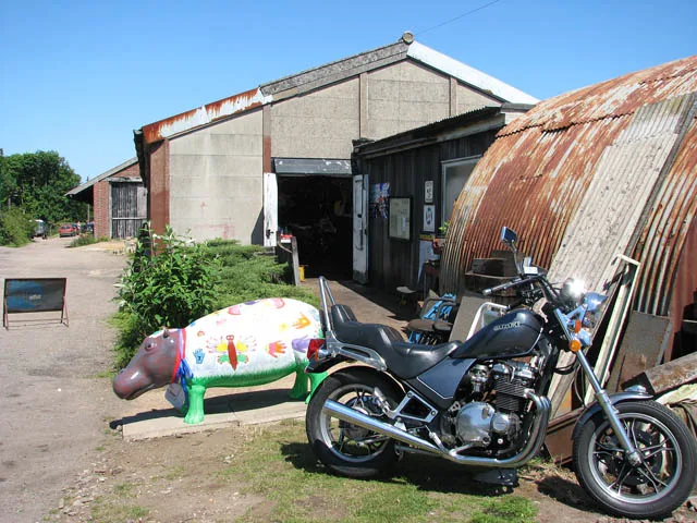
Norfolk Motorcycle Museum
Museums · 1.2 km

Two Mills
Caravan parks · 1.3 km
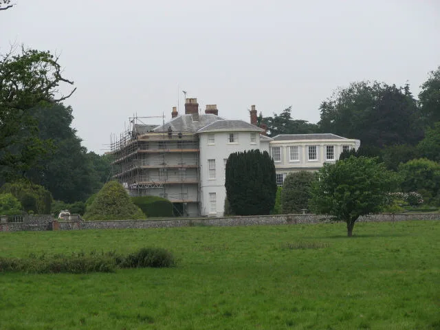
Westwick
Towns & cities · 1.4 km

Old Bridge Farm
Caravan parks · 1.9 km

Tanglewood
Caravan parks · 1.9 km
Model Farm
Campsites · 1.9 km

Kings Arms Hotel
Hotels · 2.0 km

Black Swan Theater
Theatres · 2.0 km

Visiting Teacher Service North
Natural landmarks · 2.0 km

North Walsham Village Sign
Public art & sculpture · 2.0 km

St Nicholas Church
Historic churches · 2.0 km
Nearby
📷 3Memorials & monuments · East of England
Cross 300m north west of Tollbar Cottages
Cross 300m north west of Tollbar Cottages — scheduled monument-listed memorial in england-east-midlands, United Kingdom.
📷 3Museums · East of England
Norfolk Motorcycle Museum
Norfolk Motorcycle Museum — museum in North Walsham, Norfolk, England, UK.
📷 5Flagship📷 3Towns & cities · East of England
Westwick
Westwick — village and civil parish in Norfolk, United Kingdom.
📷 5Caravan parks · East of England
Old Bridge Farm
Old Bridge Farm — a caravan park in england east midlands.
📷 5Where to eat & stay near Cross 120m south west of Tollgate Farm
Places to stay
📷 5📷 5Caravan parks · East of England
Old Bridge Farm
Old Bridge Farm — a caravan park in england east midlands.
📷 5📷 5📷 5Hotels · East of England
Kings Arms Hotel
Kings Arms Hotel — a hotel in england east midlands.
 📷 5
📷 5Hotels · East of England
Beechwood Hotel & Restaurant
Beechwood Hotel & Restaurant — a hotel in england east midlands.
Places to eat & drink
 📷 5
📷 5 📷 5
📷 5 📷 5
📷 5Historic pubs · East of England
Vernon Arms
Vernon Arms in England East, United Kingdom.
 📷 7
📷 7Historic pubs · East of England
Recruiting Sergeant Inn
Recruiting Sergeant Inn in England East, United Kingdom.
 📷 5
📷 5Historic pubs · East of England
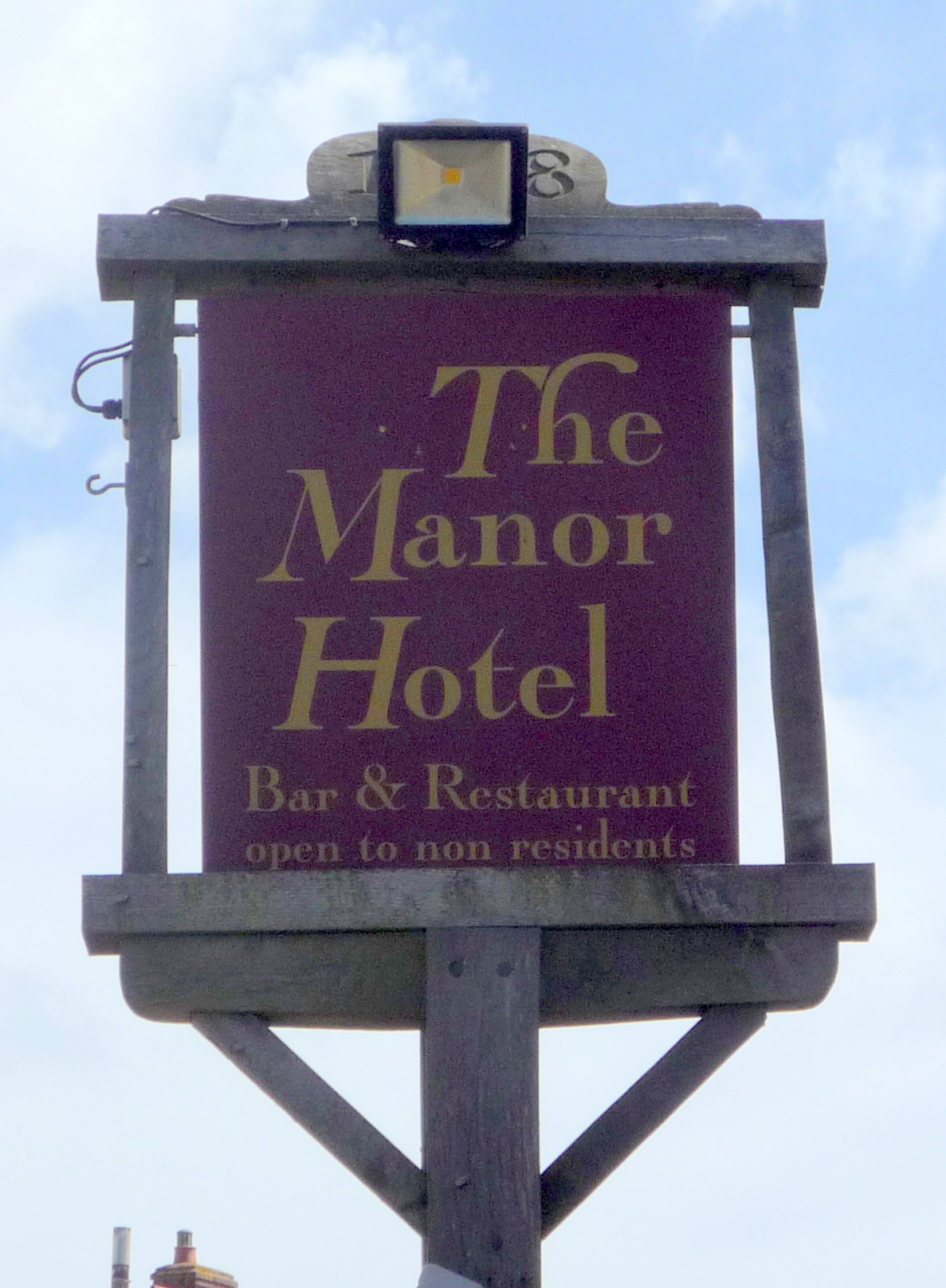
Manor Hotel, Mundesley
Manor Hotel, Mundesley in England East, United Kingdom.
 📷 5
📷 5Historic pubs · East of England
Buckinghamshire Arms Public House
Buckinghamshire Arms Public House in England East, United Kingdom.
More memorials in this region
 📷 5
📷 5Memorials & monuments · East of England
386th B.G.(M), 9th Air Force USAAF Memorial
386th B.G.(M), 9th Air Force USAAF Memorial is a memorial in the United Kingdom.
 📷 5
📷 5Memorials & monuments · East of England
Ailesbury Mausoleum
Ailesbury Mausoleum is a memorial in the United Kingdom.
 📷 5
📷 5Memorials & monuments · East of England
Archie F. Daniels Memorial
Archie F. Daniels Memorial is a memorial in the United Kingdom.
 📷 5
📷 5Memorials & monuments · East of England
Barnwell War Memorial
Barnwell War Memorial is a memorial in the United Kingdom.
Frequently asked questions
- Where is Cross 120m south west of Tollgate Farm?
- Cross 120m south west of Tollgate Farm is in Norfolk, the East Midlands, United Kingdom (postcode NR28 0JA), in the parish of North Walsham.
- What is Cross 120m south west of Tollgate Farm?
- Cross 120m south west of Tollgate Farm — a Grade II*-listed memorial in england-east-midlands, United Kingdom.
- How do I get to Cross 120m south west of Tollgate Farm?
- The nearest railway station is North Walsham, about 1.5 km away. Drivers can use postcode NR28 0JA.
- When was Cross 120m south west of Tollgate Farm built?
- Built or established in 1500.
- Is Cross 120m south west of Tollgate Farm a listed building?
- Cross 120m south west of Tollgate Farm is officially recognised as Grade II* listed.
- Is Cross 120m south west of Tollgate Farm a protected site?
- Yes — Cross 120m south west of Tollgate Farm is part of the Norfolk Coast National Landscape (AONB).
- Is Cross 120m south west of Tollgate Farm free to visit?
- Yes, Cross 120m south west of Tollgate Farm is free to enter.
- How do I get to Cross 120m south west of Tollgate Farm?
- The nearest railway station is North Walsham, about 1.5 km away. Drivers can navigate to postcode NR28 0JA.