
Farms (open to visitors) · South Wales
Croft-Y-Bwla
In or near Dixton.
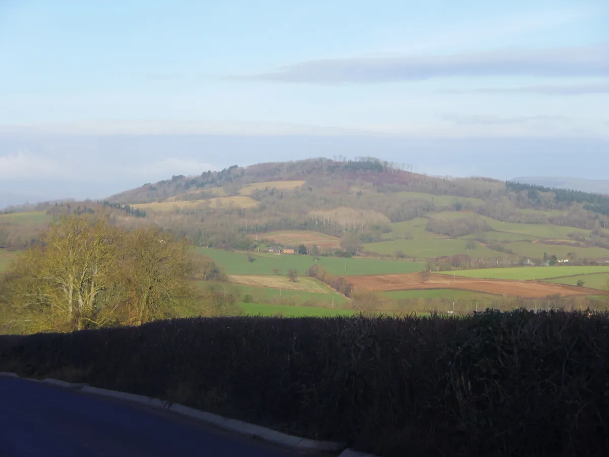
Croft-Y-Bwla — a Grade II*-listed farm in wales-south, United Kingdom.

Jaggery — CC BY-SA 2.0 via Wikimedia Commons licence

Plan your visit
- Typical visit
- 2 h–4 h
- Nearest railway station
- Rookwood · 9.5 km
- Family-friendly
Getting there & planning your visit
To visit Croft-Y-Bwla, the nearest railway station is Rookwood, located 9.5 km away. The postcode for sat-nav is NP25 5GB. Entry details are not provided, so please check in advance for accessibility information.
About
Croft-Y-Bwla is a Grade II*-listed building in wales-south, United Kingdom. Grade II* status is conferred by Historic England (or Cadw, Historic Environment Scotland or NIEA equivalents) on buildings of exceptional national interest. See the linked Wikipedia article for full historical and architectural details.
Photo gallery
Heritage listing
http://cadwpublic-api.azurewebsites.net/reports/listedbuilding/FullReport?lang=en&id=2371
From Cadw under OGL v3.
Protected designations
- Site of Special Scientific Interest: River Wye SSSI
- Area of Outstanding Natural Beauty: Wye Valley
Designations sourced from Natural England open data under OGL v3.
From the Wikipedia article
Croft-Y-Bwla is a country house and farm 1.5 miles (2.4 km) north-west of Monmouth, south-east Wales. The house was built around 1830 and was designed by the noted Monmouth architect George Vaughan Maddox. It has been listed as Grade II since 1974. Part of the estate is being developed for housing, under the name Parc Glyndwr. During archaeological investigations in advance of development, excavations revealed the remains of a Neolithic crannog built on a man-made island away from the shore of a now-vanished lake, as well as evidence of a Bronze Age boatbuilding community on the site.
Excerpt from Wikipedia under CC BY-SA 4.0. See the source article linked in Sources below.
Background
History
Croft-Y-Bwla was built in about 1830 for Thomas Dyke, a Monmouth grocer, and was designed by G.V. Maddox. It is sited on a low spur of land with a distant view of the town. The two-storey house is of classical design, square in plan with three bays on each side. The walls are smoothly rendered. The entrance porch is of greenish stone from the Forest of Dean, with a pair of Doric columns. On the south-east side there is a verandah, described in 2000 as "exquisite" but "much decayed". The actress Helen Barry once lived at the house with her husband Major Alexander Rolls (1818–1882), who was Mayor of Monmouth between 1870 and 1874 and the brother of John Etherington Welch Rolls. Col J.H.…
Sourced from Wikipedia under CC BY-SA 4.0.
- Coordinates
- 51.8182, -2.7396
- District
- Monmouthshire
- Parish
- Monmouth
- Postcode
- NP25 5GB
- Parliamentary constituency
- Monmouthshire
- Nearest railway station
- Rookwood — 9.5 km
Sources
- wikidata: Q614797 (CC0)
- wikipedia: Croft-Y-Bwla (CC BY-SA 4.0)
Other places nearby

Rockfield Castle
Literary houses · 1.0 km

Ancre Hill Estates
Vineyards · 1.2 km

Caxton Tower
Historic houses · 1.2 km

Vauxhall Fields, Monmouth
Parks · 1.3 km

Swiss Cottage
Gardens · 1.3 km

Drybridge House
Gardens · 1.5 km

Rockfield
Villages · 1.6 km

Monnow Bridge Caravan Site
Campsites · 1.6 km
White Hill, Monmouth
Natural landmarks · 1.6 km

Monnow Mill
Mills · 1.6 km

The Three Horseshoes, Monmouth
Historic houses · 1.6 km

St Cenedlon's Church
Historic churches · 1.6 km
Nearby
📷 5Literary houses · South Wales
Rockfield Castle
Rockfield Castle — a literary house museum in wales south.
📷 4Vineyards · South Wales
Ancre Hill Estates
Ancre Hill Estates — vineyard and winery in Monmouth, Wales.
📷 3Historic houses · South Wales
Caxton Tower
Caxton Tower — a historic house in wales-south, United Kingdom.
📷 4Parks · South Wales
Vauxhall Fields, Monmouth
Vauxhall Fields, Monmouth — park in Monmouth, United Kingdom.
📷 4📷 5Gardens · South Wales
Drybridge House
Drybridge House — a garden in wales-south, United Kingdom.
Where to eat & stay near Croft-Y-Bwla
Places to stay
📷 5Campsites · South Wales
Monnow Bridge Caravan Site
Monnow Bridge Caravan Site — a campsite in wales south.
 📷 5
📷 5Hotels · South Wales
The Riverside Hotel
The Riverside Hotel — a hotel in wales south.
 📷 5
📷 5 📷 5
📷 5Campsites · South Wales
Glen Trothy C. & C. Park
Glen Trothy C. & C. Park — a campsite in wales south.
 📷 5
📷 5Campsites · South Wales
Hendre Farmhouse Orchard Campsite
Hendre Farmhouse Orchard Campsite — a campsite in wales south.
 📷 5
📷 5Caravan parks · South Wales
Bridge Caravan and Camping Site
Bridge Caravan and Camping Site — a caravan park in wales south.
Places to eat & drink
 📷 5
📷 5Historic pubs · South Wales
The Green Dragon, Monmouth
The Green Dragon, Monmouth in Wales South, United Kingdom.
 📷 5
📷 5Historic pubs · South Wales
The Gatehouse
The Gatehouse in Wales South, United Kingdom.
 📷 5
📷 5 📷 5
📷 5Historic pubs · South Wales
The Punch House
The Punch House — Historic pub — listed building or notable heritage status.
 📷 5
📷 5 📷 6
📷 6Other works by George Vaughan Maddox
 📷 4
📷 4Historic houses · South Wales
Oak House
Oak House — Grade II Listed building in Monk Street Monmouth, Wales.
.jpg?width=1200) 📷 3
📷 3Chapels · South Wales
St James's English Methodist Church
St James's English Methodist Church — Wesleyan chapel in Monmouth.
 📷 4
📷 4 📷 4
📷 4Gardens · South Wales
1–6 Priory Street
1–6 Priory Street — a garden in wales-south, United Kingdom.
More places in this region
 📷 3
📷 3Farms (open to visitors) · South Wales
Clyne Farm Centre
Clyne Farm Centre — a other in wales-south, United Kingdom.
 📷 3
📷 3Farms (open to visitors) · South Wales
Tredilion Fruit Farm
Tredilion Fruit Farm — a other in wales-south, United Kingdom.
 📷 3
📷 3Farms (open to visitors) · South Wales
Dirt Farm Cycle Centre
Dirt Farm Cycle Centre — a other in wales-south, United Kingdom.
 📷 3
📷 3Farms (open to visitors) · South Wales
Greenmeadow Community Farm
Greenmeadow Community Farm — a other in wales-south, United Kingdom.
Frequently asked questions
- Where is Croft-Y-Bwla?
- Croft-Y-Bwla is in South Wales, United Kingdom (postcode NP25 5GB), in the parish of Monmouth.
- What is Croft-Y-Bwla?
- Croft-Y-Bwla — a Grade II*-listed farm in wales-south, United Kingdom.
- How do I get to Croft-Y-Bwla?
- The nearest railway station is Rookwood, about 9.5 km away. Drivers can use postcode NP25 5GB.
- Who owns Croft-Y-Bwla?
- Croft-Y-Bwla is owned by | current_tenants =.
- Is Croft-Y-Bwla a listed building?
- Croft-Y-Bwla is officially recognised as Grade II* listed.
- Is Croft-Y-Bwla a protected site?
- Yes — Croft-Y-Bwla is part of the River Wye SSSI Site of Special Scientific Interest and the Wye Valley National Landscape (AONB).
- How do I get to Croft-Y-Bwla?
- Drivers can navigate to postcode NP25 5GB. It sits within the Monmouthshire parliamentary constituency.