
Memorials & monuments · East of England
Crinkle Crankle Walls
In or near Wheathampstead.
Crinkle Crankle Walls — a memorial in england-london, United Kingdom.

Geographer — CC BY-SA 2.0 via Wikimedia Commons licence

Plan your visit
- Typical visit
- 15 min–45 min
- Nearest railway station
- Harpenden · 4.0 km
- Free entry
- Dog-friendly
Getting there & planning your visit
To visit the Crinkle Crankle Walls, the nearest railway station is Harpenden, located 4 km away. The postcode for navigation is AL4 8AA, and entry is free.
About
Crinkle Crankle Walls is a memorial located in england-london, United Kingdom. Sourced from OpenStreetMap (ODbL licence); see local listings for visitor information, opening hours and admission details.
Photo gallery
From the Wikipedia article
A crinkle crankle wall, also known as a crinkum crankum, sinusoidal, serpentine, ribbon or wavy wall, is an unusual type of structural or garden wall built in a serpentine shape with alternating curves, originally used in Ancient Egypt, but also typically found in Suffolk in England. The sinusoidal curves in the wall provide stability and help it to resist lateral forces, leading to greater strength than a straight wall of the same thickness of bricks without the need for buttresses. The phrase "crinkle crankle" is an ablaut reduplication, defined as something with bends and turns, first attested in 1598 (though "crinkle" and "crankle" have somewhat longer histories).
Excerpt from Wikipedia under CC BY-SA 4.0. See the source article linked in Sources below.
Background
History
Sinusoidal walls featured extensively in the architecture of Egyptian city of Aten, thought to date from the period of Amenhotep III, some 3,400 years ago (1386–1353 BCE). Other examples exist at Tel el-Retaba and Thebes. As a minor part of a larger system of fortification, such a wall may have been used to force oncoming troops to break ranks from closed to open ranks, and further expose them to defensive assault. Many crinkle crankle walls are found in East Anglia, England, where the marshes of The Fens were drained by Dutch engineers starting in the mid-1600s. The construction of these walls has been attributed to these engineers, who called them slangenmuur (nl), meaning snake wall. The…
Sourced from Wikipedia under CC BY-SA 4.0.
- Coordinates
- 51.8133, -0.2941
- County
- Hertfordshire
- District
- St Albans
- Parish
- Wheathampstead
- Postcode
- AL4 8AA
- Parliamentary constituency
- Harpenden and Berkhamsted
- Nearest railway station
- Harpenden — 4 km
- Official site
- wheathampstead-pc.gov.uk
Sources
- osm: node/8764309789 (ODbL)
- wikipedia: Crinkle crankle wall (CC BY-SA 4.0)
Other places nearby
The Two Brewers
Memorials & monuments · 0.0 km

Jessamine Cottage
Memorials & monuments · 0.1 km

The Bull Inn
Memorials & monuments · 0.1 km

Wheathampstead Mill
Memorials & monuments · 0.1 km

The Bull
Restaurants · 0.1 km

Apsley Cherry-Garrard
Memorials & monuments · 0.1 km
The Mill Quay
Memorials & monuments · 0.1 km
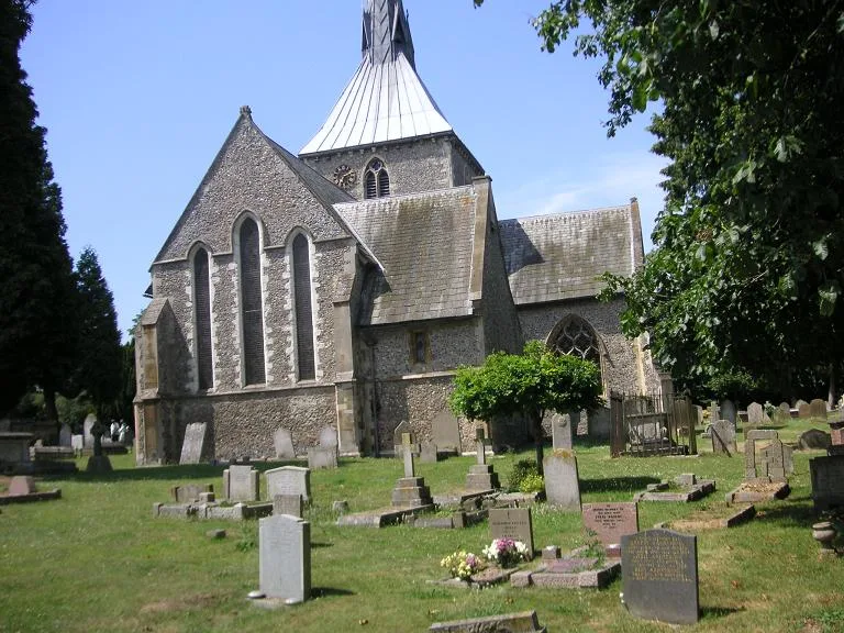
St Helen's Church, Wheathampstead
Historic churches · 0.1 km

The White Cottage
Memorials & monuments · 0.1 km

Tudor Archway
Memorials & monuments · 0.1 km
The Old Bakery
Memorials & monuments · 0.1 km
Wheathampstead Place
Memorials & monuments · 0.1 km
Nearby
📷 5Memorials & monuments · East of England
The Two Brewers
The Two Brewers — a memorial in england-london, United Kingdom.
📷 5Memorials & monuments · East of England
Jessamine Cottage
Jessamine Cottage — a memorial in england-london, United Kingdom.
📷 5Memorials & monuments · East of England
The Bull Inn
The Bull Inn — a memorial in england-london, United Kingdom.
📷 5Memorials & monuments · East of England
Wheathampstead Mill
Wheathampstead Mill — a memorial in england-london, United Kingdom.
📷 5Restaurants · East of England
The Bull
The Bull — a restaurant in england london. Cuisine: steak. Brand: Miller & Carter.
📷 5Memorials & monuments · East of England
Apsley Cherry-Garrard
Apsley Cherry-Garrard — a memorial in england-london, United Kingdom.
Where to eat & stay near Crinkle Crankle Walls
Places to stay
 📷 5
📷 5 📷 5
📷 5Hotels · East of England
Ardmore House Hotel
Ardmore House Hotel — a hotel in england london.
 📷 5
📷 5 📷 5
📷 5 📷 5
📷 5Hotels · East of England
The White Hart Hotel
The White Hart Hotel — a hotel in england london.
 📷 5
📷 5Caravan parks · East of England
Barley Mow Caravan Site
Barley Mow Caravan Site — a caravan park in england london.
Places to eat & drink
📷 5Restaurants · East of England
The Bull
The Bull — a restaurant in england london. Cuisine: steak. Brand: Miller & Carter.
 📷 5
📷 5Historic pubs · East of England
Elephant And Castle Public House
Elephant And Castle Public House in England East, United Kingdom.
 📷 5
📷 5Historic pubs · East of England
The Old Plough Public House
The Old Plough Public House in England East, United Kingdom.
 📷 5
📷 5Historic pubs · East of England
The Tin Pot Public House
The Tin Pot Public House in England East, United Kingdom.
📷 5Historic pubs · East of England
Cross Keys Public House
Cross Keys Public House in England East, United Kingdom.
 📷 5
📷 5Historic pubs · East of England
Marquis Of Grandby Public House
Marquis Of Grandby Public House in England East, United Kingdom.
More memorials in this region
 📷 5
📷 5Memorials & monuments · East of England
386th B.G.(M), 9th Air Force USAAF Memorial
386th B.G.(M), 9th Air Force USAAF Memorial is a memorial in the United Kingdom.
 📷 5
📷 5Memorials & monuments · East of England
Ailesbury Mausoleum
Ailesbury Mausoleum is a memorial in the United Kingdom.
 📷 5
📷 5Memorials & monuments · East of England
Archie F. Daniels Memorial
Archie F. Daniels Memorial is a memorial in the United Kingdom.
 📷 5
📷 5Memorials & monuments · East of England
Barnwell War Memorial
Barnwell War Memorial is a memorial in the United Kingdom.
Frequently asked questions
- Where is Crinkle Crankle Walls?
- Crinkle Crankle Walls is in Hertfordshire, London, United Kingdom (postcode AL4 8AA), in the parish of Wheathampstead.
- What is Crinkle Crankle Walls?
- Crinkle Crankle Walls — a memorial in england-london, United Kingdom.
- How do I get to Crinkle Crankle Walls?
- The nearest railway station is Harpenden, about 4.0 km away. Drivers can use postcode AL4 8AA.
- Is Crinkle Crankle Walls free to visit?
- Yes, Crinkle Crankle Walls is free to enter.
- How do I get to Crinkle Crankle Walls?
- The nearest railway station is Harpenden, about 4.0 km away. Drivers can navigate to postcode AL4 8AA.