Mountains & hills · Scottish Lowlands
Craigmawhannal North Top
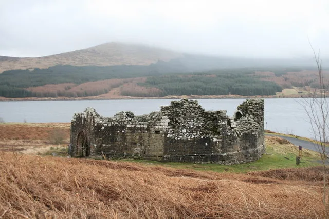
Craigmawhannal North Top — a hill or mountain in scotland lowlands.

Davie McClure — CC BY-SA 2.0 via Wikimedia Commons licence
Plan your visit
- Typical visit
- 3 h–8 h
- Best time of year
- Late spring – early autumn (May–Oct)
About
A British hill or mountain, named on Ordnance Survey maps and walked by hill-baggers. Craigmawhannal North Top is a named hill or mountain in scotland lowlands, recorded in the GeoNames UK gazetteer. British landmarks of this type are typically marked on Ordnance Survey maps and recorded in the national gazetteer for cartographic and navigational reference. Coordinates and feature classification are sourced from the GeoNames open dataset.
Photo gallery
Place summary
Craigmawhannal North Top is a mountain located in the Scottish Lowlands. It is part of the Southern Uplands, known for its rolling hills and expansive landscapes. Visitors can expect a rugged terrain typical of the region, offering opportunities for walking and enjoying the natural scenery. The area is less frequented than some other peaks, providing a more tranquil experience for those exploring the outdoors.
AI-generated from the structured facts on this page (operator, designation, listing, era). Not a substitute for visiting.
- Coordinates
- 55.2099, -4.3915
Sources
- manual: geonames-12616133 (CC BY 4.0)
Other places nearby
Loading nearby places…
Nearby
 📷 3
📷 3Archaeological sites · Scottish Lowlands
Carrick Forest
Carrick Forest is a archaeological site in the United Kingdom.
 📷 5
📷 5Castles · Scottish Lowlands
Loch Doon Castle, original site & remains of, 570m NE of Craigmalloch
Loch Doon Castle, original site & remains of, 570m NE of Craigmalloch — scheduled monument-listed castle in scotland-lowlands, United Kingdom.
 📷 5
📷 5Lakes · Scottish Lowlands
Ballochling Loch
Ballochling Loch — a lake in scotland lowlands.
 📷 3
📷 3Castles · Scottish Lowlands
Loch Doon Castle
Loch Doon Castle — castle in Dumfries and Galloway, Scotland, UK.
 📷 5
📷 5Mountains & hills · Scottish Lowlands
Craigmawhannal
Craigmawhannal — a hill or mountain in scotland lowlands.
 📷 3
📷 3Historic houses · Scottish Lowlands
Craigfionn
Craigfionn — a historic house in scotland-lowlands, United Kingdom.
Where to eat & stay near Craigmawhannal North Top
Places to stay
 📷 5
📷 5Caravan parks · Scottish Lowlands
Loch Doon Caravan Park
Loch Doon Caravan Park — a caravan park in scotland lowlands.
 📷 5
📷 5Campsites · Scottish Lowlands
Glentrool Camping & Caravan Site
Glentrool Camping & Caravan Site — a campsite in scotland lowlands.
 📷 5
📷 5Campsites · Scottish Lowlands
Otter Pool "Stay the night"
Otter Pool "Stay the night" — a campsite in scotland lowlands.
Places to eat & drink
 📷 5
📷 5Historic pubs · Scottish Lowlands
Doon Tavern, High Street, Dalmellington
Doon Tavern, High Street, Dalmellington in Scotland Lowlands, United Kingdom.
 📷 5
📷 5Historic pubs · Scottish Lowlands
The White House and Adjoining Joiner's Shop, Kirkmichael Arms, Straiton Road, Kirkmichael
The White House and Adjoining Joiner's Shop, Kirkmichael Arms, Straiton Road, Kirkmichael in Scotland Lowlands, United Kingdom.
More mountains in this region
 📷 3
📷 3Mountains & hills · Scottish Lowlands
Andrewhinney Hill
Andrewhinney Hill — Named summit at 677 m.
 📷 3
📷 3Mountains & hills · Scottish Lowlands
Arbory Hill
Arbory Hill — Named summit at 429 m.
 📷 3
📷 3Mountains & hills · Scottish Lowlands
Auchenton Hill ( East Mount Lowther)
Auchenton Hill ( East Mount Lowther) — Named summit at 631 m.
 📷 3
📷 3Mountains & hills · Scottish Lowlands
Bakestall
Bakestall — Named summit at 673.5 m.
Frequently asked questions
- Where is Craigmawhannal North Top?
- Craigmawhannal North Top is in the Scottish Lowlands, United Kingdom.
- What is Craigmawhannal North Top?
- Craigmawhannal North Top — a hill or mountain in scotland lowlands.
- How do I get to Craigmawhannal North Top?
- Its coordinates are 55.2099°, -4.3915°.