Mountains & hills · Scottish Highlands
Craigievar Hill
Craigievar Hill — mountain in scotland highlands. Elevation: 349 m.

Ralph Greig — CC BY-SA 2.0 via Wikimedia Commons licence
Plan your visit
- Typical visit
- 3 h–8 h
- Best time of year
- Late spring – early autumn (May–Oct)
About
Craigievar Hill is a mountain located in scotland highlands. Elevation: 349 m. A named British peak recorded in OpenStreetMap. Peaks are typically named on Ordnance Survey 1:50k mapping.
Photo gallery
Place summary
Craigievar Hill is located in the Scottish Highlands. This mountain is known for its distinctive shape and offers a range of walking opportunities for outdoor enthusiasts. The surrounding landscape features typical Highland scenery, including heather-covered hills and panoramic views. Visitors can expect a rugged terrain that is characteristic of the region.
AI-generated from the structured facts on this page (operator, designation, listing, era). Not a substitute for visiting.
- Coordinates
- 57.1747, -2.7260
Sources
- osm: n12042685859 (ODbL)
Other places nearby
Loading nearby places…
Nearby
📷 5Mountains & hills · Scottish Highlands
Craigievar Hill
Craigievar Hill — a hill or mountain in scotland highlands.
 📷 5
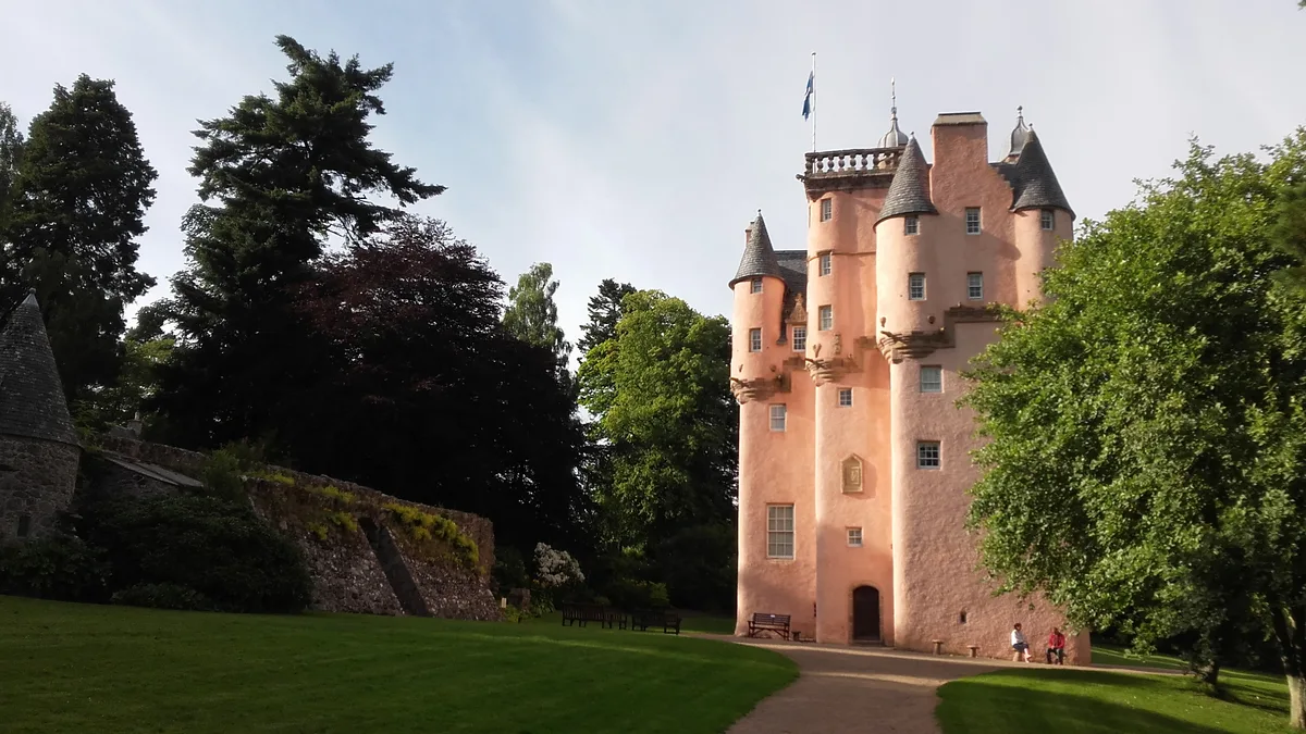
📷 5Castles · Scottish Highlands
Craigievar Castle
Craigievar Castle — castle and museum in Aberdeenshire, Scotland, UK.
 📷 5
📷 5Watermills · Scottish Highlands
Mill Of Kintocher
Mill Of Kintocher — category C listed building-listed watermill in scotland-highlands, United Kingdom.
 📷 5
📷 5Castles · Scottish Highlands
Craigievar Castle
Craigievar Castle — a castle in scotland highlands.
 📷 5
📷 5Historic churches · Scottish Highlands
St Marnoch's Church
St Marnoch's Church — scheduled monument-listed church in scotland-highlands, United Kingdom.
 📷 5
📷 5Mountains & hills · Scottish Highlands
Knock Hill
Knock Hill — mountain in scotland highlands. Elevation: 272 m.
Where to eat & stay near Craigievar Hill
Places to stay
 📷 5
📷 5Campsites · Scottish Highlands
Haughton House Park Campsite
Haughton House Park Campsite — a campsite in scotland highlands.
 📷 5
📷 5Caravan parks · Scottish Highlands
Tarland Camping and Caravanning Club
Tarland Camping and Caravanning Club — a caravan park in scotland highlands.
 📷 5
📷 5Caravan parks · Scottish Highlands
Aboyne Loch Caravan Park
Aboyne Loch Caravan Park — a caravan park in scotland highlands.
 📷 5
📷 5Caravan parks · Scottish Highlands
Campfield Caravan Site
Campfield Caravan Site — a caravan park in scotland highlands.
 📷 5
📷 5Hotels · Scottish Highlands
Tor-na-Coille Hotel
Tor-na-Coille Hotel — a hotel in scotland highlands.
 📷 5
📷 5Caravan parks · Scottish Highlands
Banchory Lodge Caravan Park
Banchory Lodge Caravan Park — a caravan park in scotland highlands.
Places to eat & drink
 📷 5
📷 5Historic pubs · Scottish Highlands
Learney Arms Hotel, The Square, Torphins
Learney Arms Hotel, The Square, Torphins in Scotland Highlands, United Kingdom.
 📷 5
📷 5Historic pubs · Scottish Highlands
Grant Arms Hotel, The Square, Monymusk
Grant Arms Hotel, The Square, Monymusk in Scotland Highlands, United Kingdom.
 📷 5
📷 5Historic pubs · Scottish Highlands
Burnett Arms Hotel, High Street, Banchory
Burnett Arms Hotel, High Street, Banchory in Scotland Highlands, United Kingdom.
More mountains in this region
 📷 3
📷 3Mountains & hills · Scottish Highlands
A' Bhuidheanach Bheag
A' Bhuidheanach Bheag — Named summit at 936 m.
 📷 3
📷 3Mountains & hills · Scottish Highlands
A' Chailleach
A' Chailleach — Named summit at 997 m.
 📷 3
📷 3Mountains & hills · Scottish Highlands
A' Chailleach
A' Chailleach — Named summit at 930 m.
 📷 3
📷 3Mountains & hills · Scottish Highlands
A' Chaoirnich
A' Chaoirnich — Named summit at 875 m.
Frequently asked questions
- Where is Craigievar Hill?
- Craigievar Hill is in the Scottish Highlands, United Kingdom.
- What is Craigievar Hill?
- Craigievar Hill — mountain in scotland highlands. Elevation: 349 m.
- How do I get to Craigievar Hill?
- Its coordinates are 57.1747°, -2.7260°.