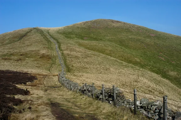
Mountains & hills · Central Scotland
Craigengelt Hill
Craigengelt Hill — mountain in scotland central. Elevation: 353 m.

Robert Murray — CC BY-SA 2.0 via Wikimedia Commons licence
Plan your visit
- Typical visit
- 3 h–8 h
- Best time of year
- Late spring – early autumn (May–Oct)
About
Craigengelt Hill is a mountain located in scotland central. Elevation: 353 m. A named British peak recorded in OpenStreetMap. Peaks are typically named on Ordnance Survey 1:50k mapping.
Photo gallery
Place summary
Craigengelt Hill is a mountain located in central Scotland. It offers a range of outdoor activities, including hiking and nature observation. The area is characterised by its rugged terrain and scenic views, appealing to those interested in exploring the natural landscape of Scotland. Visitors can expect a tranquil environment, suitable for both casual walkers and more experienced hikers.
AI-generated from the structured facts on this page (operator, designation, listing, era). Not a substitute for visiting.
- Coordinates
- 56.0539, -4.0481
Sources
- osm: n943607908 (ODbL)
Other places nearby
Loading nearby places…
Nearby
 📷 2
📷 2Canals · Scottish Highlands
Earls Hill
Earls Hill in Scotland Islands, United Kingdom.
 📷 5
📷 5Mountains & hills · Central Scotland
Craigannet Hill
Craigannet Hill — mountain in scotland central. Elevation: 352 m.
 📷 5
📷 5Mountains & hills · Central Scotland
Earl's Hill
Earl's Hill — a hill or mountain in scotland central.
📷 5Mountains & hills · Central Scotland
Earl's Hill
Earl's Hill — mountain in scotland central. Elevation: 439 m.
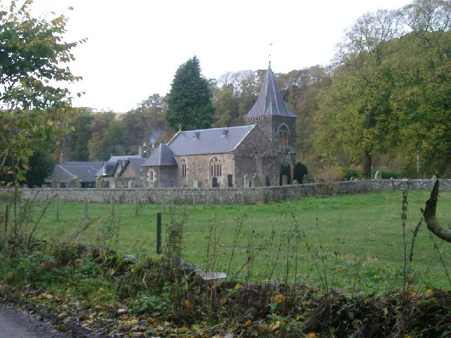
📷 2Historic bridges · Scottish Highlands
Central 103.1 FM
Central 103.1 FM in Scotland Islands, United Kingdom.
📷 5Mountains & hills · Central Scotland
Craigannet Hill
Craigannet Hill — a hill or mountain in scotland central.
Where to eat & stay near Craigengelt Hill
Places to stay
 📷 5
📷 5Hostels · Central Scotland
Stirling Youth Hostel
Stirling Youth Hostel — a hostel in scotland central.
 📷 5
📷 5Hostels · Central Scotland
William Wallace Hotel
William Wallace Hotel — a hostel in scotland central.
 📷 5
📷 5Hotels · Central Scotland
DoubleTree by Hilton Glasgow Westerwood Spa & Golf Resort
DoubleTree by Hilton Glasgow Westerwood Spa & Golf Resort — a hotel in scotland central. 4-star. Brand: DoubleTree by Hilton.
 📷 5
📷 5Caravan parks · Central Scotland
Campsie Glen Holiday Park
Campsie Glen Holiday Park — a caravan park in scotland central.
 📷 5
📷 5Hotels · Central Scotland
Stirling Court Hotel
Stirling Court Hotel — a hotel in scotland central.
 📷 5
📷 5Campsites · Central Scotland
Blair Drummond Caravan Park
Blair Drummond Caravan Park — a campsite in scotland central.
Places to eat & drink
 📷 5
📷 5Historic pubs · Scottish Highlands
Dennyloanhead
Dennyloanhead in Scotland Islands, United Kingdom.
 📷 5
📷 5Historic pubs · Central Scotland
The Masonic Arms, 62 Main Street, Cumbernauld Village
The Masonic Arms, 62 Main Street, Cumbernauld Village in Scotland Central, United Kingdom.
 📷 4
📷 4Historic pubs · Scottish Highlands
The Gothenburg
The Gothenburg in Scotland Islands, United Kingdom.
 📷 5
📷 5Historic pubs · Central Scotland
Westerton Arms, 34 Henderson Street, Bridge of Allan
Westerton Arms, 34 Henderson Street, Bridge of Allan in Scotland Central, United Kingdom.
 📷 5
📷 5Historic pubs · Central Scotland
Johnstone Arms Hotel, 48 Stirling Street, Alva
Johnstone Arms Hotel, 48 Stirling Street, Alva in Scotland Central, United Kingdom.
 📷 5
📷 5Historic pubs · Central Scotland
Ye Olde House Inn, 25-26 Forth Street, Kincardine On Forth
Ye Olde House Inn, 25-26 Forth Street, Kincardine On Forth in Scotland Central, United Kingdom.
More mountains in this region
 📷 3
📷 3Mountains & hills · Central Scotland
Abbey Hill
Abbey Hill — Named summit at 278 m.
 📷 3
📷 3Mountains & hills · Central Scotland
Aberlady Bay
Aberlady Bay — bay on the north coast of East Lothian, Scotland, UK.
 📷 3
📷 3Mountains & hills · Central Scotland
Allermuir Hill
Allermuir Hill — Named summit at 493 m.
 📷 3
📷 3Mountains & hills · Central Scotland
Ardnandave
Ardnandave — Named summit at 715 m.
Frequently asked questions
- Where is Craigengelt Hill?
- Craigengelt Hill is in central Scotland, United Kingdom.
- What is Craigengelt Hill?
- Craigengelt Hill — mountain in scotland central. Elevation: 353 m.
- How do I get to Craigengelt Hill?
- Its coordinates are 56.0539°, -4.0481°.