Mountains & hills · Scottish Lowlands
Craig Fell
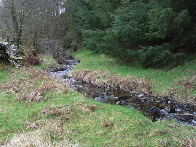
Craig Fell — mountain in scotland lowlands. Elevation: 479 m.

Thomas Dick — CC BY-SA 2.0 via Wikimedia Commons licence
Plan your visit
- Typical visit
- 3 h–8 h
- Best time of year
- Late spring – early autumn (May–Oct)
About
Craig Fell is a mountain located in scotland lowlands. Elevation: 479 m. A named British peak recorded in OpenStreetMap. Peaks are typically named on Ordnance Survey 1:50k mapping.
Photo gallery
Place summary
Craig Fell is a mountain located in the Scottish Lowlands. It offers a variety of walking trails for those looking to explore the natural landscape. The area is characterised by rolling hills and scenic views, making it a suitable destination for outdoor enthusiasts. Visitors can expect a mix of terrain, providing opportunities for both casual walkers and more experienced hikers.
AI-generated from the structured facts on this page (operator, designation, listing, era). Not a substitute for visiting.
- Coordinates
- 55.2961, -3.3709
Sources
- osm: n3546857840 (ODbL)
Other places nearby
Loading nearby places…
Nearby
📷 5Mountains & hills · Scottish Lowlands
Priestgill Head
Priestgill Head — mountain in scotland lowlands. Elevation: 503 m.
 📷 5
📷 5Mountains & hills · Scottish Lowlands
Broken Back
Broken Back — mountain in scotland lowlands. Elevation: 397 m.
 📷 5
📷 5Mountains & hills · Scottish Lowlands
Brock Hill
Brock Hill — mountain in scotland lowlands. Elevation: 240 m.
 📷 5
📷 5Mountains & hills · Scottish Lowlands
Breckonside Hill
Breckonside Hill — a hill or mountain in scotland lowlands.
 📷 5
📷 5Mountains & hills · Scottish Lowlands
Yadburgh Hill
Yadburgh Hill — mountain in scotland lowlands. Elevation: 474 m.
📷 5Mountains & hills · Scottish Lowlands
Yadburgh Hill
Yadburgh Hill — a hill or mountain in scotland lowlands.
Where to eat & stay near Craig Fell
Places to stay
 📷 5
📷 5Campsites · Scottish Lowlands
Green Frog
Green Frog — a campsite in scotland lowlands.
 📷 5
📷 5Campsites · Scottish Lowlands
Moffat Camping & Caravanning Club site
Moffat Camping & Caravanning Club site — a campsite in scotland lowlands.
 📷 5
📷 5Hotels · Scottish Lowlands
Buccleuch Arms Hotel
Buccleuch Arms Hotel — a hotel in scotland lowlands.
 📷 5
📷 5Hostels · Scottish Lowlands
Rivox Bunkhouse
Rivox Bunkhouse — a hostel in scotland lowlands.
 📷 5
📷 5Hostels · Scottish Lowlands
Johnstone House
Johnstone House — a hostel in scotland lowlands.
 📷 5
📷 5Campsites · Scottish Lowlands
Kirk Loch Campsite
Kirk Loch Campsite — a campsite in scotland lowlands.

More mountains in this region
 📷 3
📷 3Mountains & hills · Scottish Lowlands
Andrewhinney Hill
Andrewhinney Hill — Named summit at 677 m.
 📷 3
📷 3Mountains & hills · Scottish Lowlands
Arbory Hill
Arbory Hill — Named summit at 429 m.
 📷 3
📷 3Mountains & hills · Scottish Lowlands
Auchenton Hill ( East Mount Lowther)
Auchenton Hill ( East Mount Lowther) — Named summit at 631 m.
 📷 3
📷 3Mountains & hills · Scottish Lowlands
Bakestall
Bakestall — Named summit at 673.5 m.
Frequently asked questions
- Where is Craig Fell?
- Craig Fell is in the Scottish Lowlands, United Kingdom.
- What is Craig Fell?
- Craig Fell — mountain in scotland lowlands. Elevation: 479 m.
- How do I get to Craig Fell?
- Its coordinates are 55.2961°, -3.3709°.