
Historic houses · South West England
Court House, East Quantoxhead
In or near Otterhampton.
Court House, East Quantoxhead — Grade I listed house in West Somerset, England, UK.

Wikimedia Commons contributors — see linked file page for photographer and licence licence

Plan your visit
- Typical visit
- 1 h–2 h
- Nearest railway station
- Doniford Halt · 5.3 km
- Family-friendly
- Limited wheelchair access
Getting there & planning your visit
To visit Court House in East Quantoxhead, the nearest railway station is Doniford Halt, located 5.3 km away. The postcode for sat-nav is TA5 1EJ. Accessibility is limited for wheelchair users.
About
Court House, East Quantoxhead is a historic house in the United Kingdom — typically a country seat, manor, or town house with notable architecture or history. Heritage designation: Grade I listed building. Wikidata describes it as: "Grade I listed house in West Somerset, England, UK". Coordinates: 51.1856°, -3.2371°.
Photo gallery
Protected designations
- Site of Special Scientific Interest: Blue Anchor to Lilstock Coast SSSI
- Area of Outstanding Natural Beauty: Quantock Hills
Designations sourced from Natural England open data under OGL v3.
From the Wikipedia article
The Court House in East Quantoxhead, Somerset, England has a medieval tower and other parts of the building which date from the 17th century. It has been designated as a Grade I listed building. The manor has been held by the Luttrell family, who also owned Dunster Castle, since they acquired it around 1070. Only a tower survives from the medieval manor house which was built around 1400 to replace the one constructed in 1273. Most of the current building was added in the 1620s by George Luttrell and his wife Silvestra Capps. It was then used as a farmhouse until the 20th century when the latest descendants of the Luttrell line lived in it again. The house includes a hall and gallery with a large kitchen area. The interior of the house is noted for plasterwork friezes. Surrounding the house are gardens of 5 acres (2.0 ha) with 3 acres (1.2 ha) of woodland.
Excerpt from Wikipedia under CC BY-SA 4.0. See the source article linked in Sources below.
Background
History
It has been owned by the Luttrell family, who also owned Dunster Castle, for many generations since they acquired it around 1070. The original manor house was constructed around 1273, adjacent to the Church of St Mary. The only remaining section of the medieval house is the four-storey tower with battlements which was dated in a survey during 2003 by Historic England as coming from the late 14th or early 15th century. The rest of the current building was constructed in the 17th century. By the time George Luttrell inherited Dunster castle in 1571, it was dilapidated, with the family preferring to live at Court House. In the 1620s George Luttrell's first wife and mother of his twelve…
Architecture
The two-storey house is laid out around a courtyard. The interior of the house is noted for plasterwork friezes. In the hall the fireplace mantel, which dates from 1629, bears the Luttrell coat of arms with soldiers on either side. It was created by two Flemish workers brought in by George Luttrell. They and their descendants stayed in West Somerset and are responsible for the plasterwork in all the great houses in the area, including Court House and Dunster Castle. In most of the rooms of the house the friezes depict biblical scenes. In the drawing room is a representation of Christ with the children, the north bedroom has Christ's entry into Jerusalem, another room depicts Christ's…
Sourced from Wikipedia under CC BY-SA 4.0.
- Coordinates
- 51.1856, -3.2371
- District
- Somerset
- Parish
- East Quantoxhead
- Postcode
- TA5 1EJ
- Parliamentary constituency
- Tiverton and Minehead
- Nearest railway station
- Doniford Halt — 5.3 km
Sources
- wikidata: Q5178237 (CC0)
- wikipedia: Court House, East Quantoxhead (CC BY-SA 4.0)
- commons: Court House, East Quantoxhead.jpg (CC BY-SA 4.0)
Other places nearby

East Quantoxhead
Villages · 0.3 km
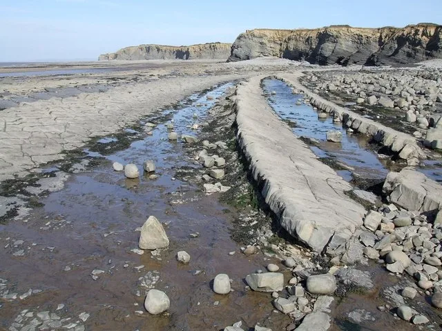
Kilve Beach
Beaches · 1.0 km
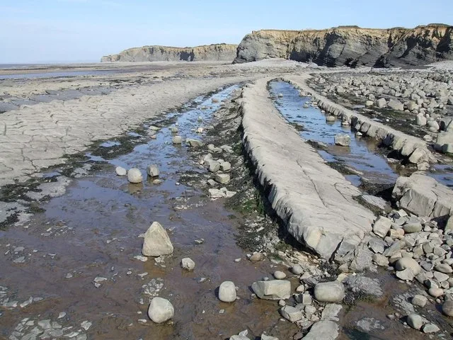
Kilve Beach
Beaches · 1.0 km

River Holford
Museums · 1.1 km

Chantry
Historic houses · 1.1 km

Chantry
Archaeological sites · 1.1 km

West Hill
Mountains & hills · 2.4 km

St Audries Bay Holiday Club
Campsites · 2.4 km

Alfoxton House
Historic houses · 2.6 km

ROC Nuclear Fallout Shelter
Archaeological sites · 2.7 km

Kilton
Villages · 2.7 km

St Audrie's Bay
Natural landmarks · 2.8 km
Nearby
📷 5📷 5📷 5📷 5Museums · South West England
River Holford
River Holford — a museum in england-south-west, United Kingdom.
📷 3Historic houses · South West England
Chantry
Chantry — a historic house in england-south-west, United Kingdom.
📷 5Where to eat & stay near Court House, East Quantoxhead
Places to stay
📷 5Campsites · South West England
St Audries Bay Holiday Club
St Audries Bay Holiday Club — a campsite in england south west.
📷 5Campsites · South West England
Home Farm Holiday Centre
Home Farm Holiday Centre — a campsite in england south west.
 📷 5
📷 5Campsites · South West England
Moorhouse Farm Campsite
Moorhouse Farm Campsite — a campsite in england south west.
 📷 7
📷 7Hotels · South West England
Combe House Hotel
Combe House Hotel — a hotel in england south west.
 📷 5
📷 5Caravan parks · South West England
Doniford Bay Caravan Park
Doniford Bay Caravan Park — a caravan park in england south west.
 📷 5
📷 5Places to eat & drink
 📷 6
📷 6Historic pubs · South West England
West Somerset Hotel
West Somerset Hotel in England South West, United Kingdom.
 📷 7
📷 7 📷 5
📷 5Historic pubs · South West England
The Carew Arms And Attached Outbuilding
The Carew Arms And Attached Outbuilding in England South West, United Kingdom.
 📷 5
📷 5 📷 3
📷 3Historic pubs · South West England
The Farmers Arms
The Farmers Arms — Historic pub — listed building or notable heritage status.
 📷 7
📷 7Historic pubs · South West England
The Butchers Arms
The Butchers Arms in England South West, United Kingdom.
More historic houses in this region
 📷 5
📷 5Historic houses · South West England
1 South Parade
1 South Parade — Grade I listed house in Bath, Somerset, England, UK.
_(geograph_6440799).jpg?width=1200) 📷 5
📷 5Historic houses · South West England
1-4 Lansdowne Grove, Morris Lane
1-4 Lansdowne Grove, Morris Lane — houses in Devizes, Wiltshire, England, UK.
 📷 5
📷 5Historic houses · South West England
2 North Parade
2 North Parade — building in Bath, UK; part of Abbey Hotel.
 📷 5
📷 5Historic houses · South West England
2, South Place, Lacock Road
2, South Place, Lacock Road — house in Corsham, Wiltshire, England, UK.
Frequently asked questions
- Where is Court House, East Quantoxhead?
- Court House, East Quantoxhead is in South-West England, United Kingdom (postcode TA5 1EJ), in the parish of East Quantoxhead.
- What is Court House, East Quantoxhead?
- Court House, East Quantoxhead — Grade I listed house in West Somerset, England, UK.
- How do I get to Court House, East Quantoxhead?
- The nearest railway station is Doniford Halt, about 5.3 km away. The nearest town is Otterhampton. Drivers can use postcode TA5 1EJ.
- Who owns Court House, East Quantoxhead?
- Court House, East Quantoxhead is owned by | designation1 =Grade I listed building.
- Is Court House, East Quantoxhead a listed building?
- Court House, East Quantoxhead is officially recognised as Grade I listed building listed.
- Is Court House, East Quantoxhead a protected site?
- Yes — Court House, East Quantoxhead is part of the Blue Anchor to Lilstock Coast SSSI Site of Special Scientific Interest and the Quantock Hills National Landscape (AONB).
- How do I get to Court House, East Quantoxhead?
- The nearest railway station is Doniford Halt, about 5.3 km away. Drivers can navigate to postcode TA5 1EJ.